417:
351:
295:
231:
210:
194:
178:
162:
145:
435:
358:
310:
302:
372:
324:
395:
441:
38:
446:
86:
959:"}},"text\/plain":{"en":{"":"heading"}}},"{\"value\":{\"amount\":\"+67\",\"unit\":\"http:\\\/\\\/www.wikidata.org\\\/entity\\\/Q28390\"},\"type\":\"quantity\"}":{"text\/html":{"en":{"P7787":"67
955:
343:
287:
496:– You must give appropriate credit, provide a link to the license, and indicate if changes were made. You may do so in any reasonable manner, but not in any way that suggests the licensor endorses you or your use.
52:
48:
42:
97:
65:
956:
144:
350:
294:
230:
193:
416:
209:
177:
161:
1196:
1076:
857:
748:
712:
593:
365:
317:
907:
1201:
402:
821:
503:
662:
576:
1096:
1060:
1026:
997:
970:
885:
841:
774:
761:
696:
670:
655:
640:
928:
900:
870:
732:
613:
560:
1164:
1159:
805:
56:
37:
389:
249:
456:
254:
502:– If you remix, transform, or build upon the material, you must distribute your contributions under the
409:
on the
Geograph website for the photographer's contact details. The copyright on this image is owned by
1175:
453:
963:"}},"text\/plain":{"en":{"P7787":"67 degree"}}}}": -->
248:
105:
266:
892:
877:
647:
371:
323:
243:
422:
92:
355:
307:
261:
260:
255:
172:
1182:
Uploading geograph.org.uk image from https://www.geograph.org.uk/photo/2221217
188:
411:
204:
242:
236:
223:
394:
406:
1132:
Click on a date/time to view the file as it appeared at that time.
357:
309:
334:
278:
80:
1019:
237:
224:
344:
51° 50′ 26.6″ N, 2° 14′ 32″ W
288:
51° 50′ 25.3″ N, 2° 14′ 35″ W
1229:
1219:
267:
126:
104:
Commons is a freely licensed media file repository.
749:
Creative
Commons Attribution-ShareAlike 2.0 Generic
70:(1,024 × 768 pixels, file size: 147 KB, MIME type:
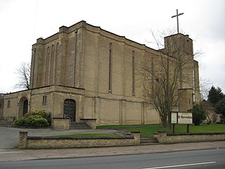
132:St Barnabas church - geograph.org.uk - 2221217.jpg
513:https://creativecommons.org/licenses/by-sa/2.0
85:
519:Creative Commons Attribution-Share Alike 2.0
434:
8:
960:
479:– to copy, distribute and transmit the work
1134:
540:
415:
349:
293:
229:
208:
192:
176:
160:
143:
1212:The following other wikis use this file:
878:https://www.geograph.org.uk/photo/2221217
648:https://www.geograph.org.uk/profile/1837
1194:
1110:
1094:
1074:
1058:
1040:
1024:
984:
968:
942:
926:
855:
839:
819:
803:
746:
730:
710:
694:
627:
611:
591:
574:
558:
555:
536:
529:
337:
281:
364:View this and other nearby images on:
316:View this and other nearby images on:
1192:The following 2 pages use this file:
7:
421:and is licensed for reuse under the
1197:List of churches in Gloucestershire
1123:
457:Attribution-Share Alike 2.0 Generic
445:
440:
425:Attribution-ShareAlike 2.0 license.
549:
543:
431:
400:
136:
117:
63:
548:
159:church building, Gloucester
971:coordinates of the point of view
534:
490:Under the following conditions:
452:This file is licensed under the
444:
439:
433:
393:
370:
356:
322:
308:
300:
84:
31:
21:
531:
14:
1202:St Barnabas Church, Gloucester
858:file available on the internet
530:
401:This image was taken from the
26:
1:
1027:coordinates of depicted place
908:Geograph Britain and Ireland
656:object of statement has role
556:Items portrayed in this file
299:
189:Geograph Britain and Ireland
1248:
1226:Usage on www.wikidata.org
1216:Usage on sv.wikipedia.org
784:
504:same or compatible license
1124:
1042:51°50'26.5"N, 2°14'31.9"W
986:51°50'25.4"N, 2°14'34.4"W
781:
16:
886:geograph.org.uk image ID
533:
470:
142:St Barnabas church
91:This is a file from the
1181:
200:
184:
171:
168:
129:
95:. Information from its
467:by Philip Halling
407:this photograph's page
376:51.840733; -2.242203
328:51.840374; -2.242926
98:description page there
41:Size of this preview:
1061:location of creation
1160:07:30, 24 June 2021
485:– to adapt the work
47:Other resolutions:
782:St Barnabas church
762:author name string
671:author name string
544:St Barnabas church
465:St Barnabas church
256:South West England
57:1,024 × 768 pixels
1208:Global file usage
1185:
962:
733:copyright license
542:
430:
429:
405:collection. See
381:
380:
333:
332:
276:
275:
271:
217:Place of creation
113:
112:
93:Wikimedia Commons
32:Global file usage
1239:
1172:
1008:
1007:
1002:
910:
905:
895:
890:
880:
875:
871:described at URL
787:
786:
783:
779:
769:
766:
697:copyright status
678:
675:
665:
660:
650:
645:
526:
523:
520:
517:
514:
506:as the original.
468:
454:Creative Commons
448:
447:
443:
442:
437:
436:
423:Creative Commons
419:
403:Geograph project
397:
390:
386:
377:
374:
360:
359:
353:
347:
346:
335:
329:
326:
312:
311:
305:
304:
303:
297:
291:
290:
279:
269:
263:
257:
251:
245:
239:
235:
233:
226:
212:
196:
180:
174:
164:
147:
141:
133:
127:
122:
109:
88:
87:
81:
75:
73:
60:
53:640 × 480 pixels
49:320 × 240 pixels
43:800 × 600 pixels
1247:
1246:
1242:
1241:
1240:
1238:
1237:
1236:
1206:
1186:
1178:
1170:
1126:
1125:
1122:
1121:
1120:
1119:
1118:
1117:
1116:
1115:
1113:
1103:
1102:
1101:
1099:
1088:
1087:
1086:
1085:
1084:
1083:
1082:
1081:
1079:
1067:
1066:
1065:
1063:
1052:
1051:
1050:
1049:
1048:
1047:
1046:
1045:
1043:
1033:
1032:
1031:
1029:
1018:
1017:
1016:
1015:
1014:
1013:
1012:
1011:
1010:
1009:
1005:
1003:
1000:
991:
990:
989:
987:
977:
976:
975:
973:
954:
953:
952:
951:
950:
949:
948:
947:
945:
935:
934:
933:
931:
920:
919:
918:
917:
916:
915:
914:
913:
912:
911:
906:
903:
897:
896:
891:
888:
882:
881:
876:
873:
864:
863:
862:
860:
848:
847:
846:
844:
833:
832:
831:
830:
829:
828:
827:
826:
824:
812:
811:
810:
808:
797:
796:
795:
794:
793:
792:
791:
790:
789:
788:
780:
777:
771:
770:
767:
764:
755:
754:
753:
751:
739:
738:
737:
735:
724:
723:
722:
721:
720:
719:
718:
717:
715:
703:
702:
701:
699:
688:
687:
686:
685:
684:
683:
682:
681:
680:
679:
676:
673:
667:
666:
661:
658:
652:
651:
646:
643:
634:
633:
632:
630:
620:
619:
618:
616:
605:
604:
603:
602:
601:
600:
599:
598:
596:
585:
584:
583:
582:
581:
579:
577:church building
567:
566:
565:
563:
547:
546:
545:
528:
527:
524:
521:
518:
515:
512:
511:
469:
463:
460:
449:
426:
388:
384:
375:
342:
341:
338:Object location
327:
301:
286:
285:
282:Camera location
277:
250:Gloucestershire
244:Gloucestershire
220:
156:
148:
137:
131:
124:
120:
115:
114:
103:
102:
101:is shown below.
77:
71:
69:
62:
61:
46:
12:
11:
5:
1245:
1243:
1235:
1234:
1233:
1232:
1224:
1223:
1222:
1210:
1209:
1205:
1204:
1199:
1190:
1189:
1184:
1183:
1180:
1176:
1173:
1167:
1162:
1157:
1153:
1152:
1149:
1146:
1143:
1140:
1137:
1130:
1129:
1114:
1111:
1109:
1108:
1107:
1106:
1105:
1104:
1100:
1095:
1093:
1092:
1091:
1090:
1089:
1080:
1075:
1073:
1072:
1071:
1070:
1069:
1068:
1064:
1059:
1057:
1056:
1055:
1054:
1053:
1044:
1041:
1039:
1038:
1037:
1036:
1035:
1034:
1030:
1025:
1023:
1022:
1021:
1020:
996:
995:
994:
993:
992:
988:
985:
983:
982:
981:
980:
979:
978:
974:
969:
967:
966:
965:
964:
958:
946:
943:
941:
940:
939:
938:
937:
936:
932:
927:
925:
924:
923:
922:
921:
899:
898:
884:
883:
869:
868:
867:
866:
865:
861:
856:
854:
853:
852:
851:
850:
849:
845:
842:source of file
840:
838:
837:
836:
835:
834:
825:
820:
818:
817:
816:
815:
814:
813:
809:
804:
802:
801:
800:
799:
798:
773:
772:
768:Philip Halling
760:
759:
758:
757:
756:
752:
747:
745:
744:
743:
742:
741:
740:
736:
731:
729:
728:
727:
726:
725:
716:
711:
709:
708:
707:
706:
705:
704:
700:
695:
693:
692:
691:
690:
689:
677:Philip Halling
669:
668:
654:
653:
639:
638:
637:
636:
635:
631:
628:
626:
625:
624:
623:
622:
621:
617:
612:
610:
609:
608:
607:
606:
597:
592:
590:
589:
588:
587:
586:
580:
575:
573:
572:
571:
570:
569:
568:
564:
559:
557:
554:
553:
552:
551:
550:
539:
538:
535:
532:
510:
509:
508:
507:
497:
488:
487:
486:
480:
473:You are free:
461:
451:
450:
432:
428:
427:
412:Philip Halling
398:
387:
382:
379:
378:
368:
362:
339:
331:
330:
320:
314:
283:
274:
273:
268:United Kingdom
221:
218:
214:
213:
205:Philip Halling
202:
198:
197:
186:
182:
181:
170:
166:
165:
157:
154:
150:
149:
134:
125:
123:
118:
116:
111:
110:
89:
79:
78:
40:
36:
35:
34:
29:
24:
19:
13:
10:
9:
6:
4:
3:
2:
1244:
1231:
1228:
1227:
1225:
1221:
1218:
1217:
1215:
1214:
1213:
1207:
1203:
1200:
1198:
1195:
1193:
1187:
1179:
1174:
1168:
1166:
1163:
1161:
1158:
1155:
1154:
1150:
1147:
1144:
1141:
1138:
1136:
1135:
1133:
1127:
1098:
1078:
1062:
1028:
999:
972:
944:20 March 2010
930:
909:
902:
894:
887:
879:
872:
859:
843:
823:
807:
776:
763:
750:
734:
714:
698:
672:
664:
657:
649:
642:
615:
595:
578:
562:
516:CC BY-SA 2.0
505:
501:
498:
495:
492:
491:
489:
484:
481:
478:
475:
474:
472:
471:
466:
462:Attribution:
458:
455:
438:
424:
420:
418:
413:
408:
404:
399:
396:
392:
391:
383:
373:
369:
367:
366:OpenStreetMap
363:
361:
352:
345:
340:
336:
325:
321:
319:
318:OpenStreetMap
315:
313:
296:
289:
284:
280:
270:
264:
258:
252:
246:
240:
232:
227:
222:
216:
215:
211:
206:
203:
199:
195:
190:
187:
183:
179:
173:20 March 2010
167:
163:
158:
152:
151:
146:
140:
135:
128:
119:
107:
100:
99:
94:
90:
83:
82:
76:
67:
66:Original file
58:
54:
50:
44:
39:
33:
30:
28:
25:
23:
20:
18:
15:
1211:
1191:
1169:1,024 × 768
1131:
1128:File history
663:photographer
499:
493:
482:
476:
464:
410:
298:
138:
106:You can help
96:
64:
22:File history
1177:GeographBot
806:instance of
713:copyrighted
500:share alike
494:attribution
130:Description
1188:File usage
1145:Dimensions
1112:image/jpeg
1097:media type
1077:Gloucester
822:photograph
629:some value
594:Gloucester
238:Gloucester
225:Gloucester
72:image/jpeg
27:File usage
1230:Q17537731
1142:Thumbnail
1139:Date/Time
929:inception
785:(English)
385:Licensing
219:InfoField
155:InfoField
1171:(147 KB)
901:operator
537:Captions
483:to remix
477:to share
459:license.
139:English:
1220:Tuffley
1156:current
1151:Comment
998:heading
957:heading
893:2221217
614:creator
561:depicts
541:English
262:England
153:Depicts
121:Summary
68:
1006:degree
961:degree
414:
354:
348:
306:
292:
228:
207:
201:Author
191:
185:Source
175:
775:title
1148:User
525:true
522:true
169:Date
17:File
1004:67
641:URL
1001::
904::
889::
874::
778::
765::
674::
659::
644::
55:|
51:|
45:.
272:)
265:→
259:→
253:→
247:→
241:→
234:(
108:.
74:)
59:.
Text is available under the Creative Commons Attribution-ShareAlike License. Additional terms may apply.
