349:
284:
234:
276:
226:
298:
248:
317:
355:
360:
62:
880:"}},"text\/plain":{"en":{"":"heading"}}},"{\"value\":{\"amount\":\"+22\",\"unit\":\"http:\\\/\\\/www.wikidata.org\\\/entity\\\/Q28390\"},\"type\":\"quantity\"}":{"text\/html":{"en":{"P7787":"22
816:"}},"text\/plain":{"en":{"":"heading"}}},"{\"value\":{\"amount\":\"+22\",\"unit\":\"http:\\\/\\\/www.wikidata.org\\\/entity\\\/Q28390\"},\"type\":\"quantity\"}":{"text\/html":{"en":{"P7787":"22
982:
812:
33:
217:
407:– You must give appropriate credit, provide a link to the license, and indicate if changes were made. You may do so in any reasonable manner, but not in any way that suggests the licensor endorses you or your use.
73:
41:
877:
813:
154:
981:
976:
32:
799:
712:
642:
606:
291:
241:
747:
324:
414:
992:
554:
487:
918:
891:
854:
827:
783:
725:
696:
590:
562:
547:
534:
755:
740:
662:
626:
507:
471:
311:
370:
413:– If you remix, transform, or build upon the material, you must distribute your contributions under the
331:
on the
Geograph website for the photographer's contact details. The copyright on this image is owned by
367:
884:"}},"text\/plain":{"en":{"P7787":"22 degree"}}}}": -->
820:"}},"text\/plain":{"en":{"P7787":"22 degree"}}}}": -->
1000:
81:
186:
762:
732:
569:
170:
128:
999:{{Information |Description=St Bartholomew Church, Barbrook |Source=From ; transferd by
297:
247:
336:
68:
231:
113:
281:
143:
124:
1017:
316:
328:
949:
Click on a date/time to view the file as it appeared at that time.
283:
233:
218:
51° 12′ 50.01″ N, 3° 50′ 32.24″ W
132:
101:
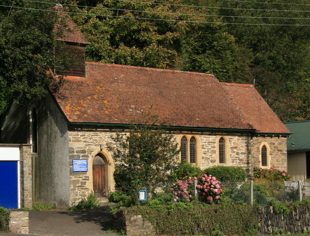
St
Bartholomew Church, Barbrook - geograph.org.uk - 1003231.jpg
42:
St_Bartholomew_Church,_Barbrook_-_geograph.org.uk_-_1003231.jpg
258:
208:
56:
268:
51° 12′ 51″ N, 3° 50′ 32″ W
455:
Add a one-line explanation of what this file represents
161:
Creative
Commons Attribution Share-alike license 2.0
95:
80:
Commons is a freely licensed media file repository.
643:
Creative
Commons Attribution-ShareAlike 2.0 Generic
46:(640 × 488 pixels, file size: 129 KB, MIME type:
424:https://creativecommons.org/licenses/by-sa/2.0
61:
430:Creative Commons Attribution-Share Alike 2.0
348:
8:
881:
817:
390:– to copy, distribute and transmit the work
951:
451:
763:https://www.geograph.org.uk/photo/1003231
570:https://www.geograph.org.uk/profile/19336
1015:
905:
889:
841:
825:
797:
781:
710:
694:
676:
660:
640:
624:
604:
588:
521:
505:
485:
469:
466:
447:
440:
261:
211:
290:View this and other nearby images on:
240:View this and other nearby images on:
7:
335:and is licensed for reuse under the
1013:The following page uses this file:
940:
371:Attribution-Share Alike 2.0 Generic
359:
354:
339:Attribution-ShareAlike 2.0 license.
460:
454:
345:
322:
93:
39:
459:
828:coordinates of the point of view
445:
401:Under the following conditions:
366:This file is licensed under the
358:
353:
347:
315:
296:
282:
274:
246:
232:
224:
60:
21:
994:File Upload Bot (Magnus Manske)
442:
201:St Bartholomew Church, Barbrook
182:St Bartholomew Church, Barbrook
105:St Bartholomew Church, Barbrook
36:No higher resolution available.
14:
713:file available on the internet
441:
323:This image was taken from the
26:
1:
892:coordinates of depicted place
843:51°12'50.015"N, 3°50'32.244"W
748:Geograph Britain and Ireland
548:object of statement has role
467:Items portrayed in this file
907:51°12'51.16"N, 3°50'31.56"W
273:
223:
1034:
415:same or compatible license
941:
16:
726:geograph.org.uk image ID
444:
381:
199:Guy Wareham /
180:Guy Wareham /
67:This is a file from the
998:
171:required by the license
149:
139:
119:
112:
109:
98:
71:. Information from its
329:this photograph's page
302:51.214210; -3.842100
252:51.213893; -3.842290
74:description page there
784:location of creation
133:geograph_org2commons
977:22:02, 1 March 2009
800:Lynton and Lynmouth
396:– to adapt the work
1001:User:Magnus Manske
535:author name string
129:User:Magnus Manske
1006:
883:
819:
627:copyright license
453:
344:
343:
327:collection. See
307:
306:
257:
256:
206:
205:
174:
158:
155:Reusing this file
127:; transferred by
89:
88:
69:Wikimedia Commons
1025:
989:
929:
928:
923:
865:
864:
859:
765:
760:
756:described at URL
750:
745:
735:
730:
591:copyright status
572:
567:
557:
552:
542:
539:
437:
434:
431:
428:
425:
417:as the original.
379:
368:Creative Commons
362:
361:
357:
356:
351:
350:
337:Creative Commons
325:Geograph project
319:
312:
303:
300:
286:
285:
279:
278:
277:
271:
270:
259:
253:
250:
236:
235:
229:
228:
227:
221:
220:
209:
168:
152:
115:
102:
96:
85:
64:
63:
57:
51:
49:
1033:
1032:
1028:
1027:
1026:
1024:
1023:
1022:
1007:
995:
987:
943:
942:
939:
938:
937:
936:
935:
934:
933:
932:
931:
930:
926:
924:
921:
912:
911:
910:
908:
898:
897:
896:
894:
875:
874:
873:
872:
871:
870:
869:
868:
867:
866:
862:
860:
857:
848:
847:
846:
844:
834:
833:
832:
830:
811:
810:
809:
808:
807:
806:
805:
804:
802:
790:
789:
788:
786:
775:
774:
773:
772:
771:
770:
769:
768:
767:
766:
761:
758:
752:
751:
746:
743:
737:
736:
731:
728:
719:
718:
717:
715:
703:
702:
701:
699:
688:
687:
686:
685:
684:
683:
682:
681:
679:
678:10 October 2008
669:
668:
667:
665:
654:
653:
652:
651:
650:
649:
648:
647:
645:
633:
632:
631:
629:
618:
617:
616:
615:
614:
613:
612:
611:
609:
597:
596:
595:
593:
582:
581:
580:
579:
578:
577:
576:
575:
574:
573:
568:
565:
559:
558:
553:
550:
544:
543:
540:
537:
528:
527:
526:
524:
514:
513:
512:
510:
499:
498:
497:
496:
495:
494:
493:
492:
490:
488:church building
478:
477:
476:
474:
458:
457:
456:
439:
438:
435:
432:
429:
426:
423:
422:
380:
377:
374:
363:
340:
301:
275:
266:
265:
262:Object location
251:
225:
216:
215:
212:Camera location
207:
196:
189:
177:
125:geograph.org.uk
114:10 October 2008
100:
91:
90:
79:
78:
77:is shown below.
53:
47:
45:
38:
37:
12:
11:
5:
1031:
1029:
1021:
1020:
1011:
1010:
1005:
1004:
997:
993:
990:
984:
979:
974:
970:
969:
966:
963:
960:
957:
954:
947:
946:
917:
916:
915:
914:
913:
909:
906:
904:
903:
902:
901:
900:
899:
895:
890:
888:
887:
886:
885:
879:
853:
852:
851:
850:
849:
845:
842:
840:
839:
838:
837:
836:
835:
831:
826:
824:
823:
822:
821:
815:
803:
798:
796:
795:
794:
793:
792:
791:
787:
782:
780:
779:
778:
777:
776:
754:
753:
739:
738:
724:
723:
722:
721:
720:
716:
711:
709:
708:
707:
706:
705:
704:
700:
697:source of file
695:
693:
692:
691:
690:
689:
680:
677:
675:
674:
673:
672:
671:
670:
666:
661:
659:
658:
657:
656:
655:
646:
641:
639:
638:
637:
636:
635:
634:
630:
625:
623:
622:
621:
620:
619:
610:
605:
603:
602:
601:
600:
599:
598:
594:
589:
587:
586:
585:
584:
583:
561:
560:
546:
545:
533:
532:
531:
530:
529:
525:
522:
520:
519:
518:
517:
516:
515:
511:
506:
504:
503:
502:
501:
500:
491:
486:
484:
483:
482:
481:
480:
479:
475:
470:
468:
465:
464:
463:
462:
461:
450:
449:
446:
443:
421:
420:
419:
418:
408:
399:
398:
397:
391:
384:You are free:
375:
365:
364:
346:
342:
341:
320:
305:
304:
294:
288:
263:
255:
254:
244:
238:
213:
204:
203:
197:
194:
191:
190:
185:
178:
175:
163:
162:
159:
147:
146:
141:
137:
136:
121:
117:
116:
111:
107:
106:
103:
94:
92:
87:
86:
65:
55:
54:
35:
31:
30:
29:
24:
19:
13:
10:
9:
6:
4:
3:
2:
1030:
1019:
1016:
1014:
1008:
1002:
996:
991:
985:
983:
980:
978:
975:
972:
971:
967:
964:
961:
958:
955:
953:
952:
950:
944:
920:
893:
856:
829:
801:
785:
764:
757:
749:
742:
734:
727:
714:
698:
664:
644:
628:
608:
592:
571:
564:
556:
549:
536:
509:
489:
473:
427:CC BY-SA 2.0
416:
412:
409:
406:
403:
402:
400:
395:
392:
389:
386:
385:
383:
382:
376:Attribution:
372:
369:
352:
338:
334:
330:
326:
321:
318:
314:
313:
310:
309:
299:
295:
293:
292:OpenStreetMap
289:
287:
269:
264:
260:
249:
245:
243:
242:OpenStreetMap
239:
237:
219:
214:
210:
202:
198:
193:
192:
188:
184: /
183:
179:
172:
167:
165:
164:
160:
156:
151:
148:
145:
142:
138:
134:
130:
126:
122:
118:
108:
104:
97:
83:
76:
75:
70:
66:
59:
58:
52:
43:
34:
28:
25:
23:
20:
18:
15:
1012:
948:
945:File history
555:photographer
410:
404:
393:
387:
332:
308:
272:
222:
200:
187:CC BY-SA 2.0
181:
82:You can help
72:
40:
22:File history
607:copyrighted
541:Guy Wareham
411:share alike
405:attribution
378:Guy Wareham
333:Guy Wareham
166:Attribution
144:Guy Wareham
99:Description
1009:File usage
986:640 × 488
962:Dimensions
523:some value
150:Permission
48:image/jpeg
27:File usage
1003:using . |
959:Thumbnail
956:Date/Time
663:inception
195:InfoField
176:InfoField
1018:Barbrook
988:(129 KB)
741:operator
448:Captions
394:to remix
388:to share
373:license.
973:current
968:Comment
919:heading
878:heading
855:heading
814:heading
733:1003231
508:creator
472:depicts
452:English
44:
927:degree
882:degree
863:degree
818:degree
280:
230:
140:Author
131:using
120:Source
123:From
965:User
436:true
433:true
110:Date
17:File
925:22
861:22
563:URL
922::
858::
759::
744::
729::
566::
551::
538::
173:)
169:(
157:)
153:(
135:.
84:.
50:)
Text is available under the Creative Commons Attribution-ShareAlike License. Additional terms may apply.
_region:GB-ENG_heading:22.00&language=en)
