307:
240:
232:
254:
275:
313:
318:
72:
632:"}},"text\/plain":{"en":{"":"heading"}}},"{\"value\":{\"amount\":\"+0\",\"unit\":\"http:\\\/\\\/www.wikidata.org\\\/entity\\\/Q28390\"},\"type\":\"quantity\"}":{"text\/html":{"en":{"P7787":"0
628:
43:
365:– You must give appropriate credit, provide a link to the license, and indicate if changes were made. You may do so in any reasonable manner, but not in any way that suggests the licensor endorses you or your use.
223:
898:
629:
83:
51:
888:
160:
893:
715:
581:
545:
247:
802:
735:
1086:
282:
949:
This file contains additional information, probably added from the digital camera or scanner used to create or digitize it.
372:
495:
786:
758:
699:
670:
643:
529:
503:
488:
473:
743:
728:
601:
565:
446:
429:
269:
856:
851:
328:
42:
874:{{Information |Description={{en|1=TBD}} |Source=Geograph |Author=TBD |Date= |Permission= |other_versions= }}
952:
If the file has been modified from its original state, some details may not fully reflect the modified file.
884:
The following pages on the
English Knowledge (XXG) use this file (pages on other projects are not listed):
916:
1113:
371:– If you remix, transform, or build upon the material, you must distribute your contributions under the
289:
on the
Geograph website for the photographer's contact details. The copyright on this image is owned by
325:
1149:
636:"}},"text\/plain":{"en":{"P7787":"0 degree"}}}}": -->
91:
192:
1055:
1222:
480:
765:
750:
176:
867:
936:
253:
1185:
1131:
978:
294:
78:
1232:
1195:
1018:
237:
1159:
931:
128:
998:
149:
139:
1242:
988:
274:
286:
824:
Click on a date/time to view the file as it appeared at that time.
971:
961:
239:
224:
53° 24′ 51.45″ N, 6° 10′ 52.91″ W
214:
66:
413:
Add a one-line explanation of what this file represents
926:
167:
Creative
Commons Attribution Share-alike license 2.0
110:
90:
Commons is a freely licensed media file repository.
582:
Creative
Commons Attribution-ShareAlike 2.0 Generic
899:User:JohnArmagh/List of monastic houses in Ireland
56:(640 × 480 pixels, file size: 97 KB, MIME type:
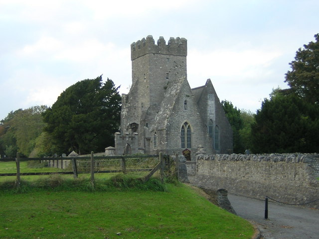
382:https://creativecommons.org/licenses/by-sa/2.0
71:
388:Creative Commons Attribution-Share Alike 2.0
306:
8:
116:St Doulaghs Church Dublin Geograph Image.jpg
52:St_Doulaghs_Church_Dublin_Geograph_Image.jpg
633:
348:– to copy, distribute and transmit the work
954:
937:User:Pawel Marynowski (WMIE)/Tables/Dublin
826:
409:
909:The following other wikis use this file:
481:https://www.geograph.org.uk/profile/17220
889:List of monastic houses in County Dublin
751:https://www.geograph.org.uk/photo/548187
1250:
1240:
1230:
1220:
1212:
1204:
1193:
1183:
1175:
1167:
1157:
1147:
1139:
1129:
1121:
1111:
1103:
1095:
1084:
1076:
1068:
1060:
1050:
1042:
1034:
1026:
1015:
1007:
996:
986:
976:
966:
886:
800:
784:
713:
697:
657:
641:
615:
599:
579:
563:
543:
527:
460:
444:
427:
424:
405:
398:
217:
246:View this and other nearby images on:
956:
7:
293:and is licensed for reuse under the
932:User:Pawel Marynowski (WMIE)/Tables
815:
329:Attribution-Share Alike 2.0 Generic
317:
312:
297:Attribution-ShareAlike 2.0 license.
947:
894:List of monastic houses in Ireland
418:
412:
303:
280:
103:
49:
417:
1009:Date and time of data generation
644:coordinates of the point of view
403:
359:Under the following conditions:
324:This file is licensed under the
316:
311:
305:
273:
252:
238:
230:
70:
31:
21:
400:
46:No higher resolution available.
14:
716:file available on the internet
399:
281:This image was taken from the
207:St. Doulagh's Church, Malahide
188:St. Doulagh's Church, Malahide
120:St. Doulagh's Church, Malahide
26:
1:
1154:Flash did not fire, auto mode
983:5/204 sec (0.024509803921569)
659:53°24'51.455"N, 6°10'52.907"W
205:T Michael Weddle /
186:T Michael Weddle /
36:
736:Geograph Britain and Ireland
489:object of statement has role
425:Items portrayed in this file
1097:Date and time of digitizing
1272:
1206:Focal length in 35 mm film
923:Usage on www.wikidata.org
913:Usage on ru.wikipedia.org
373:same or compatible license
229:
1062:File change date and time
816:
16:
759:geograph.org.uk image ID
402:
339:
77:This is a file from the
1169:Custom image processing
873:
177:required by the license
155:
145:
134:
127:
124:
113:
81:. Information from its
1252:Subject distance range
1105:Image compression mode
1100:12:57, 10 October 2004
1065:12:57, 10 October 2004
1012:12:57, 10 October 2004
287:this photograph's page
258:53.414293; -6.181363
84:description page there
1123:Maximum land aperture
1036:Horizontal resolution
852:16:05, 2 August 2009
1070:Y and C positioning
1044:Vertical resolution
958:Camera manufacturer
354:– to adapt the work
1214:Scene capture type
1190:Auto white balance
803:Nikon Coolpix 2100
504:author name string
1259:
1258:
905:Global file usage
877:
635:
566:copyright license
411:
302:
301:
285:collection. See
263:
262:
212:
211:
180:
164:
161:Reusing this file
99:
98:
79:Wikimedia Commons
32:Global file usage
1263:
1078:Exposure Program
955:
864:
768:
763:
753:
748:
744:described at URL
738:
733:
681:
680:
675:
530:copyright status
511:
510:T Michael Weddle
508:
498:
493:
483:
478:
395:
392:
389:
386:
383:
375:as the original.
337:
336:T Michael Weddle
326:Creative Commons
320:
319:
315:
314:
309:
308:
295:Creative Commons
291:T Michael Weddle
283:Geograph project
277:
270:
259:
256:
242:
241:
235:
234:
233:
227:
226:
215:
174:
158:
150:T Michael Weddle
130:
117:
111:
95:
74:
73:
67:
61:
59:
1271:
1270:
1266:
1265:
1264:
1262:
1261:
1260:
1126:3 APEX (f/2.83)
943:
903:
885:
878:
870:
862:
818:
817:
814:
813:
812:
811:
810:
809:
808:
807:
805:
793:
792:
791:
789:
778:
777:
776:
775:
774:
773:
772:
771:
770:
769:
764:
761:
755:
754:
749:
746:
740:
739:
734:
731:
722:
721:
720:
718:
706:
705:
704:
702:
691:
690:
689:
688:
687:
686:
685:
684:
683:
682:
678:
676:
673:
664:
663:
662:
660:
650:
649:
648:
646:
627:
626:
625:
624:
623:
622:
621:
620:
618:
617:10 October 2004
608:
607:
606:
604:
593:
592:
591:
590:
589:
588:
587:
586:
584:
572:
571:
570:
568:
557:
556:
555:
554:
553:
552:
551:
550:
548:
536:
535:
534:
532:
521:
520:
519:
518:
517:
516:
515:
514:
513:
512:
509:
506:
500:
499:
494:
491:
485:
484:
479:
476:
467:
466:
465:
463:
453:
452:
451:
449:
438:
437:
436:
435:
434:
432:
416:
415:
414:
397:
396:
393:
390:
387:
384:
381:
380:
338:
335:
332:
321:
298:
268:
257:
231:
222:
221:
218:Camera location
213:
202:
195:
183:
140:geograph.org.uk
129:10 October 2004
115:
108:
101:
100:
89:
88:
87:is shown below.
63:
57:
55:
48:
47:
12:
11:
5:
1269:
1267:
1257:
1256:
1253:
1249:
1248:
1245:
1239:
1238:
1235:
1229:
1228:
1225:
1219:
1218:
1215:
1211:
1210:
1207:
1203:
1202:
1199:
1192:
1191:
1188:
1182:
1181:
1178:
1174:
1173:
1172:Normal process
1170:
1166:
1165:
1162:
1156:
1155:
1152:
1146:
1145:
1142:
1138:
1137:
1134:
1128:
1127:
1124:
1120:
1119:
1116:
1110:
1109:
1106:
1102:
1101:
1098:
1094:
1093:
1090:
1083:
1082:
1081:Normal program
1079:
1075:
1074:
1071:
1067:
1066:
1063:
1059:
1058:
1053:
1049:
1048:
1045:
1041:
1040:
1037:
1033:
1032:
1029:
1025:
1024:
1021:
1014:
1013:
1010:
1006:
1005:
1002:
995:
994:
991:
985:
984:
981:
975:
974:
969:
965:
964:
959:
946:
942:
941:
940:
939:
934:
929:
921:
920:
919:
907:
906:
902:
901:
896:
891:
883:
882:
881:
876:
875:
872:
868:
865:
859:
854:
849:
845:
844:
841:
838:
835:
832:
829:
822:
821:
806:
801:
799:
798:
797:
796:
795:
794:
790:
785:
783:
782:
781:
780:
779:
757:
756:
742:
741:
727:
726:
725:
724:
723:
719:
714:
712:
711:
710:
709:
708:
707:
703:
700:source of file
698:
696:
695:
694:
693:
692:
669:
668:
667:
666:
665:
661:
658:
656:
655:
654:
653:
652:
651:
647:
642:
640:
639:
638:
637:
631:
619:
616:
614:
613:
612:
611:
610:
609:
605:
600:
598:
597:
596:
595:
594:
585:
580:
578:
577:
576:
575:
574:
573:
569:
564:
562:
561:
560:
559:
558:
549:
544:
542:
541:
540:
539:
538:
537:
533:
528:
526:
525:
524:
523:
522:
502:
501:
487:
486:
472:
471:
470:
469:
468:
464:
461:
459:
458:
457:
456:
455:
454:
450:
445:
443:
442:
441:
440:
439:
433:
428:
426:
423:
422:
421:
420:
419:
408:
407:
404:
401:
379:
378:
377:
376:
366:
357:
356:
355:
349:
342:You are free:
333:
323:
322:
304:
300:
299:
278:
267:
264:
261:
260:
250:
244:
219:
210:
209:
203:
200:
197:
196:
191:
184:
181:
169:
168:
165:
153:
152:
147:
143:
142:
136:
132:
131:
126:
122:
121:
118:
109:
107:
104:
102:
97:
96:
75:
65:
64:
45:
41:
40:
39:
34:
29:
24:
19:
13:
10:
9:
6:
4:
3:
2:
1268:
1254:
1251:
1246:
1244:
1241:
1236:
1234:
1231:
1226:
1224:
1221:
1216:
1213:
1208:
1205:
1200:
1197:
1194:
1189:
1187:
1186:White balance
1184:
1180:Auto exposure
1179:
1177:Exposure mode
1176:
1171:
1168:
1163:
1161:
1158:
1153:
1151:
1148:
1143:
1140:
1135:
1133:
1132:Metering mode
1130:
1125:
1122:
1117:
1115:
1114:Exposure bias
1112:
1107:
1104:
1099:
1096:
1091:
1088:
1085:
1080:
1077:
1072:
1069:
1064:
1061:
1057:
1054:
1052:Software used
1051:
1046:
1043:
1038:
1035:
1030:
1027:
1022:
1020:
1016:
1011:
1008:
1003:
1000:
997:
992:
990:
987:
982:
980:
979:Exposure time
977:
973:
970:
967:
963:
960:
957:
953:
950:
944:
938:
935:
933:
930:
928:
925:
924:
922:
918:
915:
914:
912:
911:
910:
904:
900:
897:
895:
892:
890:
887:
879:
871:
866:
860:
858:
855:
853:
850:
847:
846:
842:
839:
836:
833:
830:
828:
827:
825:
819:
804:
788:
787:captured with
767:
760:
752:
745:
737:
730:
717:
701:
672:
645:
603:
583:
567:
547:
531:
505:
497:
490:
482:
475:
448:
431:
385:CC BY-SA 2.0
374:
370:
367:
364:
361:
360:
358:
353:
350:
347:
344:
343:
341:
340:
334:Attribution:
330:
327:
310:
296:
292:
288:
284:
279:
276:
272:
271:
265:
255:
251:
249:
248:OpenStreetMap
245:
243:
225:
220:
216:
208:
204:
199:
198:
194:
190: /
189:
185:
178:
173:
171:
170:
166:
162:
157:
154:
151:
148:
144:
141:
137:
133:
123:
119:
112:
105:
93:
86:
85:
80:
76:
69:
68:
62:
53:
44:
38:
35:
33:
30:
28:
25:
23:
20:
18:
15:
1196:Digital zoom
1141:Light source
1019:focal length
968:Camera model
951:
948:
908:
823:
820:File history
496:photographer
368:
362:
351:
345:
290:
228:
206:
193:CC BY-SA 2.0
187:
92:You can help
82:
50:
22:File history
1160:Color space
1028:Orientation
546:copyrighted
369:share alike
363:attribution
172:Attribution
114:Description
1233:Saturation
917:Балгриффин
880:File usage
869:Guliolopez
861:640 × 480
837:Dimensions
462:some value
156:Permission
58:image/jpeg
27:File usage
1243:Sharpness
1056:E2100v1.0
999:ISO speed
834:Thumbnail
831:Date/Time
602:inception
266:Licensing
201:InfoField
182:InfoField
1223:Contrast
1217:Standard
1073:Co-sited
989:F-number
945:Metadata
927:Q7587770
729:operator
406:Captions
352:to remix
346:to share
331:license.
37:Metadata
1255:Unknown
1144:Unknown
1136:Pattern
1089:version
1047:300 dpi
1039:300 dpi
863:(97 KB)
848:current
843:Comment
671:heading
630:heading
447:creator
430:depicts
410:English
106:Summary
54:
1247:Normal
1237:Normal
1227:Normal
1031:Normal
1023:9.1 mm
1001:rating
766:548187
679:degree
634:degree
236:
146:Author
135:Source
1209:70 mm
1198:ratio
1150:Flash
1017:Lens
993:f/3.6
972:E2100
962:NIKON
138:From
1164:sRGB
1087:Exif
840:User
394:true
391:true
125:Date
17:File
1092:2.2
1004:100
474:URL
762::
747::
732::
677:0
674::
507::
492::
477::
1201:0
1118:0
1108:2
179:)
175:(
163:)
159:(
94:.
60:)
Text is available under the Creative Commons Attribution-ShareAlike License. Additional terms may apply.
