254:
187:
179:
201:
222:
260:
265:
72:
496:"}},"text\/plain":{"en":{"":"heading"}}},"{\"value\":{\"amount\":\"+315.0\",\"unit\":\"http:\\\/\\\/www.wikidata.org\\\/entity\\\/Q28390\"},\"type\":\"quantity\"}":{"text\/html":{"en":{"P7787":"315.0
676:
492:
312:– You must give appropriate credit, provide a link to the license, and indicate if changes were made. You may do so in any reasonable manner, but not in any way that suggests the licensor endorses you or your use.
643:
170:
43:
615:{{Information |Description=Photograph |Source=http://www.geograph.org.uk/photo/444400 |Date=24 May 2007 |Author=Alexander P Kapp |Permission= |other_versions= }} {{geograph}}
616:
493:
638:
653:
83:
51:
648:
445:
409:
194:
873:
229:
744:
This file contains additional information, probably added from the digital camera or scanner used to create or digitize it.
319:
534:
507:
393:
850:
465:
429:
376:
216:
658:
275:
747:
If the file has been modified from its original state, some details may not fully reflect the modified file.
629:
The following pages on the
English Knowledge (XXG) use this file (pages on other projects are not listed):
921:
318:– If you remix, transform, or build upon the material, you must distribute your contributions under the
236:
on the
Geograph website for the photographer's contact details. The copyright on this image is owned by
766:
597:
592:
500:"}},"text\/plain":{"en":{"P7787":"315.0 degree"}}}}": -->
42:
272:
949:
608:
756:
91:
1038:
200:
1001:
939:
773:
241:
78:
1048:
1011:
813:
184:
975:
126:
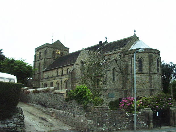
Parish church of St John the
Evangelist, Flookburgh, Cumbria, seen from the east
135:
793:
633:
145:
1058:
783:
221:
233:
565:
Click on a date/time to view the file as it appeared at that time.
186:
171:
54° 10′ 32.1″ N, 2° 58′ 22.02″ W
161:
66:
644:
List of ecclesiastical works by Austin and Paley (1895–1916)
677:كنيسه القديس يوحنا المعمدان (لوير هولكير, المملكه المتحده)
716:
706:
696:
686:
360:
Add a one-line explanation of what this file represents
731:
726:
110:
90:
Commons is a freely licensed media file repository.
446:
Creative
Commons Attribution-ShareAlike 2.0 Generic
56:(620 × 464 pixels, file size: 148 KB, MIME type:
617:Category:Anglican churches in the United Kingdom
329:https://creativecommons.org/licenses/by-sa/2.0
71:
654:St John the Baptist's Church, Flookburgh
335:Creative Commons Attribution-Share Alike 2.0
253:
8:
639:Grade II* listed buildings in South Lakeland
497:
295:– to copy, distribute and transmit the work
749:
567:
356:
669:The following other wikis use this file:
1066:
1056:
1046:
1036:
1028:
1020:
1009:
999:
991:
983:
973:
965:
957:
947:
937:
929:
919:
911:
890:
882:
871:
863:
855:
845:
837:
829:
821:
810:
802:
791:
781:
771:
761:
631:
521:
505:
479:
463:
443:
427:
407:
391:
374:
371:
352:
345:
164:
193:View this and other nearby images on:
751:
7:
240:and is licensed for reuse under the
52:St_John's_Church,_Flookburgh.jpg
556:
276:Attribution-Share Alike 2.0 Generic
264:
259:
244:Attribution-ShareAlike 2.0 license.
742:
365:
359:
250:
227:
120:
103:
49:
364:
804:Date and time of data generation
649:Listed buildings in Lower Holker
508:coordinates of the point of view
350:
306:Under the following conditions:
271:This file is licensed under the
263:
258:
252:
220:
199:
185:
177:
116:St John's Church, Flookburgh.jpg
70:
31:
21:
347:
121:
46:No higher resolution available.
14:
346:
228:This image was taken from the
26:
1:
954:Flash did not fire, auto mode
523:54°10'32.095"N, 2°58'22.015"W
36:
372:Items portrayed in this file
176:
884:Date and time of digitizing
851:ACD Systems Digital Imaging
673:Usage on arz.wikipedia.org
619:[[Category:Buildings in Cum
1088:
1022:Focal length in 35 mm film
967:Supported Flashpix version
723:Usage on www.wikidata.org
713:Usage on fr.wikipedia.org
703:Usage on eu.wikipedia.org
693:Usage on es.wikipedia.org
683:Usage on cy.wikipedia.org
320:same or compatible license
892:Meaning of each component
857:File change date and time
557:
16:
659:User:Magnus Manske/test3
349:
286:
77:This is a file from the
985:Custom image processing
944:Center weighted average
614:
151:
141:
134:
131:
113:
81:. Information from its
1068:Subject distance range
913:Image compression mode
234:this photograph's page
205:54.175582; -2.972782
84:description page there
931:Maximum land aperture
831:Horizontal resolution
959:DateTime subseconds
865:Y and C positioning
839:Vertical resolution
778:1/1,000 sec (0.001)
753:Camera manufacturer
301:– to adapt the work
1030:Scene capture type
1006:Auto white balance
887:14:46, 24 May 2007
860:21:14, 25 May 2007
807:14:46, 24 May 2007
757:PENTAX Corporation
593:16:01, 16 May 2008
1075:
1074:
934:2.8 APEX (f/2.64)
665:Global file usage
622:
499:
430:copyright license
358:
249:
248:
232:collection. See
210:
209:
159:
158:
99:
98:
79:Wikimedia Commons
32:Global file usage
1079:
767:PENTAX Optio S40
750:
605:
545:
544:
539:
394:copyright status
342:
339:
336:
333:
330:
322:as the original.
284:
283:Alexander P Kapp
273:Creative Commons
267:
266:
262:
261:
256:
255:
242:Creative Commons
238:Alexander P Kapp
230:Geograph project
224:
217:
206:
203:
189:
188:
182:
181:
180:
174:
173:
162:
155:Alexander P Kapp
137:
125:
117:
111:
95:
74:
73:
67:
61:
59:
1087:
1086:
1082:
1081:
1080:
1078:
1077:
1076:
996:Manual exposure
738:
663:
630:
623:
611:
603:
559:
558:
555:
554:
553:
552:
551:
550:
549:
548:
547:
546:
542:
540:
537:
528:
527:
526:
524:
514:
513:
512:
510:
491:
490:
489:
488:
487:
486:
485:
484:
482:
472:
471:
470:
468:
457:
456:
455:
454:
453:
452:
451:
450:
448:
436:
435:
434:
432:
421:
420:
419:
418:
417:
416:
415:
414:
412:
400:
399:
398:
396:
385:
384:
383:
382:
381:
379:
363:
362:
361:
344:
343:
340:
337:
334:
331:
328:
327:
285:
282:
279:
268:
245:
215:
204:
178:
169:
168:
165:Camera location
160:
146:geograph.org.uk
127:
115:
108:
101:
100:
89:
88:
87:is shown below.
63:
57:
55:
48:
47:
12:
11:
5:
1085:
1083:
1073:
1072:
1069:
1065:
1064:
1061:
1055:
1054:
1051:
1045:
1044:
1041:
1035:
1034:
1031:
1027:
1026:
1023:
1019:
1018:
1015:
1008:
1007:
1004:
998:
997:
994:
990:
989:
988:Normal process
986:
982:
981:
978:
972:
971:
968:
964:
963:
960:
956:
955:
952:
946:
945:
942:
936:
935:
932:
928:
927:
924:
918:
917:
914:
910:
909:
908:
907:
906:does not exist
904:
901:
898:
893:
889:
888:
885:
881:
880:
877:
870:
869:
866:
862:
861:
858:
854:
853:
848:
844:
843:
840:
836:
835:
832:
828:
827:
824:
820:
819:
816:
809:
808:
805:
801:
800:
797:
790:
789:
786:
780:
779:
776:
770:
769:
764:
760:
759:
754:
741:
737:
736:
735:
734:
729:
721:
720:
719:
711:
710:
709:
701:
700:
699:
691:
690:
689:
681:
680:
679:
667:
666:
662:
661:
656:
651:
646:
641:
636:
628:
627:
626:
621:
620:
613:
610:Peter I. Vardy
609:
606:
600:
595:
590:
586:
585:
582:
579:
576:
573:
570:
563:
562:
533:
532:
531:
530:
529:
525:
522:
520:
519:
518:
517:
516:
515:
511:
506:
504:
503:
502:
501:
495:
483:
480:
478:
477:
476:
475:
474:
473:
469:
464:
462:
461:
460:
459:
458:
449:
444:
442:
441:
440:
439:
438:
437:
433:
428:
426:
425:
424:
423:
422:
413:
408:
406:
405:
404:
403:
402:
401:
397:
392:
390:
389:
388:
387:
386:
380:
375:
373:
370:
369:
368:
367:
366:
355:
354:
351:
348:
326:
325:
324:
323:
313:
304:
303:
302:
296:
289:You are free:
280:
270:
269:
251:
247:
246:
225:
214:
211:
208:
207:
197:
191:
166:
157:
156:
153:
149:
148:
143:
139:
138:
133:
129:
128:
118:
109:
107:
104:
102:
97:
96:
75:
65:
64:
45:
41:
40:
39:
34:
29:
24:
19:
13:
10:
9:
6:
4:
3:
2:
1084:
1070:
1067:
1062:
1060:
1057:
1052:
1050:
1047:
1042:
1040:
1037:
1032:
1029:
1024:
1021:
1016:
1013:
1010:
1005:
1003:
1002:White balance
1000:
995:
993:Exposure mode
992:
987:
984:
979:
977:
974:
969:
966:
961:
958:
953:
951:
948:
943:
941:
940:Metering mode
938:
933:
930:
925:
923:
922:Exposure bias
920:
915:
912:
905:
902:
899:
896:
895:
894:
891:
886:
883:
878:
875:
872:
867:
864:
859:
856:
852:
849:
847:Software used
846:
841:
838:
833:
830:
825:
822:
817:
815:
811:
806:
803:
798:
795:
792:
787:
785:
782:
777:
775:
774:Exposure time
772:
768:
765:
762:
758:
755:
752:
748:
745:
739:
733:
730:
728:
725:
724:
722:
718:
715:
714:
712:
708:
705:
704:
702:
698:
695:
694:
692:
688:
685:
684:
682:
678:
675:
674:
672:
671:
670:
664:
660:
657:
655:
652:
650:
647:
645:
642:
640:
637:
635:
632:
624:
618:
612:
607:
601:
599:
596:
594:
591:
588:
587:
583:
580:
577:
574:
571:
569:
568:
566:
560:
536:
509:
467:
447:
431:
411:
395:
378:
332:CC BY-SA 2.0
321:
317:
314:
311:
308:
307:
305:
300:
297:
294:
291:
290:
288:
287:
281:Attribution:
277:
274:
257:
243:
239:
235:
231:
226:
223:
219:
218:
212:
202:
198:
196:
195:OpenStreetMap
192:
190:
172:
167:
163:
154:
150:
147:
144:
140:
130:
124:
119:
112:
105:
93:
86:
85:
80:
76:
69:
68:
62:
53:
44:
38:
35:
33:
30:
28:
25:
23:
20:
18:
15:
1071:Distant view
1012:Digital zoom
814:focal length
763:Camera model
746:
743:
668:
564:
561:File history
315:
309:
298:
292:
237:
175:
122:
92:You can help
82:
50:
22:File history
976:Color space
823:Orientation
481:24 May 2007
410:copyrighted
316:share alike
310:attribution
136:24 May 2007
114:Description
1049:Saturation
717:Flookburgh
707:Flookburgh
697:Flookburgh
687:Flookburgh
634:Flookburgh
625:File usage
602:620 × 464
578:Dimensions
58:image/jpeg
27:File usage
1059:Sharpness
1033:Landscape
916:1.7553125
794:ISO speed
575:Thumbnail
572:Date/Time
466:inception
213:Licensing
123:English:
1039:Contrast
868:Centered
784:F-number
740:Metadata
732:Q7593719
604:(148 KB)
353:Captions
299:to remix
293:to share
278:license.
37:Metadata
876:version
727:Q662167
589:current
584:Comment
535:heading
494:heading
377:depicts
357:English
106:Summary
54:
1053:Normal
1043:Normal
842:72 dpi
834:72 dpi
826:Normal
818:5.8 mm
796:rating
543:degree
541:315.0
498:degree
183:
152:Author
142:Source
1025:35 mm
1014:ratio
950:Flash
812:Lens
788:f/4.3
1063:Hard
980:sRGB
874:Exif
581:User
341:true
338:true
132:Date
17:File
962:250
926:0.3
879:2.2
799:200
903:Cr
900:Cb
538::
1017:0
970:1
897:Y
94:.
60:)
