351:
289:
239:
281:
231:
303:
253:
319:
357:
362:
72:
559:"}},"text\/plain":{"en":{"":"heading"}}},"{\"value\":{\"amount\":\"+247.0\",\"unit\":\"http:\\\/\\\/www.wikidata.org\\\/entity\\\/Q28390\"},\"type\":\"quantity\"}":{"text\/html":{"en":{"P7787":"247.0
657:"}},"text\/plain":{"en":{"":"heading"}}},"{\"value\":{\"amount\":\"+247\",\"unit\":\"http:\\\/\\\/www.wikidata.org\\\/entity\\\/Q28390\"},\"type\":\"quantity\"}":{"text\/html":{"en":{"P7787":"247
653:
272:
222:
409:– You must give appropriate credit, provide a link to the license, and indicate if changes were made. You may do so in any reasonable manner, but not in any way that suggests the licensor endorses you or your use.
43:
654:
556:
159:
800:
542:
506:
296:
246:
326:
841:
This file contains additional information, probably added from the digital camera or scanner used to create or digitize it.
416:
795:
83:
695:
668:
597:
570:
490:
51:
790:
626:
526:
473:
313:
372:
844:
If the file has been modified from its original state, some details may not fully reflect the modified file.
415:– If you remix, transform, or build upon the material, you must distribute your contributions under the
333:
on the
Geograph website for the photographer's contact details. The copyright on this image is owned by
563:"}},"text\/plain":{"en":{"P7787":"247.0 degree"}}}}": -->
369:
661:"}},"text\/plain":{"en":{"P7787":"247 degree"}}}}": -->
91:
191:
175:
758:
753:
42:
302:
252:
338:
78:
769:
818:
130:
286:
236:
140:
318:
828:
330:
726:
Click on a date/time to view the file as it appeared at that time.
288:
238:
263:
213:
66:
273:
56° 12′ 18″ N, 2° 45′ 31″ W
223:
56° 12′ 25″ N, 2° 45′ 12″ W
457:
Add a one-line explanation of what this file represents
105:
90:
Commons is a freely licensed media file repository.
543:
Creative
Commons Attribution-ShareAlike 2.0 Generic
56:(640 × 420 pixels, file size: 52 KB, MIME type:
426:https://creativecommons.org/licenses/by-sa/2.0
71:
432:Creative Commons Attribution-Share Alike 2.0
350:
8:
658:
560:
392:– to copy, distribute and transmit the work
846:
728:
453:
811:The following other wikis use this file:
141:https://www.geograph.org.uk/photo/497071
848:
788:
682:
666:
640:
624:
584:
568:
540:
524:
504:
488:
471:
468:
449:
442:
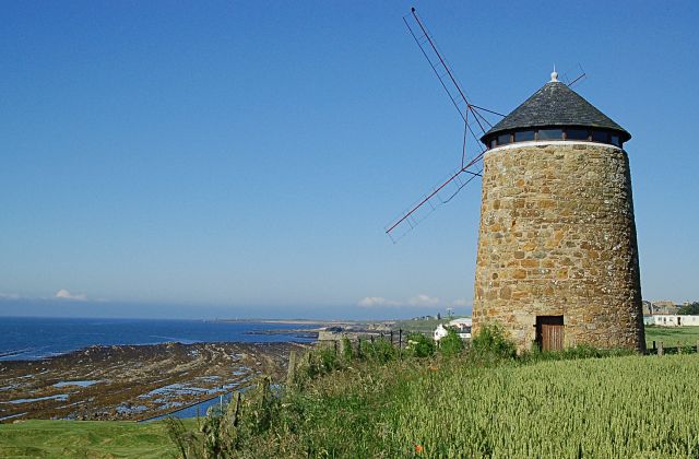
266:
216:
295:View this and other nearby images on:
245:View this and other nearby images on:
786:The following 3 pages use this file:
7:
337:and is licensed for reuse under the
717:
373:Attribution-Share Alike 2.0 Generic
361:
356:
341:Attribution-ShareAlike 2.0 license.
839:
462:
456:
347:
324:
115:
103:
49:
461:
801:Sir John Anstruther, 2nd Baronet
571:coordinates of the point of view
447:
403:Under the following conditions:
368:This file is licensed under the
360:
355:
349:
317:
301:
287:
279:
251:
237:
229:
70:
31:
21:
444:
121:The windmill at St Monans, Fife
116:
46:No higher resolution available.
14:
819:Liste des musées d'Écosse
443:
325:This image was taken from the
26:
1:
796:List of windmills in Scotland
669:coordinates of depicted place
36:
469:Items portrayed in this file
278:
228:
791:List of museums in Scotland
684:56°12'17.60"N, 2°45'30.60"W
586:56°12'24.52"N, 2°45'11.88"W
870:
825:Usage on nl.wikipedia.org
815:Usage on fr.wikipedia.org
417:same or compatible license
829:Gebruiker:Mjroots/Sandbox
718:
16:
446:
383:
77:This is a file from the
775:
176:required by the license
154:
146:
136:
129:
126:
108:
81:. Information from its
754:22:06, 5 November 2008
331:this photograph's page
307:56.204890; -2.758500
257:56.206810; -2.753300
111:St Monans windmill.jpg
84:description page there
52:St_Monans_windmill.jpg
204:Jim Bain /
185:Jim Bain /
398:– to adapt the work
206:St Monans Windmill
187:St Monans Windmill
857:
856:
807:Global file usage
779:
660:
562:
527:copyright license
455:
346:
345:
329:collection. See
312:
311:
262:
261:
211:
210:
179:
163:
160:Reusing this file
99:
98:
79:Wikimedia Commons
32:Global file usage
861:
847:
766:
706:
705:
700:
608:
607:
602:
491:copyright status
439:
436:
433:
430:
427:
419:as the original.
381:
370:Creative Commons
364:
363:
359:
358:
353:
352:
339:Creative Commons
327:Geograph project
321:
314:
308:
305:
291:
290:
284:
283:
282:
276:
275:
264:
258:
255:
241:
240:
234:
233:
232:
226:
225:
214:
173:
157:
132:
120:
112:
106:
95:
74:
73:
67:
61:
59:
869:
868:
864:
863:
862:
860:
859:
858:
835:
805:
780:
772:
764:
720:
719:
716:
715:
714:
713:
712:
711:
710:
709:
708:
707:
703:
701:
698:
689:
688:
687:
685:
675:
674:
673:
671:
652:
651:
650:
649:
648:
647:
646:
645:
643:
633:
632:
631:
629:
618:
617:
616:
615:
614:
613:
612:
611:
610:
609:
605:
603:
600:
591:
590:
589:
587:
577:
576:
575:
573:
554:
553:
552:
551:
550:
549:
548:
547:
545:
533:
532:
531:
529:
518:
517:
516:
515:
514:
513:
512:
511:
509:
497:
496:
495:
493:
482:
481:
480:
479:
478:
476:
460:
459:
458:
441:
440:
437:
434:
431:
428:
425:
424:
382:
379:
376:
365:
342:
306:
280:
271:
270:
267:Object location
256:
230:
221:
220:
217:Camera location
212:
201:
194:
182:
122:
110:
101:
100:
89:
88:
87:is shown below.
63:
57:
55:
48:
47:
12:
11:
5:
867:
865:
855:
854:
851:
838:
834:
833:
832:
831:
823:
822:
821:
809:
808:
804:
803:
798:
793:
784:
783:
778:
777:
774:
770:
767:
761:
756:
751:
747:
746:
743:
740:
737:
734:
731:
724:
723:
694:
693:
692:
691:
690:
686:
683:
681:
680:
679:
678:
677:
676:
672:
667:
665:
664:
663:
662:
656:
644:
641:
639:
638:
637:
636:
635:
634:
630:
625:
623:
622:
621:
620:
619:
596:
595:
594:
593:
592:
588:
585:
583:
582:
581:
580:
579:
578:
574:
569:
567:
566:
565:
564:
558:
546:
541:
539:
538:
537:
536:
535:
534:
530:
525:
523:
522:
521:
520:
519:
510:
505:
503:
502:
501:
500:
499:
498:
494:
489:
487:
486:
485:
484:
483:
477:
472:
470:
467:
466:
465:
464:
463:
452:
451:
448:
445:
423:
422:
421:
420:
410:
401:
400:
399:
393:
386:You are free:
377:
367:
366:
348:
344:
343:
322:
310:
309:
299:
293:
268:
260:
259:
249:
243:
218:
209:
208:
202:
199:
196:
195:
190:
183:
180:
168:
167:
164:
152:
151:
148:
144:
143:
138:
134:
133:
128:
124:
123:
113:
104:
102:
97:
96:
75:
65:
64:
45:
41:
40:
39:
34:
29:
24:
19:
13:
10:
9:
6:
4:
3:
2:
866:
852:
849:
845:
842:
836:
830:
827:
826:
824:
820:
817:
816:
814:
813:
812:
806:
802:
799:
797:
794:
792:
789:
787:
781:
773:
768:
762:
760:
757:
755:
752:
749:
748:
744:
741:
738:
735:
732:
730:
729:
727:
721:
697:
670:
628:
599:
572:
544:
528:
508:
492:
475:
429:CC BY-SA 2.0
418:
414:
411:
408:
405:
404:
402:
397:
394:
391:
388:
387:
385:
384:
378:Attribution:
374:
371:
354:
340:
336:
332:
328:
323:
320:
316:
315:
304:
300:
298:
297:OpenStreetMap
294:
292:
274:
269:
265:
254:
250:
248:
247:OpenStreetMap
244:
242:
224:
219:
215:
207:
203:
198:
197:
193:
189: /
188:
184:
177:
172:
170:
169:
165:
161:
156:
153:
149:
145:
142:
139:
135:
125:
119:
114:
107:
93:
86:
85:
80:
76:
69:
68:
62:
53:
44:
38:
35:
33:
30:
28:
25:
23:
20:
18:
15:
843:
840:
810:
785:
725:
722:File history
642:15 July 2007
412:
406:
395:
389:
334:
277:
227:
205:
192:CC BY-SA 2.0
186:
131:15 July 2007
117:
92:You can help
82:
50:
22:File history
507:copyrighted
413:share alike
407:attribution
171:Attribution
166:Attribution
109:Description
850:_error
782:File usage
763:640 × 420
739:Dimensions
155:Permission
58:image/jpeg
27:File usage
736:Thumbnail
733:Date/Time
627:inception
200:InfoField
181:InfoField
118:English:
837:Metadata
450:Captions
396:to remix
390:to share
380:Jim Bain
375:license.
335:Jim Bain
150:Jim Bain
37:Metadata
771:Mjroots
765:(52 KB)
750:current
745:Comment
696:heading
655:heading
598:heading
557:heading
474:depicts
454:English
54:
704:degree
659:degree
606:degree
604:247.0
561:degree
285:
235:
147:Author
137:Source
742:User
702:247
438:true
435:true
127:Date
17:File
699::
601::
853:0
178:)
174:(
162:)
158:(
94:.
60:)
Text is available under the Creative Commons Attribution-ShareAlike License. Additional terms may apply.
_heading:247.00&language=en)
_heading:247.00&language=en)
