332:
265:
223:
279:
237:
300:
338:
343:
72:
909:
850:
256:
43:
214:
390:– You must give appropriate credit, provide a link to the license, and indicate if changes were made. You may do so in any reasonable manner, but not in any way that suggests the licensor endorses you or your use.
83:
51:
867:== {{int:filedesc}} == {{Information |description={{en|1=St Margaret's Church, Streatley. http://www.stmargaret-streatley.org.uk}} |date=2006-01-29 |source=From |author=[http://www.geograph.org.uk/
881:
891:
849:
844:
42:
642:
606:
570:
272:
230:
677:
1119:
307:
982:
This file contains additional information, probably added from the digital camera or scanner used to create or digitize it.
397:
1088:
520:
781:
713:
685:
626:
554:
528:
513:
498:
747:
670:
655:
590:
471:
454:
294:
353:
985:
If the file has been modified from its original state, some details may not fully reflect the modified file.
877:
The following pages on the
English Knowledge (XXG) use this file (pages on other projects are not listed):
1172:
396:– If you remix, transform, or build upon the material, you must distribute your contributions under the
314:
on the
Geograph website for the photographer's contact details. The copyright on this image is owned by
860:
350:
1208:
929:
91:
183:
692:
662:
167:
886:
505:
278:
236:
919:
1276:
1190:
1146:
1011:
1004:
319:
78:
1051:
949:
1218:
135:
1031:
126:
St
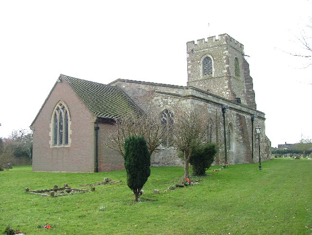
Margaret's parish church, Streatley, Bedfordshire, seen from the northeast
262:
220:
146:
156:
1294:
1021:
994:
299:
939:
311:
817:
Click on a date/time to view the file as it appeared at that time.
52:
St_Margaret's_Church,_Streatley._-_geograph.org.uk_-_113926.jpg
264:
222:
116:
St
Margaret's Church, Streatley. - geograph.org.uk - 113926.jpg
247:
205:
66:
774:
706:
257:
51° 56′ 46″ N, 0° 26′ 38″ W
215:
51° 56′ 46″ N, 0° 26′ 38″ W
910:كنيسه سانت مارجريت (سينترال بيدفوردشير, المملكه المتحده)
438:
Add a one-line explanation of what this file represents
959:
969:
110:
90:
Commons is a freely licensed media file repository.
607:
Creative
Commons Attribution-ShareAlike 2.0 Generic
930:Liste der Hallenkirchen im Vereinigten Königreich
1213:Flash did not fire, compulsory flash suppression
56:(640 × 482 pixels, file size: 98 KB, MIME type:
882:Church of St Margaret, Streatley, Bedfordshire
407:https://creativecommons.org/licenses/by-sa/2.0
71:
413:Creative Commons Attribution-Share Alike 2.0
331:
8:
373:– to copy, distribute and transmit the work
987:
819:
434:
902:The following other wikis use this file:
920:Grade I listed buildings in Bedfordshire
892:Grade I listed buildings in Bedfordshire
663:https://www.geograph.org.uk/photo/113926
1302:
1292:
1284:
1274:
1266:
1258:
1250:
1242:
1234:
1226:
1216:
1206:
1198:
1188:
1180:
1170:
1162:
1154:
1144:
1136:
1128:
1117:
1109:
1101:
1093:
1083:
1075:
1067:
1059:
1048:
1040:
1029:
1019:
1009:
999:
879:
795:
779:
761:
745:
727:
711:
640:
624:
604:
588:
568:
552:
506:https://www.geograph.org.uk/profile/764
485:
469:
452:
449:
430:
423:
250:
208:
271:View this and other nearby images on:
229:View this and other nearby images on:
989:
950:Igreja de Santa Margarida (Streatley)
7:
1089:Digital Camera FinePix S5000 Ver3.00
318:and is licensed for reuse under the
808:
354:Attribution-Share Alike 2.0 Generic
342:
337:
322:Attribution-ShareAlike 2.0 license.
980:
443:
437:
328:
305:
120:
103:
49:
442:
1042:Date and time of data generation
714:coordinates of the point of view
428:
384:Under the following conditions:
349:This file is licensed under the
341:
336:
330:
298:
277:
263:
235:
221:
198:St Margaret's Church, Streatley.
179:St Margaret's Church, Streatley.
70:
31:
21:
425:
121:
46:No higher resolution available.
14:
1016:1/450 sec (0.0022222222222222)
643:file available on the internet
424:
306:This image was taken from the
26:
1:
782:coordinates of depicted place
36:
678:Geograph Britain and Ireland
514:object of statement has role
450:Items portrayed in this file
1244:Focal plane resolution unit
1130:Date and time of digitizing
916:Usage on dag.wikipedia.org
906:Usage on arz.wikipedia.org
1324:
1255:One-chip color area sensor
966:Usage on www.wikidata.org
956:Usage on vo.wikipedia.org
946:Usage on pt.wikipedia.org
936:Usage on nl.wikipedia.org
926:Usage on de.wikipedia.org
398:same or compatible license
1095:File change date and time
809:
797:51°56'46.0"N, 0°26'38.4"W
729:51°56'46.0"N, 0°26'38.4"W
16:
1236:Focal plane Y resolution
1228:Focal plane X resolution
940:Streatley (Bedfordshire)
686:geograph.org.uk image ID
427:
364:
77:This is a file from the
1260:Custom image processing
866:
196:Robin Hall /
177:Robin Hall /
168:required by the license
152:
141:
134:
131:
113:
81:. Information from its
1304:Subject distance range
1138:Image compression mode
845:12:28, 31 January 2010
312:this photograph's page
283:51.946100; -0.444000
241:51.946100; -0.444000
84:description page there
1182:Maximum land aperture
1133:03:43, 5 January 2003
1098:03:43, 5 January 2003
1069:Horizontal resolution
1045:03:43, 5 January 2003
1103:Y and C positioning
1077:Vertical resolution
991:Camera manufacturer
379:– to adapt the work
1286:Scene capture type
1281:Auto white balance
529:author name string
1311:
1310:
898:Global file usage
870:
591:copyright license
436:
327:
326:
310:collection. See
288:
287:
246:
245:
203:
202:
171:
99:
98:
79:Wikimedia Commons
32:Global file usage
1315:
1111:Exposure Program
988:
857:
695:
690:
680:
675:
665:
660:
656:described at URL
555:copyright status
536:
533:
523:
518:
508:
503:
420:
417:
414:
411:
408:
400:as the original.
362:
351:Creative Commons
345:
344:
340:
339:
334:
333:
320:Creative Commons
308:Geograph project
302:
295:
284:
281:
267:
266:
260:
259:
248:
242:
239:
225:
224:
218:
217:
206:
165:
137:
125:
117:
111:
95:
74:
73:
67:
61:
59:
1323:
1322:
1318:
1317:
1316:
1314:
1313:
1312:
1185:3 APEX (f/2.83)
1164:APEX brightness
976:
896:
887:Francis Procter
878:
871:
863:
855:
811:
810:
807:
806:
805:
804:
803:
802:
801:
800:
798:
788:
787:
786:
784:
773:
772:
771:
770:
769:
768:
767:
766:
764:
763:29 January 2006
754:
753:
752:
750:
739:
738:
737:
736:
735:
734:
733:
732:
730:
720:
719:
718:
716:
705:
704:
703:
702:
701:
700:
699:
698:
697:
696:
691:
688:
682:
681:
676:
673:
667:
666:
661:
658:
649:
648:
647:
645:
633:
632:
631:
629:
618:
617:
616:
615:
614:
613:
612:
611:
609:
597:
596:
595:
593:
582:
581:
580:
579:
578:
577:
576:
575:
573:
561:
560:
559:
557:
546:
545:
544:
543:
542:
541:
540:
539:
538:
537:
534:
531:
525:
524:
519:
516:
510:
509:
504:
501:
492:
491:
490:
488:
478:
477:
476:
474:
463:
462:
461:
460:
459:
457:
441:
440:
439:
422:
421:
418:
415:
412:
409:
406:
405:
363:
360:
357:
346:
323:
293:
282:
255:
254:
251:Object location
240:
213:
212:
209:Camera location
204:
193:
186:
174:
147:geograph.org.uk
136:29 January 2006
127:
115:
108:
101:
100:
89:
88:
87:is shown below.
63:
57:
55:
48:
47:
12:
11:
5:
1321:
1319:
1309:
1308:
1305:
1301:
1300:
1297:
1291:
1290:
1287:
1283:
1282:
1279:
1273:
1272:
1269:
1265:
1264:
1263:Normal process
1261:
1257:
1256:
1253:
1252:Sensing method
1249:
1248:
1245:
1241:
1240:
1237:
1233:
1232:
1229:
1225:
1224:
1221:
1215:
1214:
1211:
1205:
1204:
1201:
1197:
1196:
1193:
1187:
1186:
1183:
1179:
1178:
1175:
1169:
1168:
1165:
1161:
1160:
1157:
1153:
1152:
1149:
1143:
1142:
1139:
1135:
1134:
1131:
1127:
1126:
1123:
1116:
1115:
1114:Normal program
1112:
1108:
1107:
1104:
1100:
1099:
1096:
1092:
1091:
1086:
1082:
1081:
1078:
1074:
1073:
1070:
1066:
1065:
1062:
1058:
1057:
1054:
1047:
1046:
1043:
1039:
1038:
1035:
1028:
1027:
1024:
1018:
1017:
1014:
1008:
1007:
1005:FinePix S5000
1002:
998:
997:
992:
979:
975:
974:
973:
972:
964:
963:
962:
954:
953:
952:
944:
943:
942:
934:
933:
932:
924:
923:
922:
914:
913:
912:
900:
899:
895:
894:
889:
884:
876:
875:
874:
869:
868:
865:
861:
858:
852:
847:
842:
838:
837:
834:
831:
828:
825:
822:
815:
814:
799:
796:
794:
793:
792:
791:
790:
789:
785:
780:
778:
777:
776:
775:
765:
762:
760:
759:
758:
757:
756:
755:
751:
746:
744:
743:
742:
741:
740:
731:
728:
726:
725:
724:
723:
722:
721:
717:
712:
710:
709:
708:
707:
684:
683:
669:
668:
654:
653:
652:
651:
650:
646:
641:
639:
638:
637:
636:
635:
634:
630:
627:source of file
625:
623:
622:
621:
620:
619:
610:
605:
603:
602:
601:
600:
599:
598:
594:
589:
587:
586:
585:
584:
583:
574:
569:
567:
566:
565:
564:
563:
562:
558:
553:
551:
550:
549:
548:
547:
527:
526:
512:
511:
497:
496:
495:
494:
493:
489:
486:
484:
483:
482:
481:
480:
479:
475:
470:
468:
467:
466:
465:
464:
458:
453:
451:
448:
447:
446:
445:
444:
433:
432:
429:
426:
404:
403:
402:
401:
391:
382:
381:
380:
374:
367:You are free:
358:
348:
347:
329:
325:
324:
303:
292:
289:
286:
285:
275:
269:
252:
244:
243:
233:
227:
210:
201:
200:
194:
191:
188:
187:
182:
175:
172:
160:
159:
154:
150:
149:
143:
139:
138:
133:
129:
128:
118:
109:
107:
104:
102:
97:
96:
75:
65:
64:
45:
41:
40:
39:
34:
29:
24:
19:
13:
10:
9:
6:
4:
3:
2:
1320:
1306:
1303:
1298:
1296:
1293:
1288:
1285:
1280:
1278:
1277:White balance
1275:
1271:Auto exposure
1270:
1268:Exposure mode
1267:
1262:
1259:
1254:
1251:
1246:
1243:
1238:
1235:
1230:
1227:
1222:
1220:
1217:
1212:
1210:
1207:
1202:
1199:
1194:
1192:
1191:Metering mode
1189:
1184:
1181:
1176:
1174:
1173:Exposure bias
1171:
1166:
1163:
1158:
1156:APEX aperture
1155:
1150:
1148:
1147:Shutter speed
1145:
1140:
1137:
1132:
1129:
1124:
1121:
1118:
1113:
1110:
1105:
1102:
1097:
1094:
1090:
1087:
1085:Software used
1084:
1079:
1076:
1071:
1068:
1063:
1060:
1055:
1053:
1049:
1044:
1041:
1036:
1033:
1030:
1025:
1023:
1020:
1015:
1013:
1012:Exposure time
1010:
1006:
1003:
1000:
996:
993:
990:
986:
983:
977:
971:
968:
967:
965:
961:
958:
957:
955:
951:
948:
947:
945:
941:
938:
937:
935:
931:
928:
927:
925:
921:
918:
917:
915:
911:
908:
907:
905:
904:
903:
897:
893:
890:
888:
885:
883:
880:
872:
864:
859:
853:
851:
848:
846:
843:
840:
839:
835:
832:
829:
826:
823:
821:
820:
818:
812:
783:
749:
715:
694:
687:
679:
672:
664:
657:
644:
628:
608:
592:
572:
556:
530:
522:
515:
507:
500:
473:
456:
410:CC BY-SA 2.0
399:
395:
392:
389:
386:
385:
383:
378:
375:
372:
369:
368:
366:
365:
359:Attribution:
355:
352:
335:
321:
317:
313:
309:
304:
301:
297:
296:
290:
280:
276:
274:
273:OpenStreetMap
270:
268:
258:
253:
249:
238:
234:
232:
231:OpenStreetMap
228:
226:
216:
211:
207:
199:
195:
190:
189:
185:
181: /
180:
176:
169:
164:
162:
161:
158:
155:
151:
148:
144:
140:
130:
124:
119:
112:
105:
93:
86:
85:
80:
76:
69:
68:
62:
53:
44:
38:
35:
33:
30:
28:
25:
23:
20:
18:
15:
1200:Light source
1052:focal length
1001:Camera model
984:
981:
901:
816:
813:File history
521:photographer
393:
387:
376:
370:
315:
197:
184:CC BY-SA 2.0
178:
122:
92:You can help
82:
50:
22:File history
1219:Color space
1061:Orientation
862:GeographBot
571:copyrighted
394:share alike
388:attribution
163:Attribution
114:Description
873:File usage
854:640 × 482
830:Dimensions
535:Robin Hall
487:some value
361:Robin Hall
316:Robin Hall
157:Robin Hall
58:image/jpeg
27:File usage
1295:Sharpness
1032:ISO speed
960:Streatley
827:Thumbnail
824:Date/Time
748:inception
291:Licensing
192:InfoField
173:InfoField
123:English:
1289:Standard
1106:Co-sited
1022:F-number
995:FUJIFILM
978:Metadata
970:Q5117489
671:operator
431:Captions
377:to remix
371:to share
356:license.
37:Metadata
1307:Unknown
1203:Unknown
1195:Pattern
1122:version
856:(98 KB)
841:current
836:Comment
472:creator
455:depicts
435:English
106:Summary
54:
1080:72 dpi
1072:72 dpi
1064:Normal
1056:5.7 mm
1034:rating
693:113926
261:
219:
153:Author
142:Source
1239:5,263
1231:5,263
1209:Flash
1050:Lens
1026:f/2.8
145:From
1223:sRGB
1167:6.28
1120:Exif
833:User
419:true
416:true
132:Date
17:File
1151:8.8
1125:2.2
1037:200
499:URL
689::
674::
659::
532::
517::
502::
1299:3
1247:3
1177:0
1159:3
1141:2
170:)
166:(
94:.
60:)
Text is available under the Creative Commons Attribution-ShareAlike License. Additional terms may apply.
_&language=en)
_&language=en)
