43:
251:
212:
226:
257:
262:
103:
679:
303:– You must give appropriate credit, provide a link to the license, and indicate if changes were made. You may do so in any reasonable manner, but not in any way that suggests the licensor endorses you or your use.
203:
69:
65:
61:
57:
53:
47:
82:
114:
728:
556:
520:
484:
219:
894:
710:
741:
This file contains additional information, probably added from the digital camera or scanner used to create or digitize it.
310:
447:
576:
540:
468:
440:
427:
412:
678:
673:
73:
42:
610:
504:
385:
368:
272:
744:
If the file has been modified from its original state, some details may not fully reflect the modified file.
871:
706:
The following pages on the
English Knowledge (XXG) use this file (pages on other projects are not listed):
944:
309:– If you remix, transform, or build upon the material, you must distribute your contributions under the
269:
419:
972:
689:
122:
763:
186:
166:
225:
1016:
954:
934:
770:
109:
244:
I, the copyright holder of this work, hereby publish it under the following license:
1026:
810:
209:
990:
790:
157:
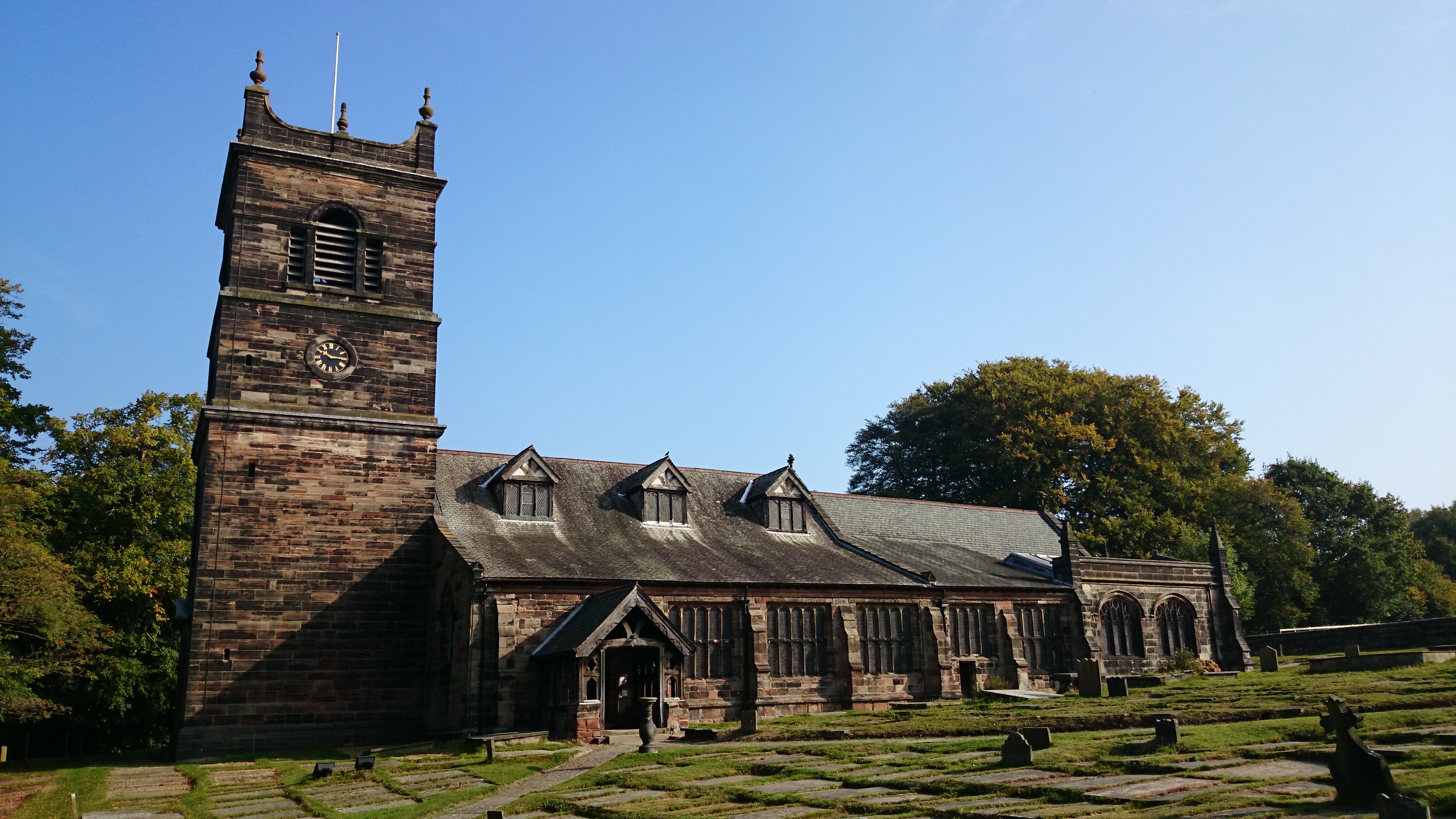
The church, image taken from the graveyard, just to the right of the gate.
780:
569:
646:
Click on a date/time to view the file as it appeared at that time.
753:
211:
204:
53° 20′ 56.91″ N, 2° 23′ 18.36″ W
194:
97:
521:
Creative
Commons Attribution-ShareAlike 4.0 International
352:
Add a one-line explanation of what this file represents
87:(3,840 × 2,160 pixels, file size: 3.93 MB, MIME type:
141:
121:
Commons is a freely licensed media file repository.
420:https://commons.wikimedia.org/user:Parrot_of_Doom
977:Flash did not fire, compulsory flash suppression
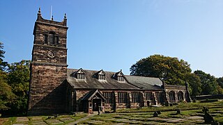
147:St Mary's Church, Rostherne, September 2014.JPG
320:https://creativecommons.org/licenses/by-sa/4.0
102:
326:Creative Commons Attribution-Share Alike 4.0
250:
8:
286:– to copy, distribute and transmit the work
746:
648:
348:
721:The following other wikis use this file:
273:Attribution-Share Alike 4.0 International
1083:
1075:
1067:
1059:
1051:
1043:
1035:
1024:
1014:
1006:
998:
988:
980:
970:
962:
952:
942:
932:
911:
903:
892:
884:
876:
866:
858:
850:
842:
834:
826:
818:
807:
799:
788:
778:
768:
758:
708:
624:
608:
590:
574:
554:
538:
518:
502:
482:
466:
399:
383:
366:
363:
344:
337:
197:
218:View this and other nearby images on:
748:
7:
696:User created page with UploadWizard
637:
261:
256:
739:
357:
351:
247:
243:
151:
134:
80:
592:53°20'56.90602"N, 2°23'18.35902"W
356:
801:Date and time of data generation
711:St Mary's Church, Rostherne
577:coordinates of the point of view
342:
297:Under the following conditions:
268:This file is licensed under the
260:
255:
249:
224:
210:
101:
31:
21:
339:
152:
14:
338:
26:
1:
557:original creation by uploader
36:
364:Items portrayed in this file
905:Date and time of digitizing
167:17 September 2014, 10:16:01
1105:
982:Supported Flashpix version
725:Usage on ru.wikipedia.org
311:same or compatible license
1069:Geodetic survey data used
913:Meaning of each component
878:File change date and time
839:97 meters above sea level
638:
176:
16:
908:10:16, 17 September 2014
881:10:16, 17 September 2014
804:10:16, 17 September 2014
674:19:58, 17 September 2014
341:
277:
108:This is a file from the
1064:Measurement in progress
1053:GPS time (atomic clock)
1000:Custom image processing
959:Center weighted average
729:Маклауд, Норман Аласдер
695:
182:
172:
165:
162:
144:
112:. Information from its
1045:Subject distance range
775:1/1,600 sec (0.000625)
230:53.349141; -2.388433
115:description page there
46:Size of this preview:
872:17.1.2.A.0.323_9_f300
852:Horizontal resolution
74:3,840 × 2,160 pixels
70:2,560 × 1,440 pixels
886:Y and C positioning
860:Vertical resolution
750:Camera manufacturer
292:– to adapt the work
52:Other resolutions:
1037:Scene capture type
1021:Auto white balance
441:Wikimedia username
428:author name string
66:1,280 × 720 pixels
62:1,024 × 576 pixels
1092:
1091:
1080:17 September 2014
717:Global file usage
699:
626:17 September 2014
505:copyright license
350:
235:
234:
192:
191:
130:
129:
110:Wikimedia Commons
32:Global file usage
1096:
823:53° 20′ 56.91″ N
747:
686:
469:copyright status
450:
445:
435:
432:
422:
417:
333:
330:
327:
324:
321:
313:as the original.
270:Creative Commons
264:
263:
259:
258:
253:
252:
231:
228:
214:
213:
207:
206:
195:
178:
168:
156:
148:
142:
126:
105:
104:
98:
92:
90:
77:
58:640 × 360 pixels
54:320 × 180 pixels
48:800 × 450 pixels
1104:
1103:
1099:
1098:
1097:
1095:
1094:
1093:
1085:GPS tag version
1061:Receiver status
831:2° 23′ 18.36″ W
735:
715:
707:
700:
692:
684:
640:
639:
636:
635:
634:
633:
632:
631:
630:
629:
627:
617:
616:
615:
613:
602:
601:
600:
599:
598:
597:
596:
595:
593:
583:
582:
581:
579:
568:
567:
566:
565:
564:
563:
562:
561:
559:
547:
546:
545:
543:
532:
531:
530:
529:
528:
527:
526:
525:
523:
511:
510:
509:
507:
496:
495:
494:
493:
492:
491:
490:
489:
487:
475:
474:
473:
471:
460:
459:
458:
457:
456:
455:
454:
453:
452:
451:
446:
443:
437:
436:
433:
430:
424:
423:
418:
415:
406:
405:
404:
402:
392:
391:
390:
388:
377:
376:
375:
374:
373:
371:
355:
354:
353:
336:
335:
334:
331:
328:
325:
322:
319:
318:
276:
265:
246:
245:
240:
229:
202:
201:
198:Camera location
193:
158:
146:
139:
132:
131:
120:
119:
118:is shown below.
94:
88:
86:
79:
78:
51:
12:
11:
5:
1102:
1100:
1090:
1089:
1086:
1082:
1081:
1078:
1074:
1073:
1070:
1066:
1065:
1062:
1058:
1057:
1054:
1050:
1049:
1046:
1042:
1041:
1038:
1034:
1033:
1030:
1023:
1022:
1019:
1013:
1012:
1009:
1005:
1004:
1003:Normal process
1001:
997:
996:
993:
987:
986:
983:
979:
978:
975:
969:
968:
965:
961:
960:
957:
951:
950:
947:
941:
940:
937:
931:
930:
929:
928:
927:does not exist
925:
922:
919:
914:
910:
909:
906:
902:
901:
898:
891:
890:
887:
883:
882:
879:
875:
874:
869:
865:
864:
861:
857:
856:
853:
849:
848:
845:
841:
840:
837:
833:
832:
829:
825:
824:
821:
817:
816:
813:
806:
805:
802:
798:
797:
794:
787:
786:
783:
777:
776:
773:
767:
766:
761:
757:
756:
751:
738:
734:
733:
732:
731:
719:
718:
714:
713:
705:
704:
703:
698:
697:
694:
691:Parrot of Doom
690:
687:
683:3,840 × 2,160
681:
676:
671:
667:
666:
663:
660:
657:
654:
651:
644:
643:
628:
625:
623:
622:
621:
620:
619:
618:
614:
609:
607:
606:
605:
604:
603:
594:
591:
589:
588:
587:
586:
585:
584:
580:
575:
573:
572:
571:
570:
560:
555:
553:
552:
551:
550:
549:
548:
544:
541:source of file
539:
537:
536:
535:
534:
533:
524:
519:
517:
516:
515:
514:
513:
512:
508:
503:
501:
500:
499:
498:
497:
488:
483:
481:
480:
479:
478:
477:
476:
472:
467:
465:
464:
463:
462:
461:
448:Parrot of Doom
439:
438:
434:Parrot of Doom
426:
425:
411:
410:
409:
408:
407:
403:
400:
398:
397:
396:
395:
394:
393:
389:
384:
382:
381:
380:
379:
378:
372:
367:
365:
362:
361:
360:
359:
358:
347:
346:
343:
340:
317:
316:
315:
314:
304:
295:
294:
293:
287:
280:You are free:
267:
266:
248:
242:
241:
239:
236:
233:
232:
222:
216:
199:
190:
189:
187:Parrot of Doom
184:
180:
179:
174:
170:
169:
164:
160:
159:
149:
140:
138:
135:
133:
128:
127:
106:
96:
95:
45:
41:
40:
39:
34:
29:
24:
19:
13:
10:
9:
6:
4:
3:
2:
1101:
1087:
1084:
1079:
1076:
1071:
1068:
1063:
1060:
1055:
1052:
1047:
1044:
1039:
1036:
1031:
1028:
1025:
1020:
1018:
1017:White balance
1015:
1011:Auto exposure
1010:
1008:Exposure mode
1007:
1002:
999:
994:
992:
989:
984:
981:
976:
974:
971:
966:
963:
958:
956:
955:Metering mode
953:
948:
946:
945:Exposure bias
943:
938:
936:
935:Shutter speed
933:
926:
923:
920:
917:
916:
915:
912:
907:
904:
899:
896:
893:
888:
885:
880:
877:
873:
870:
868:Software used
867:
862:
859:
854:
851:
846:
843:
838:
835:
830:
827:
822:
819:
814:
812:
808:
803:
800:
795:
792:
789:
784:
782:
779:
774:
772:
771:Exposure time
769:
765:
762:
759:
755:
752:
749:
745:
742:
736:
730:
727:
726:
724:
723:
722:
716:
712:
709:
701:
693:
688:
682:
680:
677:
675:
672:
669:
668:
664:
661:
658:
655:
652:
650:
649:
647:
641:
612:
578:
558:
542:
522:
506:
486:
470:
449:
442:
429:
421:
414:
387:
370:
323:CC BY-SA 4.0
312:
308:
305:
302:
299:
298:
296:
291:
288:
285:
282:
281:
279:
278:
274:
271:
254:
237:
227:
223:
221:
220:OpenStreetMap
217:
215:
205:
200:
196:
188:
185:
181:
175:
171:
161:
155:
150:
143:
136:
124:
117:
116:
111:
107:
100:
99:
93:
84:
83:Original file
75:
71:
67:
63:
59:
55:
49:
44:
38:
35:
33:
30:
28:
25:
23:
20:
18:
15:
1027:Digital zoom
964:Light source
811:focal length
760:Camera model
743:
740:
720:
645:
642:File history
306:
300:
289:
283:
153:
123:You can help
113:
81:
22:File history
991:Color space
844:Orientation
485:copyrighted
307:share alike
301:attribution
145:Description
702:File usage
659:Dimensions
401:some value
89:image/jpeg
27:File usage
1040:Landscape
828:Longitude
791:ISO speed
685:(3.93 MB)
656:Thumbnail
653:Date/Time
611:inception
238:Licensing
154:English:
1077:GPS date
889:Centered
836:Altitude
820:Latitude
781:F-number
737:Metadata
345:Captions
290:to remix
284:to share
275:license.
177:Own work
37:Metadata
1088:0.0.2.2
1048:Unknown
967:Unknown
897:version
670:current
665:Comment
386:creator
369:depicts
349:English
137:Summary
85:
1072:WGS-84
863:72 dpi
855:72 dpi
847:Normal
815:4.9 mm
793:rating
208:
183:Author
173:Source
1056:09:15
1029:ratio
973:Flash
939:10.64
809:Lens
764:D6503
995:sRGB
895:Exif
754:SONY
662:User
332:true
329:true
163:Date
17:File
900:2.2
785:f/2
413:URL
924:Cr
921:Cb
796:64
444::
431::
416::
72:|
68:|
64:|
60:|
56:|
50:.
1032:1
985:1
949:0
918:Y
125:.
91:)
76:.
Text is available under the Creative Commons Attribution-ShareAlike License. Additional terms may apply.