369:
302:
252:
43:
294:
244:
316:
266:
337:
375:
380:
87:
864:"}},"text\/plain":{"en":{"":"heading"}}},"{\"value\":{\"amount\":\"+90\",\"unit\":\"http:\\\/\\\/www.wikidata.org\\\/entity\\\/Q28390\"},\"type\":\"quantity\"}":{"text\/html":{"en":{"P7787":"90
800:"}},"text\/plain":{"en":{"":"heading"}}},"{\"value\":{\"amount\":\"+90\",\"unit\":\"http:\\\/\\\/www.wikidata.org\\\/entity\\\/Q28390\"},\"type\":\"quantity\"}":{"text\/html":{"en":{"P7787":"90
1002:
796:
235:
427:– You must give appropriate credit, provide a link to the license, and indicate if changes were made. You may do so in any reasonable manner, but not in any way that suggests the licensor endorses you or your use.
98:
53:
47:
66:
1037:
861:
797:
213:
1001:
996:
57:
42:
732:
662:
626:
507:
309:
259:
947:
752:
344:
1168:
This file contains additional information, probably added from the digital camera or scanner used to create or digitize it.
434:
1012:
589:
931:
902:
875:
838:
811:
760:
716:
610:
582:
569:
554:
775:
745:
682:
646:
527:
491:
331:
390:
1171:
If the file has been modified from its original state, some details may not fully reflect the modified file.
1019:== Summary == {{Information |Description=St Mary's Church at West Winch |Source=From ; transferd by
433:– If you remix, transform, or build upon the material, you must distribute your contributions under the
351:
on the
Geograph website for the photographer's contact details. The copyright on this image is owned by
387:
130:
868:"}},"text\/plain":{"en":{"P7787":"90 degree"}}}}": -->
804:"}},"text\/plain":{"en":{"P7787":"90 degree"}}}}": -->
106:
125:
782:
767:
561:
1090:
315:
265:
356:
93:
1020:
249:
172:
1042:
1023:
using [http://toolserver.org/~magnus/geograph_org2commons.php geograph_org2co
163:
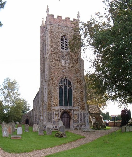
Parish church of St Mary the Virgin, West Winch, Norfolk, seen from the west
299:
202:
187:
183:
336:
348:
969:
Click on a date/time to view the file as it appeared at that time.
301:
251:
1038:
Grade II* listed buildings in King's Lynn and West
Norfolk
236:
52° 42′ 54.89″ N, 0° 24′ 52.67″ E
191:
276:
226:
81:
153:
St Mary's Church at West Winch - geograph.org.uk - 255412.jpg
286:
52° 42′ 57″ N, 0° 24′ 54″ E
1120:
1060:
1140:
1130:
1110:
1100:
1080:
1070:
475:
Add a one-line explanation of what this file represents
1155:
1150:
220:
Creative
Commons Attribution Share-alike license 2.0
147:
119:
105:
Commons is a freely licensed media file repository.
663:
Creative
Commons Attribution-ShareAlike 2.0 Generic
71:(540 × 639 pixels, file size: 101 KB, MIME type:
444:https://creativecommons.org/licenses/by-sa/2.0
86:
450:Creative Commons Attribution-Share Alike 2.0
368:
8:
865:
801:
410:– to copy, distribute and transmit the work
1173:
971:
471:
1053:The following other wikis use this file:
783:https://www.geograph.org.uk/photo/255412
562:https://www.geograph.org.uk/profile/6526
1175:
1035:
945:
929:
889:
873:
825:
809:
730:
714:
696:
680:
660:
644:
624:
608:
541:
525:
505:
489:
486:
467:
460:
279:
229:
308:View this and other nearby images on:
258:View this and other nearby images on:
1033:The following 2 pages use this file:
7:
355:and is licensed for reuse under the
960:
391:Attribution-Share Alike 2.0 Generic
379:
374:
359:Attribution-ShareAlike 2.0 license.
1166:
480:
474:
365:
342:
157:
123:
118:
64:
479:
812:coordinates of the point of view
465:
421:Under the following conditions:
386:This file is licensed under the
378:
373:
367:
335:
314:
300:
292:
264:
250:
242:
85:
31:
21:
1014:File Upload Bot (Magnus Manske)
462:
158:
14:
733:file available on the internet
461:
343:This image was taken from the
26:
1:
876:coordinates of depicted place
827:52°42'54.889"N, 0°24'52.672"E
36:
753:Geograph Britain and Ireland
583:object of statement has role
487:Items portrayed in this file
1117:Usage on lld.wikipedia.org
1057:Usage on ceb.wikipedia.org
291:
241:
1197:
1147:Usage on www.wikidata.org
1137:Usage on pl.wikipedia.org
1127:Usage on nl.wikipedia.org
1107:Usage on it.wikipedia.org
1097:Usage on fr.wikipedia.org
1087:Usage on fa.wikipedia.org
1077:Usage on es.wikipedia.org
1067:Usage on cy.wikipedia.org
435:same or compatible license
961:
891:52°42'56.5"N, 0°24'54.0"E
16:
761:geograph.org.uk image ID
464:
401:
92:This is a file from the
1018:
208:
198:
178:
171:
168:
150:
96:. Information from its
997:21:04, 25 October 2009
349:this photograph's page
320:52.715700; 0.415000
270:52.715247; 0.414631
99:description page there
46:Size of this preview:
932:location of creation
192:geograph_org2commons
416:– to adapt the work
124:This is a photo of
52:Other resolutions:
570:author name string
1184:
1183:
1049:Global file usage
1026:
867:
803:
647:copyright license
508:Church of St Mary
473:
364:
363:
347:collection. See
325:
324:
275:
274:
224:
223:
217:
214:Reusing this file
186:; transferred by
140:
139:
114:
113:
94:Wikimedia Commons
32:Global file usage
1188:
1174:
1009:
913:
912:
907:
849:
848:
843:
785:
780:
776:described at URL
770:
765:
755:
750:
611:copyright status
592:
587:
577:
574:
564:
559:
457:
454:
451:
448:
445:
437:as the original.
399:
388:Creative Commons
382:
381:
377:
376:
371:
370:
357:Creative Commons
345:Geograph project
339:
332:
321:
318:
304:
303:
297:
296:
295:
289:
288:
277:
271:
268:
254:
253:
247:
246:
245:
239:
238:
227:
211:
174:
162:
154:
148:
133:
120:
110:
89:
88:
82:
76:
74:
61:
58:540 × 639 pixels
54:203 × 240 pixels
48:507 × 600 pixels
1196:
1195:
1191:
1190:
1189:
1187:
1186:
1185:
1162:
1047:
1027:
1015:
1007:
963:
962:
959:
958:
957:
956:
955:
954:
953:
952:
950:
938:
937:
936:
934:
923:
922:
921:
920:
919:
918:
917:
916:
915:
914:
910:
908:
905:
896:
895:
894:
892:
882:
881:
880:
878:
859:
858:
857:
856:
855:
854:
853:
852:
851:
850:
846:
844:
841:
832:
831:
830:
828:
818:
817:
816:
814:
795:
794:
793:
792:
791:
790:
789:
788:
787:
786:
781:
778:
772:
771:
766:
763:
757:
756:
751:
748:
739:
738:
737:
735:
723:
722:
721:
719:
708:
707:
706:
705:
704:
703:
702:
701:
699:
689:
688:
687:
685:
674:
673:
672:
671:
670:
669:
668:
667:
665:
653:
652:
651:
649:
638:
637:
636:
635:
634:
633:
632:
631:
629:
617:
616:
615:
613:
602:
601:
600:
599:
598:
597:
596:
595:
594:
593:
588:
585:
579:
578:
575:
572:
566:
565:
560:
557:
548:
547:
546:
544:
534:
533:
532:
530:
519:
518:
517:
516:
515:
514:
513:
512:
510:
498:
497:
496:
494:
478:
477:
476:
459:
458:
455:
452:
449:
446:
443:
442:
400:
397:
394:
383:
360:
330:
319:
293:
284:
283:
280:Object location
269:
243:
234:
233:
230:Camera location
225:
184:geograph.org.uk
164:
152:
145:
135:
129:
126:listed building
116:
115:
104:
103:
102:is shown below.
78:
72:
70:
63:
62:
51:
12:
11:
5:
1194:
1192:
1182:
1181:
1178:
1165:
1161:
1160:
1159:
1158:
1153:
1145:
1144:
1143:
1135:
1134:
1133:
1125:
1124:
1123:
1115:
1114:
1113:
1105:
1104:
1103:
1095:
1094:
1093:
1085:
1084:
1083:
1075:
1074:
1073:
1065:
1064:
1063:
1051:
1050:
1046:
1045:
1040:
1031:
1030:
1025:
1024:
1017:
1013:
1010:
1004:
999:
994:
990:
989:
986:
983:
980:
977:
974:
967:
966:
951:
946:
944:
943:
942:
941:
940:
939:
935:
930:
928:
927:
926:
925:
924:
901:
900:
899:
898:
897:
893:
890:
888:
887:
886:
885:
884:
883:
879:
874:
872:
871:
870:
869:
863:
837:
836:
835:
834:
833:
829:
826:
824:
823:
822:
821:
820:
819:
815:
810:
808:
807:
806:
805:
799:
774:
773:
759:
758:
744:
743:
742:
741:
740:
736:
731:
729:
728:
727:
726:
725:
724:
720:
717:source of file
715:
713:
712:
711:
710:
709:
700:
698:8 October 2006
697:
695:
694:
693:
692:
691:
690:
686:
681:
679:
678:
677:
676:
675:
666:
661:
659:
658:
657:
656:
655:
654:
650:
645:
643:
642:
641:
640:
639:
630:
625:
623:
622:
621:
620:
619:
618:
614:
609:
607:
606:
605:
604:
603:
581:
580:
576:Martin Pearman
568:
567:
553:
552:
551:
550:
549:
545:
542:
540:
539:
538:
537:
536:
535:
531:
526:
524:
523:
522:
521:
520:
511:
506:
504:
503:
502:
501:
500:
499:
495:
490:
488:
485:
484:
483:
482:
481:
470:
469:
466:
463:
441:
440:
439:
438:
428:
419:
418:
417:
411:
404:You are free:
398:Martin Pearman
395:
385:
384:
366:
362:
361:
353:Martin Pearman
340:
329:
326:
323:
322:
312:
306:
281:
273:
272:
262:
256:
231:
222:
221:
218:
206:
205:
203:Martin Pearman
200:
196:
195:
180:
176:
175:
173:8 October 2006
170:
166:
165:
155:
146:
144:
141:
138:
137:
117:
112:
111:
90:
80:
79:
45:
41:
40:
39:
34:
29:
24:
19:
13:
10:
9:
6:
4:
3:
2:
1193:
1179:
1176:
1172:
1169:
1163:
1157:
1154:
1152:
1149:
1148:
1146:
1142:
1139:
1138:
1136:
1132:
1129:
1128:
1126:
1122:
1119:
1118:
1116:
1112:
1109:
1108:
1106:
1102:
1099:
1098:
1096:
1092:
1089:
1088:
1086:
1082:
1079:
1078:
1076:
1072:
1069:
1068:
1066:
1062:
1059:
1058:
1056:
1055:
1054:
1048:
1044:
1041:
1039:
1036:
1034:
1028:
1022:
1016:
1011:
1005:
1003:
1000:
998:
995:
992:
991:
987:
984:
981:
978:
975:
973:
972:
970:
964:
949:
933:
904:
877:
840:
813:
784:
777:
769:
762:
754:
747:
734:
718:
684:
664:
648:
628:
612:
591:
584:
571:
563:
556:
529:
509:
493:
447:CC BY-SA 2.0
436:
432:
429:
426:
423:
422:
420:
415:
412:
409:
406:
405:
403:
402:
396:Attribution:
392:
389:
372:
358:
354:
350:
346:
341:
338:
334:
333:
327:
317:
313:
311:
310:OpenStreetMap
307:
305:
287:
282:
278:
267:
263:
261:
260:OpenStreetMap
257:
255:
237:
232:
228:
219:
215:
210:
207:
204:
201:
197:
193:
189:
185:
181:
177:
167:
161:
156:
149:
142:
136:
132:
127:
122:
121:
108:
101:
100:
95:
91:
84:
83:
77:
68:
67:Original file
59:
55:
49:
44:
38:
35:
33:
30:
28:
25:
23:
20:
18:
15:
1170:
1167:
1052:
1032:
968:
965:File history
590:photographer
430:
424:
413:
407:
352:
290:
240:
159:
107:You can help
97:
65:
22:File history
1021:User:oxyman
627:copyrighted
431:share alike
425:attribution
188:User:oxyman
151:Description
1177:_error
1141:West Winch
1131:West Winch
1121:West Winch
1111:West Winch
1101:West Winch
1081:West Winch
1071:West Winch
1061:West Winch
1043:West Winch
1029:File usage
1006:540 × 639
982:Dimensions
948:West Winch
543:some value
209:Permission
73:image/jpeg
27:File usage
1156:Q17555607
979:Thumbnail
976:Date/Time
683:inception
328:Licensing
160:English:
1164:Metadata
1151:Q2272899
1091:وست وینچ
1008:(101 KB)
746:operator
468:Captions
414:to remix
408:to share
393:license.
37:Metadata
993:current
988:Comment
903:heading
862:heading
839:heading
798:heading
528:creator
492:depicts
472:English
143:Summary
131:1342420
128:number
69:
911:degree
866:degree
847:degree
802:degree
768:255412
298:
248:
199:Author
190:using
179:Source
182:From
985:User
456:true
453:true
169:Date
17:File
909:90
845:90
555:URL
906::
842::
779::
764::
749::
586::
573::
558::
56:|
50:.
1180:0
216:)
212:(
194:.
134:.
109:.
75:)
60:.
Text is available under the Creative Commons Attribution-ShareAlike License. Additional terms may apply.

_region:GB-GBN_heading:90.00&language=en)
