363:
43:
296:
246:
288:
238:
310:
260:
331:
369:
374:
87:
839:"}},"text\/plain":{"en":{"":"heading"}}},"{\"value\":{\"amount\":\"+315\",\"unit\":\"http:\\\/\\\/www.wikidata.org\\\/entity\\\/Q28390\"},\"type\":\"quantity\"}":{"text\/html":{"en":{"P7787":"315
775:"}},"text\/plain":{"en":{"":"heading"}}},"{\"value\":{\"amount\":\"+315\",\"unit\":\"http:\\\/\\\/www.wikidata.org\\\/entity\\\/Q28390\"},\"type\":\"quantity\"}":{"text\/html":{"en":{"P7787":"315
941:
835:
1000:
229:
421:– You must give appropriate credit, provide a link to the license, and indicate if changes were made. You may do so in any reasonable manner, but not in any way that suggests the licensor endorses you or your use.
53:
47:
98:
66:
977:
836:
772:
972:
958:== {{int:filedesc}} == {{Information |description={{en|1=St Mary's Priory Church, Tutbury}} |date=2007-12-08 |source=From |author= |permissi
940:
935:
57:
42:
673:
637:
601:
303:
253:
708:
338:
1023:
This file contains additional information, probably added from the digital camera or scanner used to create or digitize it.
428:
564:
982:
877:
850:
813:
786:
686:
657:
585:
557:
542:
529:
744:
716:
701:
621:
502:
485:
325:
384:
1026:
If the file has been modified from its original state, some details may not fully reflect the modified file.
427:– If you remix, transform, or build upon the material, you must distribute your contributions under the
345:
on the
Geograph website for the photographer's contact details. The copyright on this image is owned by
951:
381:
843:"}},"text\/plain":{"en":{"P7787":"315 degree"}}}}": -->
779:"}},"text\/plain":{"en":{"P7787":"315 degree"}}}}": -->
106:
198:
549:
723:
693:
182:
309:
259:
350:
93:
150:
293:
243:
171:
161:
330:
342:
908:
Click on a date/time to view the file as it appeared at that time.
295:
245:
131:
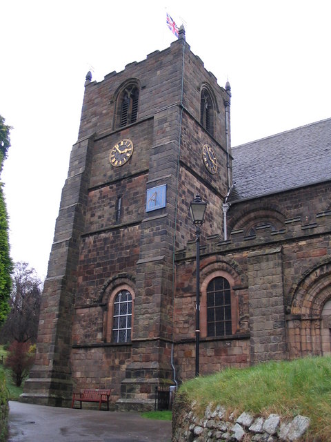
St Mary's Priory Church, Tutbury - geograph.org.uk - 632654.jpg
270:
220:
81:
978:
List of church restorations and alterations by G. E. Street
280:
52° 51′ 32″ N, 1° 41′ 18″ W
230:
52° 51′ 31″ N, 1° 41′ 16″ W
469:
Add a one-line explanation of what this file represents
1010:
125:
105:
Commons is a freely licensed media file repository.
638:
Creative
Commons Attribution-ShareAlike 2.0 Generic
71:(480 × 640 pixels, file size: 80 KB, MIME type:
438:https://creativecommons.org/licenses/by-sa/2.0
86:
1001:كنيسه القديسه مريم (توتبورى, المملكه المتحده)
444:Creative Commons Attribution-Share Alike 2.0
362:
8:
840:
776:
404:– to copy, distribute and transmit the work
1028:
910:
465:
993:The following other wikis use this file:
550:https://www.geograph.org.uk/profile/15498
973:Grade I listed churches in Staffordshire
724:https://www.geograph.org.uk/photo/632654
1030:
970:
864:
848:
800:
784:
758:
742:
671:
655:
635:
619:
599:
583:
516:
500:
483:
480:
461:
454:
273:
223:
302:View this and other nearby images on:
252:View this and other nearby images on:
968:The following 3 pages use this file:
7:
349:and is licensed for reuse under the
899:
385:Attribution-Share Alike 2.0 Generic
373:
368:
353:Attribution-ShareAlike 2.0 license.
1021:
474:
468:
359:
336:
135:
118:
64:
473:
787:coordinates of the point of view
459:
415:Under the following conditions:
380:This file is licensed under the
372:
367:
361:
329:
308:
294:
286:
258:
244:
236:
213:St Mary's Priory Church, Tutbury
194:St Mary's Priory Church, Tutbury
141:St Mary's Priory Church, Tutbury
85:
31:
21:
456:
136:
14:
983:St Mary's Church, Tutbury
674:file available on the internet
455:
337:This image was taken from the
26:
1:
851:coordinates of depicted place
36:
709:Geograph Britain and Ireland
558:object of statement has role
481:Items portrayed in this file
285:
235:
997:Usage on arz.wikipedia.org
866:52°51'31.86"N, 1°41'17.88"W
802:52°51'30.89"N, 1°41'16.08"W
211:M J Richardson /
192:M J Richardson /
1052:
1007:Usage on www.wikidata.org
429:same or compatible license
900:
16:
687:geograph.org.uk image ID
458:
395:
92:This is a file from the
957:
183:required by the license
167:
156:
149:
146:
128:
96:. Information from its
936:10:27, 7 February 2011
343:this photograph's page
314:52.858850; -1.688300
264:52.858580; -1.687800
99:description page there
46:Size of this preview:
410:– to adapt the work
52:Other resolutions:
530:author name string
1039:
1038:
989:Global file usage
961:
842:
778:
622:copyright license
467:
358:
357:
341:collection. See
319:
318:
269:
268:
218:
217:
186:
114:
113:
94:Wikimedia Commons
32:Global file usage
1043:
1029:
948:
888:
887:
882:
824:
823:
818:
726:
721:
717:described at URL
711:
706:
696:
691:
586:copyright status
567:
562:
552:
547:
537:
534:
451:
448:
445:
442:
439:
431:as the original.
393:
382:Creative Commons
376:
375:
371:
370:
365:
364:
351:Creative Commons
339:Geograph project
333:
326:
315:
312:
298:
297:
291:
290:
289:
283:
282:
271:
265:
262:
248:
247:
241:
240:
239:
233:
232:
221:
180:
152:
140:
132:
126:
110:
89:
88:
82:
76:
74:
61:
58:480 × 640 pixels
54:180 × 240 pixels
48:450 × 600 pixels
1051:
1050:
1046:
1045:
1044:
1042:
1041:
1040:
1017:
987:
962:
954:
946:
902:
901:
898:
897:
896:
895:
894:
893:
892:
891:
890:
889:
885:
883:
880:
871:
870:
869:
867:
857:
856:
855:
853:
834:
833:
832:
831:
830:
829:
828:
827:
826:
825:
821:
819:
816:
807:
806:
805:
803:
793:
792:
791:
789:
770:
769:
768:
767:
766:
765:
764:
763:
761:
760:8 December 2007
751:
750:
749:
747:
736:
735:
734:
733:
732:
731:
730:
729:
728:
727:
722:
719:
713:
712:
707:
704:
698:
697:
692:
689:
680:
679:
678:
676:
664:
663:
662:
660:
649:
648:
647:
646:
645:
644:
643:
642:
640:
628:
627:
626:
624:
613:
612:
611:
610:
609:
608:
607:
606:
604:
592:
591:
590:
588:
577:
576:
575:
574:
573:
572:
571:
570:
569:
568:
563:
560:
554:
553:
548:
545:
539:
538:
535:
532:
523:
522:
521:
519:
509:
508:
507:
505:
494:
493:
492:
491:
490:
488:
472:
471:
470:
453:
452:
449:
446:
443:
440:
437:
436:
394:
391:
388:
377:
354:
324:
313:
287:
278:
277:
274:Object location
263:
237:
228:
227:
224:Camera location
219:
208:
201:
189:
162:geograph.org.uk
151:8 December 2007
142:
130:
123:
116:
115:
104:
103:
102:is shown below.
78:
72:
70:
63:
62:
51:
12:
11:
5:
1049:
1047:
1037:
1036:
1033:
1020:
1016:
1015:
1014:
1013:
1005:
1004:
1003:
991:
990:
986:
985:
980:
975:
966:
965:
960:
959:
956:
952:
949:
943:
938:
933:
929:
928:
925:
922:
919:
916:
913:
906:
905:
876:
875:
874:
873:
872:
868:
865:
863:
862:
861:
860:
859:
858:
854:
849:
847:
846:
845:
844:
838:
812:
811:
810:
809:
808:
804:
801:
799:
798:
797:
796:
795:
794:
790:
785:
783:
782:
781:
780:
774:
762:
759:
757:
756:
755:
754:
753:
752:
748:
743:
741:
740:
739:
738:
737:
715:
714:
700:
699:
685:
684:
683:
682:
681:
677:
672:
670:
669:
668:
667:
666:
665:
661:
658:source of file
656:
654:
653:
652:
651:
650:
641:
636:
634:
633:
632:
631:
630:
629:
625:
620:
618:
617:
616:
615:
614:
605:
600:
598:
597:
596:
595:
594:
593:
589:
584:
582:
581:
580:
579:
578:
556:
555:
541:
540:
536:M J Richardson
528:
527:
526:
525:
524:
520:
517:
515:
514:
513:
512:
511:
510:
506:
501:
499:
498:
497:
496:
495:
489:
484:
482:
479:
478:
477:
476:
475:
464:
463:
460:
457:
435:
434:
433:
432:
422:
413:
412:
411:
405:
398:You are free:
392:M J Richardson
389:
379:
378:
360:
356:
355:
347:M J Richardson
334:
323:
320:
317:
316:
306:
300:
275:
267:
266:
256:
250:
225:
216:
215:
209:
206:
203:
202:
197:
190:
187:
175:
174:
172:M J Richardson
169:
165:
164:
158:
154:
153:
148:
144:
143:
133:
124:
122:
119:
117:
112:
111:
90:
80:
79:
45:
41:
40:
39:
34:
29:
24:
19:
13:
10:
9:
6:
4:
3:
2:
1048:
1034:
1031:
1027:
1024:
1018:
1012:
1009:
1008:
1006:
1002:
999:
998:
996:
995:
994:
988:
984:
981:
979:
976:
974:
971:
969:
963:
955:
950:
944:
942:
939:
937:
934:
931:
930:
926:
923:
920:
917:
914:
912:
911:
909:
903:
879:
852:
815:
788:
746:
725:
718:
710:
703:
695:
688:
675:
659:
639:
623:
603:
587:
566:
559:
551:
544:
531:
504:
487:
441:CC BY-SA 2.0
430:
426:
423:
420:
417:
416:
414:
409:
406:
403:
400:
399:
397:
396:
390:Attribution:
386:
383:
366:
352:
348:
344:
340:
335:
332:
328:
327:
321:
311:
307:
305:
304:OpenStreetMap
301:
299:
281:
276:
272:
261:
257:
255:
254:OpenStreetMap
251:
249:
231:
226:
222:
214:
210:
205:
204:
200:
196: /
195:
191:
184:
179:
177:
176:
173:
170:
166:
163:
159:
155:
145:
139:
134:
127:
120:
108:
101:
100:
95:
91:
84:
83:
77:
68:
67:Original file
59:
55:
49:
44:
38:
35:
33:
30:
28:
25:
23:
20:
18:
15:
1025:
1022:
992:
967:
907:
904:File history
565:photographer
424:
418:
407:
401:
346:
284:
234:
212:
199:CC BY-SA 2.0
193:
137:
107:You can help
97:
65:
22:File history
953:GeographBot
602:copyrighted
425:share alike
419:attribution
178:Attribution
129:Description
1032:_error
964:File usage
945:480 × 640
921:Dimensions
518:some value
73:image/jpeg
27:File usage
1011:Q17540717
918:Thumbnail
915:Date/Time
745:inception
322:Licensing
207:InfoField
188:InfoField
138:English:
1019:Metadata
702:operator
462:Captions
408:to remix
402:to share
387:license.
37:Metadata
947:(80 KB)
932:current
927:Comment
878:heading
837:heading
814:heading
773:heading
503:creator
486:depicts
466:English
121:Summary
69:
886:degree
841:degree
822:degree
777:degree
694:632654
292:
242:
168:Author
157:Source
160:From
924:User
884:315
820:315
450:true
447:true
147:Date
17:File
543:URL
881::
817::
720::
705::
690::
561::
546::
533::
56:|
50:.
1035:0
185:)
181:(
109:.
75:)
60:.
Text is available under the Creative Commons Attribution-ShareAlike License. Additional terms may apply.
_heading:315.00&language=en)
_heading:315.00&language=en)
