333:
263:
277:
301:
339:
344:
72:
872:
254:
43:
391:– You must give appropriate credit, provide a link to the license, and indicate if changes were made. You may do so in any reasonable manner, but not in any way that suggests the licensor endorses you or your use.
922:
51:
83:
912:
917:
191:
662:
626:
590:
471:
270:
697:
1210:
871:
866:
308:
42:
1073:
This file contains additional information, probably added from the digital camera or scanner used to create or digitize it.
817:
398:
882:
553:
801:
767:
705:
646:
574:
546:
533:
518:
733:
690:
675:
610:
491:
455:
295:
354:
1076:
If the file has been modified from its original state, some details may not fully reflect the modified file.
903:
The following pages on the
English Knowledge (XXG) use this file (pages on other projects are not listed):
1237:
397:– If you remix, transform, or build upon the material, you must distribute your contributions under the
315:
on the
Geograph website for the photographer's contact details. The copyright on this image is owned by
351:
115:
1273:
1179:
91:
223:
889:== Summary == {{Information |Description=St Mary, Aspenden, Herts |Source=From ; transferd by
110:
1045:
712:
682:
525:
207:
960:
276:
1255:
1102:
320:
78:
1142:
970:
1283:
890:
150:
1122:
260:
180:
165:
161:
1112:
907:
300:
1000:
312:
839:
Click on a date/time to view the file as it appeared at that time.
1085:
1095:
940:
262:
169:
760:
245:
66:
923:
User:Alex.brad/List of churches in the
Diocese of St Albans
255:
51° 56′ 17″ N, 0° 01′ 57″ W
439:
Add a one-line explanation of what this file represents
138:
St Mary, Aspenden, Herts - geograph.org.uk - 355532.jpg
52:
St_Mary,_Aspenden,_Herts_-_geograph.org.uk_-_355532.jpg
1060:
1055:
1040:
1030:
1020:
1010:
990:
980:
950:
198:
Creative
Commons Attribution Share-alike license 2.0
132:
104:
90:
Commons is a freely licensed media file repository.
627:
Creative
Commons Attribution-ShareAlike 2.0 Generic
1046:Hertfordshire'daki civil parishlerin listesi
56:(640 × 410 pixels, file size: 74 KB, MIME type:
408:https://creativecommons.org/licenses/by-sa/2.0
71:
414:Creative Commons Attribution-Share Alike 2.0
332:
8:
374:– to copy, distribute and transmit the work
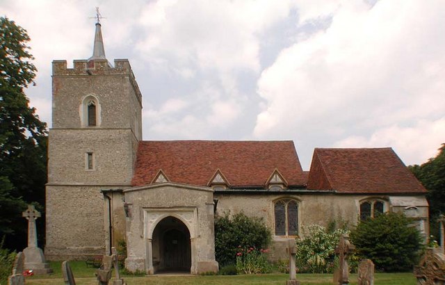
1078:
841:
435:
961:Grade I listed buildings in Hertfordshire
933:The following other wikis use this file:
913:Grade I listed buildings in Hertfordshire
683:https://www.geograph.org.uk/photo/355532
526:https://www.geograph.org.uk/profile/9419
1281:
1271:
1263:
1253:
1245:
1235:
1227:
1219:
1208:
1200:
1192:
1184:
1174:
1166:
1158:
1150:
1139:
1131:
1120:
1110:
1100:
1090:
918:List of civil parishes in Hertfordshire
905:
815:
799:
781:
765:
747:
731:
660:
644:
624:
608:
588:
572:
505:
489:
469:
453:
450:
431:
424:
248:
269:View this and other nearby images on:
1080:
7:
319:and is licensed for reuse under the
830:
355:Attribution-Share Alike 2.0 Generic
343:
338:
323:Attribution-ShareAlike 2.0 license.
1071:
444:
438:
329:
306:
108:
103:
49:
443:
1133:Date and time of data generation
429:
385:Under the following conditions:
350:This file is licensed under the
342:
337:
331:
299:
275:
261:
70:
31:
21:
884:File Upload Bot (Magnus Manske)
426:
46:No higher resolution available.
14:
1107:1/267 sec (0.0037453183520599)
663:file available on the internet
425:
307:This image was taken from the
26:
1:
768:coordinates of depicted place
36:
698:Geograph Britain and Ireland
547:object of statement has role
451:Items portrayed in this file
1221:Date and time of digitizing
997:Usage on lld.wikipedia.org
957:Usage on dag.wikipedia.org
937:Usage on ceb.wikipedia.org
1305:
1052:Usage on www.wikidata.org
1037:Usage on tr.wikipedia.org
1027:Usage on sv.wikipedia.org
1017:Usage on pl.wikipedia.org
1007:Usage on nl.wikipedia.org
987:Usage on it.wikipedia.org
977:Usage on fr.wikipedia.org
967:Usage on fa.wikipedia.org
947:Usage on cy.wikipedia.org
783:51°56'17.02"N, 0°1'56.64"W
399:same or compatible license
1186:File change date and time
831:
16:
1001:Aspenden (Hertfordshire)
706:geograph.org.uk image ID
472:Parish Church of St Mary
428:
365:
238:St Mary, Aspenden, Herts
236:John Salmon /
219:St Mary, Aspenden, Herts
217:John Salmon /
142:St Mary, Aspenden, Herts
77:This is a file from the
888:
208:required by the license
186:
176:
156:
149:
146:
135:
81:. Information from its
1229:Image compression mode
867:21:04, 23 October 2009
313:this photograph's page
281:51.938060; -0.032400
84:description page there
1247:Maximum land aperture
1160:Horizontal resolution
802:location of creation
170:geograph_org2commons
1224:12:49, 16 June 2003
1194:Y and C positioning
1189:15:13, 6 March 2007
1180:Adobe Photoshop 7.0
1168:Vertical resolution
1136:12:49, 16 June 2003
1082:Camera manufacturer
380:– to adapt the work
109:This is a photo of
1278:Flash did not fire
941:Aspenden (lungsod)
818:East Hertfordshire
534:author name string
1292:
1291:
1250:3.5 APEX (f/3.36)
929:Global file usage
896:
611:copyright license
437:
328:
327:
311:collection. See
286:
285:
243:
242:
211:
195:
192:Reusing this file
164:; transferred by
125:
124:
99:
98:
79:Wikimedia Commons
32:Global file usage
1296:
1202:Exposure Program
1079:
879:
715:
710:
700:
695:
685:
680:
676:described at URL
575:copyright status
556:
551:
541:
538:
528:
523:
421:
418:
415:
412:
409:
401:as the original.
363:
352:Creative Commons
346:
345:
341:
340:
335:
334:
321:Creative Commons
309:Geograph project
303:
296:
282:
279:
265:
264:
258:
257:
246:
205:
189:
152:
139:
133:
118:
105:
95:
74:
73:
67:
61:
59:
1304:
1303:
1299:
1298:
1297:
1295:
1294:
1293:
1067:
927:
904:
897:
885:
877:
833:
832:
829:
828:
827:
826:
825:
824:
823:
822:
820:
808:
807:
806:
804:
793:
792:
791:
790:
789:
788:
787:
786:
784:
774:
773:
772:
770:
759:
758:
757:
756:
755:
754:
753:
752:
750:
740:
739:
738:
736:
725:
724:
723:
722:
721:
720:
719:
718:
717:
716:
711:
708:
702:
701:
696:
693:
687:
686:
681:
678:
669:
668:
667:
665:
653:
652:
651:
649:
638:
637:
636:
635:
634:
633:
632:
631:
629:
617:
616:
615:
613:
602:
601:
600:
599:
598:
597:
596:
595:
593:
581:
580:
579:
577:
566:
565:
564:
563:
562:
561:
560:
559:
558:
557:
552:
549:
543:
542:
539:
536:
530:
529:
524:
521:
512:
511:
510:
508:
498:
497:
496:
494:
483:
482:
481:
480:
479:
478:
477:
476:
474:
462:
461:
460:
458:
442:
441:
440:
423:
422:
419:
416:
413:
410:
407:
406:
364:
361:
358:
347:
324:
294:
280:
253:
252:
249:Object location
244:
233:
226:
214:
162:geograph.org.uk
137:
130:
120:
114:
111:listed building
101:
100:
89:
88:
87:is shown below.
63:
57:
55:
48:
47:
12:
11:
5:
1302:
1300:
1290:
1289:
1286:
1280:
1279:
1276:
1270:
1269:
1266:
1262:
1261:
1258:
1252:
1251:
1248:
1244:
1243:
1240:
1234:
1233:
1230:
1226:
1225:
1222:
1218:
1217:
1214:
1207:
1206:
1205:Normal program
1203:
1199:
1198:
1195:
1191:
1190:
1187:
1183:
1182:
1177:
1173:
1172:
1169:
1165:
1164:
1161:
1157:
1156:
1153:
1149:
1148:
1145:
1138:
1137:
1134:
1130:
1129:
1126:
1119:
1118:
1115:
1109:
1108:
1105:
1099:
1098:
1093:
1089:
1088:
1083:
1070:
1066:
1065:
1064:
1063:
1058:
1050:
1049:
1048:
1043:
1035:
1034:
1033:
1025:
1024:
1023:
1015:
1014:
1013:
1005:
1004:
1003:
995:
994:
993:
985:
984:
983:
975:
974:
973:
965:
964:
963:
955:
954:
953:
945:
944:
943:
931:
930:
926:
925:
920:
915:
910:
902:
901:
900:
895:
894:
887:
883:
880:
874:
869:
864:
860:
859:
856:
853:
850:
847:
844:
837:
836:
821:
816:
814:
813:
812:
811:
810:
809:
805:
800:
798:
797:
796:
795:
794:
785:
782:
780:
779:
778:
777:
776:
775:
771:
766:
764:
763:
762:
761:
751:
748:
746:
745:
744:
743:
742:
741:
737:
732:
730:
729:
728:
727:
726:
704:
703:
689:
688:
674:
673:
672:
671:
670:
666:
661:
659:
658:
657:
656:
655:
654:
650:
647:source of file
645:
643:
642:
641:
640:
639:
630:
625:
623:
622:
621:
620:
619:
618:
614:
609:
607:
606:
605:
604:
603:
594:
589:
587:
586:
585:
584:
583:
582:
578:
573:
571:
570:
569:
568:
567:
545:
544:
532:
531:
517:
516:
515:
514:
513:
509:
506:
504:
503:
502:
501:
500:
499:
495:
490:
488:
487:
486:
485:
484:
475:
470:
468:
467:
466:
465:
464:
463:
459:
454:
452:
449:
448:
447:
446:
445:
434:
433:
430:
427:
405:
404:
403:
402:
392:
383:
382:
381:
375:
368:You are free:
359:
349:
348:
330:
326:
325:
304:
293:
290:
284:
283:
273:
267:
250:
241:
240:
234:
231:
228:
227:
222:
215:
212:
200:
199:
196:
184:
183:
178:
174:
173:
158:
154:
153:
148:
144:
143:
140:
131:
129:
126:
123:
122:
102:
97:
96:
75:
65:
64:
45:
41:
40:
39:
34:
29:
24:
19:
13:
10:
9:
6:
4:
3:
2:
1301:
1287:
1285:
1282:
1277:
1275:
1272:
1267:
1264:
1259:
1257:
1256:Metering mode
1254:
1249:
1246:
1241:
1239:
1238:Exposure bias
1236:
1231:
1228:
1223:
1220:
1215:
1212:
1209:
1204:
1201:
1196:
1193:
1188:
1185:
1181:
1178:
1176:Software used
1175:
1170:
1167:
1162:
1159:
1154:
1151:
1146:
1144:
1140:
1135:
1132:
1127:
1124:
1121:
1116:
1114:
1111:
1106:
1104:
1103:Exposure time
1101:
1097:
1094:
1091:
1087:
1084:
1081:
1077:
1074:
1068:
1062:
1059:
1057:
1054:
1053:
1051:
1047:
1044:
1042:
1039:
1038:
1036:
1032:
1029:
1028:
1026:
1022:
1019:
1018:
1016:
1012:
1009:
1008:
1006:
1002:
999:
998:
996:
992:
989:
988:
986:
982:
979:
978:
976:
972:
969:
968:
966:
962:
959:
958:
956:
952:
949:
948:
946:
942:
939:
938:
936:
935:
934:
928:
924:
921:
919:
916:
914:
911:
909:
906:
898:
892:
886:
881:
875:
873:
870:
868:
865:
862:
861:
857:
854:
851:
848:
845:
843:
842:
840:
834:
819:
803:
769:
735:
714:
707:
699:
692:
684:
677:
664:
648:
628:
612:
592:
576:
555:
548:
535:
527:
520:
493:
473:
457:
411:CC BY-SA 2.0
400:
396:
393:
390:
387:
386:
384:
379:
376:
373:
370:
369:
367:
366:
360:Attribution:
356:
353:
336:
322:
318:
314:
310:
305:
302:
298:
297:
291:
289:
288:
278:
274:
272:
271:OpenStreetMap
268:
266:
256:
251:
247:
239:
235:
230:
229:
225:
221: /
220:
216:
209:
204:
202:
201:
197:
193:
188:
185:
182:
179:
175:
171:
167:
163:
159:
155:
145:
141:
134:
127:
121:
117:
112:
107:
106:
93:
86:
85:
80:
76:
69:
68:
62:
53:
44:
38:
35:
33:
30:
28:
25:
23:
20:
18:
15:
1265:Light source
1143:focal length
1092:Camera model
1075:
1072:
932:
838:
835:File history
749:16 June 2003
554:photographer
394:
388:
377:
371:
316:
287:
237:
224:CC BY-SA 2.0
218:
151:16 June 2003
92:You can help
82:
50:
22:File history
1284:Color space
1152:Orientation
893:using . |Da
891:User:oxyman
591:copyrighted
540:John Salmon
395:share alike
389:attribution
362:John Salmon
317:John Salmon
203:Attribution
181:John Salmon
166:User:oxyman
136:Description
899:File usage
876:640 × 410
852:Dimensions
507:some value
187:Permission
58:image/jpeg
27:File usage
1123:ISO speed
1061:Q17528996
849:Thumbnail
846:Date/Time
734:inception
292:Licensing
232:InfoField
213:InfoField
1197:Co-sited
1113:F-number
1069:Metadata
1056:Q1987354
1041:Aspenden
1031:Aspenden
1021:Aspenden
1011:Aspenden
991:Aspenden
981:Aspenden
951:Aspenden
908:Aspenden
691:operator
432:Captions
378:to remix
372:to share
357:license.
37:Metadata
1268:Unknown
1260:Pattern
1213:version
878:(74 KB)
863:current
858:Comment
492:creator
456:depicts
436:English
128:Summary
116:1347966
113:number
54:
1171:72 dpi
1163:72 dpi
1155:Normal
1147:8.2 mm
1125:rating
971:اسپندن
713:355532
259:
177:Author
168:using
157:Source
1274:Flash
1141:Lens
1117:f/6.2
1086:NIKON
160:From
1288:sRGB
1211:Exif
1096:E990
855:User
420:true
417:true
147:Date
17:File
1216:2.1
1128:100
519:URL
709::
694::
679::
550::
537::
522::
1242:0
1232:3
210:)
206:(
194:)
190:(
172:.
119:.
94:.
60:)
Text is available under the Creative Commons Attribution-ShareAlike License. Additional terms may apply.
_region:GB-GBN_&language=en)
