293:
223:
237:
261:
299:
304:
72:
921:
214:
43:
351:– You must give appropriate credit, provide a link to the license, and indicate if changes were made. You may do so in any reasonable manner, but not in any way that suggests the licensor endorses you or your use.
51:
83:
938:== {{int:filedesc}} == {{Information |description={{en|1=St Mary, Thrigby, Norfolk}} |date=2007-01-04 |source=From |author= |permission= |other_
637:
567:
531:
230:
920:
915:
657:
42:
1101:
268:
983:
This file contains additional information, probably added from the digital camera or scanner used to create or digitize it.
724:
358:
494:
849:
815:
778:
744:
708:
665:
621:
515:
487:
474:
459:
680:
650:
587:
551:
432:
415:
255:
314:
986:
If the file has been modified from its original state, some details may not fully reflect the modified file.
948:
The following pages on the
English Knowledge (XXG) use this file (pages on other projects are not listed):
1146:
357:– If you remix, transform, or build upon the material, you must distribute your contributions under the
275:
on the
Geograph website for the photographer's contact details. The copyright on this image is owned by
931:
1005:
311:
1174:
1078:
91:
183:
687:
672:
466:
167:
995:
236:
1242:
1164:
1128:
1012:
280:
78:
1252:
1041:
1184:
135:
220:
156:
146:
1022:
260:
952:
272:
888:
Click on a date/time to view the file as it appeared at that time.
222:
737:
205:
66:
215:
52° 39′ 12″ N, 1° 38′ 12″ E
116:
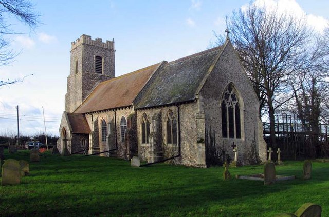
St Mary, Thrigby, Norfolk - geograph.org.uk - 306891.jpg
52:
St_Mary,_Thrigby,_Norfolk_-_geograph.org.uk_-_306891.jpg
399:
Add a one-line explanation of what this file represents
970:
110:
90:
Commons is a freely licensed media file repository.
568:
Creative
Commons Attribution-ShareAlike 2.0 Generic
1179:Flash did not fire, compulsory flash suppression
56:(640 × 423 pixels, file size: 96 KB, MIME type:
368:https://creativecommons.org/licenses/by-sa/2.0
71:
374:Creative Commons Attribution-Share Alike 2.0
292:
8:
334:– to copy, distribute and transmit the work
988:
890:
395:
963:The following other wikis use this file:
688:https://www.geograph.org.uk/photo/306891
467:https://www.geograph.org.uk/profile/9419
1261:
1250:
1240:
1232:
1224:
1216:
1208:
1200:
1192:
1182:
1172:
1162:
1154:
1144:
1136:
1126:
1118:
1110:
1099:
1091:
1083:
1073:
1065:
1057:
1049:
1038:
1030:
1020:
1010:
1000:
950:
863:
847:
829:
813:
792:
776:
758:
742:
722:
706:
635:
619:
601:
585:
565:
549:
529:
513:
446:
430:
413:
410:
391:
384:
208:
229:View this and other nearby images on:
990:
7:
279:and is licensed for reuse under the
879:
315:Attribution-Share Alike 2.0 Generic
303:
298:
283:Attribution-ShareAlike 2.0 license.
981:
404:
398:
289:
266:
120:
103:
49:
403:
1032:Date and time of data generation
389:
345:Under the following conditions:
310:This file is licensed under the
302:
297:
291:
259:
235:
221:
70:
31:
21:
386:
121:
46:No higher resolution available.
14:
638:file available on the internet
385:
267:This image was taken from the
26:
1:
745:coordinates of depicted place
36:
658:Geograph Britain and Ireland
488:object of statement has role
411:Items portrayed in this file
1210:Focal plane resolution unit
1112:Date and time of digitizing
760:52°39'11.95"N, 1°38'11.76"E
1283:
1221:One-chip color area sensor
967:Usage on sv.wikipedia.org
359:same or compatible license
1085:File change date and time
880:
198:St Mary, Thrigby, Norfolk
179:St Mary, Thrigby, Norfolk
126:St Mary, Thrigby, Norfolk
16:
1202:Focal plane Y resolution
1194:Focal plane X resolution
666:geograph.org.uk image ID
388:
325:
196:John Salmon /
177:John Salmon /
77:This is a file from the
1226:Custom image processing
937:
916:22:35, 22 December 2010
168:required by the license
152:
141:
134:
131:
113:
81:. Information from its
1120:Image compression mode
273:this photograph's page
241:52.653320; 1.636600
84:description page there
1156:Maximum land aperture
1115:12:24, 4 January 2007
1088:18:02, 7 January 2007
1059:Horizontal resolution
1035:12:24, 4 January 2007
1159:2.53125 APEX (f/2.4)
1006:Canon PowerShot Pro1
725:Canon PowerShot Pro1
1093:Y and C positioning
1079:Adobe Photoshop 7.0
1067:Vertical resolution
992:Camera manufacturer
340:– to adapt the work
1263:Scene capture type
1247:Auto white balance
475:author name string
1270:
1269:
1017:1/200 sec (0.005)
959:Global file usage
941:
552:copyright license
397:
288:
287:
271:collection. See
246:
245:
203:
202:
171:
99:
98:
79:Wikimedia Commons
32:Global file usage
1274:
1205:9,415.3846153846
1197:9,406.3400576369
989:
928:
868:
797:
690:
685:
681:described at URL
675:
670:
660:
655:
516:copyright status
497:
492:
482:
479:
469:
464:
381:
378:
375:
372:
369:
361:as the original.
323:
312:Creative Commons
306:
305:
301:
300:
295:
294:
281:Creative Commons
269:Geograph project
263:
256:
242:
239:
225:
224:
218:
217:
206:
165:
137:
125:
117:
111:
95:
74:
73:
67:
61:
59:
1282:
1281:
1277:
1276:
1275:
1273:
1272:
1271:
977:
957:
949:
942:
934:
926:
882:
881:
878:
877:
876:
875:
874:
873:
872:
871:
869:
866:
856:
855:
854:
852:
841:
840:
839:
838:
837:
836:
835:
834:
832:
822:
821:
820:
818:
807:
806:
805:
804:
803:
802:
801:
800:
798:
795:
785:
784:
783:
781:
770:
769:
768:
767:
766:
765:
764:
763:
761:
751:
750:
749:
747:
736:
735:
734:
733:
732:
731:
730:
729:
727:
715:
714:
713:
711:
700:
699:
698:
697:
696:
695:
694:
693:
692:
691:
686:
683:
677:
676:
671:
668:
662:
661:
656:
653:
644:
643:
642:
640:
628:
627:
626:
624:
613:
612:
611:
610:
609:
608:
607:
606:
604:
594:
593:
592:
590:
579:
578:
577:
576:
575:
574:
573:
572:
570:
558:
557:
556:
554:
543:
542:
541:
540:
539:
538:
537:
536:
534:
522:
521:
520:
518:
507:
506:
505:
504:
503:
502:
501:
500:
499:
498:
493:
490:
484:
483:
480:
477:
471:
470:
465:
462:
453:
452:
451:
449:
439:
438:
437:
435:
424:
423:
422:
421:
420:
418:
402:
401:
400:
383:
382:
379:
376:
373:
370:
367:
366:
324:
321:
318:
307:
284:
254:
240:
213:
212:
209:Object location
204:
193:
186:
174:
147:geograph.org.uk
127:
115:
108:
101:
100:
89:
88:
87:is shown below.
63:
57:
55:
48:
47:
12:
11:
5:
1280:
1278:
1268:
1267:
1264:
1260:
1259:
1256:
1249:
1248:
1245:
1239:
1238:
1235:
1231:
1230:
1229:Normal process
1227:
1223:
1222:
1219:
1218:Sensing method
1215:
1214:
1211:
1207:
1206:
1203:
1199:
1198:
1195:
1191:
1190:
1187:
1181:
1180:
1177:
1171:
1170:
1167:
1161:
1160:
1157:
1153:
1152:
1149:
1143:
1142:
1139:
1135:
1134:
1131:
1125:
1124:
1121:
1117:
1116:
1113:
1109:
1108:
1105:
1098:
1097:
1094:
1090:
1089:
1086:
1082:
1081:
1076:
1072:
1071:
1068:
1064:
1063:
1060:
1056:
1055:
1052:
1048:
1047:
1044:
1037:
1036:
1033:
1029:
1028:
1025:
1019:
1018:
1015:
1009:
1008:
1003:
999:
998:
993:
980:
976:
975:
974:
973:
961:
960:
956:
955:
947:
946:
945:
940:
939:
936:
932:
929:
923:
918:
913:
909:
908:
905:
902:
899:
896:
893:
886:
885:
870:
864:
862:
861:
860:
859:
858:
857:
853:
848:
846:
845:
844:
843:
842:
833:
830:
828:
827:
826:
825:
824:
823:
819:
814:
812:
811:
810:
809:
808:
799:
793:
791:
790:
789:
788:
787:
786:
782:
777:
775:
774:
773:
772:
771:
762:
759:
757:
756:
755:
754:
753:
752:
748:
743:
741:
740:
739:
738:
728:
723:
721:
720:
719:
718:
717:
716:
712:
707:
705:
704:
703:
702:
701:
679:
678:
664:
663:
649:
648:
647:
646:
645:
641:
636:
634:
633:
632:
631:
630:
629:
625:
622:source of file
620:
618:
617:
616:
615:
614:
605:
603:4 January 2007
602:
600:
599:
598:
597:
596:
595:
591:
586:
584:
583:
582:
581:
580:
571:
566:
564:
563:
562:
561:
560:
559:
555:
550:
548:
547:
546:
545:
544:
535:
530:
528:
527:
526:
525:
524:
523:
519:
514:
512:
511:
510:
509:
508:
486:
485:
473:
472:
458:
457:
456:
455:
454:
450:
447:
445:
444:
443:
442:
441:
440:
436:
431:
429:
428:
427:
426:
425:
419:
414:
412:
409:
408:
407:
406:
405:
394:
393:
390:
387:
365:
364:
363:
362:
352:
343:
342:
341:
335:
328:You are free:
319:
309:
308:
290:
286:
285:
264:
253:
250:
244:
243:
233:
227:
210:
201:
200:
194:
191:
188:
187:
182:
175:
172:
160:
159:
154:
150:
149:
143:
139:
138:
136:4 January 2007
133:
129:
128:
118:
109:
107:
104:
102:
97:
96:
75:
65:
64:
45:
41:
40:
39:
34:
29:
24:
19:
13:
10:
9:
6:
4:
3:
2:
1279:
1265:
1262:
1257:
1254:
1251:
1246:
1244:
1243:White balance
1241:
1237:Auto exposure
1236:
1234:Exposure mode
1233:
1228:
1225:
1220:
1217:
1212:
1209:
1204:
1201:
1196:
1193:
1188:
1186:
1183:
1178:
1176:
1173:
1168:
1166:
1165:Metering mode
1163:
1158:
1155:
1150:
1148:
1147:Exposure bias
1145:
1140:
1138:APEX aperture
1137:
1132:
1130:
1129:Shutter speed
1127:
1122:
1119:
1114:
1111:
1106:
1103:
1100:
1095:
1092:
1087:
1084:
1080:
1077:
1075:Software used
1074:
1069:
1066:
1061:
1058:
1053:
1050:
1045:
1043:
1039:
1034:
1031:
1026:
1024:
1021:
1016:
1014:
1013:Exposure time
1011:
1007:
1004:
1001:
997:
994:
991:
987:
984:
978:
972:
969:
968:
966:
965:
964:
958:
954:
951:
943:
935:
930:
924:
922:
919:
917:
914:
911:
910:
906:
903:
900:
897:
894:
892:
891:
889:
883:
851:
817:
780:
779:exposure time
746:
726:
710:
709:captured with
689:
682:
674:
667:
659:
652:
639:
623:
589:
569:
553:
533:
517:
496:
489:
476:
468:
461:
434:
417:
371:CC BY-SA 2.0
360:
356:
353:
350:
347:
346:
344:
339:
336:
333:
330:
329:
327:
326:
320:Attribution:
316:
313:
296:
282:
278:
274:
270:
265:
262:
258:
257:
251:
249:
248:
238:
234:
232:
231:OpenStreetMap
228:
226:
216:
211:
207:
199:
195:
190:
189:
185:
181: /
180:
176:
169:
164:
162:
161:
158:
155:
151:
148:
144:
140:
130:
124:
119:
112:
105:
93:
86:
85:
80:
76:
69:
68:
62:
53:
44:
38:
35:
33:
30:
28:
25:
23:
20:
18:
15:
1253:Digital zoom
1042:focal length
1002:Camera model
985:
982:
962:
887:
884:File history
850:focal length
495:photographer
354:
348:
337:
331:
276:
247:
197:
184:CC BY-SA 2.0
178:
122:
92:You can help
82:
50:
22:File history
1185:Color space
1051:Orientation
933:GeographBot
532:copyrighted
481:John Salmon
355:share alike
349:attribution
322:John Salmon
277:John Salmon
163:Attribution
157:John Salmon
114:Description
944:File usage
925:640 × 423
901:Dimensions
867:millimetre
448:some value
58:image/jpeg
27:File usage
1046:7.1875 mm
898:Thumbnail
895:Date/Time
588:inception
252:Licensing
192:InfoField
173:InfoField
123:English:
1266:Standard
1096:Centered
1023:F-number
979:Metadata
816:f-number
651:operator
392:Captions
338:to remix
332:to share
317:license.
37:Metadata
1169:Pattern
1133:7.65625
1104:version
1070:180 dpi
1062:180 dpi
971:Thrigby
953:Thrigby
927:(96 KB)
912:current
907:Comment
865:7.1875
433:creator
416:depicts
396:English
106:Summary
54:
1213:inches
1054:Normal
796:second
794:0.005
673:306891
219:
153:Author
142:Source
1255:ratio
1175:Flash
1040:Lens
996:Canon
145:From
1189:sRGB
1107:2.21
1102:Exif
904:User
380:true
377:true
132:Date
17:File
1027:f/4
460:URL
684::
669::
654::
491::
478::
463::
1258:1
1151:0
1141:4
1123:5
831:4
170:)
166:(
94:.
60:)
Text is available under the Creative Commons Attribution-ShareAlike License. Additional terms may apply.
_&language=en)
