361:
294:
244:
286:
236:
308:
258:
329:
367:
372:
67:
837:"}},"text\/plain":{"en":{"":"heading"}}},"{\"value\":{\"amount\":\"+315\",\"unit\":\"http:\\\/\\\/www.wikidata.org\\\/entity\\\/Q28390\"},\"type\":\"quantity\"}":{"text\/html":{"en":{"P7787":"315
773:"}},"text\/plain":{"en":{"":"heading"}}},"{\"value\":{\"amount\":\"+315\",\"unit\":\"http:\\\/\\\/www.wikidata.org\\\/entity\\\/Q28390\"},\"type\":\"quantity\"}":{"text\/html":{"en":{"P7787":"315
769:
277:
227:
38:
419:– You must give appropriate credit, provide a link to the license, and indicate if changes were made. You may do so in any reasonable manner, but not in any way that suggests the licensor endorses you or your use.
78:
46:
834:
770:
974:
164:
705:
635:
599:
301:
251:
755:
336:
426:
949:
534:
875:
848:
811:
784:
733:
689:
583:
557:
542:
527:
748:
718:
655:
619:
500:
483:
938:
933:
323:
37:
382:
970:
The following pages on the
English Knowledge (XXG) use this file (pages on other projects are not listed):
425:– If you remix, transform, or build upon the material, you must distribute your contributions under the
343:
on the
Geograph website for the photographer's contact details. The copyright on this image is owned by
379:
841:"}},"text\/plain":{"en":{"P7787":"315 degree"}}}}": -->
777:"}},"text\/plain":{"en":{"P7787":"315 degree"}}}}": -->
86:
196:
740:
725:
549:
180:
956:== Summary == {{Information |Description=St Mary Wherstead |Source=From ; transferd by
307:
257:
348:
73:
957:
241:
123:
979:
1017:
291:
153:
138:
134:
328:
340:
906:
Click on a date/time to view the file as it appeared at that time.
293:
243:
228:
52° 01′ 21.63″ N, 1° 08′ 56.49″ E
142:
1102:
268:
218:
61:
1067:
278:
52° 01′ 22″ N, 1° 08′ 56″ E
1037:
997:
467:
Add a one-line explanation of what this file represents
1092:
1077:
1057:
1047:
1027:
1007:
1087:
171:
Creative
Commons Attribution Share-alike license 2.0
105:
85:
Commons is a freely licensed media file repository.
636:
Creative
Commons Attribution-ShareAlike 2.0 Generic
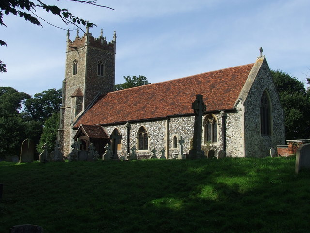
111:St Mary Wherstead - geograph.org.uk - 961507.jpg
51:(640 × 480 pixels, file size: 76 KB, MIME type:
47:St_Mary_Wherstead_-_geograph.org.uk_-_961507.jpg
436:https://creativecommons.org/licenses/by-sa/2.0
66:
442:Creative Commons Attribution-Share Alike 2.0
360:
8:
838:
774:
402:– to copy, distribute and transmit the work
908:
463:
990:The following other wikis use this file:
726:https://www.geograph.org.uk/photo/961507
550:https://www.geograph.org.uk/profile/6337
972:
862:
846:
798:
782:
703:
687:
669:
653:
633:
617:
597:
581:
514:
498:
481:
478:
459:
452:
271:
221:
300:View this and other nearby images on:
250:View this and other nearby images on:
975:Grade II* listed buildings in Babergh
7:
347:and is licensed for reuse under the
897:
383:Attribution-Share Alike 2.0 Generic
371:
366:
351:Attribution-ShareAlike 2.0 license.
1099:Usage on zh-min-nan.wikipedia.org
472:
466:
357:
334:
98:
44:
471:
785:coordinates of the point of view
457:
413:Under the following conditions:
378:This file is licensed under the
370:
365:
359:
327:
306:
292:
284:
256:
242:
234:
65:
31:
21:
951:File Upload Bot (Magnus Manske)
454:
41:No higher resolution available.
14:
1064:Usage on simple.wikipedia.org
706:file available on the internet
453:
335:This image was taken from the
26:
1:
849:coordinates of depicted place
756:Geograph Britain and Ireland
528:object of statement has role
479:Items portrayed in this file
283:
233:
1034:Usage on lld.wikipedia.org
994:Usage on ceb.wikipedia.org
800:52°1'21.634"N, 1°8'56.494"E
1121:
1084:Usage on www.wikidata.org
1074:Usage on sv.wikipedia.org
1054:Usage on pl.wikipedia.org
1044:Usage on nl.wikipedia.org
1024:Usage on fr.wikipedia.org
1014:Usage on fa.wikipedia.org
1004:Usage on de.wikipedia.org
427:same or compatible license
898:
864:52°1'22.44"N, 1°8'56.40"E
16:
734:geograph.org.uk image ID
456:
393:
209:Keith Evans /
190:Keith Evans /
72:This is a file from the
955:
181:required by the license
159:
149:
129:
122:
119:
108:
76:. Information from its
341:this photograph's page
312:52.022900; 1.149000
262:52.022676; 1.149026
79:description page there
143:geograph_org2commons
408:– to adapt the work
934:12:27, 30 May 2009
558:author name string
986:Global file usage
963:
960:using . |Date=200
840:
776:
671:13 September 2008
620:copyright license
465:
356:
355:
339:collection. See
317:
316:
267:
266:
216:
215:
211:St Mary Wherstead
192:St Mary Wherstead
184:
168:
165:Reusing this file
137:; transferred by
124:13 September 2008
115:St Mary Wherstead
94:
93:
74:Wikimedia Commons
32:Global file usage
1112:
946:
886:
885:
880:
822:
821:
816:
758:
753:
743:
738:
728:
723:
719:described at URL
584:copyright status
565:
562:
552:
547:
537:
532:
449:
446:
443:
440:
437:
429:as the original.
391:
380:Creative Commons
374:
373:
369:
368:
363:
362:
349:Creative Commons
337:Geograph project
331:
324:
313:
310:
296:
295:
289:
288:
287:
281:
280:
269:
263:
260:
246:
245:
239:
238:
237:
231:
230:
219:
178:
162:
125:
112:
106:
90:
69:
68:
62:
56:
54:
1120:
1119:
1115:
1114:
1113:
1111:
1110:
1109:
984:
971:
964:
952:
944:
900:
899:
896:
895:
894:
893:
892:
891:
890:
889:
888:
887:
883:
881:
878:
869:
868:
867:
865:
855:
854:
853:
851:
832:
831:
830:
829:
828:
827:
826:
825:
824:
823:
819:
817:
814:
805:
804:
803:
801:
791:
790:
789:
787:
768:
767:
766:
765:
764:
763:
762:
761:
760:
759:
754:
751:
745:
744:
739:
736:
730:
729:
724:
721:
712:
711:
710:
708:
696:
695:
694:
692:
681:
680:
679:
678:
677:
676:
675:
674:
672:
662:
661:
660:
658:
647:
646:
645:
644:
643:
642:
641:
640:
638:
626:
625:
624:
622:
611:
610:
609:
608:
607:
606:
605:
604:
602:
590:
589:
588:
586:
575:
574:
573:
572:
571:
570:
569:
568:
567:
566:
563:
560:
554:
553:
548:
545:
539:
538:
533:
530:
521:
520:
519:
517:
507:
506:
505:
503:
492:
491:
490:
489:
488:
486:
470:
469:
468:
451:
450:
447:
444:
441:
438:
435:
434:
392:
389:
386:
375:
352:
322:
311:
285:
276:
275:
272:Object location
261:
235:
226:
225:
222:Camera location
217:
206:
199:
187:
135:geograph.org.uk
110:
103:
96:
95:
84:
83:
82:is shown below.
58:
52:
50:
43:
42:
12:
11:
5:
1118:
1116:
1108:
1107:
1106:
1105:
1097:
1096:
1095:
1090:
1082:
1081:
1080:
1072:
1071:
1070:
1062:
1061:
1060:
1052:
1051:
1050:
1042:
1041:
1040:
1032:
1031:
1030:
1022:
1021:
1020:
1012:
1011:
1010:
1002:
1001:
1000:
988:
987:
983:
982:
977:
969:
968:
967:
962:
961:
954:
950:
947:
941:
936:
931:
927:
926:
923:
920:
917:
914:
911:
904:
903:
874:
873:
872:
871:
870:
866:
863:
861:
860:
859:
858:
857:
856:
852:
847:
845:
844:
843:
842:
836:
810:
809:
808:
807:
806:
802:
799:
797:
796:
795:
794:
793:
792:
788:
783:
781:
780:
779:
778:
772:
747:
746:
732:
731:
717:
716:
715:
714:
713:
709:
704:
702:
701:
700:
699:
698:
697:
693:
690:source of file
688:
686:
685:
684:
683:
682:
673:
670:
668:
667:
666:
665:
664:
663:
659:
654:
652:
651:
650:
649:
648:
639:
634:
632:
631:
630:
629:
628:
627:
623:
618:
616:
615:
614:
613:
612:
603:
598:
596:
595:
594:
593:
592:
591:
587:
582:
580:
579:
578:
577:
576:
556:
555:
541:
540:
526:
525:
524:
523:
522:
518:
515:
513:
512:
511:
510:
509:
508:
504:
499:
497:
496:
495:
494:
493:
487:
482:
480:
477:
476:
475:
474:
473:
462:
461:
458:
455:
433:
432:
431:
430:
420:
411:
410:
409:
403:
396:You are free:
387:
377:
376:
358:
354:
353:
332:
321:
318:
315:
314:
304:
298:
273:
265:
264:
254:
248:
223:
214:
213:
207:
204:
201:
200:
195:
188:
185:
173:
172:
169:
157:
156:
151:
147:
146:
131:
127:
126:
121:
117:
116:
113:
104:
102:
99:
97:
92:
91:
70:
60:
59:
40:
36:
35:
34:
29:
24:
19:
13:
10:
9:
6:
4:
3:
2:
1117:
1104:
1101:
1100:
1098:
1094:
1091:
1089:
1086:
1085:
1083:
1079:
1076:
1075:
1073:
1069:
1066:
1065:
1063:
1059:
1056:
1055:
1053:
1049:
1046:
1045:
1043:
1039:
1036:
1035:
1033:
1029:
1026:
1025:
1023:
1019:
1016:
1015:
1013:
1009:
1006:
1005:
1003:
999:
996:
995:
993:
992:
991:
985:
981:
978:
976:
973:
965:
959:
953:
948:
942:
940:
937:
935:
932:
929:
928:
924:
921:
918:
915:
912:
910:
909:
907:
901:
877:
850:
813:
786:
757:
750:
742:
735:
727:
720:
707:
691:
657:
637:
621:
601:
585:
559:
551:
544:
536:
529:
502:
485:
439:CC BY-SA 2.0
428:
424:
421:
418:
415:
414:
412:
407:
404:
401:
398:
397:
395:
394:
388:Attribution:
384:
381:
364:
350:
346:
342:
338:
333:
330:
326:
325:
319:
309:
305:
303:
302:OpenStreetMap
299:
297:
279:
274:
270:
259:
255:
253:
252:OpenStreetMap
249:
247:
229:
224:
220:
212:
208:
203:
202:
198:
194: /
193:
189:
182:
177:
175:
174:
170:
166:
161:
158:
155:
152:
148:
144:
140:
136:
132:
128:
118:
114:
107:
100:
88:
81:
80:
75:
71:
64:
63:
57:
48:
39:
33:
30:
28:
25:
23:
20:
18:
15:
989:
905:
902:File history
535:photographer
422:
416:
405:
399:
344:
282:
232:
210:
197:CC BY-SA 2.0
191:
87:You can help
77:
45:
22:File history
958:User:oxyman
600:copyrighted
564:Keith Evans
423:share alike
417:attribution
390:Keith Evans
345:Keith Evans
176:Attribution
154:Keith Evans
139:User:oxyman
109:Description
966:File usage
943:640 × 480
919:Dimensions
516:some value
160:Permission
53:image/jpeg
27:File usage
1103:Wherstead
1093:Q17534060
1078:Wherstead
1068:Wherstead
1058:Wherstead
1048:Wherstead
1038:Wherstead
1028:Wherstead
1008:Wherstead
998:Wherstead
980:Wherstead
916:Thumbnail
913:Date/Time
656:inception
320:Licensing
205:InfoField
186:InfoField
1088:Q2788077
749:operator
460:Captions
406:to remix
400:to share
385:license.
945:(76 KB)
930:current
925:Comment
876:heading
835:heading
812:heading
771:heading
501:creator
484:depicts
464:English
101:Summary
49:
884:degree
839:degree
820:degree
775:degree
741:961507
290:
240:
150:Author
141:using
130:Source
1018:ورستد
133:From
922:User
882:315
818:315
448:true
445:true
120:Date
17:File
543:URL
879::
815::
752::
737::
722::
561::
546::
531::
183:)
179:(
167:)
163:(
145:.
89:.
55:)
Text is available under the Creative Commons Attribution-ShareAlike License. Additional terms may apply.
_region:GB-GBN_heading:315.00&language=en)
