332:
265:
223:
279:
237:
300:
338:
343:
72:
850:
867:== {{int:filedesc}} == {{Information |description={{en|1=St Nicholas, Stenigot. A brick church of 1892. Inside are two alabaster monuments to Francis Velles de Guevara (1592) and Sir John Guevara (1607). The family came over from Spain with Catherine of A
256:
214:
43:
390:– You must give appropriate credit, provide a link to the license, and indicate if changes were made. You may do so in any reasonable manner, but not in any way that suggests the licensor endorses you or your use.
126:
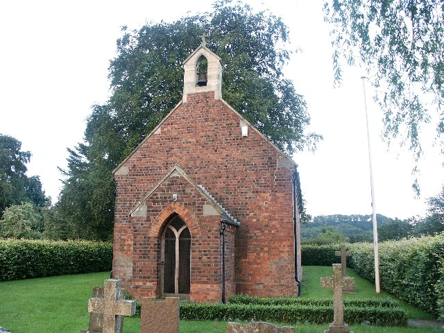
St
Nicholas, Stenigot. A brick church of 1892. Inside are two alabaster monuments to Francis Velles de Guevara (1592) and Sir John Guevara (1607). The family came over from Spain with Catherine of Aragon.
83:
51:
642:
606:
570:
272:
230:
677:
307:
952:
This file contains additional information, probably added from the digital camera or scanner used to create or digitize it.
397:
520:
849:
844:
781:
713:
685:
626:
554:
528:
513:
498:
42:
747:
670:
655:
590:
471:
454:
294:
353:
955:
If the file has been modified from its original state, some details may not fully reflect the modified file.
877:
The following pages on the
English Knowledge (XXG) use this file (pages on other projects are not listed):
396:– If you remix, transform, or build upon the material, you must distribute your contributions under the
314:
on the
Geograph website for the photographer's contact details. The copyright on this image is owned by
860:
350:
91:
183:
692:
662:
505:
167:
278:
236:
319:
78:
135:
262:
220:
156:
146:
881:
299:
311:
817:
Click on a date/time to view the file as it appeared at that time.
264:
222:
247:
205:
66:
774:
706:
257:
53° 18′ 39″ N, 0° 07′ 19″ W
215:
53° 18′ 39″ N, 0° 07′ 23″ W
438:
Add a one-line explanation of what this file represents
919:
899:
939:
929:
909:
116:
St
Nicholas, Stenigot - geograph.org.uk - 105683.jpg
110:
90:
Commons is a freely licensed media file repository.
52:
St_Nicholas,_Stenigot_-_geograph.org.uk_-_105683.jpg
607:
Creative
Commons Attribution-ShareAlike 2.0 Generic
56:(640 × 480 pixels, file size: 119 KB, MIME type:
407:https://creativecommons.org/licenses/by-sa/2.0
71:
413:Creative Commons Attribution-Share Alike 2.0
331:
8:
373:– to copy, distribute and transmit the work
957:
819:
434:
892:The following other wikis use this file:
663:https://www.geograph.org.uk/photo/105683
506:https://www.geograph.org.uk/profile/4330
959:
879:
795:
779:
761:
745:
727:
711:
640:
624:
604:
588:
568:
552:
485:
469:
452:
449:
430:
423:
250:
208:
271:View this and other nearby images on:
229:View this and other nearby images on:
7:
318:and is licensed for reuse under the
808:
354:Attribution-Share Alike 2.0 Generic
342:
337:
322:Attribution-ShareAlike 2.0 license.
950:
443:
437:
328:
305:
120:
103:
49:
442:
714:coordinates of the point of view
428:
384:Under the following conditions:
349:This file is licensed under the
341:
336:
330:
298:
277:
263:
235:
221:
70:
31:
21:
425:
121:
46:No higher resolution available.
14:
643:file available on the internet
424:
306:This image was taken from the
26:
1:
782:coordinates of depicted place
36:
678:Geograph Britain and Ireland
514:object of statement has role
450:Items portrayed in this file
196:Dave Hitchborne /
177:Dave Hitchborne /
916:Usage on lld.wikipedia.org
896:Usage on ceb.wikipedia.org
981:
936:Usage on www.wikidata.org
926:Usage on pl.wikipedia.org
906:Usage on cy.wikipedia.org
398:same or compatible license
809:
16:
797:53°18'38.5"N, 0°7'19.2"W
729:53°18'38.5"N, 0°7'22.8"W
686:geograph.org.uk image ID
427:
364:
77:This is a file from the
866:
168:required by the license
152:
141:
134:
131:
113:
81:. Information from its
845:01:54, 31 January 2010
312:this photograph's page
283:53.310700; -0.122000
241:53.310700; -0.123000
84:description page there
198:St Nicholas, Stenigot
179:St Nicholas, Stenigot
379:– to adapt the work
529:author name string
968:
967:
888:Global file usage
870:
591:copyright license
436:
327:
326:
310:collection. See
288:
287:
246:
245:
203:
202:
171:
99:
98:
79:Wikimedia Commons
32:Global file usage
972:
958:
857:
695:
690:
680:
675:
665:
660:
656:described at URL
555:copyright status
536:
533:
523:
518:
508:
503:
420:
417:
414:
411:
408:
400:as the original.
362:
351:Creative Commons
345:
344:
340:
339:
334:
333:
320:Creative Commons
308:Geograph project
302:
295:
284:
281:
267:
266:
260:
259:
248:
242:
239:
225:
224:
218:
217:
206:
165:
137:
125:
117:
111:
95:
74:
73:
67:
61:
59:
980:
979:
975:
974:
973:
971:
970:
969:
946:
886:
878:
871:
863:
855:
811:
810:
807:
806:
805:
804:
803:
802:
801:
800:
798:
788:
787:
786:
784:
773:
772:
771:
770:
769:
768:
767:
766:
764:
754:
753:
752:
750:
739:
738:
737:
736:
735:
734:
733:
732:
730:
720:
719:
718:
716:
705:
704:
703:
702:
701:
700:
699:
698:
697:
696:
691:
688:
682:
681:
676:
673:
667:
666:
661:
658:
649:
648:
647:
645:
633:
632:
631:
629:
618:
617:
616:
615:
614:
613:
612:
611:
609:
597:
596:
595:
593:
582:
581:
580:
579:
578:
577:
576:
575:
573:
561:
560:
559:
557:
546:
545:
544:
543:
542:
541:
540:
539:
538:
537:
535:Dave Hitchborne
534:
531:
525:
524:
519:
516:
510:
509:
504:
501:
492:
491:
490:
488:
478:
477:
476:
474:
463:
462:
461:
460:
459:
457:
441:
440:
439:
422:
421:
418:
415:
412:
409:
406:
405:
363:
361:Dave Hitchborne
360:
357:
346:
323:
316:Dave Hitchborne
293:
282:
255:
254:
251:Object location
240:
213:
212:
209:Camera location
204:
193:
186:
174:
157:Dave Hitchborne
147:geograph.org.uk
127:
115:
108:
101:
100:
89:
88:
87:is shown below.
63:
57:
55:
48:
47:
12:
11:
5:
978:
976:
966:
965:
962:
949:
945:
944:
943:
942:
934:
933:
932:
924:
923:
922:
914:
913:
912:
904:
903:
902:
890:
889:
885:
884:
876:
875:
874:
869:
868:
865:
861:
858:
852:
847:
842:
838:
837:
834:
831:
828:
825:
822:
815:
814:
799:
796:
794:
793:
792:
791:
790:
789:
785:
780:
778:
777:
776:
775:
765:
762:
760:
759:
758:
757:
756:
755:
751:
746:
744:
743:
742:
741:
740:
731:
728:
726:
725:
724:
723:
722:
721:
717:
712:
710:
709:
708:
707:
684:
683:
669:
668:
654:
653:
652:
651:
650:
646:
641:
639:
638:
637:
636:
635:
634:
630:
627:source of file
625:
623:
622:
621:
620:
619:
610:
605:
603:
602:
601:
600:
599:
598:
594:
589:
587:
586:
585:
584:
583:
574:
569:
567:
566:
565:
564:
563:
562:
558:
553:
551:
550:
549:
548:
547:
527:
526:
512:
511:
497:
496:
495:
494:
493:
489:
486:
484:
483:
482:
481:
480:
479:
475:
470:
468:
467:
466:
465:
464:
458:
453:
451:
448:
447:
446:
445:
444:
433:
432:
429:
426:
404:
403:
402:
401:
391:
382:
381:
380:
374:
367:You are free:
358:
348:
347:
329:
325:
324:
303:
292:
289:
286:
285:
275:
269:
252:
244:
243:
233:
227:
210:
201:
200:
194:
191:
188:
187:
182:
175:
172:
160:
159:
154:
150:
149:
143:
139:
138:
133:
129:
128:
118:
109:
107:
104:
102:
97:
96:
75:
65:
64:
45:
41:
40:
39:
34:
29:
24:
19:
13:
10:
9:
6:
4:
3:
2:
977:
963:
960:
956:
953:
947:
941:
938:
937:
935:
931:
928:
927:
925:
921:
918:
917:
915:
911:
908:
907:
905:
901:
898:
897:
895:
894:
893:
887:
883:
880:
872:
864:
859:
853:
851:
848:
846:
843:
840:
839:
835:
832:
829:
826:
823:
821:
820:
818:
812:
783:
749:
715:
694:
687:
679:
672:
664:
657:
644:
628:
608:
592:
572:
556:
530:
522:
515:
507:
500:
473:
456:
410:CC BY-SA 2.0
399:
395:
392:
389:
386:
385:
383:
378:
375:
372:
369:
368:
366:
365:
359:Attribution:
355:
352:
335:
321:
317:
313:
309:
304:
301:
297:
296:
290:
280:
276:
274:
273:OpenStreetMap
270:
268:
258:
253:
249:
238:
234:
232:
231:OpenStreetMap
228:
226:
216:
211:
207:
199:
195:
190:
189:
185:
181: /
180:
176:
169:
164:
162:
161:
158:
155:
151:
148:
144:
140:
130:
124:
119:
112:
105:
93:
86:
85:
80:
76:
69:
68:
62:
53:
44:
38:
35:
33:
30:
28:
25:
23:
20:
18:
15:
954:
951:
891:
816:
813:File history
521:photographer
393:
387:
376:
370:
315:
197:
184:CC BY-SA 2.0
178:
122:
92:You can help
82:
50:
22:File history
862:GeographBot
763:6 July 2004
571:copyrighted
394:share alike
388:attribution
163:Attribution
136:6 July 2004
114:Description
961:_error
873:File usage
854:640 × 480
830:Dimensions
487:some value
58:image/jpeg
27:File usage
827:Thumbnail
824:Date/Time
748:inception
291:Licensing
192:InfoField
173:InfoField
123:English:
948:Metadata
940:Q7607576
930:Stenigot
920:Stenigot
910:Stenigot
900:Stenigot
882:Stenigot
856:(119 KB)
671:operator
431:Captions
377:to remix
371:to share
356:license.
37:Metadata
841:current
836:Comment
472:creator
455:depicts
435:English
106:Summary
54:
693:105683
261:
219:
153:Author
142:Source
145:From
833:User
419:true
416:true
132:Date
17:File
499:URL
689::
674::
659::
532::
517::
502::
964:0
170:)
166:(
94:.
60:)
Text is available under the Creative Commons Attribution-ShareAlike License. Additional terms may apply.
_&language=en)
_&language=en)
