329:
262:
212:
254:
204:
276:
226:
297:
335:
340:
72:
860:"}},"text\/plain":{"en":{"":"heading"}}},"{\"value\":{\"amount\":\"+270\",\"unit\":\"http:\\\/\\\/www.wikidata.org\\\/entity\\\/Q28390\"},\"type\":\"quantity\"}":{"text\/html":{"en":{"P7787":"270
760:"}},"text\/plain":{"en":{"":"heading"}}},"{\"value\":{\"amount\":\"+270\",\"unit\":\"http:\\\/\\\/www.wikidata.org\\\/entity\\\/Q28390\"},\"type\":\"quantity\"}":{"text\/html":{"en":{"P7787":"270
962:
856:
195:
979:== {{int:filedesc}} == {{Information |description={{en|1=St Peter's Church, Racton Looking across the churchyard. The cottage just visible is believed to be where King Charles lodged on his way to Brighton.}} |date=2008-05-11 |source=From [http://www.geo
43:
387:– You must give appropriate credit, provide a link to the license, and indicate if changes were made. You may do so in any reasonable manner, but not in any way that suggests the licensor endorses you or your use.
83:
51:
998:
857:
757:
148:
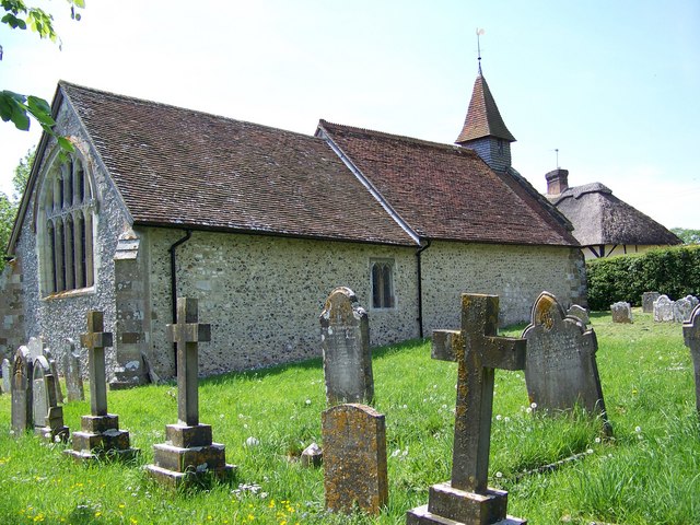
St Peter's Church, Racton
Looking across the churchyard. The cottage just visible is believed to be where King Charles lodged on his way to Brighton.
993:
658:
622:
586:
467:
269:
219:
961:
956:
843:
708:
42:
304:
1029:
This file contains additional information, probably added from the digital camera or scanner used to create or digitize it.
394:
521:
898:
871:
827:
798:
771:
686:
642:
570:
542:
529:
514:
729:
701:
671:
606:
487:
451:
291:
350:
1032:
If the file has been modified from its original state, some details may not fully reflect the modified file.
393:– If you remix, transform, or build upon the material, you must distribute your contributions under the
311:
on the
Geograph website for the photographer's contact details. The copyright on this image is owned by
972:
347:
115:
864:"}},"text\/plain":{"en":{"P7787":"270 degree"}}}}": -->
764:"}},"text\/plain":{"en":{"P7787":"270 degree"}}}}": -->
91:
110:
693:
678:
549:
275:
225:
316:
78:
157:
259:
209:
178:
168:
296:
308:
929:
Click on a date/time to view the file as it appeared at that time.
261:
211:
236:
186:
66:
52:
St_Peter's_Church,_Racton_-_geograph.org.uk_-_798577.jpg
246:
50° 52′ 38″ N, 0° 53′ 37″ W
196:
50° 52′ 38″ N, 0° 53′ 37″ W
999:
List of current places of worship in
Chichester District
138:
St Peter's Church, Racton - geograph.org.uk - 798577.jpg
435:
Add a one-line explanation of what this file represents
1016:
132:
104:
90:
Commons is a freely licensed media file repository.
623:
Creative
Commons Attribution-ShareAlike 2.0 Generic
56:(640 × 480 pixels, file size: 105 KB, MIME type:
404:https://creativecommons.org/licenses/by-sa/2.0
71:
410:Creative Commons Attribution-Share Alike 2.0
328:
8:
861:
761:
370:– to copy, distribute and transmit the work
1034:
931:
431:
1009:The following other wikis use this file:
679:https://www.geograph.org.uk/photo/798577
550:https://www.geograph.org.uk/profile/9274
1036:
994:Grade I listed buildings in West Sussex
991:
885:
869:
841:
825:
785:
769:
743:
727:
656:
640:
620:
604:
584:
568:
501:
485:
465:
449:
446:
427:
420:
239:
189:
268:View this and other nearby images on:
218:View this and other nearby images on:
989:The following 2 pages use this file:
7:
315:and is licensed for reuse under the
920:
351:Attribution-Share Alike 2.0 Generic
339:
334:
319:Attribution-ShareAlike 2.0 license.
1027:
440:
434:
325:
302:
142:
108:
103:
49:
439:
772:coordinates of the point of view
425:
381:Under the following conditions:
346:This file is licensed under the
338:
333:
327:
295:
274:
260:
252:
224:
210:
202:
70:
31:
21:
422:
143:
46:No higher resolution available.
14:
659:file available on the internet
421:
303:This image was taken from the
26:
1:
872:coordinates of depicted place
36:
709:Geograph Britain and Ireland
515:object of statement has role
447:Items portrayed in this file
251:
201:
887:50°52'38.17"N, 0°53'36.60"W
787:50°52'38.17"N, 0°53'36.60"W
1058:
1013:Usage on www.wikidata.org
395:same or compatible license
921:
16:
687:geograph.org.uk image ID
424:
361:
77:This is a file from the
978:
957:06:04, 20 February 2011
174:
163:
156:
153:
135:
81:. Information from its
309:this photograph's page
280:50.877270; -0.893500
230:50.877270; -0.893500
84:description page there
828:location of creation
376:– to adapt the work
109:This is a photo of
530:author name string
1045:
1044:
1005:Global file usage
982:
863:
763:
607:copyright license
433:
324:
323:
307:collection. See
285:
284:
235:
234:
184:
183:
125:
124:
99:
98:
79:Wikimedia Commons
32:Global file usage
1049:
1035:
969:
909:
908:
903:
809:
808:
803:
711:
706:
696:
691:
681:
676:
672:described at URL
571:copyright status
552:
547:
537:
534:
524:
519:
417:
414:
411:
408:
405:
397:as the original.
359:
348:Creative Commons
342:
341:
337:
336:
331:
330:
317:Creative Commons
305:Geograph project
299:
292:
281:
278:
264:
263:
257:
256:
255:
249:
248:
237:
231:
228:
214:
213:
207:
206:
205:
199:
198:
187:
159:
147:
139:
133:
118:
105:
95:
74:
73:
67:
61:
59:
1057:
1056:
1052:
1051:
1050:
1048:
1047:
1046:
1023:
1003:
983:
975:
967:
923:
922:
919:
918:
917:
916:
915:
914:
913:
912:
911:
910:
906:
904:
901:
892:
891:
890:
888:
878:
877:
876:
874:
855:
854:
853:
852:
851:
850:
849:
848:
846:
834:
833:
832:
830:
819:
818:
817:
816:
815:
814:
813:
812:
811:
810:
806:
804:
801:
792:
791:
790:
788:
778:
777:
776:
774:
755:
754:
753:
752:
751:
750:
749:
748:
746:
736:
735:
734:
732:
721:
720:
719:
718:
717:
716:
715:
714:
713:
712:
707:
704:
698:
697:
692:
689:
683:
682:
677:
674:
665:
664:
663:
661:
649:
648:
647:
645:
634:
633:
632:
631:
630:
629:
628:
627:
625:
613:
612:
611:
609:
598:
597:
596:
595:
594:
593:
592:
591:
589:
577:
576:
575:
573:
562:
561:
560:
559:
558:
557:
556:
555:
554:
553:
548:
545:
539:
538:
535:
532:
526:
525:
520:
517:
508:
507:
506:
504:
494:
493:
492:
490:
479:
478:
477:
476:
475:
474:
473:
472:
470:
458:
457:
456:
454:
438:
437:
436:
419:
418:
415:
412:
409:
406:
403:
402:
360:
357:
354:
343:
320:
290:
279:
253:
244:
243:
240:Object location
229:
203:
194:
193:
190:Camera location
185:
169:geograph.org.uk
149:
137:
130:
120:
114:
111:listed building
101:
100:
89:
88:
87:is shown below.
63:
57:
55:
48:
47:
12:
11:
5:
1055:
1053:
1043:
1042:
1039:
1026:
1022:
1021:
1020:
1019:
1007:
1006:
1002:
1001:
996:
987:
986:
981:
980:
977:
973:
970:
964:
959:
954:
950:
949:
946:
943:
940:
937:
934:
927:
926:
897:
896:
895:
894:
893:
889:
886:
884:
883:
882:
881:
880:
879:
875:
870:
868:
867:
866:
865:
859:
847:
842:
840:
839:
838:
837:
836:
835:
831:
826:
824:
823:
822:
821:
820:
797:
796:
795:
794:
793:
789:
786:
784:
783:
782:
781:
780:
779:
775:
770:
768:
767:
766:
765:
759:
747:
744:
742:
741:
740:
739:
738:
737:
733:
728:
726:
725:
724:
723:
722:
700:
699:
685:
684:
670:
669:
668:
667:
666:
662:
657:
655:
654:
653:
652:
651:
650:
646:
643:source of file
641:
639:
638:
637:
636:
635:
626:
621:
619:
618:
617:
616:
615:
614:
610:
605:
603:
602:
601:
600:
599:
590:
585:
583:
582:
581:
580:
579:
578:
574:
569:
567:
566:
565:
564:
563:
541:
540:
528:
527:
513:
512:
511:
510:
509:
505:
502:
500:
499:
498:
497:
496:
495:
491:
486:
484:
483:
482:
481:
480:
471:
466:
464:
463:
462:
461:
460:
459:
455:
450:
448:
445:
444:
443:
442:
441:
430:
429:
426:
423:
401:
400:
399:
398:
388:
379:
378:
377:
371:
364:You are free:
355:
345:
344:
326:
322:
321:
300:
289:
286:
283:
282:
272:
266:
241:
233:
232:
222:
216:
191:
182:
181:
176:
172:
171:
165:
161:
160:
155:
151:
150:
140:
131:
129:
126:
123:
122:
102:
97:
96:
75:
65:
64:
45:
41:
40:
39:
34:
29:
24:
19:
13:
10:
9:
6:
4:
3:
2:
1054:
1040:
1037:
1033:
1030:
1024:
1018:
1015:
1014:
1012:
1011:
1010:
1004:
1000:
997:
995:
992:
990:
984:
976:
971:
965:
963:
960:
958:
955:
952:
951:
947:
944:
941:
938:
935:
933:
932:
930:
924:
900:
873:
845:
829:
800:
773:
731:
710:
703:
695:
688:
680:
673:
660:
644:
624:
608:
588:
572:
551:
544:
531:
523:
516:
489:
469:
468:Racton Church
453:
407:CC BY-SA 2.0
396:
392:
389:
386:
383:
382:
380:
375:
372:
369:
366:
365:
363:
362:
356:Attribution:
352:
349:
332:
318:
314:
310:
306:
301:
298:
294:
293:
287:
277:
273:
271:
270:OpenStreetMap
267:
265:
247:
242:
238:
227:
223:
221:
220:OpenStreetMap
217:
215:
197:
192:
188:
180:
177:
173:
170:
166:
162:
152:
146:
141:
134:
127:
121:
117:
112:
107:
106:
93:
86:
85:
80:
76:
69:
68:
62:
53:
44:
38:
35:
33:
30:
28:
25:
23:
20:
18:
15:
1031:
1028:
1008:
988:
928:
925:File history
522:photographer
390:
384:
373:
367:
312:
250:
200:
144:
92:You can help
82:
50:
22:File history
974:GeographBot
745:11 May 2008
587:copyrighted
536:Trish Steel
391:share alike
385:attribution
358:Trish Steel
313:Trish Steel
179:Trish Steel
158:11 May 2008
136:Description
1038:_error
985:File usage
966:640 × 480
942:Dimensions
844:Chichester
503:some value
58:image/jpeg
27:File usage
1017:Q17528806
939:Thumbnail
936:Date/Time
730:inception
288:Licensing
145:English:
1025:Metadata
968:(105 KB)
702:operator
428:Captions
374:to remix
368:to share
353:license.
37:Metadata
953:current
948:Comment
899:heading
858:heading
799:heading
758:heading
488:creator
452:depicts
432:English
128:Summary
116:1026186
113:number
54:
907:degree
862:degree
807:degree
762:degree
694:798577
258:
208:
175:Author
164:Source
167:From
945:User
905:270
805:270
416:true
413:true
154:Date
17:File
543:URL
902::
802::
705::
690::
675::
546::
533::
518::
1041:0
119:.
94:.
60:)
Text is available under the Creative Commons Attribution-ShareAlike License. Additional terms may apply.
_heading:270.00&language=en)
_heading:270.00&language=en)
