307:
240:
190:
232:
182:
254:
204:
275:
313:
318:
72:
783:"}},"text\/plain":{"en":{"":"heading"}}},"{\"value\":{\"amount\":\"+292\",\"unit\":\"http:\\\/\\\/www.wikidata.org\\\/entity\\\/Q28390\"},\"type\":\"quantity\"}":{"text\/html":{"en":{"P7787":"292
598:"}},"text\/plain":{"en":{"":"heading"}}},"{\"value\":{\"amount\":\"+292\",\"unit\":\"http:\\\/\\\/www.wikidata.org\\\/entity\\\/Q28390\"},\"type\":\"quantity\"}":{"text\/html":{"en":{"P7787":"292
779:
223:
173:
43:
365:– You must give appropriate credit, provide a link to the license, and indicate if changes were made. You may do so in any reasonable manner, but not in any way that suggests the licensor endorses you or your use.
83:
51:
780:
595:
126:
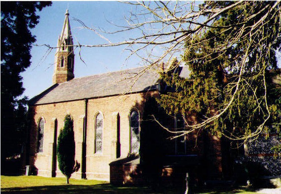
St Peter's parish church, Knowl Hill, Berkshire: designed by JC & G Buckler and built in 1840. W Scott
Champion designed the chancel, which was added in 1870.
936:== {{int:filedesc}} == {{Information |description={{en|1=St Peter, Knowl Hill Built in 1840.}} |date=2004 |source=From |author= |permission=
681:
581:
545:
247:
197:
701:
282:
991:
This file contains additional information, probably added from the digital camera or scanner used to create or digitize it.
372:
480:
918:
913:
850:
821:
794:
709:
665:
636:
609:
529:
501:
488:
473:
42:
752:
724:
694:
565:
446:
429:
269:
328:
994:
If the file has been modified from its original state, some details may not fully reflect the modified file.
946:
The following pages on the
English Knowledge (XXG) use this file (pages on other projects are not listed):
371:– If you remix, transform, or build upon the material, you must distribute your contributions under the
289:
on the
Geograph website for the photographer's contact details. The copyright on this image is owned by
929:
325:
787:"}},"text\/plain":{"en":{"P7787":"292 degree"}}}}": -->
602:"}},"text\/plain":{"en":{"P7787":"292 degree"}}}}": -->
91:
731:
716:
508:
253:
203:
294:
78:
950:
237:
187:
156:
146:
274:
135:
286:
886:
Click on a date/time to view the file as it appeared at that time.
239:
189:
214:
164:
66:
224:
51° 30′ 33″ N, 0° 48′ 45″ W
174:
51° 30′ 33″ N, 0° 48′ 44″ W
978:
968:
413:
Add a one-line explanation of what this file represents
116:
St Peter, Knowl Hill - geograph.org.uk - 1536728.jpg
110:
90:
Commons is a freely licensed media file repository.
52:
St_Peter,_Knowl_Hill_-_geograph.org.uk_-_1536728.jpg
582:
Creative
Commons Attribution-ShareAlike 2.0 Generic
56:(571 × 395 pixels, file size: 107 KB, MIME type:
382:https://creativecommons.org/licenses/by-sa/2.0
71:
388:Creative Commons Attribution-Share Alike 2.0
306:
8:
784:
599:
348:– to copy, distribute and transmit the work
996:
888:
409:
961:The following other wikis use this file:
732:https://www.geograph.org.uk/photo/1536728
509:https://www.geograph.org.uk/profile/40664
1006:
998:
948:
864:
848:
808:
792:
766:
750:
679:
663:
623:
607:
579:
563:
543:
527:
460:
444:
427:
424:
405:
398:
217:
167:
246:View this and other nearby images on:
196:View this and other nearby images on:
7:
293:and is licensed for reuse under the
877:
329:Attribution-Share Alike 2.0 Generic
317:
312:
297:Attribution-ShareAlike 2.0 license.
989:
418:
412:
303:
280:
120:
103:
49:
417:
610:coordinates of the point of view
403:
359:Under the following conditions:
324:This file is licensed under the
316:
311:
305:
273:
252:
238:
230:
202:
188:
180:
70:
31:
21:
400:
121:
46:No higher resolution available.
14:
682:file available on the internet
399:
281:This image was taken from the
26:
1:
795:coordinates of depicted place
36:
702:Geograph Britain and Ireland
474:object of statement has role
425:Items portrayed in this file
229:
179:
810:51°30'33.37"N, 0°48'45.36"W
625:51°30'33.05"N, 0°48'44.28"W
1028:
975:Usage on www.wikidata.org
965:Usage on es.wikipedia.org
373:same or compatible license
1008:File change date and time
878:
16:
710:geograph.org.uk image ID
402:
339:
77:This is a file from the
935:
152:
141:
134:
131:
113:
81:. Information from its
287:this photograph's page
258:51.509270; -0.812600
208:51.509180; -0.812300
84:description page there
1011:17:00, 8 October 2009
914:07:38, 3 March 2011
354:– to adapt the work
489:author name string
1015:
1014:
957:Global file usage
939:
786:
601:
566:copyright license
411:
302:
301:
285:collection. See
263:
262:
213:
212:
162:
161:
99:
98:
79:Wikimedia Commons
32:Global file usage
1019:
997:
926:
832:
831:
826:
734:
729:
725:described at URL
719:
714:
704:
699:
647:
646:
641:
530:copyright status
511:
506:
496:
493:
483:
478:
395:
392:
389:
386:
383:
375:as the original.
337:
326:Creative Commons
320:
319:
315:
314:
309:
308:
295:Creative Commons
283:Geograph project
277:
270:
259:
256:
242:
241:
235:
234:
233:
227:
226:
215:
209:
206:
192:
191:
185:
184:
183:
177:
176:
165:
137:
125:
117:
111:
95:
74:
73:
67:
61:
59:
1027:
1026:
1022:
1021:
1020:
1018:
1017:
1016:
985:
955:
947:
940:
932:
924:
880:
879:
876:
875:
874:
873:
872:
871:
870:
869:
867:
857:
856:
855:
853:
842:
841:
840:
839:
838:
837:
836:
835:
834:
833:
829:
827:
824:
815:
814:
813:
811:
801:
800:
799:
797:
778:
777:
776:
775:
774:
773:
772:
771:
769:
759:
758:
757:
755:
744:
743:
742:
741:
740:
739:
738:
737:
736:
735:
730:
727:
721:
720:
715:
712:
706:
705:
700:
697:
688:
687:
686:
684:
672:
671:
670:
668:
657:
656:
655:
654:
653:
652:
651:
650:
649:
648:
644:
642:
639:
630:
629:
628:
626:
616:
615:
614:
612:
593:
592:
591:
590:
589:
588:
587:
586:
584:
572:
571:
570:
568:
557:
556:
555:
554:
553:
552:
551:
550:
548:
536:
535:
534:
532:
521:
520:
519:
518:
517:
516:
515:
514:
513:
512:
507:
504:
498:
497:
494:
491:
485:
484:
479:
476:
467:
466:
465:
463:
453:
452:
451:
449:
438:
437:
436:
435:
434:
432:
416:
415:
414:
397:
396:
393:
390:
387:
384:
381:
380:
338:
335:
332:
321:
298:
268:
257:
231:
222:
221:
218:Object location
207:
181:
172:
171:
168:Camera location
163:
147:geograph.org.uk
127:
115:
108:
101:
100:
89:
88:
87:is shown below.
63:
57:
55:
48:
47:
12:
11:
5:
1025:
1023:
1013:
1012:
1009:
1005:
1004:
1001:
988:
984:
983:
982:
981:
973:
972:
971:
959:
958:
954:
953:
945:
944:
943:
938:
937:
934:
930:
927:
921:
916:
911:
907:
906:
903:
900:
897:
894:
891:
884:
883:
868:
865:
863:
862:
861:
860:
859:
858:
854:
849:
847:
846:
845:
844:
843:
820:
819:
818:
817:
816:
812:
809:
807:
806:
805:
804:
803:
802:
798:
793:
791:
790:
789:
788:
782:
770:
767:
765:
764:
763:
762:
761:
760:
756:
751:
749:
748:
747:
746:
745:
723:
722:
708:
707:
693:
692:
691:
690:
689:
685:
680:
678:
677:
676:
675:
674:
673:
669:
666:source of file
664:
662:
661:
660:
659:
658:
635:
634:
633:
632:
631:
627:
624:
622:
621:
620:
619:
618:
617:
613:
608:
606:
605:
604:
603:
597:
585:
580:
578:
577:
576:
575:
574:
573:
569:
564:
562:
561:
560:
559:
558:
549:
544:
542:
541:
540:
539:
538:
537:
533:
528:
526:
525:
524:
523:
522:
500:
499:
487:
486:
472:
471:
470:
469:
468:
464:
461:
459:
458:
457:
456:
455:
454:
450:
445:
443:
442:
441:
440:
439:
433:
428:
426:
423:
422:
421:
420:
419:
408:
407:
404:
401:
379:
378:
377:
376:
366:
357:
356:
355:
349:
342:You are free:
333:
323:
322:
304:
300:
299:
278:
267:
264:
261:
260:
250:
244:
219:
211:
210:
200:
194:
169:
160:
159:
154:
150:
149:
143:
139:
138:
133:
129:
128:
118:
109:
107:
104:
102:
97:
96:
75:
65:
64:
45:
41:
40:
39:
34:
29:
24:
19:
13:
10:
9:
6:
4:
3:
2:
1024:
1010:
1007:
1002:
999:
995:
992:
986:
980:
977:
976:
974:
970:
967:
966:
964:
963:
962:
956:
952:
949:
941:
933:
928:
922:
920:
917:
915:
912:
909:
908:
904:
901:
898:
895:
892:
890:
889:
887:
881:
852:
823:
796:
754:
733:
726:
718:
711:
703:
696:
683:
667:
638:
611:
583:
567:
547:
531:
510:
503:
490:
482:
475:
448:
431:
385:CC BY-SA 2.0
374:
370:
367:
364:
361:
360:
358:
353:
350:
347:
344:
343:
341:
340:
334:Attribution:
330:
327:
310:
296:
292:
288:
284:
279:
276:
272:
271:
265:
255:
251:
249:
248:OpenStreetMap
245:
243:
225:
220:
216:
205:
201:
199:
198:OpenStreetMap
195:
193:
175:
170:
166:
158:
155:
151:
148:
144:
140:
130:
124:
119:
112:
105:
93:
86:
85:
80:
76:
69:
68:
62:
53:
44:
38:
35:
33:
30:
28:
25:
23:
20:
18:
15:
993:
990:
960:
885:
882:File history
495:Michael Ford
481:photographer
368:
362:
351:
345:
336:Michael Ford
291:Michael Ford
290:
228:
178:
157:Michael Ford
122:
92:You can help
82:
50:
22:File history
1000:Orientation
931:GeographBot
546:copyrighted
369:share alike
363:attribution
114:Description
979:Q105072442
969:Knowl Hill
951:Knowl Hill
942:File usage
923:571 × 395
899:Dimensions
866:image/jpeg
851:media type
462:some value
58:image/jpeg
27:File usage
896:Thumbnail
893:Date/Time
753:inception
266:Licensing
123:English:
987:Metadata
925:(107 KB)
695:operator
406:Captions
352:to remix
346:to share
331:license.
37:Metadata
910:current
905:Comment
822:heading
781:heading
717:1536728
637:heading
596:heading
447:creator
430:depicts
410:English
106:Summary
54:
1003:Normal
830:degree
785:degree
645:degree
600:degree
236:
186:
153:Author
142:Source
145:From
902:User
828:292
768:2004
643:292
394:true
391:true
136:2004
132:Date
17:File
502:URL
825::
728::
713::
698::
640::
505::
492::
477::
94:.
60:)
Text is available under the Creative Commons Attribution-ShareAlike License. Additional terms may apply.
_heading:292.00&language=en)
_heading:292.00&language=en)
