300:
230:
222:
244:
268:
306:
311:
67:
748:"}},"text\/plain":{"en":{"":"heading"}}},"{\"value\":{\"amount\":\"+90\",\"unit\":\"http:\\\/\\\/www.wikidata.org\\\/entity\\\/Q28390\"},\"type\":\"quantity\"}":{"text\/html":{"en":{"P7787":"90
850:
744:
38:
900:
358:– You must give appropriate credit, provide a link to the license, and indicate if changes were made. You may do so in any reasonable manner, but not in any way that suggests the licensor endorses you or your use.
46:
78:
122:
910:
745:
905:
885:
849:
844:
37:
890:
644:
574:
538:
237:
731:
664:
1047:
275:
921:
This file contains additional information, probably added from the digital camera or scanner used to create or digitize it.
365:
488:
786:
759:
715:
687:
628:
522:
496:
481:
466:
672:
657:
594:
558:
439:
422:
262:
321:
924:
If the file has been modified from its original state, some details may not fully reflect the modified file.
881:
The following pages on the
English Knowledge (XXG) use this file (pages on other projects are not listed):
1074:
364:– If you remix, transform, or build upon the material, you must distribute your contributions under the
282:
on the
Geograph website for the photographer's contact details. The copyright on this image is owned by
860:
318:
1110:
752:"}},"text\/plain":{"en":{"P7787":"90 degree"}}}}": -->
867:== {{int:filedesc}} == {{Information |description={{en|1=St Tassach's church, Raholp (2) See
86:
182:
871:. The inside of the church.}} |date=2007-09-01 |source=From |author=[http://www.geograph.org.
1215:
1016:
933:
868:
694:
679:
473:
166:
243:
1178:
1092:
950:
287:
73:
1225:
1188:
979:
1144:
134:
943:
155:
145:
227:
1235:
960:
267:
895:
279:
901:
User:HwætGrimmalkin/List of scheduled monuments in
Northern Ireland
817:
Click on a date/time to view the file as it appeared at that time.
47:
St_Tassach's_church,_Raholp_(2)_-_geograph.org.uk_-_542235.jpg
229:
204:
111:
St
Tassach's church, Raholp (2) - geograph.org.uk - 542235.jpg
61:
406:
Add a one-line explanation of what this file represents
105:
85:
Commons is a freely licensed media file repository.
575:
Creative
Commons Attribution-ShareAlike 2.0 Generic
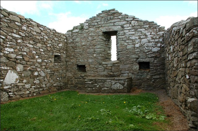
911:User:JohnArmagh/List of monastic houses in Ireland
51:(640 × 426 pixels, file size: 107 KB, MIME type:
375:https://creativecommons.org/licenses/by-sa/2.0
66:
381:Creative Commons Attribution-Share Alike 2.0
299:
8:
749:
341:– to copy, distribute and transmit the work
926:
819:
402:
906:User:HwætGrimmalkin/State Care Monuments
680:https://www.geograph.org.uk/photo/542235
474:https://www.geograph.org.uk/profile/5835
1243:
1233:
1223:
1213:
1205:
1197:
1186:
1176:
1168:
1160:
1152:
1142:
1134:
1126:
1118:
1108:
1100:
1090:
1082:
1072:
1064:
1056:
1045:
1037:
1029:
1021:
1011:
1003:
995:
987:
976:
968:
958:
948:
938:
883:
773:
757:
729:
713:
642:
626:
608:
592:
572:
556:
536:
520:
453:
437:
420:
417:
398:
391:
214:54° 21′ N, 5° 37′ W
207:
886:List of monastic houses in County Down
236:View this and other nearby images on:
928:
121:St Tassach's church, Raholp (2). See
7:
286:and is licensed for reuse under the
808:
322:Attribution-Share Alike 2.0 Generic
310:
305:
290:Attribution-ShareAlike 2.0 license.
919:
891:List of monastic houses in Ireland
411:
405:
296:
273:
115:
98:
44:
410:
970:Date and time of data generation
396:
352:Under the following conditions:
317:This file is licensed under the
309:
304:
298:
266:
242:
228:
220:
65:
21:
393:
197:St Tassach's church, Raholp (2)
178:St Tassach's church, Raholp (2)
116:
41:No higher resolution available.
14:
645:file available on the internet
392:
274:This image was taken from the
26:
1:
760:coordinates of depicted place
31:
1136:DateTimeDigitized subseconds
955:1/15 sec (0.066666666666667)
665:Geograph Britain and Ireland
482:object of statement has role
418:Items portrayed in this file
125:. The inside of the church.
1128:DateTimeOriginal subseconds
1058:Date and time of digitizing
219:
1265:
1199:Focal length in 35 mm film
1157:One-chip color area sensor
366:same or compatible license
195:Albert Bridge /
176:Albert Bridge /
1023:File change date and time
809:
16:
688:geograph.org.uk image ID
395:
332:
72:This is a file from the
1162:Custom image processing
1061:11:26, 1 September 2007
1026:11:26, 1 September 2007
973:11:26, 1 September 2007
866:
167:required by the license
151:
140:
133:
130:
108:
76:. Information from its
1245:Subject distance range
1066:Image compression mode
845:00:40, 6 February 2011
280:this photograph's page
248:54.353000; -5.620000
79:description page there
1084:Maximum land aperture
997:Horizontal resolution
775:54°21'11"N, 5°37'12"W
1120:DateTime subseconds
1031:Y and C positioning
1005:Vertical resolution
930:Camera manufacturer
347:– to adapt the work
1207:Scene capture type
1183:Auto white balance
1115:Flash did not fire
497:author name string
1252:
1251:
1087:3.6 APEX (f/3.48)
934:NIKON CORPORATION
874:
751:
559:copyright license
404:
295:
294:
278:collection. See
253:
252:
202:
201:
170:
94:
93:
74:Wikimedia Commons
1256:
1039:Exposure Program
927:
857:
797:
796:
791:
697:
692:
682:
677:
673:described at URL
667:
662:
610:1 September 2007
523:copyright status
504:
501:
491:
486:
476:
471:
388:
385:
382:
379:
376:
368:as the original.
330:
319:Creative Commons
313:
312:
308:
307:
302:
301:
288:Creative Commons
276:Geograph project
270:
263:
249:
246:
232:
231:
225:
224:
223:
217:
216:
205:
164:
136:
135:1 September 2007
120:
112:
106:
90:
69:
68:
62:
56:
54:
1264:
1263:
1259:
1258:
1257:
1255:
1254:
1253:
1173:Manual exposure
915:
882:
875:
863:
855:
811:
810:
807:
806:
805:
804:
803:
802:
801:
800:
799:
798:
794:
792:
789:
780:
779:
778:
776:
766:
765:
764:
762:
743:
742:
741:
740:
739:
738:
737:
736:
734:
722:
721:
720:
718:
707:
706:
705:
704:
703:
702:
701:
700:
699:
698:
693:
690:
684:
683:
678:
675:
669:
668:
663:
660:
651:
650:
649:
647:
635:
634:
633:
631:
620:
619:
618:
617:
616:
615:
614:
613:
611:
601:
600:
599:
597:
586:
585:
584:
583:
582:
581:
580:
579:
577:
565:
564:
563:
561:
550:
549:
548:
547:
546:
545:
544:
543:
541:
529:
528:
527:
525:
514:
513:
512:
511:
510:
509:
508:
507:
506:
505:
502:
499:
493:
492:
487:
484:
478:
477:
472:
469:
460:
459:
458:
456:
446:
445:
444:
442:
431:
430:
429:
428:
427:
425:
409:
408:
407:
390:
389:
386:
383:
380:
377:
374:
373:
331:
328:
325:
314:
291:
261:
247:
221:
212:
211:
208:Object location
203:
192:
185:
173:
146:geograph.org.uk
126:
110:
103:
96:
95:
84:
83:
82:is shown below.
58:
52:
50:
43:
42:
12:
11:
5:
1262:
1260:
1250:
1249:
1246:
1242:
1241:
1238:
1232:
1231:
1228:
1222:
1221:
1218:
1212:
1211:
1208:
1204:
1203:
1200:
1196:
1195:
1192:
1185:
1184:
1181:
1175:
1174:
1171:
1167:
1166:
1165:Normal process
1163:
1159:
1158:
1155:
1154:Sensing method
1151:
1150:
1147:
1141:
1140:
1137:
1133:
1132:
1129:
1125:
1124:
1121:
1117:
1116:
1113:
1107:
1106:
1103:
1099:
1098:
1095:
1089:
1088:
1085:
1081:
1080:
1077:
1071:
1070:
1067:
1063:
1062:
1059:
1055:
1054:
1051:
1044:
1043:
1040:
1036:
1035:
1032:
1028:
1027:
1024:
1020:
1019:
1014:
1010:
1009:
1006:
1002:
1001:
998:
994:
993:
990:
986:
985:
982:
975:
974:
971:
967:
966:
963:
957:
956:
953:
947:
946:
941:
937:
936:
931:
918:
914:
913:
908:
903:
898:
893:
888:
880:
879:
878:
873:
872:
865:
861:
858:
852:
847:
842:
838:
837:
834:
831:
828:
825:
822:
815:
814:
785:
784:
783:
782:
781:
777:
774:
772:
771:
770:
769:
768:
767:
763:
758:
756:
755:
754:
753:
747:
735:
730:
728:
727:
726:
725:
724:
723:
719:
714:
712:
711:
710:
709:
708:
686:
685:
671:
670:
656:
655:
654:
653:
652:
648:
643:
641:
640:
639:
638:
637:
636:
632:
629:source of file
627:
625:
624:
623:
622:
621:
612:
609:
607:
606:
605:
604:
603:
602:
598:
593:
591:
590:
589:
588:
587:
578:
573:
571:
570:
569:
568:
567:
566:
562:
557:
555:
554:
553:
552:
551:
542:
537:
535:
534:
533:
532:
531:
530:
526:
521:
519:
518:
517:
516:
515:
495:
494:
480:
479:
465:
464:
463:
462:
461:
457:
454:
452:
451:
450:
449:
448:
447:
443:
438:
436:
435:
434:
433:
432:
426:
421:
419:
416:
415:
414:
413:
412:
401:
400:
397:
394:
372:
371:
370:
369:
359:
350:
349:
348:
342:
335:You are free:
326:
316:
315:
297:
293:
292:
271:
260:
257:
251:
250:
240:
234:
209:
200:
199:
193:
190:
187:
186:
181:
174:
171:
159:
158:
153:
149:
148:
142:
138:
137:
132:
128:
127:
113:
104:
102:
99:
97:
92:
91:
70:
60:
59:
40:
36:
35:
34:
29:
24:
19:
13:
10:
9:
6:
4:
3:
2:
1261:
1247:
1244:
1239:
1237:
1234:
1229:
1227:
1224:
1219:
1217:
1214:
1209:
1206:
1201:
1198:
1193:
1190:
1187:
1182:
1180:
1179:White balance
1177:
1172:
1170:Exposure mode
1169:
1164:
1161:
1156:
1153:
1148:
1146:
1143:
1138:
1135:
1130:
1127:
1122:
1119:
1114:
1112:
1109:
1104:
1101:
1096:
1094:
1093:Metering mode
1091:
1086:
1083:
1078:
1076:
1075:Exposure bias
1073:
1068:
1065:
1060:
1057:
1052:
1049:
1046:
1041:
1038:
1033:
1030:
1025:
1022:
1018:
1015:
1013:Software used
1012:
1007:
1004:
999:
996:
991:
988:
983:
981:
977:
972:
969:
964:
962:
959:
954:
952:
951:Exposure time
949:
945:
942:
939:
935:
932:
929:
925:
922:
916:
912:
909:
907:
904:
902:
899:
897:
894:
892:
889:
887:
884:
876:
870:
864:
859:
853:
851:
848:
846:
843:
840:
839:
835:
832:
829:
826:
823:
821:
820:
818:
812:
788:
761:
733:
717:
716:captured with
696:
689:
681:
674:
666:
659:
646:
630:
596:
576:
560:
540:
524:
503:Albert Bridge
498:
490:
483:
475:
468:
441:
424:
378:CC BY-SA 2.0
367:
363:
360:
357:
354:
353:
351:
346:
343:
340:
337:
336:
334:
333:
329:Albert Bridge
327:Attribution:
323:
320:
303:
289:
285:
284:Albert Bridge
281:
277:
272:
269:
265:
264:
258:
256:
255:
245:
241:
239:
238:OpenStreetMap
235:
233:
215:
210:
206:
198:
194:
189:
188:
184:
180: /
179:
175:
168:
163:
161:
160:
157:
156:Albert Bridge
154:
150:
147:
143:
139:
129:
124:
119:
114:
107:
100:
88:
81:
80:
75:
71:
64:
63:
57:
48:
39:
33:
30:
28:
25:
23:
20:
18:
15:
1189:Digital zoom
1102:Light source
980:focal length
940:Camera model
923:
920:
816:
813:File history
489:photographer
361:
355:
344:
338:
283:
254:
218:
196:
183:CC BY-SA 2.0
177:
117:
87:You can help
77:
45:
22:File history
1145:Color space
989:Orientation
862:GeographBot
539:copyrighted
362:share alike
356:attribution
162:Attribution
109:Description
1226:Saturation
877:File usage
854:640 × 426
830:Dimensions
455:some value
53:image/jpeg
27:File usage
1236:Sharpness
1017:Ver.1.00
944:NIKON D50
827:Thumbnail
824:Date/Time
732:Nikon D50
595:inception
259:Licensing
191:InfoField
172:InfoField
118:English:
1216:Contrast
1210:Standard
1034:Co-sited
961:F-number
917:Metadata
856:(107 KB)
658:operator
399:Captions
345:to remix
339:to share
324:license.
32:Metadata
1248:Unknown
1105:Unknown
1097:Pattern
1050:version
1008:300 dpi
1000:300 dpi
841:current
836:Comment
787:heading
746:heading
440:creator
423:depicts
403:English
101:Summary
49:
1240:Normal
1230:Normal
1220:Normal
1042:Manual
992:Normal
896:Tassac
869:542226
795:degree
750:degree
695:542235
226:
152:Author
141:Source
123:542226
1202:27 mm
1191:ratio
1111:Flash
984:18 mm
978:Lens
144:From
1149:sRGB
1053:2.21
1048:Exif
965:f/16
833:User
387:true
384:true
131:Date
17:File
793:90
467:URL
1139:60
1131:60
1123:60
790::
691::
676::
661::
500::
485::
470::
1194:1
1079:0
1069:2
169:)
165:(
89:.
55:)
Text is available under the Creative Commons Attribution-ShareAlike License. Additional terms may apply.
_-_geograph.org.uk_-_542235.jpg)
_-_geograph.org.uk_-_542226.jpg)
_-_geograph.org.uk_-_542235.jpg¶ms=054.353000_N_-005.620000_E_globe:Earth_class:object_type:object_source:geograph-irishgrid(J5447)_heading:90.00&language=en)
