348:
281:
231:
273:
223:
295:
245:
316:
354:
359:
72:
824:"}},"text\/plain":{"en":{"":"heading"}}},"{\"value\":{\"amount\":\"+180\",\"unit\":\"http:\\\/\\\/www.wikidata.org\\\/entity\\\/Q28390\"},\"type\":\"quantity\"}":{"text\/html":{"en":{"P7787":"180
760:"}},"text\/plain":{"en":{"":"heading"}}},"{\"value\":{\"amount\":\"+180\",\"unit\":\"http:\\\/\\\/www.wikidata.org\\\/entity\\\/Q28390\"},\"type\":\"quantity\"}":{"text\/html":{"en":{"P7787":"180
756:
264:
943:== {{int:filedesc}} == {{Information |description={{en|1=St Tudwal's Island West. The lighthouse is operational. It appears that the lighthouse buildings are occupied, at least temporarily, but the light is automatic these days.}} |date=2005-07-13 |sourc
214:
43:
406:– You must give appropriate credit, provide a link to the license, and indicate if changes were made. You may do so in any reasonable manner, but not in any way that suggests the licensor endorses you or your use.
83:
51:
126:
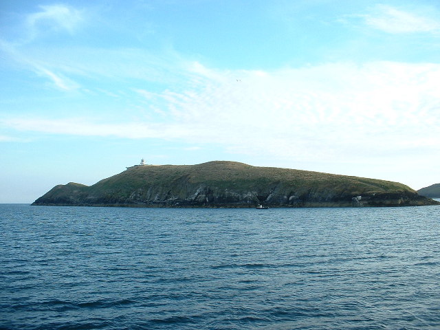
St Tudwal's Island West. The lighthouse is operational. It appears that the lighthouse buildings are occupied, at least temporarily, but the light is automatic these days.
821:
757:
658:
622:
586:
288:
238:
693:
1190:
323:
1159:
1063:
This file contains additional information, probably added from the digital camera or scanner used to create or digitize it.
413:
521:
925:
920:
42:
862:
835:
798:
771:
671:
642:
570:
542:
529:
514:
729:
701:
686:
606:
487:
470:
962:
957:
310:
369:
1066:
If the file has been modified from its original state, some details may not fully reflect the modified file.
953:
The following pages on the
English Knowledge (XXG) use this file (pages on other projects are not listed):
1243:
412:– If you remix, transform, or build upon the material, you must distribute your contributions under the
330:
on the
Geograph website for the photographer's contact details. The copyright on this image is owned by
936:
366:
828:"}},"text\/plain":{"en":{"P7787":"180 degree"}}}}": -->
764:"}},"text\/plain":{"en":{"P7787":"180 degree"}}}}": -->
1271:
91:
183:
167:
1085:
708:
678:
549:
294:
244:
1333:
1261:
1217:
335:
78:
1122:
1000:
1281:
1030:
135:
1102:
278:
228:
156:
146:
1323:
1092:
1075:
315:
1020:
327:
1010:
980:
893:
Click on a date/time to view the file as it appeared at that time.
1040:
280:
230:
255:
205:
66:
990:
265:
52° 48′ 01″ N, 4° 28′ 15″ W
215:
52° 48′ 15″ N, 4° 28′ 11″ W
52:
St_Tudwal's_Island_West_-_geograph.org.uk_-_27140.jpg
454:
Add a one-line explanation of what this file represents
1050:
116:
St Tudwal's Island West - geograph.org.uk - 27140.jpg
110:
90:
Commons is a freely licensed media file repository.
623:
Creative
Commons Attribution-ShareAlike 2.0 Generic
56:(640 × 480 pixels, file size: 88 KB, MIME type:
423:https://creativecommons.org/licenses/by-sa/2.0
71:
429:Creative Commons Attribution-Share Alike 2.0
347:
8:
825:
761:
389:– to copy, distribute and transmit the work
1068:
895:
450:
973:The following other wikis use this file:
1331:
1321:
1313:
1305:
1297:
1289:
1279:
1269:
1259:
1251:
1241:
1233:
1225:
1215:
1207:
1199:
1188:
1180:
1172:
1164:
1154:
1146:
1138:
1130:
1119:
1111:
1100:
1090:
1080:
955:
849:
833:
785:
769:
743:
727:
709:https://www.geograph.org.uk/photo/27140
656:
640:
620:
604:
584:
568:
550:https://www.geograph.org.uk/profile/180
501:
485:
468:
465:
446:
439:
258:
208:
1160:Digital Camera FinePix2600Zoom Ver3.00
287:View this and other nearby images on:
237:View this and other nearby images on:
1070:
7:
334:and is licensed for reuse under the
884:
370:Attribution-Share Alike 2.0 Generic
358:
353:
338:Attribution-ShareAlike 2.0 license.
1061:
459:
453:
344:
321:
120:
103:
49:
458:
1113:Date and time of data generation
772:coordinates of the point of view
444:
400:Under the following conditions:
365:This file is licensed under the
357:
352:
346:
314:
293:
279:
271:
243:
229:
221:
70:
31:
21:
1001:Liste von Leuchttürmen in Wales
441:
121:
46:No higher resolution available.
14:
659:file available on the internet
440:
322:This image was taken from the
26:
1:
836:coordinates of depicted place
36:
694:Geograph Britain and Ireland
515:object of statement has role
466:Items portrayed in this file
270:
220:
1307:Focal plane resolution unit
1201:Date and time of digitizing
1031:Latarnia morska St Tudwal’s
1021:Saint Tudwal's Islands
977:Usage on ceb.wikipedia.org
963:St Tudwal's Lighthouse
958:Saint Tudwal's Islands
787:52°48'15.26"N, 4°28'11.28"W
1355:
1318:One-chip color area sensor
1047:Usage on www.wikidata.org
1037:Usage on sv.wikipedia.org
1027:Usage on pl.wikipedia.org
1017:Usage on nn.wikipedia.org
1007:Usage on fr.wikipedia.org
997:Usage on de.wikipedia.org
987:Usage on cy.wikipedia.org
851:52°48'0.65"N, 4°28'14.52"W
414:same or compatible license
196:David Medcalf /
177:David Medcalf /
1166:File change date and time
885:
16:
1299:Focal plane Y resolution
1291:Focal plane X resolution
672:geograph.org.uk image ID
443:
380:
77:This is a file from the
942:
198:St Tudwal's Island West
179:St Tudwal's Island West
168:required by the license
152:
141:
134:
131:
113:
81:. Information from its
1209:Image compression mode
921:05:09, 30 January 2010
328:this photograph's page
299:52.800180; -4.470700
249:52.804240; -4.469800
84:description page there
1253:Maximum land aperture
1140:Horizontal resolution
1041:Saint Tudwals Islands
981:Saint Tudwals Islands
1204:18:52, 13 July 2005
1174:Y and C positioning
1169:18:52, 13 July 2005
1148:Vertical resolution
1116:18:52, 13 July 2005
1072:Camera manufacturer
395:– to adapt the work
1338:Auto white balance
1276:Flash did not fire
530:author name string
1342:
1341:
1256:3.6 APEX (f/3.48)
1011:Îles Saint-Tudwal
969:Global file usage
946:
827:
763:
607:copyright license
452:
343:
342:
326:collection. See
304:
303:
254:
253:
203:
202:
171:
99:
98:
79:Wikimedia Commons
32:Global file usage
1346:
1182:Exposure Program
1069:
933:
873:
872:
867:
809:
808:
803:
711:
706:
702:described at URL
696:
691:
681:
676:
571:copyright status
552:
547:
537:
534:
524:
519:
436:
433:
430:
427:
424:
416:as the original.
378:
367:Creative Commons
361:
360:
356:
355:
350:
349:
336:Creative Commons
324:Geograph project
318:
311:
300:
297:
283:
282:
276:
275:
274:
268:
267:
256:
250:
247:
233:
232:
226:
225:
224:
218:
217:
206:
165:
137:
125:
117:
111:
95:
74:
73:
67:
61:
59:
1354:
1353:
1349:
1348:
1347:
1345:
1344:
1343:
1235:APEX brightness
1086:FinePix2600Zoom
1057:
991:Ynysoedd Tudwal
967:
954:
947:
939:
931:
887:
886:
883:
882:
881:
880:
879:
878:
877:
876:
875:
874:
870:
868:
865:
856:
855:
854:
852:
842:
841:
840:
838:
819:
818:
817:
816:
815:
814:
813:
812:
811:
810:
806:
804:
801:
792:
791:
790:
788:
778:
777:
776:
774:
755:
754:
753:
752:
751:
750:
749:
748:
746:
736:
735:
734:
732:
721:
720:
719:
718:
717:
716:
715:
714:
713:
712:
707:
704:
698:
697:
692:
689:
683:
682:
677:
674:
665:
664:
663:
661:
649:
648:
647:
645:
634:
633:
632:
631:
630:
629:
628:
627:
625:
613:
612:
611:
609:
598:
597:
596:
595:
594:
593:
592:
591:
589:
577:
576:
575:
573:
562:
561:
560:
559:
558:
557:
556:
555:
554:
553:
548:
545:
539:
538:
535:
532:
526:
525:
520:
517:
508:
507:
506:
504:
494:
493:
492:
490:
479:
478:
477:
476:
475:
473:
457:
456:
455:
438:
437:
434:
431:
428:
425:
422:
421:
379:
376:
373:
362:
339:
309:
298:
272:
263:
262:
259:Object location
248:
222:
213:
212:
209:Camera location
204:
193:
186:
174:
147:geograph.org.uk
127:
115:
108:
101:
100:
89:
88:
87:is shown below.
63:
57:
55:
48:
47:
12:
11:
5:
1352:
1350:
1340:
1339:
1336:
1330:
1329:
1326:
1320:
1319:
1316:
1315:Sensing method
1312:
1311:
1308:
1304:
1303:
1300:
1296:
1295:
1292:
1288:
1287:
1284:
1278:
1277:
1274:
1268:
1267:
1264:
1258:
1257:
1254:
1250:
1249:
1246:
1240:
1239:
1236:
1232:
1231:
1228:
1224:
1223:
1220:
1214:
1213:
1210:
1206:
1205:
1202:
1198:
1197:
1194:
1187:
1186:
1185:Normal program
1183:
1179:
1178:
1175:
1171:
1170:
1167:
1163:
1162:
1157:
1153:
1152:
1149:
1145:
1144:
1141:
1137:
1136:
1133:
1129:
1128:
1125:
1118:
1117:
1114:
1110:
1109:
1106:
1099:
1098:
1095:
1089:
1088:
1083:
1079:
1078:
1073:
1060:
1056:
1055:
1054:
1053:
1045:
1044:
1043:
1035:
1034:
1033:
1025:
1024:
1023:
1015:
1014:
1013:
1005:
1004:
1003:
995:
994:
993:
985:
984:
983:
971:
970:
966:
965:
960:
952:
951:
950:
945:
944:
941:
937:
934:
928:
923:
918:
914:
913:
910:
907:
904:
901:
898:
891:
890:
861:
860:
859:
858:
857:
853:
850:
848:
847:
846:
845:
844:
843:
839:
834:
832:
831:
830:
829:
823:
797:
796:
795:
794:
793:
789:
786:
784:
783:
782:
781:
780:
779:
775:
770:
768:
767:
766:
765:
759:
747:
744:
742:
741:
740:
739:
738:
737:
733:
728:
726:
725:
724:
723:
722:
700:
699:
685:
684:
670:
669:
668:
667:
666:
662:
657:
655:
654:
653:
652:
651:
650:
646:
643:source of file
641:
639:
638:
637:
636:
635:
626:
621:
619:
618:
617:
616:
615:
614:
610:
605:
603:
602:
601:
600:
599:
590:
585:
583:
582:
581:
580:
579:
578:
574:
569:
567:
566:
565:
564:
563:
541:
540:
528:
527:
513:
512:
511:
510:
509:
505:
502:
500:
499:
498:
497:
496:
495:
491:
486:
484:
483:
482:
481:
480:
474:
469:
467:
464:
463:
462:
461:
460:
449:
448:
445:
442:
420:
419:
418:
417:
407:
398:
397:
396:
390:
383:You are free:
374:
364:
363:
345:
341:
340:
319:
308:
305:
302:
301:
291:
285:
260:
252:
251:
241:
235:
210:
201:
200:
194:
191:
188:
187:
182:
175:
172:
160:
159:
154:
150:
149:
143:
139:
138:
133:
129:
128:
118:
109:
107:
104:
102:
97:
96:
75:
65:
64:
45:
41:
40:
39:
34:
29:
24:
19:
13:
10:
9:
6:
4:
3:
2:
1351:
1337:
1335:
1334:White balance
1332:
1327:
1325:
1322:
1317:
1314:
1309:
1306:
1301:
1298:
1293:
1290:
1285:
1283:
1280:
1275:
1273:
1270:
1265:
1263:
1262:Metering mode
1260:
1255:
1252:
1247:
1245:
1244:Exposure bias
1242:
1237:
1234:
1229:
1227:APEX aperture
1226:
1221:
1219:
1218:Shutter speed
1216:
1211:
1208:
1203:
1200:
1195:
1192:
1189:
1184:
1181:
1176:
1173:
1168:
1165:
1161:
1158:
1156:Software used
1155:
1150:
1147:
1142:
1139:
1134:
1131:
1126:
1124:
1120:
1115:
1112:
1107:
1104:
1101:
1096:
1094:
1091:
1087:
1084:
1081:
1077:
1074:
1071:
1067:
1064:
1058:
1052:
1049:
1048:
1046:
1042:
1039:
1038:
1036:
1032:
1029:
1028:
1026:
1022:
1019:
1018:
1016:
1012:
1009:
1008:
1006:
1002:
999:
998:
996:
992:
989:
988:
986:
982:
979:
978:
976:
975:
974:
968:
964:
961:
959:
956:
948:
940:
935:
929:
927:
924:
922:
919:
916:
915:
911:
908:
905:
902:
899:
897:
896:
894:
888:
864:
837:
800:
773:
731:
710:
703:
695:
688:
680:
673:
660:
644:
624:
608:
588:
572:
551:
544:
536:David Medcalf
531:
523:
516:
489:
472:
426:CC BY-SA 2.0
415:
411:
408:
405:
402:
401:
399:
394:
391:
388:
385:
384:
382:
381:
377:David Medcalf
375:Attribution:
371:
368:
351:
337:
333:
332:David Medcalf
329:
325:
320:
317:
313:
312:
306:
296:
292:
290:
289:OpenStreetMap
286:
284:
266:
261:
257:
246:
242:
240:
239:OpenStreetMap
236:
234:
216:
211:
207:
199:
195:
190:
189:
185:
181: /
180:
176:
169:
164:
162:
161:
158:
157:David Medcalf
155:
151:
148:
144:
140:
130:
124:
119:
112:
105:
93:
86:
85:
80:
76:
69:
68:
62:
53:
44:
38:
35:
33:
30:
28:
25:
23:
20:
18:
15:
1123:focal length
1082:Camera model
1065:
1062:
972:
892:
889:File history
745:13 July 2005
522:photographer
409:
403:
392:
386:
331:
269:
219:
197:
184:CC BY-SA 2.0
178:
136:13 July 2005
122:
92:You can help
82:
50:
22:File history
1282:Color space
1132:Orientation
938:GeographBot
587:copyrighted
410:share alike
404:attribution
163:Attribution
114:Description
949:File usage
930:640 × 480
906:Dimensions
503:some value
58:image/jpeg
27:File usage
1324:Sharpness
1103:ISO speed
903:Thumbnail
900:Date/Time
730:inception
307:Licensing
192:InfoField
173:InfoField
123:English:
1177:Co-sited
1093:F-number
1076:FUJIFILM
1059:Metadata
1051:Q2367889
687:operator
447:Captions
393:to remix
387:to share
372:license.
37:Metadata
1266:Pattern
1193:version
932:(88 KB)
917:current
912:Comment
863:heading
822:heading
799:heading
758:heading
488:creator
471:depicts
451:English
106:Summary
54:
1151:72 dpi
1143:72 dpi
1135:Normal
1105:rating
871:degree
826:degree
807:degree
762:degree
277:
227:
153:Author
142:Source
1302:2,442
1294:2,442
1272:Flash
1121:Lens
1097:f/3.5
679:27140
145:From
1286:sRGB
1238:7.01
1191:Exif
1127:6 mm
909:User
869:180
805:180
435:true
432:true
132:Date
17:File
1230:3.6
1222:8.3
1196:2.1
1108:100
543:URL
866::
802::
705::
690::
675::
546::
533::
518::
1328:3
1310:3
1248:0
1212:2
170:)
166:(
94:.
60:)
Text is available under the Creative Commons Attribution-ShareAlike License. Additional terms may apply.
_heading:180.00&language=en)
_heading:180.00&language=en)
