228:
163:
177:
196:
234:
239:
67:
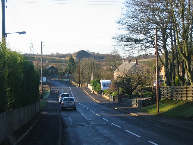
759:{{Information |Description=Standburn, a former mining village - note the coal bing, aka spoil heap, in the distance - near Falkirk, Scotland |Source=Geograph http://www.geograph.org.uk/photo/90376 |Date=Monday, 12 December, 2005 |Author=Richard Webb |Perm
154:
742:
286:– You must give appropriate credit, provide a link to the license, and indicate if changes were made. You may do so in any reasonable manner, but not in any way that suggests the licensor endorses you or your use.
38:
686:
419:
383:
170:
203:
293:
652:
615:
578:
541:
507:
473:
367:
679:
439:
403:
350:
190:
110:
Standburn, a former mining village - note the coal bing, aka spoil heap, in the distance - near
Falkirk, Scotland
249:
769:
The following pages on the
English Knowledge (XXG) use this file (pages on other projects are not listed):
292:– If you remix, transform, or build upon the material, you must distribute your contributions under the
210:
on the
Geograph website for the photographer's contact details. The copyright on this image is owned by
78:
246:
46:
752:
86:
176:
215:
73:
741:
736:
118:
37:
773:
160:
129:
195:
207:
709:
Click on a date/time to view the file as it appeared at that time.
162:
145:
61:
466:
155:
55° 57′ 20″ N, 3° 43′ 05″ W
334:
Add a one-line explanation of what this file represents
811:
801:
791:
821:
100:
85:
Commons is a freely licensed media file repository.
420:
Creative
Commons Attribution-ShareAlike 2.0 Generic
51:(640 × 480 pixels, file size: 85 KB, MIME type:
303:https://creativecommons.org/licenses/by-sa/2.0
66:
309:Creative Commons Attribution-Share Alike 2.0
227:
8:
269:– to copy, distribute and transmit the work
711:
330:
784:The following other wikis use this file:
668:fcfd8307b46c6109a3bcf476c30630493b3cd8f7
771:
666:
650:
629:
613:
592:
576:
555:
539:
521:
505:
487:
471:
453:
437:
417:
401:
381:
365:
348:
345:
326:
319:
148:
130:https://www.geograph.org.uk/photo/90376
169:View this and other nearby images on:
7:
214:and is licensed for reuse under the
700:
250:Attribution-Share Alike 2.0 Generic
238:
233:
218:Attribution-ShareAlike 2.0 license.
339:
333:
224:
201:
98:
44:
338:
324:
280:Under the following conditions:
245:This file is licensed under the
237:
232:
226:
194:
175:
161:
65:
31:
21:
321:
41:No higher resolution available.
14:
320:
202:This image was taken from the
26:
1:
474:coordinates of depicted place
346:Items portrayed in this file
840:
818:Usage on www.wikidata.org
808:Usage on gd.wikipedia.org
798:Usage on fr.wikipedia.org
788:Usage on eu.wikipedia.org
294:same or compatible license
701:
16:
489:55°57'20.2"N, 3°43'4.8"W
323:
260:
72:This is a file from the
758:
135:
124:
117:
114:
103:
76:. Information from its
208:this photograph's page
181:55.955600; -3.718000
79:description page there
680:determination method
275:– to adapt the work
780:Global file usage
762:
737:19:26, 9 May 2008
404:copyright license
332:
223:
222:
206:collection. See
186:
185:
143:
142:
94:
93:
74:Wikimedia Commons
32:Global file usage
831:
749:
689:
684:
634:
597:
560:
455:12 December 2005
368:copyright status
316:
313:
310:
307:
304:
296:as the original.
258:
247:Creative Commons
241:
240:
236:
235:
230:
229:
216:Creative Commons
204:Geograph project
198:
191:
182:
179:
165:
164:
158:
157:
146:
120:
119:12 December 2005
107:
101:
90:
69:
68:
62:
56:
54:
839:
838:
834:
833:
832:
830:
829:
828:
778:
770:
763:
755:
747:
703:
702:
699:
698:
697:
696:
695:
694:
693:
692:
691:
690:
685:
682:
673:
672:
671:
669:
659:
658:
657:
655:
644:
643:
642:
641:
640:
639:
638:
637:
635:
632:
622:
621:
620:
618:
607:
606:
605:
604:
603:
602:
601:
600:
598:
595:
585:
584:
583:
581:
570:
569:
568:
567:
566:
565:
564:
563:
561:
558:
548:
547:
546:
544:
533:
532:
531:
530:
529:
528:
527:
526:
524:
514:
513:
512:
510:
499:
498:
497:
496:
495:
494:
493:
492:
490:
480:
479:
478:
476:
465:
464:
463:
462:
461:
460:
459:
458:
456:
446:
445:
444:
442:
431:
430:
429:
428:
427:
426:
425:
424:
422:
410:
409:
408:
406:
395:
394:
393:
392:
391:
390:
389:
388:
386:
374:
373:
372:
370:
359:
358:
357:
356:
355:
353:
337:
336:
335:
318:
317:
314:
311:
308:
305:
302:
301:
259:
256:
253:
242:
219:
180:
153:
152:
149:Object location
144:
105:
96:
95:
84:
83:
82:is shown below.
58:
52:
50:
43:
42:
12:
11:
5:
837:
835:
827:
826:
825:
824:
816:
815:
814:
806:
805:
804:
796:
795:
794:
782:
781:
777:
776:
768:
767:
766:
761:
760:
757:
753:
750:
744:
739:
734:
730:
729:
726:
723:
720:
717:
714:
707:
706:
678:
677:
676:
675:
674:
670:
667:
665:
664:
663:
662:
661:
660:
656:
651:
649:
648:
647:
646:
645:
636:
630:
628:
627:
626:
625:
624:
623:
619:
614:
612:
611:
610:
609:
608:
599:
593:
591:
590:
589:
588:
587:
586:
582:
577:
575:
574:
573:
572:
571:
562:
556:
554:
553:
552:
551:
550:
549:
545:
540:
538:
537:
536:
535:
534:
525:
522:
520:
519:
518:
517:
516:
515:
511:
506:
504:
503:
502:
501:
500:
491:
488:
486:
485:
484:
483:
482:
481:
477:
472:
470:
469:
468:
467:
457:
454:
452:
451:
450:
449:
448:
447:
443:
438:
436:
435:
434:
433:
432:
423:
418:
416:
415:
414:
413:
412:
411:
407:
402:
400:
399:
398:
397:
396:
387:
382:
380:
379:
378:
377:
376:
375:
371:
366:
364:
363:
362:
361:
360:
354:
349:
347:
344:
343:
342:
341:
340:
329:
328:
325:
322:
300:
299:
298:
297:
287:
278:
277:
276:
270:
263:You are free:
254:
244:
243:
225:
221:
220:
199:
184:
183:
173:
167:
150:
141:
140:
137:
133:
132:
126:
122:
121:
116:
112:
111:
108:
99:
97:
92:
91:
70:
60:
59:
40:
36:
35:
34:
29:
24:
19:
13:
10:
9:
6:
4:
3:
2:
836:
823:
820:
819:
817:
813:
810:
809:
807:
803:
800:
799:
797:
793:
790:
789:
787:
786:
785:
779:
775:
772:
764:
756:
754:Angusmclellan
751:
745:
743:
740:
738:
735:
732:
731:
727:
724:
721:
718:
715:
713:
712:
710:
704:
688:
681:
654:
617:
580:
543:
509:
475:
441:
421:
405:
385:
369:
352:
306:CC BY-SA 2.0
295:
291:
288:
285:
282:
281:
279:
274:
271:
268:
265:
264:
262:
261:
255:Attribution:
251:
248:
231:
217:
213:
209:
205:
200:
197:
193:
192:
189:
188:
178:
174:
172:
171:OpenStreetMap
168:
166:
156:
151:
147:
138:
134:
131:
127:
123:
113:
109:
106:Standburn.jpg
102:
88:
81:
80:
75:
71:
64:
63:
57:
48:
47:Standburn.jpg
39:
33:
30:
28:
25:
23:
20:
18:
15:
783:
708:
705:File history
289:
283:
272:
266:
257:Richard Webb
212:Richard Webb
211:
187:
139:Richard Webb
87:You can help
77:
45:
22:File history
384:copyrighted
290:share alike
284:attribution
104:Description
765:File usage
746:640 × 480
722:Dimensions
523:image/jpeg
508:media type
53:image/jpeg
27:File usage
812:Standburn
802:Standburn
792:Standburn
774:Standburn
719:Thumbnail
716:Date/Time
542:data size
440:inception
128:Geograph
822:Q7598439
653:checksum
327:Captions
273:to remix
267:to share
252:license.
748:(85 KB)
733:current
728:Comment
557:87,135
351:depicts
331:English
49:
579:height
159:
136:Author
125:Source
687:SHA-1
633:pixel
616:width
596:pixel
725:User
631:640
594:480
559:byte
315:true
312:true
115:Date
17:File
683::
89:.
55:)
Text is available under the Creative Commons Attribution-ShareAlike License. Additional terms may apply.
_region:GB-SCT_&language=en)
