338:
271:
221:
263:
213:
285:
235:
306:
344:
349:
984:
62:
814:"}},"text\/plain":{"en":{"":"heading"}}},"{\"value\":{\"amount\":\"+22\",\"unit\":\"http:\\\/\\\/www.wikidata.org\\\/entity\\\/Q28390\"},\"type\":\"quantity\"}":{"text\/html":{"en":{"P7787":"22
750:"}},"text\/plain":{"en":{"":"heading"}}},"{\"value\":{\"amount\":\"+22\",\"unit\":\"http:\\\/\\\/www.wikidata.org\\\/entity\\\/Q28390\"},\"type\":\"quantity\"}":{"text\/html":{"en":{"P7787":"22
950:
810:
204:
33:
41:
73:
396:– You must give appropriate credit, provide a link to the license, and indicate if changes were made. You may do so in any reasonable manner, but not in any way that suggests the licensor endorses you or your use.
811:
747:
983:
978:
1001:== {{int:filedesc}} == {{Information |description={{en|1=Staner Court, near Newington, Ramsgate}} |date=2007-03-31 |source=From |author= |permiss
949:
944:
32:
648:
612:
576:
278:
228:
683:
313:
403:
539:
881:
852:
825:
788:
761:
691:
632:
560:
532:
519:
504:
719:
676:
661:
596:
477:
460:
300:
359:
402:– If you remix, transform, or build upon the material, you must distribute your contributions under the
320:
on the
Geograph website for the photographer's contact details. The copyright on this image is owned by
994:
356:
818:"}},"text\/plain":{"en":{"P7787":"22 degree"}}}}": -->
754:"}},"text\/plain":{"en":{"P7787":"22 degree"}}}}": -->
81:
173:
1015:
960:
698:
668:
511:
157:
284:
234:
325:
68:
968:
125:
218:
268:
146:
136:
305:
317:
106:
Staner Court, near
Newington, Ramsgate - geograph.org.uk - 382527.jpg
42:
Staner_Court,_near_Newington,_Ramsgate_-_geograph.org.uk_-_382527.jpg
917:
Click on a date/time to view the file as it appeared at that time.
270:
220:
245:
195:
56:
255:
51° 20′ 31″ N, 1° 23′ 28″ E
205:
51° 20′ 25″ N, 1° 23′ 23″ E
444:
Add a one-line explanation of what this file represents
100:
80:
Commons is a freely licensed media file repository.
613:
Creative
Commons Attribution-ShareAlike 2.0 Generic
967:Cropped 31 % horizontally, 39 % vertically using
46:(443 × 291 pixels, file size: 16 KB, MIME type:
413:https://creativecommons.org/licenses/by-sa/2.0
61:
419:Creative Commons Attribution-Share Alike 2.0
337:
8:
815:
751:
379:– to copy, distribute and transmit the work
919:
440:
669:https://www.geograph.org.uk/photo/382527
512:https://www.geograph.org.uk/profile/4474
1013:
895:
879:
839:
823:
775:
759:
733:
717:
646:
630:
610:
594:
574:
558:
491:
475:
458:
455:
436:
429:
248:
198:
277:View this and other nearby images on:
227:View this and other nearby images on:
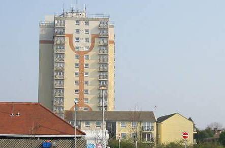
188:Staner Court, near Newington, Ramsgate
169:Staner Court, near Newington, Ramsgate
116:Staner Court, near Newington, Ramsgate
7:
324:and is licensed for reuse under the
1011:The following page uses this file:
908:
360:Attribution-Share Alike 2.0 Generic
348:
343:
328:Attribution-ShareAlike 2.0 license.
449:
443:
334:
311:
110:
93:
39:
448:
762:coordinates of the point of view
434:
390:Under the following conditions:
355:This file is licensed under the
347:
342:
336:
304:
283:
269:
261:
233:
219:
211:
60:
21:
431:
111:
36:No higher resolution available.
14:
649:file available on the internet
430:
312:This image was taken from the
26:
1:
826:coordinates of depicted place
684:Geograph Britain and Ireland
533:object of statement has role
456:Items portrayed in this file
841:51°20'30.95"N, 1°23'27.60"E
777:51°20'25.22"N, 1°23'22.92"E
260:
210:
1032:
404:same or compatible license
909:
16:
692:geograph.org.uk image ID
433:
370:
67:This is a file from the
1000:
966:
186:Nick Smith /
167:Nick Smith /
158:required by the license
142:
131:
124:
121:
103:
71:. Information from its
979:15:18, 3 February 2011
318:this photograph's page
289:51.341930; 1.391000
239:51.340340; 1.389700
74:description page there
945:15:55, 26 March 2021
385:– to adapt the work
971:with precise mode.
520:author name string
1016:Newington, Thanet
1004:
817:
753:
597:copyright license
442:
333:
332:
316:collection. See
294:
293:
244:
243:
193:
192:
161:
89:
88:
69:Wikimedia Commons
1023:
991:
957:
863:
862:
857:
799:
798:
793:
701:
696:
686:
681:
671:
666:
662:described at URL
561:copyright status
542:
537:
527:
524:
514:
509:
426:
423:
420:
417:
414:
406:as the original.
368:
357:Creative Commons
351:
350:
346:
345:
340:
339:
326:Creative Commons
314:Geograph project
308:
301:
290:
287:
273:
272:
266:
265:
264:
258:
257:
246:
240:
237:
223:
222:
216:
215:
214:
208:
207:
196:
155:
127:
115:
107:
101:
85:
64:
63:
57:
51:
49:
1031:
1030:
1026:
1025:
1024:
1022:
1021:
1020:
1005:
997:
989:
963:
955:
911:
910:
907:
906:
905:
904:
903:
902:
901:
900:
898:
888:
887:
886:
884:
873:
872:
871:
870:
869:
868:
867:
866:
865:
864:
860:
858:
855:
846:
845:
844:
842:
832:
831:
830:
828:
809:
808:
807:
806:
805:
804:
803:
802:
801:
800:
796:
794:
791:
782:
781:
780:
778:
768:
767:
766:
764:
745:
744:
743:
742:
741:
740:
739:
738:
736:
726:
725:
724:
722:
711:
710:
709:
708:
707:
706:
705:
704:
703:
702:
697:
694:
688:
687:
682:
679:
673:
672:
667:
664:
655:
654:
653:
651:
639:
638:
637:
635:
624:
623:
622:
621:
620:
619:
618:
617:
615:
603:
602:
601:
599:
588:
587:
586:
585:
584:
583:
582:
581:
579:
567:
566:
565:
563:
552:
551:
550:
549:
548:
547:
546:
545:
544:
543:
538:
535:
529:
528:
525:
522:
516:
515:
510:
507:
498:
497:
496:
494:
484:
483:
482:
480:
469:
468:
467:
466:
465:
463:
447:
446:
445:
428:
427:
424:
421:
418:
415:
412:
411:
369:
366:
363:
352:
329:
299:
288:
262:
253:
252:
249:Object location
238:
212:
203:
202:
199:Camera location
194:
183:
176:
164:
137:geograph.org.uk
117:
105:
98:
91:
90:
79:
78:
77:is shown below.
53:
47:
45:
38:
37:
12:
11:
5:
1029:
1027:
1019:
1018:
1009:
1008:
1003:
1002:
999:
995:
992:
986:
981:
976:
973:
972:
965:
961:
958:
952:
947:
942:
938:
937:
934:
931:
928:
925:
922:
915:
914:
899:
896:
894:
893:
892:
891:
890:
889:
885:
880:
878:
877:
876:
875:
874:
851:
850:
849:
848:
847:
843:
840:
838:
837:
836:
835:
834:
833:
829:
824:
822:
821:
820:
819:
813:
787:
786:
785:
784:
783:
779:
776:
774:
773:
772:
771:
770:
769:
765:
760:
758:
757:
756:
755:
749:
737:
734:
732:
731:
730:
729:
728:
727:
723:
718:
716:
715:
714:
713:
712:
690:
689:
675:
674:
660:
659:
658:
657:
656:
652:
647:
645:
644:
643:
642:
641:
640:
636:
633:source of file
631:
629:
628:
627:
626:
625:
616:
611:
609:
608:
607:
606:
605:
604:
600:
595:
593:
592:
591:
590:
589:
580:
575:
573:
572:
571:
570:
569:
568:
564:
559:
557:
556:
555:
554:
553:
531:
530:
518:
517:
503:
502:
501:
500:
499:
495:
492:
490:
489:
488:
487:
486:
485:
481:
476:
474:
473:
472:
471:
470:
464:
459:
457:
454:
453:
452:
451:
450:
439:
438:
435:
432:
410:
409:
408:
407:
397:
388:
387:
386:
380:
373:You are free:
364:
354:
353:
335:
331:
330:
309:
298:
295:
292:
291:
281:
275:
250:
242:
241:
231:
225:
200:
191:
190:
184:
181:
178:
177:
172:
165:
162:
150:
149:
144:
140:
139:
133:
129:
128:
123:
119:
118:
108:
99:
97:
94:
92:
87:
86:
65:
55:
54:
35:
31:
30:
29:
24:
19:
13:
10:
9:
6:
4:
3:
2:
1028:
1017:
1014:
1012:
1006:
998:
993:
987:
985:
982:
980:
977:
975:
974:
970:
964:
959:
953:
951:
948:
946:
943:
940:
939:
935:
932:
929:
926:
923:
921:
920:
918:
912:
883:
854:
827:
790:
763:
735:31 March 2007
721:
700:
693:
685:
678:
670:
663:
650:
634:
614:
598:
578:
562:
541:
534:
521:
513:
506:
479:
462:
416:CC BY-SA 2.0
405:
401:
398:
395:
392:
391:
389:
384:
381:
378:
375:
374:
372:
371:
365:Attribution:
361:
358:
341:
327:
323:
319:
315:
310:
307:
303:
302:
296:
286:
282:
280:
279:OpenStreetMap
276:
274:
256:
251:
247:
236:
232:
230:
229:OpenStreetMap
226:
224:
206:
201:
197:
189:
185:
180:
179:
175:
171: /
170:
166:
159:
154:
152:
151:
148:
145:
141:
138:
134:
130:
126:31 March 2007
120:
114:
109:
102:
95:
83:
76:
75:
70:
66:
59:
58:
52:
43:
34:
28:
25:
23:
20:
18:
15:
1010:
916:
913:File history
540:photographer
399:
393:
382:
376:
321:
259:
209:
187:
174:CC BY-SA 2.0
168:
112:
82:You can help
72:
40:
22:File history
996:GeographBot
962:Crookesmoor
577:copyrighted
400:share alike
394:attribution
153:Attribution
104:Description
1007:File usage
988:640 × 480
954:443 × 291
930:Dimensions
897:image/jpeg
882:media type
526:Nick Smith
493:some value
367:Nick Smith
322:Nick Smith
147:Nick Smith
48:image/jpeg
27:File usage
927:Thumbnail
924:Date/Time
720:inception
297:Licensing
182:InfoField
163:InfoField
113:English:
969:CropTool
677:operator
437:Captions
383:to remix
377:to share
362:license.
990:(36 KB)
956:(16 KB)
941:current
936:Comment
853:heading
812:heading
789:heading
748:heading
478:creator
461:depicts
441:English
96:Summary
44:
861:degree
816:degree
797:degree
752:degree
699:382527
267:
217:
143:Author
132:Source
135:From
933:User
425:true
422:true
122:Date
17:File
859:22
795:22
505:URL
856::
792::
695::
680::
665::
536::
523::
508::
160:)
156:(
84:.
50:)
Text is available under the Creative Commons Attribution-ShareAlike License. Additional terms may apply.
_heading:22.00&language=en)
_heading:22.00&language=en)
