129:
316:
230:
271:
244:
322:
327:
91:
43:
982:
1021:
1026:
221:
385:– You must give appropriate credit, provide a link to the license, and indicate if changes were made. You may do so in any reasonable manner, but not in any way that suggests the licensor endorses you or your use.
288:
57:
53:
47:
102:
70:
136:
286:; with no Invariant Sections, no Front-Cover Texts, and no Back-Cover Texts. A copy of the license is included in the section entitled
278:
645:
609:
592:
575:
558:
541:
524:
488:
237:
1044:
681:
1194:
1057:
This file contains additional information, probably added from the digital camera or scanner used to create or digitize it.
927:
392:
877:
840:
806:
769:
735:
665:
629:
472:
283:
701:
508:
455:
1003:, an area known to contain archaeological remains known as the Corbin Farm Site. |Source={{own}} |Date=2012 |Author=
911:
354:
350:
346:
342:
338:
173:
1060:
If the file has been modified from its original state, some details may not fully reflect the modified file.
1000:
1017:
The following pages on the
English Knowledge (XXG) use this file (pages on other projects are not listed):
1242:
391:– If you remix, transform, or build upon the material, you must distribute your contributions under the
334:
981:
976:
61:
42:
1278:
110:
1415:
1069:
265:
276:
Permission is granted to copy, distribute and/or modify this document under the terms of the
1004:
992:
243:
145:
1370:
1260:
1086:
262:
I, the copyright holder of this work, hereby publish it under the following licenses:
97:
1022:
List of archaeological sites on the
National Register of Historic Places in Illinois
1425:
1380:
1126:
204:
1320:
227:
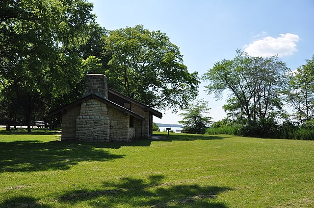
176:, an area known to contain archaeological remains known as the Corbin Farm Site.
123:
1163:
1106:
1079:
1045:
Liste der Einträge im
National Register of Historic Places im LaSalle County
1435:
1096:
1027:
National
Register of Historic Places listings in LaSalle County, Illinois
184:
949:
Click on a date/time to view the file as it appeared at that time.
140:
728:
229:
222:
41° 18′ 36.97″ N, 88° 56′ 20.98″ W
212:
135:
This is an image of a place or building that is listed on the
85:
999:{{Information |Description=The Lone Point picnic area at
542:
Creative
Commons Attribution-ShareAlike 4.0 International
439:
Add a one-line explanation of what this file represents
593:
525:
Creative
Commons Attribution-ShareAlike 3.0 Unported
282:, Version 1.2 or any later version published by the
162:
109:
Commons is a freely licensed media file repository.
610:
Creative
Commons Attribution-ShareAlike 2.0 Generic
576:
Creative
Commons Attribution-ShareAlike 1.0 Generic
559:
Creative
Commons Attribution-ShareAlike 2.5 Generic
75:(1,024 × 680 pixels, file size: 247 KB, MIME type:
402:https://creativecommons.org/licenses/by-sa/4.0
90:
408:Creative Commons Attribution-Share Alike 4.0
315:
8:
368:– to copy, distribute and transmit the work
1062:
951:
435:
420:You may select the license of your choice.
1037:The following other wikis use this file:
1451:
1443:
1433:
1423:
1413:
1405:
1397:
1389:
1378:
1368:
1360:
1352:
1344:
1336:
1328:
1318:
1310:
1302:
1294:
1286:
1276:
1268:
1258:
1250:
1240:
1232:
1211:
1203:
1192:
1184:
1176:
1168:
1158:
1150:
1142:
1134:
1123:
1115:
1104:
1094:
1084:
1074:
1019:
925:
909:
891:
875:
854:
838:
820:
804:
783:
767:
749:
733:
715:
699:
679:
663:
643:
627:
607:
590:
573:
556:
539:
522:
506:
486:
470:
453:
450:
431:
424:
215:
236:View this and other nearby images on:
1064:
7:
294:http://www.gnu.org/copyleft/fdl.html
137:National Register of Historic Places
940:
326:
321:
1055:
444:
438:
419:
312:
261:
168:StarvedRockStatePark LonePoint.jpg
122:
68:
443:
1117:Date and time of data generation
1007:|Permission=see below |other_...
429:
379:Under the following conditions:
333:This file is licensed under the
325:
320:
314:
270:
269:
242:
228:
127:
89:
31:
21:
426:
14:
425:
300:GNU Free Documentation License
289:GNU Free Documentation License
279:GNU Free Documentation License
172:The Lone Point picnic area at
26:
1:
1349:A directly photographed image
736:coordinates of depicted place
646:original creation by uploader
36:
1304:DateTimeDigitized subseconds
751:41°18'36.97"N, 88°56'20.98"W
451:Items portrayed in this file
1296:DateTimeOriginal subseconds
1205:Date and time of digitizing
1473:
1391:Focal length in 35 mm film
1333:One-chip color area sensor
1312:Supported Flashpix version
1041:Usage on de.wikipedia.org
393:same or compatible license
143:. Its reference number is
1213:Meaning of each component
1170:File change date and time
1001:w:Starved Rock State Park
941:
194:
16:
428:
359:
337:Attribution-Share Alike
284:Free Software Foundation
141:United States of America
96:This is a file from the
1354:Custom image processing
1265:Center weighted average
998:
200:
190:
183:
180:
174:Starved Rock State Park
165:
100:. Information from its
1445:Subject distance range
1234:Image compression mode
248:41.310270; -88.939160
103:description page there
46:Size of this preview:
1252:Maximum land aperture
1144:Horizontal resolution
1375:Manual white balance
1341:Digital still camera
1288:DateTime subseconds
1178:Y and C positioning
1173:22:12, 10 June 2012
1152:Vertical resolution
1091:1/800 sec (0.00125)
1066:Camera manufacturer
977:04:41, 11 June 2012
374:– to adapt the work
52:Other resolutions:
1399:Scene capture type
1283:Flash did not fire
1208:17:35, 4 June 2012
1120:17:35, 4 June 2012
62:1,024 × 680 pixels
1460:
1459:
1255:3.6 APEX (f/3.48)
1189:Aperture priority
1070:NIKON CORPORATION
1033:Global file usage
1010:
509:copyright license
437:
339:4.0 International
311:
310:
253:
252:
210:
209:
155:
154:
118:
117:
98:Wikimedia Commons
32:Global file usage
1464:
1186:Exposure Program
1063:
989:
859:
788:
473:copyright status
415:
412:
409:
406:
403:
395:as the original.
335:Creative Commons
329:
328:
324:
323:
318:
317:
307:
304:
301:
298:
295:
273:
272:
266:
249:
246:
232:
231:
225:
224:
213:
196:
186:
169:
163:
148:
131:
130:
124:
114:
93:
92:
86:
80:
78:
65:
58:640 × 425 pixels
54:320 × 213 pixels
48:800 × 531 pixels
1472:
1471:
1467:
1466:
1465:
1463:
1462:
1461:
1453:GPS tag version
1051:
1031:
1018:
1011:
1005:User:Magicpiano
995:
987:
943:
942:
939:
938:
937:
936:
935:
934:
933:
932:
930:
918:
917:
916:
914:
903:
902:
901:
900:
899:
898:
897:
896:
894:
884:
883:
882:
880:
869:
868:
867:
866:
865:
864:
863:
862:
860:
857:
847:
846:
845:
843:
832:
831:
830:
829:
828:
827:
826:
825:
823:
813:
812:
811:
809:
798:
797:
796:
795:
794:
793:
792:
791:
789:
786:
776:
775:
774:
772:
761:
760:
759:
758:
757:
756:
755:
754:
752:
742:
741:
740:
738:
727:
726:
725:
724:
723:
722:
721:
720:
718:
708:
707:
706:
704:
693:
692:
691:
690:
689:
688:
687:
686:
684:
672:
671:
670:
668:
657:
656:
655:
654:
653:
652:
651:
650:
648:
636:
635:
634:
632:
621:
620:
619:
618:
617:
616:
615:
614:
612:
601:
600:
599:
598:
597:
595:
584:
583:
582:
581:
580:
578:
567:
566:
565:
564:
563:
561:
550:
549:
548:
547:
546:
544:
533:
532:
531:
530:
529:
527:
515:
514:
513:
511:
500:
499:
498:
497:
496:
495:
494:
493:
491:
479:
478:
477:
475:
464:
463:
462:
461:
460:
458:
442:
441:
440:
423:
422:
421:
417:
416:
413:
410:
407:
404:
401:
400:
358:
330:
305:
302:
299:
296:
293:
264:
263:
258:
247:
220:
219:
216:Object location
211:
205:User:Magicpiano
167:
160:
144:
128:
120:
119:
108:
107:
106:is shown below.
82:
76:
74:
67:
66:
51:
12:
11:
5:
1470:
1468:
1458:
1457:
1454:
1450:
1449:
1446:
1442:
1441:
1438:
1432:
1431:
1428:
1422:
1421:
1418:
1412:
1411:
1408:
1404:
1403:
1400:
1396:
1395:
1392:
1388:
1387:
1384:
1377:
1376:
1373:
1367:
1366:
1363:
1359:
1358:
1357:Normal process
1355:
1351:
1350:
1347:
1343:
1342:
1339:
1335:
1334:
1331:
1330:Sensing method
1327:
1326:
1323:
1317:
1316:
1313:
1309:
1308:
1305:
1301:
1300:
1297:
1293:
1292:
1289:
1285:
1284:
1281:
1275:
1274:
1271:
1267:
1266:
1263:
1257:
1256:
1253:
1249:
1248:
1245:
1239:
1238:
1235:
1231:
1230:
1229:
1228:
1227:does not exist
1225:
1222:
1219:
1214:
1210:
1209:
1206:
1202:
1201:
1198:
1191:
1190:
1187:
1183:
1182:
1179:
1175:
1174:
1171:
1167:
1166:
1161:
1157:
1156:
1153:
1149:
1148:
1145:
1141:
1140:
1137:
1133:
1132:
1129:
1122:
1121:
1118:
1114:
1113:
1110:
1103:
1102:
1099:
1093:
1092:
1089:
1083:
1082:
1077:
1073:
1072:
1067:
1054:
1050:
1049:
1048:
1047:
1035:
1034:
1030:
1029:
1024:
1016:
1015:
1014:
1009:
1008:
997:
993:
990:
984:
979:
974:
970:
969:
966:
963:
960:
957:
954:
947:
946:
931:
926:
924:
923:
922:
921:
920:
919:
915:
910:
908:
907:
906:
905:
904:
895:
892:
890:
889:
888:
887:
886:
885:
881:
876:
874:
873:
872:
871:
870:
861:
855:
853:
852:
851:
850:
849:
848:
844:
839:
837:
836:
835:
834:
833:
824:
821:
819:
818:
817:
816:
815:
814:
810:
805:
803:
802:
801:
800:
799:
790:
784:
782:
781:
780:
779:
778:
777:
773:
768:
766:
765:
764:
763:
762:
753:
750:
748:
747:
746:
745:
744:
743:
739:
734:
732:
731:
730:
729:
719:
716:
714:
713:
712:
711:
710:
709:
705:
700:
698:
697:
696:
695:
694:
685:
680:
678:
677:
676:
675:
674:
673:
669:
664:
662:
661:
660:
659:
658:
649:
644:
642:
641:
640:
639:
638:
637:
633:
630:source of file
628:
626:
625:
624:
623:
622:
613:
608:
606:
605:
604:
603:
602:
596:
591:
589:
588:
587:
586:
585:
579:
574:
572:
571:
570:
569:
568:
562:
557:
555:
554:
553:
552:
551:
545:
540:
538:
537:
536:
535:
534:
528:
523:
521:
520:
519:
518:
517:
516:
512:
507:
505:
504:
503:
502:
501:
492:
487:
485:
484:
483:
482:
481:
480:
476:
471:
469:
468:
467:
466:
465:
459:
454:
452:
449:
448:
447:
446:
445:
434:
433:
430:
427:
418:
399:
398:
397:
396:
386:
377:
376:
375:
369:
362:You are free:
332:
331:
313:
309:
308:
274:
260:
259:
257:
254:
251:
250:
240:
234:
217:
208:
207:
202:
198:
197:
192:
188:
187:
182:
178:
177:
170:
161:
159:
156:
153:
152:
132:
121:
116:
115:
94:
84:
83:
45:
41:
40:
39:
34:
29:
24:
19:
13:
10:
9:
6:
4:
3:
2:
1469:
1455:
1452:
1447:
1444:
1439:
1437:
1434:
1429:
1427:
1424:
1419:
1417:
1414:
1409:
1407:Scene control
1406:
1401:
1398:
1393:
1390:
1385:
1382:
1379:
1374:
1372:
1371:White balance
1369:
1365:Auto exposure
1364:
1362:Exposure mode
1361:
1356:
1353:
1348:
1345:
1340:
1337:
1332:
1329:
1324:
1322:
1319:
1314:
1311:
1306:
1303:
1298:
1295:
1290:
1287:
1282:
1280:
1277:
1272:
1269:
1264:
1262:
1261:Metering mode
1259:
1254:
1251:
1246:
1244:
1243:Exposure bias
1241:
1236:
1233:
1226:
1223:
1220:
1217:
1216:
1215:
1212:
1207:
1204:
1199:
1196:
1193:
1188:
1185:
1180:
1177:
1172:
1169:
1165:
1162:
1160:Software used
1159:
1154:
1151:
1146:
1143:
1138:
1135:
1130:
1128:
1124:
1119:
1116:
1111:
1108:
1105:
1100:
1098:
1095:
1090:
1088:
1087:Exposure time
1085:
1081:
1078:
1075:
1071:
1068:
1065:
1061:
1058:
1052:
1046:
1043:
1042:
1040:
1039:
1038:
1032:
1028:
1025:
1023:
1020:
1012:
1006:
1002:
996:
991:
985:
983:
980:
978:
975:
972:
971:
967:
964:
961:
958:
955:
953:
952:
950:
944:
929:
913:
879:
842:
808:
771:
770:exposure time
737:
703:
683:
667:
666:captured with
647:
631:
611:
594:
577:
560:
543:
526:
510:
490:
474:
457:
405:CC BY-SA 4.0
394:
390:
387:
384:
381:
380:
378:
373:
370:
367:
364:
363:
361:
360:
356:
352:
348:
344:
340:
336:
319:
291:
290:
285:
281:
280:
275:
268:
267:
255:
245:
241:
239:
238:OpenStreetMap
235:
233:
223:
218:
214:
206:
203:
199:
193:
189:
179:
175:
171:
164:
157:
151:
150:
147:
142:
138:
133:
126:
125:
112:
105:
104:
99:
95:
88:
87:
81:
72:
71:Original file
63:
59:
55:
49:
44:
38:
35:
33:
30:
28:
25:
23:
20:
18:
15:
1381:Digital zoom
1273:Fine weather
1270:Light source
1127:focal length
1076:Camera model
1059:
1056:
1036:
986:1,024 × 680
948:
945:File history
841:focal length
388:
382:
371:
365:
343:3.0 Unported
287:
277:
134:
111:You can help
101:
69:
22:File history
1410:Low gain up
1338:File source
1321:Color space
1136:Orientation
912:instance of
489:copyrighted
389:share alike
383:attribution
355:1.0 Generic
351:2.0 Generic
347:2.5 Generic
166:Description
1426:Saturation
1346:Scene type
1164:GIMP 2.6.8
1013:File usage
994:Magicpiano
962:Dimensions
928:photograph
858:millimetre
77:image/jpeg
27:File usage
1436:Sharpness
1107:ISO speed
1080:NIKON D90
959:Thumbnail
956:Date/Time
878:ISO speed
702:inception
682:Nikon D90
256:Licensing
1416:Contrast
1402:Standard
1181:Co-sited
1097:F-number
1053:Metadata
988:(247 KB)
807:f-number
785:0.00125
432:Captions
372:to remix
366:to share
357:license.
195:Own work
146:98000654
37:Metadata
1456:2.2.0.0
1448:Unknown
1197:version
973:current
968:Comment
456:depicts
436:English
158:Summary
139:in the
73:
1440:Normal
1430:Normal
1420:Normal
1155:72 dpi
1147:72 dpi
1139:Normal
1109:rating
787:second
226:
201:Author
191:Source
1394:27 mm
1383:ratio
1279:Flash
1131:18 mm
1125:Lens
1325:sRGB
1200:2.21
1195:Exif
965:User
717:2012
414:true
411:true
353:and
306:true
303:true
297:GFDL
185:2012
181:Date
17:File
1112:400
1101:f/8
893:400
856:18
1307:00
1299:00
1291:00
1224:Cr
1221:Cb
349:,
345:,
341:,
60:|
56:|
50:.
1386:1
1315:1
1247:0
1237:2
1218:Y
822:8
292:.
149:.
113:.
79:)
64:.
Text is available under the Creative Commons Attribution-ShareAlike License. Additional terms may apply.
