259:
220:
43:
212:
234:
265:
270:
103:
651:"}},"text\/plain":{"en":{"":"heading"}}},"{\"value\":{\"amount\":\"+129.0\",\"unit\":\"http:\\\/\\\/www.wikidata.org\\\/entity\\\/Q28390\"},\"type\":\"quantity\"}":{"text\/html":{"en":{"P7787":"129.0
647:
947:
1082:
311:– You must give appropriate credit, provide a link to the license, and indicate if changes were made. You may do so in any reasonable manner, but not in any way that suggests the licensor endorses you or your use.
887:
203:
648:
1106:
186:
1077:
789:
794:
69:
65:
61:
57:
53:
47:
114:
600:
564:
528:
492:
227:
82:
1270:
1117:
This file contains additional information, probably added from the digital camera or scanner used to create or digitize it.
982:
318:
442:
872:
689:
662:
584:
548:
476:
450:
435:
420:
620:
512:
393:
376:
1007:
857:
1012:
847:
280:
1120:
If the file has been modified from its original state, some details may not fully reflect the modified file.
780:
The following pages on the
English Knowledge (XXG) use this file (pages on other projects are not listed):
1052:
882:
1318:
317:– If you remix, transform, or build upon the material, you must distribute your contributions under the
1087:
877:
763:
655:"}},"text\/plain":{"en":{"P7787":"129.0 degree"}}}}": -->
427:
277:
1354:
1037:
1002:
837:
1247:
907:
122:
1432:
1057:
1032:
997:
942:
892:
822:
752:
747:
73:
42:
972:
922:
166:
1027:
1017:
867:
852:
233:
1414:
1336:
1146:
109:
252:
I, the copyright holder of this work, hereby publish it under the following license:
1442:
1186:
1072:
1062:
1022:
992:
842:
1372:
217:
1166:
967:
1067:
862:
827:
1452:
1156:
1139:
1047:
1042:
987:
832:
784:
720:
Click on a date/time to view the file as it appeared at that time.
157:
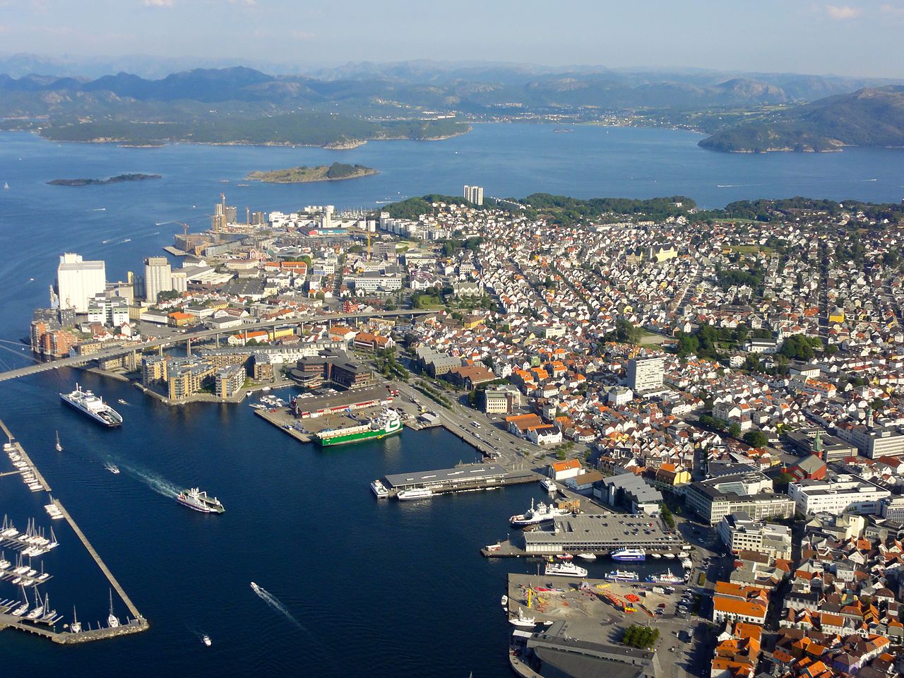
Straumsteinsundet i
Stavanger, Gandsfjorden i øvre del av bildet.
1129:
219:
204:
58° 58′ 41.05″ N, 5° 43′ 38.55″ E
194:
97:
962:
932:
529:
Creative
Commons Attribution-ShareAlike 4.0 International
902:
360:
Add a one-line explanation of what this file represents
1097:
812:
87:(3,648 × 2,736 pixels, file size: 3.67 MB, MIME type:
957:
917:
908:
Dyskusja wikiprojektu:Czy wiesz/ekspozycje/2015-09-10
141:
121:
Commons is a freely licensed media file repository.
428:
https://commons.wikimedia.org/user:%C3%98yvind_Rask
1359:Flash did not fire, compulsory flash suppression
328:https://creativecommons.org/licenses/by-sa/4.0
102:
973:Padron:Mga pinakamalaking lungsod ng Noruwega
334:Creative Commons Attribution-Share Alike 4.0
258:
8:
652:
294:– to copy, distribute and transmit the work
1122:
722:
356:
805:The following other wikis use this file:
281:Attribution-Share Alike 4.0 International
152:
1572:
1564:
1556:
1548:
1540:
1532:
1524:
1516:
1508:
1500:
1492:
1484:
1476:
1468:
1460:
1450:
1440:
1430:
1422:
1412:
1404:
1396:
1388:
1380:
1370:
1362:
1352:
1344:
1334:
1326:
1316:
1308:
1287:
1279:
1268:
1260:
1252:
1242:
1234:
1226:
1218:
1210:
1202:
1194:
1183:
1175:
1164:
1154:
1144:
1134:
923:Format:Cele mai mari orașe din Norvegia
782:
676:
660:
634:
618:
598:
582:
562:
546:
526:
510:
490:
474:
407:
391:
374:
371:
352:
345:
197:
226:View this and other nearby images on:
1124:
7:
1502:Reference for direction of movement
770:User created page with UploadWizard
711:
269:
264:
1115:
948:Шаблон:Највећи градови у Норвешкој
365:
359:
255:
251:
151:
134:
80:
968:Talaan ng mga lungsod sa Noruwega
795:Template:Largest cities of Norway
678:58°58'41.04998"N, 5°43'38.55000"E
364:
1518:Reference for direction of image
1177:Date and time of data generation
663:coordinates of the point of view
350:
305:Under the following conditions:
276:This file is licensed under the
268:
263:
257:
232:
218:
210:
101:
31:
21:
1083:Шаблон:Найбільші міста Норвегії
888:תבנית:הערים הגדולות של נורווגיה
347:
14:
346:
26:
1:
1393:A directly photographed image
565:original creation by uploader
36:
1215:311.3 meters above sea level
372:Items portrayed in this file
209:
1550:GPS differential correction
1281:Date and time of digitizing
1594:
1364:Supported Flashpix version
1094:Usage on uz.wikipedia.org
979:Usage on uk.wikipedia.org
954:Usage on tl.wikipedia.org
939:Usage on sr.wikipedia.org
929:Usage on sl.wikipedia.org
914:Usage on ro.wikipedia.org
899:Usage on pl.wikipedia.org
819:Usage on he.wikipedia.org
809:Usage on fi.wikipedia.org
319:same or compatible license
147:Stavanger sett fra fly.jpg
1534:Geodetic survey data used
1481:3-dimensional measurement
1289:Meaning of each component
1254:File change date and time
712:
176:
16:
601:Sony Cyber-shot DSC-HX5V
349:
285:
108:This is a file from the
1473:Measurement in progress
1462:GPS time (atomic clock)
1398:Custom image processing
769:
182:
172:
165:
162:
144:
112:. Information from its
1569:S4eoygF4RSek57oi7whgRw
1310:Image compression mode
238:58.978069; 5.727375
167:23 July 2014, 18:26:59
115:description page there
46:Size of this preview:
1510:Direction of movement
1494:Speed of GPS receiver
1328:Maximum land aperture
1228:Horizontal resolution
790:User:Æ?æeæ,æ!/sandbox
748:14:25, 22 August 2014
1566:Special instructions
1385:Digital still camera
74:3,648 × 2,736 pixels
70:2,560 × 1,920 pixels
1489:Kilometers per hour
1331:3.625 APEX (f/3.51)
1284:18:26, 23 July 2014
1257:18:26, 23 July 2014
1236:Vertical resolution
1180:18:26, 23 July 2014
1151:1/160 sec (0.00625)
1126:Camera manufacturer
300:– to adapt the work
52:Other resolutions:
1526:Direction of image
1521:Magnetic direction
1424:Scene capture type
1419:Auto white balance
1078:Населення Норвегії
451:author name string
436:Wikimedia username
66:1,280 × 960 pixels
62:1,024 × 768 pixels
1581:
1580:
1107:more global usage
801:Global file usage
773:
654:
513:copyright license
358:
243:
242:
192:
191:
130:
129:
110:Wikimedia Commons
32:Global file usage
1585:
1478:Measurement mode
1262:Exposure Program
1199:58° 58′ 41.05″ N
1123:
760:
700:
699:
694:
477:copyright status
458:
455:
445:
440:
430:
425:
341:
338:
335:
332:
329:
321:as the original.
278:Creative Commons
272:
271:
267:
266:
261:
260:
239:
236:
222:
221:
215:
214:
213:
207:
206:
195:
178:
168:
156:
148:
142:
126:
105:
104:
98:
92:
90:
77:
58:640 × 480 pixels
54:320 × 240 pixels
48:800 × 600 pixels
1593:
1592:
1588:
1587:
1586:
1584:
1583:
1582:
1558:GPS tag version
1470:Receiver status
1207:5° 43′ 38.55″ E
1111:
873:אסקר (נורווגיה)
799:
781:
774:
766:
758:
714:
713:
710:
709:
708:
707:
706:
705:
704:
703:
702:
701:
697:
695:
692:
683:
682:
681:
679:
669:
668:
667:
665:
646:
645:
644:
643:
642:
641:
640:
639:
637:
627:
626:
625:
623:
612:
611:
610:
609:
608:
607:
606:
605:
603:
591:
590:
589:
587:
576:
575:
574:
573:
572:
571:
570:
569:
567:
555:
554:
553:
551:
540:
539:
538:
537:
536:
535:
534:
533:
531:
519:
518:
517:
515:
504:
503:
502:
501:
500:
499:
498:
497:
495:
483:
482:
481:
479:
468:
467:
466:
465:
464:
463:
462:
461:
460:
459:
456:
453:
447:
446:
441:
438:
432:
431:
426:
423:
414:
413:
412:
410:
400:
399:
398:
396:
385:
384:
383:
382:
381:
379:
363:
362:
361:
344:
343:
342:
339:
336:
333:
330:
327:
326:
284:
273:
254:
253:
248:
237:
211:
202:
201:
198:Camera location
193:
158:
146:
139:
132:
131:
120:
119:
118:is shown below.
94:
88:
86:
79:
78:
51:
12:
11:
5:
1591:
1589:
1579:
1578:
1575:
1571:
1570:
1567:
1563:
1562:
1559:
1555:
1554:
1551:
1547:
1546:
1543:
1539:
1538:
1535:
1531:
1530:
1527:
1523:
1522:
1519:
1515:
1514:
1511:
1507:
1506:
1505:True direction
1503:
1499:
1498:
1495:
1491:
1490:
1487:
1483:
1482:
1479:
1475:
1474:
1471:
1467:
1466:
1463:
1459:
1458:
1455:
1449:
1448:
1445:
1439:
1438:
1435:
1429:
1428:
1425:
1421:
1420:
1417:
1411:
1410:
1407:
1403:
1402:
1401:Normal process
1399:
1395:
1394:
1391:
1387:
1386:
1383:
1379:
1378:
1375:
1369:
1368:
1365:
1361:
1360:
1357:
1351:
1350:
1347:
1343:
1342:
1339:
1333:
1332:
1329:
1325:
1324:
1321:
1315:
1314:
1311:
1307:
1306:
1305:
1304:
1303:does not exist
1301:
1298:
1295:
1290:
1286:
1285:
1282:
1278:
1277:
1274:
1267:
1266:
1265:Normal program
1263:
1259:
1258:
1255:
1251:
1250:
1245:
1241:
1240:
1237:
1233:
1232:
1229:
1225:
1224:
1221:
1217:
1216:
1213:
1209:
1208:
1205:
1201:
1200:
1197:
1193:
1192:
1189:
1182:
1181:
1178:
1174:
1173:
1170:
1163:
1162:
1159:
1153:
1152:
1149:
1143:
1142:
1137:
1133:
1132:
1127:
1114:
1109:of this file.
1103:
1102:
1101:
1100:
1092:
1091:
1090:
1085:
1080:
1075:
1070:
1065:
1060:
1055:
1050:
1045:
1040:
1035:
1030:
1025:
1020:
1015:
1010:
1005:
1000:
995:
990:
985:
983:Міста Норвегії
977:
976:
975:
970:
965:
963:Pook na urbano
960:
952:
951:
950:
945:
937:
936:
935:
927:
926:
925:
920:
912:
911:
910:
905:
897:
896:
895:
890:
885:
880:
875:
870:
865:
860:
858:מוס (נורווגיה)
855:
850:
845:
840:
835:
830:
825:
817:
816:
815:
803:
802:
798:
797:
792:
787:
779:
778:
777:
772:
771:
768:
764:
761:
757:3,648 × 2,736
755:
750:
745:
741:
740:
737:
734:
731:
728:
725:
718:
717:
688:
687:
686:
685:
684:
680:
677:
675:
674:
673:
672:
671:
670:
666:
661:
659:
658:
657:
656:
650:
638:
635:
633:
632:
631:
630:
629:
628:
624:
619:
617:
616:
615:
614:
613:
604:
599:
597:
596:
595:
594:
593:
592:
588:
583:
581:
580:
579:
578:
577:
568:
563:
561:
560:
559:
558:
557:
556:
552:
549:source of file
547:
545:
544:
543:
542:
541:
532:
527:
525:
524:
523:
522:
521:
520:
516:
511:
509:
508:
507:
506:
505:
496:
491:
489:
488:
487:
486:
485:
484:
480:
475:
473:
472:
471:
470:
469:
449:
448:
434:
433:
419:
418:
417:
416:
415:
411:
408:
406:
405:
404:
403:
402:
401:
397:
392:
390:
389:
388:
387:
386:
380:
375:
373:
370:
369:
368:
367:
366:
355:
354:
351:
348:
325:
324:
323:
322:
312:
303:
302:
301:
295:
288:You are free:
275:
274:
256:
250:
249:
247:
244:
241:
240:
230:
224:
199:
190:
189:
184:
180:
179:
174:
170:
169:
164:
160:
159:
154:Norsk bokmål:
149:
140:
138:
135:
133:
128:
127:
106:
96:
95:
45:
41:
40:
39:
34:
29:
24:
19:
13:
10:
9:
6:
4:
3:
2:
1590:
1576:
1573:
1568:
1565:
1560:
1557:
1552:
1549:
1544:
1541:
1536:
1533:
1528:
1525:
1520:
1517:
1512:
1509:
1504:
1501:
1496:
1493:
1488:
1485:
1480:
1477:
1472:
1469:
1464:
1461:
1456:
1454:
1451:
1446:
1444:
1441:
1436:
1434:
1431:
1426:
1423:
1418:
1416:
1415:White balance
1413:
1409:Auto exposure
1408:
1406:Exposure mode
1405:
1400:
1397:
1392:
1389:
1384:
1381:
1376:
1374:
1371:
1366:
1363:
1358:
1356:
1353:
1348:
1345:
1340:
1338:
1337:Metering mode
1335:
1330:
1327:
1322:
1320:
1319:Exposure bias
1317:
1312:
1309:
1302:
1299:
1296:
1293:
1292:
1291:
1288:
1283:
1280:
1275:
1272:
1269:
1264:
1261:
1256:
1253:
1249:
1246:
1244:Software used
1243:
1238:
1235:
1230:
1227:
1222:
1219:
1214:
1211:
1206:
1203:
1198:
1195:
1190:
1188:
1184:
1179:
1176:
1171:
1168:
1165:
1160:
1158:
1155:
1150:
1148:
1147:Exposure time
1145:
1141:
1138:
1135:
1131:
1128:
1125:
1121:
1118:
1112:
1110:
1108:
1099:
1096:
1095:
1093:
1089:
1086:
1084:
1081:
1079:
1076:
1074:
1071:
1069:
1066:
1064:
1061:
1059:
1056:
1054:
1051:
1049:
1046:
1044:
1041:
1039:
1036:
1034:
1031:
1029:
1026:
1024:
1021:
1019:
1016:
1014:
1011:
1009:
1006:
1004:
1001:
999:
996:
994:
991:
989:
986:
984:
981:
980:
978:
974:
971:
969:
966:
964:
961:
959:
956:
955:
953:
949:
946:
944:
941:
940:
938:
934:
931:
930:
928:
924:
921:
919:
916:
915:
913:
909:
906:
904:
901:
900:
898:
894:
891:
889:
886:
884:
881:
879:
876:
874:
871:
869:
866:
864:
861:
859:
856:
854:
851:
849:
846:
844:
841:
839:
836:
834:
831:
829:
826:
824:
821:
820:
818:
814:
811:
810:
808:
807:
806:
800:
796:
793:
791:
788:
786:
783:
775:
767:
762:
756:
754:
751:
749:
746:
743:
742:
738:
735:
732:
729:
726:
724:
723:
721:
715:
691:
664:
622:
602:
586:
585:captured with
566:
550:
530:
514:
494:
478:
452:
444:
437:
429:
422:
395:
378:
331:CC BY-SA 4.0
320:
316:
313:
310:
307:
306:
304:
299:
296:
293:
290:
289:
287:
286:
282:
279:
262:
245:
235:
231:
229:
228:OpenStreetMap
225:
223:
205:
200:
196:
188:
185:
181:
175:
171:
161:
155:
150:
143:
136:
124:
117:
116:
111:
107:
100:
99:
93:
84:
83:Original file
75:
71:
67:
63:
59:
55:
49:
44:
38:
35:
33:
30:
28:
25:
23:
20:
18:
15:
1545:23 July 2014
1346:Light source
1248:iPhoto 9.5.1
1187:focal length
1136:Camera model
1119:
1116:
1104:
1088:Буде (місто)
1008:Крістіансанн
878:אולסון (עיר)
804:
719:
716:File history
636:23 July 2014
314:
308:
297:
291:
208:
153:
123:You can help
113:
81:
22:File history
1574:IIM version
1382:File source
1373:Color space
1220:Orientation
1013:Фредрікстад
848:קריסטיאנסנד
765:Øyvind Rask
493:copyrighted
457:Øyvind Rask
443:Øyvind Rask
315:share alike
309:attribution
187:Øyvind Rask
145:Description
1486:Speed unit
1443:Saturation
1390:Scene type
1053:Саннефіорд
903:Vestlandet
883:פרדריקסטאד
776:File usage
733:Dimensions
409:some value
89:image/jpeg
27:File usage
1453:Sharpness
1427:Landscape
1204:Longitude
1167:ISO speed
1098:Norvegiya
1038:Гаугесунн
1003:Ставангер
838:טרונדהיים
813:Stavanger
759:(3.67 MB)
730:Thumbnail
727:Date/Time
621:inception
246:Licensing
1542:GPS date
1433:Contrast
1212:Altitude
1196:Latitude
1157:F-number
1140:DSC-HX5V
1113:Metadata
1058:Арендаль
1033:Тенсберг
998:Тронгейм
958:Noruwega
943:Норвешка
933:Norveška
918:Norvegia
893:סרפסבורג
823:נורווגיה
353:Captions
298:to remix
292:to share
283:license.
177:Own work
37:Metadata
1561:2.2.0.0
1349:Unknown
1341:Pattern
1273:version
1191:7.41 mm
1028:Олесунн
1018:Драммен
868:טונסברג
853:סטוונגר
744:current
739:Comment
690:heading
649:heading
394:creator
377:depicts
357:English
137:Summary
85:
1537:WGS-84
1513:159.33
1457:Normal
1447:Normal
1437:Normal
1239:72 dpi
1231:72 dpi
1223:Normal
1169:rating
1073:Ларвік
1063:Галден
1023:Тромсе
993:Берген
843:טרומסה
785:Norway
698:degree
696:129.0
653:degree
216:
183:Author
173:Source
1497:141.7
1465:16:32
1355:Flash
1185:Lens
1105:View
1068:Гамар
863:דראמן
828:אוסלו
1377:sRGB
1276:2.21
1271:Exif
1130:SONY
1048:Мосс
1043:Шієн
988:Осло
833:ברגן
736:User
340:true
337:true
163:Date
17:File
1529:129
1172:125
1161:f/9
421:URL
1300:Cr
1297:Cb
693::
454::
439::
424::
72:|
68:|
64:|
60:|
56:|
50:.
1577:2
1553:0
1367:1
1323:0
1313:4
1294:Y
125:.
91:)
76:.
Text is available under the Creative Commons Attribution-ShareAlike License. Additional terms may apply.
