232:
272:
239:
253:
278:
359:
283:
43:
103:
541:"}},"text\/plain":{"en":{"":"stated in"}}},"{\"value\":{\"entity-type\":\"item\",\"numeric-id\":936,\"id\":\"Q936\"},\"type\":\"wikibase-entityid\"}":{"text\/html":{"en":{"P248":"
537:
324:– You must give appropriate credit, provide a link to the license, and indicate if changes were made. You may do so in any reasonable manner, but not in any way that suggests the licensor endorses you or your use.
224:
386:{{Information |Beschreibung= '''Stempeda mit Altem Stolberg''' |Quelle= selbst fotografiert |Urheber= ] |Datum= 8. Ojtober 2006 |Genehmigung= |Andere Versionen= |Anmerkungen= }}
542:
538:
683:
701:
490:
454:
246:
884:
This file contains additional information, probably added from the digital camera or scanner used to create or digitize it.
331:
552:
438:
590:
583:
510:
474:
421:
293:
231:
887:
If the file has been modified from its original state, some details may not fully reflect the modified file.
330:– If you remix, transform, or build upon the material, you must distribute your contributions under the
69:
65:
61:
57:
53:
47:
545:"}},"text\/plain":{"en":{"P248":"OpenStreetMap"}}}}": -->
290:
114:
674:
The following pages on the
English Knowledge use this file (pages on other projects are not listed):
82:
122:
846:
836:
736:
711:
657:
678:
252:
194:
109:
165:
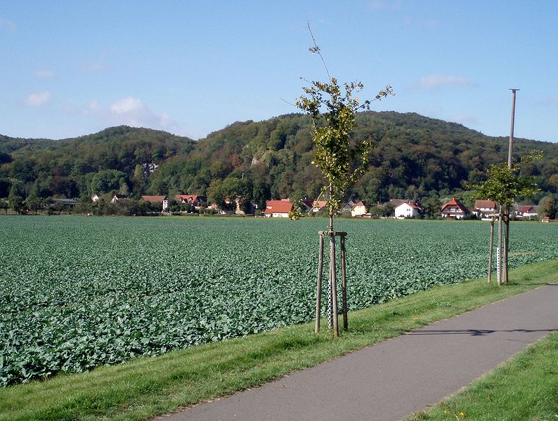
The village of
Stempeda, Germany, with the Alter Stolberg heights and nature reserve
236:
207:
381:
174:
646:
641:
73:
42:
373:
761:
766:
614:
Click on a date/time to view the file as it appeared at that time.
756:
238:
157:
Die
Ortschaft Stempeda mit dem Naturschutzgebiet Altem Stolberg
225:
51° 31′ 37.5″ N, 10° 54′ 31.5″ E
215:
97:
796:
726:
357:
751:
341:
https://creativecommons.org/licenses/by-sa/2.0/de/deed.en
776:
405:
Add a one-line explanation of what this file represents
721:
87:(3,007 × 2,271 pixels, file size: 1.09 MB, MIME type:
856:
826:
816:
806:
786:
746:
871:
866:
141:
121:
Commons is a freely licensed media file repository.
491:
Creative
Commons Attribution-ShareAlike 2.0 Germany
376:. All following user names refer to de.wikipedia.
347:Creative Commons Attribution-Share Alike 2.0 de
102:
271:
8:
307:– to copy, distribute and transmit the work
889:
616:
401:
230:
694:The following other wikis use this file:
891:
684:List of mountains and hills of the Harz
676:
576:
566:
550:
524:
508:
488:
472:
452:
436:
419:
416:
397:
390:
218:
245:View this and other nearby images on:
7:
605:
294:Attribution-Share Alike 2.0 Germany
282:
277:
882:
410:
404:
372:The original description page was
371:
268:
159:
151:
134:
80:
409:
395:
318:Under the following conditions:
289:This file is licensed under the
281:
276:
270:
251:
237:
101:
31:
21:
392:
160:
14:
391:
152:
26:
1:
553:coordinates of depicted place
36:
568:51°31'37.49"N, 10°54'31.50"E
417:Items portrayed in this file
793:Usage on lld.wikipedia.org
773:Usage on de.wikivoyage.org
718:Usage on ceb.wikipedia.org
698:Usage on arz.wikipedia.org
384:3007×2271× (1146692 bytes)
913:
863:Usage on www.wikidata.org
853:Usage on uz.wikipedia.org
843:Usage on tt.wikipedia.org
833:Usage on ru.wikipedia.org
823:Usage on ro.wikipedia.org
813:Usage on pt.wikipedia.org
803:Usage on nl.wikipedia.org
783:Usage on eo.wikipedia.org
743:Usage on de.wikipedia.org
733:Usage on ce.wikipedia.org
708:Usage on ba.wikipedia.org
332:same or compatible license
606:
16:
762:Liste von Bergen im Harz
394:
298:
108:This is a file from the
767:Benutzer:Drekamu/TH-NDH
663:
642:21:20, 30 December 2009
190:
180:
173:
170:
144:
112:. Information from its
362:
257:51.527083; 10.908750
208:Link to Openstreetmap
115:description page there
46:Size of this preview:
361:
74:3,007 × 2,271 pixels
70:2,560 × 1,933 pixels
757:Grafschaft Stolberg
368:Original upload log
313:– to adapt the work
201:Openstreetmap entry
52:Other resolutions:
363:
66:1,280 × 967 pixels
62:1,017 × 768 pixels
900:
899:
690:Global file usage
667:
475:copyright license
403:
380:2006-10-08 18:47
262:
261:
213:
212:
185:Self-photographed
130:
129:
110:Wikimedia Commons
32:Global file usage
904:
890:
654:
593:
588:
439:copyright status
360:
354:
351:
348:
345:
342:
334:as the original.
291:Creative Commons
285:
284:
280:
279:
274:
273:
258:
255:
241:
240:
234:
228:
227:
216:
186:
176:
164:
156:
148:
142:
126:
105:
104:
98:
92:
90:
77:
58:636 × 480 pixels
54:318 × 240 pixels
48:794 × 600 pixels
912:
911:
907:
906:
905:
903:
902:
901:
878:
702:ستولبرج القديمه
688:
675:
668:
660:
652:
608:
607:
604:
603:
602:
601:
600:
599:
598:
597:
596:
595:
594:
589:
586:
573:
572:
571:
569:
559:
558:
557:
555:
536:
535:
534:
533:
532:
531:
530:
529:
527:
517:
516:
515:
513:
502:
501:
500:
499:
498:
497:
496:
495:
493:
481:
480:
479:
477:
466:
465:
464:
463:
462:
461:
460:
459:
457:
445:
444:
443:
441:
430:
429:
428:
427:
426:
424:
408:
407:
406:
377:
370:
365:
364:
358:
355:
352:
349:
346:
344:CC BY-SA 2.0 de
343:
340:
339:
297:
286:
267:
256:
223:
222:
219:Object location
214:
204:
195:Benutzer:Hejkal
184:
166:
158:
146:
139:
132:
131:
120:
119:
118:is shown below.
94:
88:
86:
79:
78:
51:
12:
11:
5:
910:
908:
898:
897:
894:
881:
877:
876:
875:
874:
869:
861:
860:
859:
851:
850:
849:
841:
840:
839:
831:
830:
829:
821:
820:
819:
811:
810:
809:
801:
800:
799:
797:Alter Stolberg
791:
790:
789:
781:
780:
779:
771:
770:
769:
764:
759:
754:
752:Alter Stolberg
749:
741:
740:
739:
731:
730:
729:
727:Alter Stolberg
724:
716:
715:
714:
706:
705:
704:
692:
691:
687:
686:
681:
679:Alter Stolberg
673:
672:
671:
666:
665:
662:
658:
655:
651:3,007 × 2,271
649:
644:
639:
635:
634:
631:
628:
625:
622:
619:
612:
611:
582:
581:
580:
579:
578:
575:
574:
570:
567:
565:
564:
563:
562:
561:
560:
556:
551:
549:
548:
547:
546:
544:
540:
528:
526:8 October 2006
525:
523:
522:
521:
520:
519:
518:
514:
509:
507:
506:
505:
504:
503:
494:
489:
487:
486:
485:
484:
483:
482:
478:
473:
471:
470:
469:
468:
467:
458:
453:
451:
450:
449:
448:
447:
446:
442:
437:
435:
434:
433:
432:
431:
425:
420:
418:
415:
414:
413:
412:
411:
400:
399:
396:
393:
389:
388:
369:
366:
356:
338:
337:
336:
335:
325:
316:
315:
314:
308:
301:You are free:
288:
287:
269:
266:
263:
260:
259:
249:
243:
220:
211:
210:
205:
202:
198:
197:
192:
188:
187:
182:
178:
177:
175:8 October 2006
172:
168:
167:
149:
140:
138:
135:
133:
128:
127:
106:
96:
95:
45:
41:
40:
39:
34:
29:
24:
19:
13:
10:
9:
6:
4:
3:
2:
909:
895:
892:
888:
885:
879:
873:
870:
868:
865:
864:
862:
858:
855:
854:
852:
848:
845:
844:
842:
838:
835:
834:
832:
828:
825:
824:
822:
818:
815:
814:
812:
808:
805:
804:
802:
798:
795:
794:
792:
788:
785:
784:
782:
778:
775:
774:
772:
768:
765:
763:
760:
758:
755:
753:
750:
748:
745:
744:
742:
738:
735:
734:
732:
728:
725:
723:
720:
719:
717:
713:
710:
709:
707:
703:
700:
699:
697:
696:
695:
689:
685:
682:
680:
677:
669:
661:
656:
650:
648:
645:
643:
640:
637:
636:
632:
629:
626:
623:
620:
618:
617:
615:
609:
592:
591:OpenStreetMap
585:
554:
543:OpenStreetMap
512:
492:
476:
456:
440:
423:
387:
383:
379:
378:
375:
367:
333:
329:
326:
323:
320:
319:
317:
312:
309:
306:
303:
302:
300:
299:
295:
292:
275:
264:
254:
250:
248:
247:OpenStreetMap
244:
242:
233:
226:
221:
217:
209:
206:
200:
199:
196:
193:
189:
183:
179:
169:
163:
155:
150:
143:
136:
124:
117:
116:
111:
107:
100:
99:
93:
84:
83:Original file
75:
71:
67:
63:
59:
55:
49:
44:
38:
35:
33:
30:
28:
25:
23:
20:
18:
15:
886:
883:
693:
613:
610:File history
385:
327:
321:
310:
304:
161:
153:
147:Stempeda.jpg
123:You can help
113:
81:
22:File history
455:copyrighted
328:share alike
322:attribution
145:Description
893:_error
777:Nordhausen
670:File usage
659:Bermicourt
627:Dimensions
89:image/jpeg
27:File usage
653:(1.09 MB)
624:Thumbnail
621:Date/Time
584:stated in
577:Reference
539:stated in
511:inception
265:Licensing
203:InfoField
162:English:
154:Deutsch:
880:Metadata
857:Stempeda
847:Штемпеда
837:Штемпеда
827:Stempeda
817:Stempeda
807:Stempeda
787:Stempeda
747:Stempeda
737:Штемпеда
722:Stempeda
712:Штемпеда
398:Captions
311:to remix
305:to share
296:license.
37:Metadata
872:Q705004
867:Q438193
638:current
633:Comment
422:depicts
402:English
137:Summary
85:
382:Hejkal
235:
229:
191:Author
181:Source
630:User
374:here
353:true
350:true
171:Date
17:File
587::
72:|
68:|
64:|
60:|
56:|
50:.
896:0
125:.
91:)
76:.
Text is available under the Creative Commons Attribution-ShareAlike License. Additional terms may apply.
