38:
221:
227:
232:
94:
506:
279:– You must give appropriate credit, provide a link to the license, and indicate if changes were made. You may do so in any reasonable manner, but not in any way that suggests the licensor endorses you or your use.
632:
549:
657:
68:
64:
60:
56:
52:
48:
42:
210:
105:
77:
417:
381:
637:
286:
365:
437:
401:
348:
183:
242:
727:
285:– If you remix, transform, or build upon the material, you must distribute your contributions under the
239:
697:
170:
113:
737:
531:
highlighted. Equirectangular map projection on WGS 84 datum, with N/S stretched 160% |Source=
505:
500:
37:
167:
747:
532:
572:
602:
516:
139:
524:
100:
198:
187:
156:
143:
554:
528:
148:
Equirectangular map projection on WGS 84 datum, with N/S stretched 160%
176:
Coastline and administrative boundary data from
Boundary-Line product.
473:
Click on a date/time to view the file as it appeared at that time.
592:
250:
Contains
Ordnance Survey data © Crown copyright and database right
647:
707:
88:
622:
82:(SVG file, nominally 1,425 × 992 pixels, file size: 846 KB)
332:
Add a one-line explanation of what this file represents
717:
687:
677:
667:
612:
582:
418:
Creative
Commons Attribution-ShareAlike 3.0 Unported
127:
112:
Commons is a freely licensed media file repository.
296:https://creativecommons.org/licenses/by-sa/3.0
93:
302:Creative Commons Attribution-Share Alike 3.0
220:
8:
262:– to copy, distribute and transmit the work
41:Size of this PNG preview of this SVG file:
550:2021 Hertfordshire County Council election
475:
328:
565:The following other wikis use this file:
547:
451:
435:
415:
399:
379:
363:
346:
343:
324:
317:
545:The following 2 pages use this file:
7:
243:Attribution-Share Alike 3.0 Unported
201:, created using Ordnance Survey data
464:
231:
226:
523:{{Information |Description=Map of
337:
331:
217:
179:Lake data from Meridian 2 product.
125:
75:
336:
322:
273:Under the following conditions:
238:This file is licensed under the
230:
225:
219:
92:
31:
21:
319:
14:
734:Usage on zh-yue.wikipedia.org
318:
26:
1:
344:Items portrayed in this file
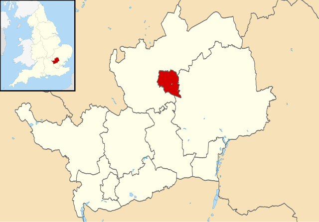
133:Stevenage UK locator map.svg
619:Usage on frr.wikipedia.org
569:Usage on azb.wikipedia.org
766:
744:Usage on zh.wikipedia.org
724:Usage on ur.wikipedia.org
714:Usage on tr.wikipedia.org
704:Usage on sv.wikipedia.org
694:Usage on ru.wikipedia.org
684:Usage on pl.wikipedia.org
674:Usage on no.wikipedia.org
664:Usage on nl.wikipedia.org
654:Usage on ml.wikipedia.org
644:Usage on lv.wikipedia.org
629:Usage on ja.wikipedia.org
609:Usage on fi.wikipedia.org
599:Usage on fa.wikipedia.org
589:Usage on cy.wikipedia.org
579:Usage on bs.wikipedia.org
287:same or compatible license
465:
16:
321:
253:
184:England location map.svg
99:This is a file from the
522:
205:
194:
162:
155:
152:
130:
103:. Information from its
633:Category:スティーブニッジ出身の人物
106:description page there
593:Bwrdeistref Stevenage
535:[https://www.ordnanc
501:22:51, 3 August 2011
65:2,560 × 1,782 pixels
268:– to adapt the work
182:Inset derived from
47:Other resolutions:
708:Stevenage District
69:1,425 × 992 pixels
61:1,280 × 891 pixels
57:1,024 × 713 pixels
638:Category:スティーブニッジ
561:Global file usage
538:
402:copyright license
330:
315:
314:
214:
211:Reusing this file
121:
120:
101:Wikimedia Commons
32:Global file usage
757:
513:
366:copyright status
309:
306:
303:
300:
297:
289:as the original.
251:
240:Creative Commons
234:
233:
229:
228:
223:
222:
208:
158:
134:
128:
117:
96:
95:
89:
83:
72:
53:640 × 446 pixels
49:320 × 223 pixels
43:800 × 557 pixels
765:
764:
760:
759:
758:
756:
755:
754:
559:
539:
533:Ordnance Survey
519:
511:
467:
466:
463:
462:
461:
460:
459:
458:
457:
456:
454:
444:
443:
442:
440:
429:
428:
427:
426:
425:
424:
423:
422:
420:
408:
407:
406:
404:
393:
392:
391:
390:
389:
388:
387:
386:
384:
372:
371:
370:
368:
357:
356:
355:
354:
353:
351:
335:
334:
333:
316:
311:
310:
307:
304:
301:
298:
295:
294:
252:
249:
246:
235:
168:Ordnance Survey
132:
123:
122:
111:
110:
109:is shown below.
85:
81:
74:
73:
46:
12:
11:
5:
763:
761:
753:
752:
751:
750:
742:
741:
740:
732:
731:
730:
722:
721:
720:
712:
711:
710:
702:
701:
700:
692:
691:
690:
682:
681:
680:
672:
671:
670:
662:
661:
660:
652:
651:
650:
642:
641:
640:
635:
627:
626:
625:
617:
616:
615:
607:
606:
605:
597:
596:
595:
587:
586:
585:
577:
576:
575:
563:
562:
558:
557:
552:
543:
542:
537:
536:
521:
517:
514:
508:
503:
498:
494:
493:
490:
487:
484:
481:
478:
471:
470:
455:
452:
450:
449:
448:
447:
446:
445:
441:
436:
434:
433:
432:
431:
430:
421:
416:
414:
413:
412:
411:
410:
409:
405:
400:
398:
397:
396:
395:
394:
385:
380:
378:
377:
376:
375:
374:
373:
369:
364:
362:
361:
360:
359:
358:
352:
347:
345:
342:
341:
340:
339:
338:
327:
326:
323:
320:
313:
312:
293:
292:
291:
290:
280:
271:
270:
269:
263:
256:You are free:
247:
237:
236:
218:
215:
203:
202:
196:
192:
191:
181:
180:
177:
164:
160:
159:
154:
150:
149:
135:
126:
124:
119:
118:
97:
87:
86:
40:
36:
35:
34:
29:
24:
19:
13:
10:
9:
6:
4:
3:
2:
762:
749:
746:
745:
743:
739:
736:
735:
733:
729:
726:
725:
723:
719:
716:
715:
713:
709:
706:
705:
703:
699:
696:
695:
693:
689:
686:
685:
683:
679:
676:
675:
673:
669:
666:
665:
663:
659:
656:
655:
653:
649:
646:
645:
643:
639:
636:
634:
631:
630:
628:
624:
623:Hertfordshire
621:
620:
618:
614:
611:
610:
608:
604:
601:
600:
598:
594:
591:
590:
588:
584:
581:
580:
578:
574:
571:
570:
568:
567:
566:
560:
556:
553:
551:
548:
546:
540:
534:
530:
526:
525:Hertfordshire
520:
515:
509:
507:
504:
502:
499:
496:
495:
491:
488:
485:
482:
479:
477:
476:
474:
468:
453:3 August 2011
439:
419:
403:
383:
367:
350:
299:CC BY-SA 3.0
288:
284:
281:
278:
275:
274:
272:
267:
264:
261:
258:
257:
255:
254:
248:Attribution:
244:
241:
224:
216:
212:
207:
204:
200:
197:
193:
189:
185:
178:
175:
174:
173:
172:
169:
165:
161:
157:3 August 2011
151:
147:
146:highlighted.
145:
141:
140:Hertfordshire
136:
129:
115:
108:
107:
102:
98:
91:
90:
84:
79:
78:Original file
70:
66:
62:
58:
54:
50:
44:
39:
33:
30:
28:
25:
23:
20:
18:
15:
564:
544:
510:1,425 × 992
472:
469:File history
282:
276:
265:
259:
166:
137:
114:You can help
104:
76:
22:File history
658:സ്റ്റീവനേജ്
382:copyrighted
283:share alike
277:attribution
131:Description
728:اسٹیوینڈیج
648:Stīvenidža
541:File usage
527:, UK with
486:Dimensions
206:Permission
142:, UK with
27:File usage
718:Stevenage
698:Стивенидж
688:Stevenage
678:Stevenage
668:Stevenage
613:Stevenage
583:Stevenage
555:Stevenage
529:Stevenage
518:Nilfanion
483:Thumbnail
480:Date/Time
438:inception
199:Nilfanion
144:Stevenage
512:(846 KB)
325:Captions
266:to remix
260:to share
245:license.
188:Spischot
171:OpenData
603:استیونج
573:استیونج
497:current
492:Comment
349:depicts
329:English
138:Map of
80:
195:Author
163:Source
748:斯蒂夫尼奇
738:史提芬尼治
489:User
308:true
305:true
153:Date
17:File
186:by
67:|
63:|
59:|
55:|
51:|
45:.
213:)
209:(
190:.
116:.
71:.
Text is available under the Creative Commons Attribution-ShareAlike License. Additional terms may apply.
