1037:
317:
255:
205:
1042:
247:
197:
269:
219:
285:
323:
328:
67:
793:"}},"text\/plain":{"en":{"":"heading"}}},"{\"value\":{\"amount\":\"+45\",\"unit\":\"http:\\\/\\\/www.wikidata.org\\\/entity\\\/Q28390\"},\"type\":\"quantity\"}":{"text\/html":{"en":{"P7787":"45
729:"}},"text\/plain":{"en":{"":"heading"}}},"{\"value\":{\"amount\":\"+45\",\"unit\":\"http:\\\/\\\/www.wikidata.org\\\/entity\\\/Q28390\"},\"type\":\"quantity\"}":{"text\/html":{"en":{"P7787":"45
1007:
725:
238:
979:
188:
38:
375:– You must give appropriate credit, provide a link to the license, and indicate if changes were made. You may do so in any reasonable manner, but not in any way that suggests the licensor endorses you or your use.
984:
78:
46:
790:
726:
969:
974:
964:
166:
116:
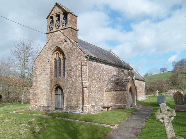
St Mary
Magdalen parish church, Stocklinch, Somerset: view from the southwest, showing the bell-gable and 15th-century west window
627:
591:
555:
262:
212:
662:
292:
382:
939:
518:
860:
831:
804:
767:
740:
640:
611:
539:
511:
496:
483:
698:
670:
655:
575:
456:
439:
928:
923:
279:
37:
338:
1038:Участник:Elrond1 2eleven/Черновик/Список церквей в Юго-Западной Англии, сохранённых Фондом сохранения церквей
960:
The following pages on the
English Knowledge (XXG) use this file (pages on other projects are not listed):
381:– If you remix, transform, or build upon the material, you must distribute your contributions under the
299:
on the
Geograph website for the photographer's contact details. The copyright on this image is owned by
335:
797:"}},"text\/plain":{"en":{"P7787":"45 degree"}}}}": -->
733:"}},"text\/plain":{"en":{"P7787":"45 degree"}}}}": -->
947:
86:
503:
677:
647:
140:
268:
218:
304:
73:
980:
List of churches preserved by the
Churches Conservation Trust in Southwest England
202:
125:
989:
252:
155:
1043:Список церквей в Юго-Западной Англии, сохранённых Фондом сохранения церквей
136:
946:{{Information |Description=Stocklinch Church |Source=From ; transferd by
284:
296:
896:
Click on a date/time to view the file as it appeared at that time.
1052:
985:
List of ecclesiastical parishes in the
Diocese of Bath and Wells
254:
204:
189:
50° 57′ 01.67″ N, 2° 52′ 48.01″ W
144:
229:
179:
61:
1008:كنيسه القديسه مريم المجدليه (سوث سوميرسيت, المملكه المتحده)
239:
50° 57′ 03″ N, 2° 52′ 47″ W
1077:
1062:
1027:
1017:
423:
Add a one-line explanation of what this file represents
1072:
173:
Creative
Commons Attribution Share-alike license 2.0
100:
85:
Commons is a freely licensed media file repository.
592:
Creative
Commons Attribution-ShareAlike 2.0 Generic
106:Stocklinch Church - geograph.org.uk - 734531.jpg
51:(640 × 480 pixels, file size: 88 KB, MIME type:
47:Stocklinch_Church_-_geograph.org.uk_-_734531.jpg
392:https://creativecommons.org/licenses/by-sa/2.0
66:
398:Creative Commons Attribution-Share Alike 2.0
316:
8:
970:Grade II* listed buildings in South Somerset
794:
730:
358:– to copy, distribute and transmit the work
975:Grade I listed buildings in South Somerset
898:
419:
1000:The following other wikis use this file:
504:https://www.geograph.org.uk/profile/19464
678:https://www.geograph.org.uk/photo/734531
965:Church of St Mary Magdalene, Stocklinch
962:
874:
858:
818:
802:
754:
738:
712:
696:
625:
609:
589:
573:
553:
537:
470:
454:
437:
434:
415:
408:
232:
182:
261:View this and other nearby images on:
211:View this and other nearby images on:
7:
303:and is licensed for reuse under the
887:
339:Attribution-Share Alike 2.0 Generic
327:
322:
307:Attribution-ShareAlike 2.0 license.
428:
422:
313:
290:
110:
98:
44:
427:
741:coordinates of the point of view
413:
369:Under the following conditions:
334:This file is licensed under the
326:
321:
315:
283:
267:
253:
245:
217:
203:
195:
65:
31:
21:
941:File Upload Bot (Magnus Manske)
410:
111:
41:No higher resolution available.
14:
628:file available on the internet
409:
291:This image was taken from the
26:
1:
805:coordinates of depicted place
756:50°57'1.670"N, 2°52'48.007"W
663:Geograph Britain and Ireland
512:object of statement has role
435:Items portrayed in this file
1004:Usage on arz.wikipedia.org
244:
194:
1096:
1069:Usage on www.wikidata.org
1059:Usage on tr.wikipedia.org
1049:Usage on sv.wikipedia.org
1034:Usage on ru.wikipedia.org
1024:Usage on pl.wikipedia.org
1014:Usage on nl.wikipedia.org
820:50°57'2.81"N, 2°52'46.92"W
383:same or compatible license
888:
16:
950:using . |Date=2008-03-21
641:geograph.org.uk image ID
412:
349:
72:This is a file from the
945:
161:
151:
131:
124:
121:
103:
76:. Information from its
297:this photograph's page
273:50.950780; -2.879700
223:50.950464; -2.880002
79:description page there
145:geograph_org2commons
1053:Stocklinch Magdalen
924:22:59, 9 March 2009
364:– to adapt the work
948:User:Magnus Manske
484:author name string
141:User:Magnus Manske
996:Global file usage
953:
796:
732:
576:copyright license
421:
312:
311:
295:collection. See
278:
277:
228:
227:
177:
176:
170:
167:Reusing this file
139:; transferred by
94:
93:
74:Wikimedia Commons
32:Global file usage
1087:
936:
842:
841:
836:
778:
777:
772:
680:
675:
671:described at URL
665:
660:
650:
645:
540:copyright status
521:
516:
506:
501:
491:
488:
405:
402:
399:
396:
393:
385:as the original.
347:
336:Creative Commons
330:
329:
325:
324:
319:
318:
305:Creative Commons
293:Geograph project
287:
280:
274:
271:
257:
256:
250:
249:
248:
242:
241:
230:
224:
221:
207:
206:
200:
199:
198:
192:
191:
180:
164:
127:
115:
107:
101:
90:
69:
68:
62:
56:
54:
1095:
1094:
1090:
1089:
1088:
1086:
1085:
1084:
994:
961:
954:
942:
934:
890:
889:
886:
885:
884:
883:
882:
881:
880:
879:
877:
867:
866:
865:
863:
852:
851:
850:
849:
848:
847:
846:
845:
844:
843:
839:
837:
834:
825:
824:
823:
821:
811:
810:
809:
807:
788:
787:
786:
785:
784:
783:
782:
781:
780:
779:
775:
773:
770:
761:
760:
759:
757:
747:
746:
745:
743:
724:
723:
722:
721:
720:
719:
718:
717:
715:
705:
704:
703:
701:
690:
689:
688:
687:
686:
685:
684:
683:
682:
681:
676:
673:
667:
666:
661:
658:
652:
651:
646:
643:
634:
633:
632:
630:
618:
617:
616:
614:
603:
602:
601:
600:
599:
598:
597:
596:
594:
582:
581:
580:
578:
567:
566:
565:
564:
563:
562:
561:
560:
558:
546:
545:
544:
542:
531:
530:
529:
528:
527:
526:
525:
524:
523:
522:
517:
514:
508:
507:
502:
499:
493:
492:
489:
486:
477:
476:
475:
473:
463:
462:
461:
459:
448:
447:
446:
445:
444:
442:
426:
425:
424:
407:
406:
403:
400:
397:
394:
391:
390:
348:
345:
342:
331:
308:
272:
246:
237:
236:
233:Object location
222:
196:
187:
186:
183:Camera location
178:
137:geograph.org.uk
117:
105:
96:
95:
84:
83:
82:is shown below.
58:
52:
50:
43:
42:
12:
11:
5:
1093:
1091:
1083:
1082:
1081:
1080:
1075:
1067:
1066:
1065:
1057:
1056:
1055:
1047:
1046:
1045:
1040:
1032:
1031:
1030:
1022:
1021:
1020:
1012:
1011:
1010:
998:
997:
993:
992:
987:
982:
977:
972:
967:
959:
958:
957:
952:
951:
944:
940:
937:
931:
926:
921:
917:
916:
913:
910:
907:
904:
901:
894:
893:
878:
875:
873:
872:
871:
870:
869:
868:
864:
859:
857:
856:
855:
854:
853:
830:
829:
828:
827:
826:
822:
819:
817:
816:
815:
814:
813:
812:
808:
803:
801:
800:
799:
798:
792:
766:
765:
764:
763:
762:
758:
755:
753:
752:
751:
750:
749:
748:
744:
739:
737:
736:
735:
734:
728:
716:
713:
711:
710:
709:
708:
707:
706:
702:
697:
695:
694:
693:
692:
691:
669:
668:
654:
653:
639:
638:
637:
636:
635:
631:
626:
624:
623:
622:
621:
620:
619:
615:
612:source of file
610:
608:
607:
606:
605:
604:
595:
590:
588:
587:
586:
585:
584:
583:
579:
574:
572:
571:
570:
569:
568:
559:
554:
552:
551:
550:
549:
548:
547:
543:
538:
536:
535:
534:
533:
532:
510:
509:
495:
494:
482:
481:
480:
479:
478:
474:
471:
469:
468:
467:
466:
465:
464:
460:
455:
453:
452:
451:
450:
449:
443:
438:
436:
433:
432:
431:
430:
429:
418:
417:
414:
411:
389:
388:
387:
386:
376:
367:
366:
365:
359:
352:You are free:
343:
333:
332:
314:
310:
309:
288:
276:
275:
265:
259:
234:
226:
225:
215:
209:
184:
175:
174:
171:
159:
158:
153:
149:
148:
133:
129:
128:
123:
119:
118:
108:
99:
97:
92:
91:
70:
60:
59:
40:
36:
35:
34:
29:
24:
19:
13:
10:
9:
6:
4:
3:
2:
1092:
1079:
1076:
1074:
1071:
1070:
1068:
1064:
1061:
1060:
1058:
1054:
1051:
1050:
1048:
1044:
1041:
1039:
1036:
1035:
1033:
1029:
1026:
1025:
1023:
1019:
1016:
1015:
1013:
1009:
1006:
1005:
1003:
1002:
1001:
995:
991:
988:
986:
983:
981:
978:
976:
973:
971:
968:
966:
963:
955:
949:
943:
938:
932:
930:
927:
925:
922:
919:
918:
914:
911:
908:
905:
902:
900:
899:
897:
891:
862:
833:
806:
769:
742:
714:21 March 2008
700:
679:
672:
664:
657:
649:
642:
629:
613:
593:
577:
557:
541:
520:
513:
505:
498:
485:
458:
441:
395:CC BY-SA 2.0
384:
380:
377:
374:
371:
370:
368:
363:
360:
357:
354:
353:
351:
350:
344:Attribution:
340:
337:
320:
306:
302:
298:
294:
289:
286:
282:
281:
270:
266:
264:
263:OpenStreetMap
260:
258:
240:
235:
231:
220:
216:
214:
213:OpenStreetMap
210:
208:
190:
185:
181:
172:
168:
163:
160:
157:
154:
150:
146:
142:
138:
134:
130:
126:21 March 2008
120:
114:
109:
102:
88:
81:
80:
75:
71:
64:
63:
57:
48:
39:
33:
30:
28:
25:
23:
20:
18:
15:
999:
895:
892:File history
519:photographer
378:
372:
361:
355:
300:
243:
193:
112:
87:You can help
77:
45:
22:File history
556:copyrighted
490:Andy Pearce
379:share alike
373:attribution
346:Andy Pearce
301:Andy Pearce
156:Andy Pearce
104:Description
1078:Q128802900
1063:Stocklinch
1028:Stocklinch
1018:Stocklinch
990:Stocklinch
956:File usage
933:640 × 480
909:Dimensions
876:image/jpeg
861:media type
472:some value
162:Permission
53:image/jpeg
27:File usage
906:Thumbnail
903:Date/Time
699:inception
113:English:
1073:Q5117556
656:operator
416:Captions
362:to remix
356:to share
341:license.
935:(88 KB)
920:current
915:Comment
832:heading
791:heading
768:heading
727:heading
457:creator
440:depicts
420:English
49:
840:degree
795:degree
776:degree
731:degree
648:734531
251:
201:
152:Author
143:using
132:Source
135:From
912:User
404:true
401:true
122:Date
17:File
838:45
774:45
497:URL
835::
771::
674::
659::
644::
515::
500::
487::
169:)
165:(
147:.
89:.
55:)
Text is available under the Creative Commons Attribution-ShareAlike License. Additional terms may apply.
_region:GB-EAW_heading:45.00&language=en)
