348:
281:
231:
273:
223:
295:
245:
316:
354:
359:
72:
824:"}},"text\/plain":{"en":{"":"heading"}}},"{\"value\":{\"amount\":\"+67\",\"unit\":\"http:\\\/\\\/www.wikidata.org\\\/entity\\\/Q28390\"},\"type\":\"quantity\"}":{"text\/html":{"en":{"P7787":"67
760:"}},"text\/plain":{"en":{"":"heading"}}},"{\"value\":{\"amount\":\"+67\",\"unit\":\"http:\\\/\\\/www.wikidata.org\\\/entity\\\/Q28390\"},\"type\":\"quantity\"}":{"text\/html":{"en":{"P7787":"67
820:
264:
214:
43:
406:– You must give appropriate credit, provide a link to the license, and indicate if changes were made. You may do so in any reasonable manner, but not in any way that suggests the licensor endorses you or your use.
83:
51:
821:
757:
943:== {{int:filedesc}} == {{Information |description={{en|1=Strathkelvin Railway Path}} |date=2007-05-18 |source=From |author= |permission= |ot
658:
622:
586:
288:
238:
678:
1143:
323:
998:
This file contains additional information, probably added from the digital camera or scanner used to create or digitize it.
413:
925:
920:
549:
42:
862:
835:
798:
771:
701:
642:
570:
542:
529:
514:
729:
686:
671:
606:
487:
470:
310:
957:
369:
1001:
If the file has been modified from its original state, some details may not fully reflect the modified file.
953:
The following pages on the
English Knowledge (XXG) use this file (pages on other projects are not listed):
1178:
412:– If you remix, transform, or build upon the material, you must distribute your contributions under the
330:
on the
Geograph website for the photographer's contact details. The copyright on this image is owned by
936:
366:
1214:
828:"}},"text\/plain":{"en":{"P7787":"67 degree"}}}}": -->
764:"}},"text\/plain":{"en":{"P7787":"67 degree"}}}}": -->
91:
183:
1287:
708:
693:
521:
167:
1112:
294:
244:
1250:
1196:
1035:
335:
78:
1297:
1260:
1075:
1224:
135:
1055:
278:
228:
1028:
156:
146:
1307:
1045:
315:
327:
893:
Click on a date/time to view the file as it appeared at that time.
1018:
280:
230:
255:
205:
66:
975:
265:
55° 57′ 11″ N, 4° 09′ 01″ W
215:
55° 57′ 11″ N, 4° 09′ 02″ W
116:
Strathkelvin
Railway Path - geograph.org.uk - 437812.jpg
52:
Strathkelvin_Railway_Path_-_geograph.org.uk_-_437812.jpg
454:
Add a one-line explanation of what this file represents
985:
110:
90:
Commons is a freely licensed media file repository.
623:
Creative
Commons Attribution-ShareAlike 2.0 Generic
56:(640 × 428 pixels, file size: 135 KB, MIME type:
423:https://creativecommons.org/licenses/by-sa/2.0
71:
429:Creative Commons Attribution-Share Alike 2.0
347:
8:
825:
761:
389:– to copy, distribute and transmit the work
1003:
895:
450:
968:The following other wikis use this file:
694:https://www.geograph.org.uk/photo/437812
522:https://www.geograph.org.uk/profile/9875
1305:
1295:
1285:
1277:
1269:
1258:
1248:
1240:
1232:
1222:
1212:
1204:
1194:
1186:
1176:
1168:
1160:
1152:
1141:
1133:
1125:
1117:
1107:
1099:
1091:
1083:
1072:
1064:
1053:
1043:
1033:
1023:
1005:
955:
849:
833:
785:
769:
743:
727:
656:
640:
620:
604:
584:
568:
501:
485:
468:
465:
446:
439:
258:
208:
287:View this and other nearby images on:
237:View this and other nearby images on:
1013:
7:
334:and is licensed for reuse under the
884:
370:Attribution-Share Alike 2.0 Generic
358:
353:
338:Attribution-ShareAlike 2.0 license.
996:
459:
453:
344:
321:
120:
103:
49:
458:
1066:Date and time of data generation
772:coordinates of the point of view
444:
400:Under the following conditions:
365:This file is licensed under the
357:
352:
346:
314:
293:
279:
271:
243:
229:
221:
70:
31:
21:
441:
121:
46:No higher resolution available.
14:
659:file available on the internet
440:
322:This image was taken from the
26:
1:
1219:Flash did not fire, auto mode
1010:SONY DSC
836:coordinates of depicted place
36:
679:Geograph Britain and Ireland
543:object of statement has role
466:Items portrayed in this file
196:Raymond Okonski /
177:Raymond Okonski /
1154:Date and time of digitizing
972:Usage on en.wikivoyage.org
270:
220:
1329:
1271:Focal length in 35 mm film
982:Usage on www.wikidata.org
414:same or compatible license
1119:File change date and time
958:Strathkelvin Railway Path
885:
851:55°57'11.02"N, 4°9'1.08"W
787:55°57'10.66"N, 4°9'2.16"W
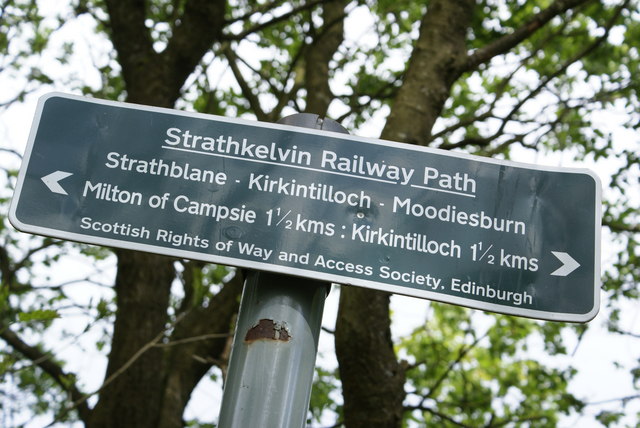
198:Strathkelvin Railway Path
179:Strathkelvin Railway Path
126:Strathkelvin Railway Path
16:
702:geograph.org.uk image ID
443:
380:
77:This is a file from the
1234:Custom image processing
942:
168:required by the license
152:
141:
134:
131:
113:
81:. Information from its
1162:Image compression mode
921:09:07, 4 February 2011
328:this photograph's page
299:55.953060; -4.150300
249:55.952960; -4.150600
84:description page there
1188:Maximum land aperture
1093:Horizontal resolution
1127:Y and C positioning
1101:Vertical resolution
1040:1/160 sec (0.00625)
1015:Camera manufacturer
395:– to adapt the work
1279:Scene capture type
1255:Auto white balance
1157:15:06, 18 May 2007
1122:15:06, 18 May 2007
1069:15:06, 18 May 2007
530:author name string
1316:
1315:
1191:4.97 APEX (f/5.6)
964:Global file usage
946:
827:
763:
607:copyright license
452:
343:
342:
326:collection. See
304:
303:
254:
253:
203:
202:
171:
99:
98:
79:Wikimedia Commons
32:Global file usage
1320:
1135:Exposure Program
1004:
933:
873:
872:
867:
809:
808:
803:
711:
706:
696:
691:
687:described at URL
681:
676:
571:copyright status
552:
547:
537:
534:
524:
519:
436:
433:
430:
427:
424:
416:as the original.
378:
367:Creative Commons
361:
360:
356:
355:
350:
349:
336:Creative Commons
324:Geograph project
318:
311:
300:
297:
283:
282:
276:
275:
274:
268:
267:
256:
250:
247:
233:
232:
226:
225:
224:
218:
217:
206:
165:
137:
125:
117:
111:
95:
74:
73:
67:
61:
59:
1328:
1327:
1323:
1322:
1321:
1319:
1318:
1317:
1170:APEX brightness
1113:DSLR-A100 v1.00
992:
962:
954:
947:
939:
931:
887:
886:
883:
882:
881:
880:
879:
878:
877:
876:
875:
874:
870:
868:
865:
856:
855:
854:
852:
842:
841:
840:
838:
819:
818:
817:
816:
815:
814:
813:
812:
811:
810:
806:
804:
801:
792:
791:
790:
788:
778:
777:
776:
774:
755:
754:
753:
752:
751:
750:
749:
748:
746:
736:
735:
734:
732:
721:
720:
719:
718:
717:
716:
715:
714:
713:
712:
707:
704:
698:
697:
692:
689:
683:
682:
677:
674:
665:
664:
663:
661:
649:
648:
647:
645:
634:
633:
632:
631:
630:
629:
628:
627:
625:
613:
612:
611:
609:
598:
597:
596:
595:
594:
593:
592:
591:
589:
577:
576:
575:
573:
562:
561:
560:
559:
558:
557:
556:
555:
554:
553:
548:
545:
539:
538:
536:Raymond Okonski
535:
532:
526:
525:
520:
517:
508:
507:
506:
504:
494:
493:
492:
490:
479:
478:
477:
476:
475:
473:
457:
456:
455:
438:
437:
434:
431:
428:
425:
422:
421:
379:
377:Raymond Okonski
376:
373:
362:
339:
332:Raymond Okonski
309:
298:
272:
263:
262:
259:Object location
248:
222:
213:
212:
209:Camera location
204:
193:
186:
174:
157:Raymond Okonski
147:geograph.org.uk
127:
115:
108:
101:
100:
89:
88:
87:is shown below.
63:
57:
55:
48:
47:
12:
11:
5:
1326:
1324:
1314:
1313:
1310:
1304:
1303:
1300:
1294:
1293:
1290:
1284:
1283:
1280:
1276:
1275:
1272:
1268:
1267:
1264:
1257:
1256:
1253:
1247:
1246:
1243:
1239:
1238:
1237:Normal process
1235:
1231:
1230:
1227:
1221:
1220:
1217:
1211:
1210:
1207:
1203:
1202:
1199:
1193:
1192:
1189:
1185:
1184:
1181:
1175:
1174:
1171:
1167:
1166:
1163:
1159:
1158:
1155:
1151:
1150:
1147:
1140:
1139:
1138:Normal program
1136:
1132:
1131:
1128:
1124:
1123:
1120:
1116:
1115:
1110:
1106:
1105:
1102:
1098:
1097:
1094:
1090:
1089:
1086:
1082:
1081:
1078:
1071:
1070:
1067:
1063:
1062:
1059:
1052:
1051:
1048:
1042:
1041:
1038:
1032:
1031:
1026:
1022:
1021:
1016:
1012:
1011:
1008:
995:
991:
990:
989:
988:
980:
979:
978:
966:
965:
961:
960:
952:
951:
950:
945:
944:
941:
937:
934:
928:
923:
918:
914:
913:
910:
907:
904:
901:
898:
891:
890:
861:
860:
859:
858:
857:
853:
850:
848:
847:
846:
845:
844:
843:
839:
834:
832:
831:
830:
829:
823:
797:
796:
795:
794:
793:
789:
786:
784:
783:
782:
781:
780:
779:
775:
770:
768:
767:
766:
765:
759:
747:
744:
742:
741:
740:
739:
738:
737:
733:
728:
726:
725:
724:
723:
722:
700:
699:
685:
684:
670:
669:
668:
667:
666:
662:
657:
655:
654:
653:
652:
651:
650:
646:
643:source of file
641:
639:
638:
637:
636:
635:
626:
621:
619:
618:
617:
616:
615:
614:
610:
605:
603:
602:
601:
600:
599:
590:
585:
583:
582:
581:
580:
579:
578:
574:
569:
567:
566:
565:
564:
563:
541:
540:
528:
527:
513:
512:
511:
510:
509:
505:
502:
500:
499:
498:
497:
496:
495:
491:
486:
484:
483:
482:
481:
480:
474:
469:
467:
464:
463:
462:
461:
460:
449:
448:
445:
442:
420:
419:
418:
417:
407:
398:
397:
396:
390:
383:You are free:
374:
364:
363:
345:
341:
340:
319:
308:
305:
302:
301:
291:
285:
260:
252:
251:
241:
235:
210:
201:
200:
194:
191:
188:
187:
182:
175:
172:
160:
159:
154:
150:
149:
143:
139:
138:
133:
129:
128:
118:
109:
107:
104:
102:
97:
96:
75:
65:
64:
45:
41:
40:
39:
34:
29:
24:
19:
13:
10:
9:
6:
4:
3:
2:
1325:
1311:
1309:
1306:
1301:
1299:
1296:
1291:
1289:
1286:
1281:
1278:
1273:
1270:
1265:
1262:
1259:
1254:
1252:
1251:White balance
1249:
1245:Auto exposure
1244:
1242:Exposure mode
1241:
1236:
1233:
1228:
1226:
1223:
1218:
1216:
1213:
1208:
1205:
1200:
1198:
1197:Metering mode
1195:
1190:
1187:
1182:
1180:
1179:Exposure bias
1177:
1172:
1169:
1164:
1161:
1156:
1153:
1148:
1145:
1142:
1137:
1134:
1129:
1126:
1121:
1118:
1114:
1111:
1109:Software used
1108:
1103:
1100:
1095:
1092:
1087:
1084:
1079:
1077:
1073:
1068:
1065:
1060:
1057:
1054:
1049:
1047:
1044:
1039:
1037:
1036:Exposure time
1034:
1030:
1027:
1024:
1020:
1017:
1014:
1009:
1006:
1002:
999:
993:
987:
984:
983:
981:
977:
976:Kirkintilloch
974:
973:
971:
970:
969:
963:
959:
956:
948:
940:
935:
929:
927:
924:
922:
919:
916:
915:
911:
908:
905:
902:
899:
897:
896:
894:
888:
864:
837:
800:
773:
731:
710:
703:
695:
688:
680:
673:
660:
644:
624:
608:
588:
572:
551:
544:
531:
523:
516:
489:
472:
426:CC BY-SA 2.0
415:
411:
408:
405:
402:
401:
399:
394:
391:
388:
385:
384:
382:
381:
375:Attribution:
371:
368:
351:
337:
333:
329:
325:
320:
317:
313:
312:
306:
296:
292:
290:
289:OpenStreetMap
286:
284:
266:
261:
257:
246:
242:
240:
239:OpenStreetMap
236:
234:
216:
211:
207:
199:
195:
190:
189:
185:
181: /
180:
176:
169:
164:
162:
161:
158:
155:
151:
148:
144:
140:
130:
124:
119:
112:
105:
93:
86:
85:
80:
76:
69:
68:
62:
53:
44:
38:
35:
33:
30:
28:
25:
23:
20:
18:
15:
1261:Digital zoom
1206:Light source
1076:focal length
1025:Camera model
1000:
997:
967:
892:
889:File history
550:photographer
409:
403:
392:
386:
331:
269:
219:
197:
184:CC BY-SA 2.0
178:
122:
92:You can help
82:
50:
22:File history
1225:Color space
1085:Orientation
1007:Image title
938:GeographBot
745:18 May 2007
587:copyrighted
410:share alike
404:attribution
163:Attribution
136:18 May 2007
114:Description
1298:Saturation
949:File usage
930:640 × 428
906:Dimensions
503:some value
58:image/jpeg
27:File usage
1308:Sharpness
1056:ISO speed
1029:DSLR-A100
903:Thumbnail
900:Date/Time
730:inception
307:Licensing
192:InfoField
173:InfoField
123:English:
1288:Contrast
1282:Standard
1130:Centered
1046:F-number
994:Metadata
986:Q7622115
932:(135 KB)
672:operator
447:Captions
393:to remix
387:to share
372:license.
37:Metadata
1209:Unknown
1201:Pattern
1146:version
917:current
912:Comment
863:heading
822:heading
799:heading
758:heading
488:creator
471:depicts
451:English
106:Summary
54:
1312:Normal
1302:Normal
1292:Normal
1104:72 dpi
1096:72 dpi
1088:Normal
1058:rating
871:degree
826:degree
807:degree
762:degree
709:437812
277:
227:
153:Author
142:Source
1274:90 mm
1263:ratio
1215:Flash
1080:60 mm
1074:Lens
145:From
1229:sRGB
1173:8.37
1149:2.21
1144:Exif
1019:SONY
909:User
435:true
432:true
132:Date
17:File
1061:100
1050:f/8
869:67
805:67
515:URL
866::
802::
705::
690::
675::
546::
533::
518::
1266:0
1183:0
1165:8
170:)
166:(
94:.
60:)
Text is available under the Creative Commons Attribution-ShareAlike License. Additional terms may apply.
_heading:67.00&language=en)
_heading:67.00&language=en)
