43:
258:
264:
269:
99:
618:
588:
1187:
1197:
316:– You must give appropriate credit, provide a link to the license, and indicate if changes were made. You may do so in any reasonable manner, but not in any way that suggests the licensor endorses you or your use.
639:, UK with the following information shown: *Administrative borders *Coastline, lakes and rivers *Roads and railways *Urban areas Equirectangular map projection on WGS 84 datum, with N/S stretched 160
1159:
650:
1461:
73:
69:
65:
61:
57:
53:
47:
247:
356:
110:
82:
465:
429:
992:
1472:
This file contains additional information, probably added from the digital camera or scanner used to create or digitize it.
323:
782:
519:
413:
617:
612:
485:
449:
396:
218:
279:
1475:
If the file has been modified from its original state, some details may not fully reflect the modified file.
649:
More than 100 pages use this file. The following list shows the first 100 pages that use this file only. A
1177:
322:– If you remix, transform, or build upon the material, you must distribute your contributions under the
276:
947:
204:
1107:
1042:
967:
862:
837:
812:
767:
747:
598:
118:
827:
702:
587:
582:
42:
1112:
1087:
952:
922:
757:
742:
201:
1282:
1207:
1057:
977:
972:
932:
872:
727:
672:
1152:
1067:
1037:
1022:
1012:
1002:
962:
752:
657:
628:
1017:
1007:
982:
822:
787:
737:
722:
105:
1237:
997:
907:
887:
847:
797:
732:
235:
1267:
1142:
1127:
1072:
1032:
987:
882:
857:
842:
807:
792:
222:
190:
1117:
1102:
1097:
1092:
1082:
1052:
937:
917:
892:
852:
832:
802:
692:
1147:
1137:
1077:
912:
762:
712:
667:
1132:
1062:
1047:
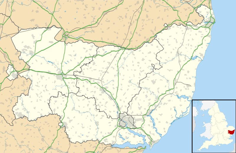
942:
897:
877:
707:
697:
144:
164:
Equirectangular map projection on WGS 84 datum, with N/S stretched 160%
1122:
957:
902:
817:
777:
772:
687:
682:
662:
636:
1027:
927:
717:
677:
211:
Administrative borders and coastline data from
Boundary-Line product.
1227:
555:
Click on a date/time to view the file as it appeared at that time.
867:
287:
Contains
Ordnance Survey data © Crown copyright and database right
1317:
1447:
1437:
1397:
1252:
93:
1407:
1372:
1347:
1312:
1332:
1292:
87:(SVG file, nominally 1,425 × 927 pixels, file size: 1.82 MB)
1342:
1247:
1242:
1412:
1392:
1257:
1427:
1232:
1352:
1297:
1367:
1287:
380:
Add a one-line explanation of what this file represents
1442:
1337:
1307:
1277:
1217:
1422:
1387:
1377:
1357:
1302:
1432:
1417:
1402:
1382:
1322:
1272:
466:
Creative
Commons Attribution-ShareAlike 3.0 Unported
132:
117:
Commons is a freely licensed media file repository.
1452:
1362:
1327:
214:All other geographic data from Meridian 2 product.
333:https://creativecommons.org/licenses/by-sa/3.0
98:
1208:Plantilya:Location map United Kingdom Suffolk
339:Creative Commons Attribution-Share Alike 3.0
257:
8:
299:– to copy, distribute and transmit the work
147:, UK with the following information shown:
46:Size of this PNG preview of this SVG file:
1477:
557:
376:
1283:Plantilla:Mapa de localización de Suffolk
1170:The following other wikis use this file:
1178:قالب:Location map United Kingdom Suffolk
357:File:Suffolk UK district map (blank).svg
1487:
1479:
655:
533:
517:
499:
483:
463:
447:
427:
411:
394:
391:
372:
365:
1238:Vorlage:Positionskarte England Suffolk
1188:Ҡалып:ПозКарта Бөйөк Британия Саффолк
7:
280:Attribution-Share Alike 3.0 Unported
238:, created using Ordnance Survey data
1268:Incidente ovni de Rendlesham Forest
546:
268:
263:
1470:
635:{{Information |Description=Map of
385:
379:
254:
130:
80:
384:
370:
310:Under the following conditions:
275:This file is licensed under the
267:
262:
256:
97:
31:
21:
1198:Шаблон:ПК Великобритания Съфолк
993:Orfordness transmitting station
367:
14:
366:
26:
1:
36:
783:East Anglia Transport Museum
392:Items portrayed in this file
1204:Usage on ceb.wikipedia.org
154:Coastline, lakes and rivers
138:Suffolk UK location map.svg
1509:
1264:Usage on es.wikipedia.org
1224:Usage on de.wikipedia.org
1214:Usage on cs.wikipedia.org
1194:Usage on bg.wikipedia.org
1184:Usage on ba.wikipedia.org
1174:Usage on ar.wikipedia.org
324:same or compatible license
547:
16:
613:19:14, 26 September 2010
605:Updated district borders
369:
290:
219:England location map.svg
104:This is a file from the
634:
604:
352:
242:
231:
196:
189:
186:
135:
108:. Information from its
1228:Kernkraftwerk Sizewell
583:01:11, 31 October 2019
151:Administrative borders
111:description page there
1318:Woodbridge (Suffolk)
70:2,560 × 1,665 pixels
948:Mildenhall, Suffolk
305:– to adapt the work
217:Inset derived from
167:Geographic limits:
52:Other resolutions:
1448:Honington Airfield
1438:Holbrook (Suffolk)
1398:Fornham All Saints
1253:Wattisham Airfield
1108:Stratford St. Mary
1043:Rushmere St Andrew
968:Newmarket, Suffolk
863:Honington, Suffolk
838:Haverhill, Suffolk
813:Framlingham Castle
768:Crowfield Airfield
748:Cavendish, Suffolk
157:Roads and railways
74:1,425 × 927 pixels
66:1,280 × 833 pixels
62:1,024 × 666 pixels
1496:
1495:
1462:more global usage
1166:Global file usage
828:Hadleigh, Suffolk
703:Brampton, Suffolk
642:
501:26 September 2010
450:copyright license
378:
363:
362:
251:
248:Reusing this file
191:26 September 2010
126:
125:
106:Wikimedia Commons
32:Global file usage
1500:
1478:
1408:Drinkstone Green
1373:Barrow (Suffolk)
1348:Bacton (Suffolk)
1313:Groton (Suffolk)
1113:Sudbury, Suffolk
1088:Stoke-by-Nayland
953:Moulton, Suffolk
923:Martlesham Heath
758:Claydon, Suffolk
743:Carlton Colville
625:
595:
414:copyright status
346:
343:
340:
337:
334:
326:as the original.
288:
277:Creative Commons
271:
270:
266:
265:
260:
259:
245:
192:
139:
133:
122:
101:
100:
94:
88:
77:
58:640 × 416 pixels
54:320 × 208 pixels
48:800 × 520 pixels
1508:
1507:
1503:
1502:
1501:
1499:
1498:
1497:
1466:
1333:Acton (Suffolk)
1293:Tesoro de Hoxne
1164:
1058:Shotley Battery
978:Orford, Suffolk
973:Norton, Suffolk
933:Melton, Suffolk
873:Ingham, Suffolk
728:Bury St Edmunds
673:Bacton, Suffolk
643:
631:
623:
601:
593:
549:
548:
545:
544:
543:
542:
541:
540:
539:
538:
536:
526:
525:
524:
522:
511:
510:
509:
508:
507:
506:
505:
504:
502:
492:
491:
490:
488:
477:
476:
475:
474:
473:
472:
471:
470:
468:
456:
455:
454:
452:
441:
440:
439:
438:
437:
436:
435:
434:
432:
420:
419:
418:
416:
405:
404:
403:
402:
401:
399:
383:
382:
381:
364:
348:
347:
344:
341:
338:
335:
332:
331:
289:
286:
283:
272:
202:Ordnance Survey
137:
128:
127:
116:
115:
114:is shown below.
90:
86:
79:
78:
51:
12:
11:
5:
1506:
1504:
1494:
1493:
1490:
1486:
1485:
1482:
1469:
1464:of this file.
1458:
1457:
1456:
1455:
1450:
1445:
1440:
1435:
1430:
1425:
1420:
1415:
1410:
1405:
1400:
1395:
1390:
1385:
1380:
1375:
1370:
1365:
1360:
1355:
1350:
1345:
1343:Coldfair Green
1340:
1335:
1330:
1325:
1320:
1315:
1310:
1305:
1300:
1295:
1290:
1285:
1280:
1275:
1270:
1262:
1261:
1260:
1255:
1250:
1248:RAF Lakenheath
1245:
1243:RAF Mildenhall
1240:
1235:
1230:
1222:
1221:
1220:
1212:
1211:
1210:
1202:
1201:
1200:
1192:
1191:
1190:
1182:
1181:
1180:
1168:
1167:
1162:to this file.
1156:
1155:
1153:Wickham Market
1150:
1145:
1140:
1135:
1130:
1125:
1120:
1115:
1110:
1105:
1100:
1095:
1090:
1085:
1080:
1075:
1070:
1068:Snape, Suffolk
1065:
1060:
1055:
1050:
1045:
1040:
1038:Risby, Suffolk
1035:
1030:
1025:
1023:RAF Woodbridge
1020:
1015:
1013:RAF Lakenheath
1010:
1005:
1003:RAF Bentwaters
1000:
995:
990:
985:
980:
975:
970:
965:
963:Needham Market
960:
955:
950:
945:
940:
935:
930:
925:
920:
915:
910:
905:
900:
895:
890:
885:
880:
875:
870:
865:
860:
855:
850:
845:
840:
835:
830:
825:
820:
815:
810:
805:
800:
795:
790:
785:
780:
775:
770:
765:
760:
755:
753:Clare, Suffolk
750:
745:
740:
735:
730:
725:
720:
715:
710:
705:
700:
695:
690:
685:
680:
675:
670:
665:
660:
658:Acton, Suffolk
653:is available.
647:
646:
641:
640:
633:
629:
626:
620:
615:
610:
607:
606:
603:
599:
596:
590:
585:
580:
576:
575:
572:
569:
566:
563:
560:
553:
552:
537:
534:
532:
531:
530:
529:
528:
527:
523:
518:
516:
515:
514:
513:
512:
503:
500:
498:
497:
496:
495:
494:
493:
489:
484:
482:
481:
480:
479:
478:
469:
464:
462:
461:
460:
459:
458:
457:
453:
448:
446:
445:
444:
443:
442:
433:
428:
426:
425:
424:
423:
422:
421:
417:
412:
410:
409:
408:
407:
406:
400:
395:
393:
390:
389:
388:
387:
386:
375:
374:
371:
368:
361:
360:
354:
353:Other versions
350:
349:
330:
329:
328:
327:
317:
308:
307:
306:
300:
293:You are free:
284:
274:
273:
255:
252:
240:
239:
233:
229:
228:
227:
226:
215:
212:
198:
194:
193:
188:
184:
183:
182:
181:
178:
175:
172:
162:
161:
158:
155:
152:
140:
131:
129:
124:
123:
102:
92:
91:
45:
41:
40:
39:
34:
29:
24:
19:
13:
10:
9:
6:
4:
3:
2:
1505:
1491:
1488:
1483:
1480:
1476:
1473:
1467:
1465:
1463:
1454:
1451:
1449:
1446:
1444:
1441:
1439:
1436:
1434:
1431:
1429:
1426:
1424:
1421:
1419:
1416:
1414:
1413:East Bergholt
1411:
1409:
1406:
1404:
1401:
1399:
1396:
1394:
1393:Eye (Suffolk)
1391:
1389:
1386:
1384:
1381:
1379:
1376:
1374:
1371:
1369:
1366:
1364:
1361:
1359:
1356:
1354:
1351:
1349:
1346:
1344:
1341:
1339:
1336:
1334:
1331:
1329:
1326:
1324:
1321:
1319:
1316:
1314:
1311:
1309:
1306:
1304:
1301:
1299:
1296:
1294:
1291:
1289:
1286:
1284:
1281:
1279:
1276:
1274:
1271:
1269:
1266:
1265:
1263:
1259:
1258:RAF Honington
1256:
1254:
1251:
1249:
1246:
1244:
1241:
1239:
1236:
1234:
1231:
1229:
1226:
1225:
1223:
1219:
1216:
1215:
1213:
1209:
1206:
1205:
1203:
1199:
1196:
1195:
1193:
1189:
1186:
1185:
1183:
1179:
1176:
1175:
1173:
1172:
1171:
1165:
1163:
1161:
1154:
1151:
1149:
1146:
1144:
1141:
1139:
1136:
1134:
1131:
1129:
1126:
1124:
1121:
1119:
1116:
1114:
1111:
1109:
1106:
1104:
1101:
1099:
1096:
1094:
1091:
1089:
1086:
1084:
1081:
1079:
1076:
1074:
1071:
1069:
1066:
1064:
1061:
1059:
1056:
1054:
1051:
1049:
1046:
1044:
1041:
1039:
1036:
1034:
1031:
1029:
1026:
1024:
1021:
1019:
1018:RAF Wattisham
1016:
1014:
1011:
1009:
1008:RAF Honington
1006:
1004:
1001:
999:
996:
994:
991:
989:
986:
984:
983:Orford Castle
981:
979:
976:
974:
971:
969:
966:
964:
961:
959:
956:
954:
951:
949:
946:
944:
941:
939:
936:
934:
931:
929:
926:
924:
921:
919:
916:
914:
911:
909:
906:
904:
901:
899:
896:
894:
891:
889:
886:
884:
881:
879:
876:
874:
871:
869:
866:
864:
861:
859:
856:
854:
851:
849:
846:
844:
841:
839:
836:
834:
831:
829:
826:
824:
823:Great Bricett
821:
819:
816:
814:
811:
809:
806:
804:
801:
799:
796:
794:
791:
789:
788:East Bergholt
786:
784:
781:
779:
776:
774:
771:
769:
766:
764:
761:
759:
756:
754:
751:
749:
746:
744:
741:
739:
738:Capel St Mary
736:
734:
731:
729:
726:
724:
723:Bungay Castle
721:
719:
716:
714:
711:
709:
706:
704:
701:
699:
696:
694:
691:
689:
686:
684:
681:
679:
676:
674:
671:
669:
666:
664:
661:
659:
656:
654:
652:
644:
638:
632:
627:
621:
619:
616:
614:
611:
609:
608:
602:
600:The Equalizer
597:
591:
589:
586:
584:
581:
578:
577:
573:
570:
567:
564:
561:
559:
558:
556:
550:
535:image/svg+xml
521:
487:
467:
451:
431:
415:
398:
358:
355:
351:
336:CC BY-SA 3.0
325:
321:
318:
315:
312:
311:
309:
304:
301:
298:
295:
294:
292:
291:
285:Attribution:
281:
278:
261:
253:
249:
244:
241:
237:
234:
230:
224:
220:
216:
213:
210:
209:
208:
206:
203:
199:
195:
185:
180:South: 51.92N
179:
177:North: 52.57N
176:
173:
170:
169:
168:
165:
159:
156:
153:
150:
149:
148:
146:
141:
134:
120:
113:
112:
107:
103:
96:
95:
89:
84:
83:Original file
75:
71:
67:
63:
59:
55:
49:
44:
38:
35:
33:
30:
28:
25:
23:
20:
18:
15:
1474:
1471:
1459:
1428:Holywell Row
1233:Portman Road
1169:
1157:
998:Oulton Broad
908:Long Melford
888:Kettlebaston
848:Herringfleet
798:Eye, Suffolk
733:Campsea Ashe
648:
622:1,425 × 927
592:1,425 × 927
554:
551:File history
319:
313:
302:
296:
200:
166:
163:
142:
119:You can help
109:
81:
22:File history
1353:Badwell Ash
1298:Edwardstone
1143:Westerfield
1128:Walberswick
1073:Somerleyton
1033:Rickinghall
988:Orford Ness
883:Kessingland
858:Homersfield
843:Hemingstone
808:Framlingham
793:Euston Hall
430:copyrighted
359:- Blank map
320:share alike
314:attribution
174:East: 1.90E
171:West: 0.30E
160:Urban areas
136:Description
1368:Barningham
1288:Felixstowe
1160:more links
1118:Thorpeness
1103:Stradbroke
1098:Stowupland
1093:Stowmarket
1083:Sproughton
1053:Saxmundham
938:Mendlesham
918:Martlesham
893:Lakenheath
853:Hintlesham
833:Halesworth
803:Felixstowe
693:Blythburgh
645:File usage
568:Dimensions
520:media type
243:Permission
27:File usage
1443:Hollesley
1338:Coddenham
1308:Newmarket
1278:Lowestoft
1218:Aldeburgh
1148:Whepstead
1138:West Stow
1078:Southwold
913:Lowestoft
763:Cratfield
713:Bruisyard
668:Aldeburgh
651:full list
630:Nilfanion
624:(1.86 MB)
594:(1.82 MB)
565:Thumbnail
562:Date/Time
486:inception
236:Nilfanion
1468:Metadata
1423:Hepworth
1388:Elmswell
1378:Debenham
1358:Bardwell
1303:Hadleigh
1133:Wangford
1063:Sizewell
1048:Sapiston
943:Metfield
898:Lavenham
878:Kesgrave
708:Brantham
698:Bramford
373:Captions
303:to remix
297:to share
282:license.
223:Spischot
205:OpenData
37:Metadata
1433:Hitcham
1418:Hessett
1403:Culford
1383:Elmsett
1323:Beccles
1273:Ipswich
1123:Troston
958:Nayland
903:Leiston
818:Gipping
778:Darsham
773:Culford
688:Beccles
683:Bawdsey
663:Akenham
637:Suffolk
579:current
574:Comment
397:depicts
377:English
145:Suffolk
143:Map of
85:
1489:Height
1453:Hopton
1363:Barnby
1328:Milden
1028:Reydon
928:Mellis
718:Bungay
678:Badley
232:Author
197:Source
1481:Width
1460:View
1158:View
868:Hoxne
1484:1425
571:User
345:true
342:true
187:Date
17:File
1492:927
221:by
207:.
72:|
68:|
64:|
60:|
56:|
50:.
250:)
246:(
225:.
121:.
76:.
Text is available under the Creative Commons Attribution-ShareAlike License. Additional terms may apply.

.svg)