239:
265:
209:
38:
375:
271:
94:
276:
674:
324:– You must give appropriate credit, provide a link to the license, and indicate if changes were made. You may do so in any reasonable manner, but not in any way that suggests the licensor endorses you or your use.
696:
692:
245:
768:
392:
763:
432:
233:
172:
158:
182:
449:
439:
390:; with no Invariant Sections, no Front-Cover Texts, and no Back-Cover Texts. A copy of the license is included in the section entitled
382:
585:
568:
532:
728:
64:
60:
331:
68:
56:
52:
48:
42:
516:
387:
605:
552:
499:
105:
821:
733:
77:
723:
718:
285:
709:
The following pages on the
English Knowledge (XXG) use this file (pages on other projects are not listed):
758:
330:– If you remix, transform, or build upon the material, you must distribute your contributions under the
753:
743:
713:
282:
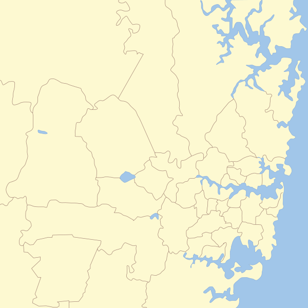
691:{{Information |Description=== Map of Sydney with Local Government areas borders marked. |Source=*
113:
748:
738:
369:
463:
380:
Permission is granted to copy, distribute and/or modify this document under the terms of the
345:
238:
227:, which means that it has been digitally altered from its original version. Modifications:
219:
811:
791:
186:
673:
668:
37:
256:
I, the copyright holder of this work, hereby publish it under the following licenses:
145:
100:
684:
208:
831:
806:
786:
641:
Click on a date/time to view the file as it appeared at that time.
796:
826:
344:
This licensing tag was added to this file as part of the GFDL
259:
202:
88:
137:== Map of Sydney with Local Government areas borders marked.
428:
This image is a derivative work of the following images:
82:(SVG file, nominally 850 × 850 pixels, file size: 195 KB)
483:
Add a one-line explanation of what this file represents
586:
Creative
Commons Attribution-ShareAlike 3.0 Unported
569:
386:, Version 1.2 or any later version published by the
127:
112:
Commons is a freely licensed media file repository.
822:
Predefinição:Imagem de Sydney com rótulos da região
454:]. Reference: {{Aus LGA maps}} {{inkscape}} [[C
697:File:New_South_Wales_Local_Government_Areas.svg
693:File:New_South_Wales_Local_Government_Areas.svg
433:File:New_South_Wales_Local_Government_Areas.svg
351:http://creativecommons.org/licenses/by-sa/3.0/
93:
769:Template talk:Sydney image with region labels
264:
8:
357:Creative Commons Attribution-Share Alike 3.0
307:– to copy, distribute and transmit the work
41:Size of this PNG preview of this SVG file:
812:Templat:Gambar Sydney dengan label wilayah
792:Nodyn:Delwedd Sydney gyda labeli rhanbarth
643:
479:
435:licensed with Cc-by-sa-3.0-migrated, GFDL
418:You may select the license of your choice.
234:New South Wales Local Government Areas.svg
229:cropping on Sydney area, Removal of names.
173:New_South_Wales_Local_Government_Areas.svg
159:New_South_Wales_Local_Government_Areas.svg
779:The following other wikis use this file:
764:Template:Sydney image with region labels
231:. The original can be viewed here:
711:
619:
603:
583:
566:
550:
530:
514:
497:
494:
475:
468:
695:|Date=2011-01-08 13:12 (UTC) |Author=*
7:
398:http://www.gnu.org/copyleft/fdl.html
286:Attribution-Share Alike 3.0 Unported
632:
275:
270:
220:
218:
488:
482:
417:
255:
125:
75:
487:
473:
374:
373:
318:Under the following conditions:
281:This file is licensed under the
274:
269:
263:
237:
207:
92:
31:
21:
729:Hills District, New South Wales
470:
14:
469:
404:GNU Free Documentation License
393:GNU Free Documentation License
383:GNU Free Documentation License
26:
1:
699:: '''User:Rok
495:Items portrayed in this file
850:
818:Usage on pt.wikipedia.org
803:Usage on ms.wikipedia.org
783:Usage on cy.wikipedia.org
734:Macarthur, New South Wales
332:same or compatible license
633:
452:2715x1461 (408167 Bytes)
442:2715x1461 (409360 Bytes)
290:
262:
16:
832:Praias do Norte (Sydney)
807:Subbandar Timur (Sydney)
724:Forest District (Sydney)
719:Eastern Suburbs (Sydney)
472:
388:Free Software Foundation
99:This is a file from the
690:
166:
152:
144:
141:
130:
103:. Information from its
787:Gorllewin Sydney Fwyaf
106:description page there
759:User:Hatgreg/sandbox2
669:13:14, 8 January 2011
448:2007-03-08T08:52:17Z
438:2007-03-19T10:32:11Z
146:8 January 2011, 13:12
797:Rhanbarthau o Sydney
754:User:Hatgreg/sandbox
744:South Western Sydney
714:Canterbury-Bankstown
133:Sydney Areas Map.svg
65:2,048 × 2,048 pixels
61:1,024 × 1,024 pixels
827:Floresta (distrito)
424:Original upload log
313:– to adapt the work
47:Other resolutions:
775:Global file usage
749:St George, Sydney
739:Regions of Sydney
702:
553:copyright license
481:
415:
414:
368:
367:
252:
251:
221:retouched picture
197:
196:
181:derivative work:
121:
120:
101:Wikimedia Commons
32:Global file usage
841:
681:
517:copyright status
444:fix hunters hill
411:
408:
405:
402:
399:
377:
376:
370:
364:
361:
358:
355:
352:
349:
346:licensing update
334:as the original.
283:Creative Commons
278:
277:
273:
272:
267:
266:
260:
247:
241:
224:
222:
211:
203:
189:
147:
134:
128:
117:
96:
95:
89:
83:
72:
69:850 × 850 pixels
57:768 × 768 pixels
53:480 × 480 pixels
49:240 × 240 pixels
43:600 × 600 pixels
849:
848:
844:
843:
842:
840:
839:
838:
773:
710:
703:
687:
679:
635:
634:
631:
630:
629:
628:
627:
626:
625:
624:
622:
612:
611:
610:
608:
597:
596:
595:
594:
593:
592:
591:
590:
588:
577:
576:
575:
574:
573:
571:
559:
558:
557:
555:
544:
543:
542:
541:
540:
539:
538:
537:
535:
523:
522:
521:
519:
508:
507:
506:
505:
504:
502:
486:
485:
484:
426:
421:
420:
419:
409:
406:
403:
400:
397:
362:
359:
356:
353:
350:
343:
258:
257:
212:
198:
187:
132:
123:
122:
111:
110:
109:is shown below.
85:
81:
74:
73:
46:
12:
11:
5:
847:
845:
837:
836:
835:
834:
829:
824:
816:
815:
814:
809:
801:
800:
799:
794:
789:
777:
776:
772:
771:
766:
761:
756:
751:
746:
741:
736:
731:
726:
721:
716:
708:
707:
706:
701:
700:
689:
685:
682:
676:
671:
666:
662:
661:
658:
655:
652:
649:
646:
639:
638:
623:
621:8 January 2011
620:
618:
617:
616:
615:
614:
613:
609:
604:
602:
601:
600:
599:
598:
589:
584:
582:
581:
580:
579:
578:
572:
567:
565:
564:
563:
562:
561:
560:
556:
551:
549:
548:
547:
546:
545:
536:
531:
529:
528:
527:
526:
525:
524:
520:
515:
513:
512:
511:
510:
509:
503:
498:
496:
493:
492:
491:
490:
489:
478:
477:
474:
471:
462:Uploaded with
459:
458:
457:
456:
446:
425:
422:
416:
413:
412:
378:
366:
365:
340:
339:
338:
337:
336:
335:
325:
316:
315:
314:
308:
301:You are free:
296:
295:
292:
291:
289:
279:
254:
253:
250:
249:
213:
206:
195:
194:
193:
192:
179:
168:
164:
163:
162:
161:
154:
150:
149:
143:
139:
138:
135:
126:
124:
119:
118:
97:
87:
86:
40:
36:
35:
34:
29:
24:
19:
13:
10:
9:
6:
4:
3:
2:
846:
833:
830:
828:
825:
823:
820:
819:
817:
813:
810:
808:
805:
804:
802:
798:
795:
793:
790:
788:
785:
784:
782:
781:
780:
774:
770:
767:
765:
762:
760:
757:
755:
752:
750:
747:
745:
742:
740:
737:
735:
732:
730:
727:
725:
722:
720:
717:
715:
712:
704:
698:
694:
688:
683:
677:
675:
672:
670:
667:
664:
663:
659:
656:
653:
650:
647:
645:
644:
642:
636:
607:
587:
570:
554:
534:
518:
501:
467:
466:
465:
455:
451:
447:
445:
441:
437:
436:
434:
431:
430:
429:
423:
395:
394:
389:
385:
384:
379:
372:
371:
347:
342:
341:
333:
329:
326:
323:
320:
319:
317:
312:
309:
306:
303:
302:
300:
299:
298:
297:
294:
293:
287:
284:
280:
268:
261:
248:
242:
240:
235:
230:
226:
225:
223:
214:
210:
205:
204:
201:
200:
190:
184:
180:
178:
174:
171:
170:
169:
165:
160:
157:
156:
155:
151:
140:
136:
129:
115:
108:
107:
102:
98:
91:
90:
84:
79:
78:Original file
70:
66:
62:
58:
54:
50:
44:
39:
33:
30:
28:
25:
23:
20:
18:
15:
778:
640:
637:File history
464:derivativeFX
461:
460:
453:
443:
427:
391:
381:
354:CC BY-SA 3.0
327:
321:
310:
304:
244:
232:
228:
217:
216:
199:
176:
114:You can help
104:
76:
22:File history
533:copyrighted
328:share alike
322:attribution
215:This is a
131:Description
705:File usage
678:850 × 850
654:Dimensions
27:File usage
651:Thumbnail
648:Date/Time
606:inception
288:license.
177:User:Roke
680:(195 KB)
476:Captions
311:to remix
305:to share
686:Hatgreg
665:current
660:Comment
500:depicts
480:English
236::
183:Hatgreg
80:
246:
167:Author
153:Source
148:(UTC)
657:User
450:Roke
440:Roke
410:true
407:true
401:GFDL
363:true
360:true
188:talk
142:Date
17:File
243:.
175::
67:|
63:|
59:|
55:|
51:|
45:.
396:.
348:.
191:)
185:(
116:.
71:.
Text is available under the Creative Commons Attribution-ShareAlike License. Additional terms may apply.
