299:
213:
205:
38:
254:
227:
305:
98:
679:"}},"text\/plain":{"en":{"":"heading"}}},"{\"value\":{\"amount\":\"+96.75\",\"unit\":\"http:\\\/\\\/www.wikidata.org\\\/entity\\\/Q28390\"},\"type\":\"quantity\"}":{"text\/html":{"en":{"P7787":"96.75
675:
346:– You must give appropriate credit, provide a link to the license, and indicate if changes were made. You may do so in any reasonable manner, but not in any way that suggests the licensor endorses you or your use.
196:
676:
271:
269:; with no Invariant Sections, no Front-Cover Texts, and no Back-Cover Texts. A copy of the license is included in the section entitled
261:
798:{{Information |Description ={{en|1=Fire station in Roztropice}} {{pl|1=OSP Roztropice}} |Source ={{own}} |Author =
662:
626:
590:
573:
537:
220:
976:
831:
This file contains additional information, probably added from the digital camera or scanner used to create or digitize it.
64:
60:
56:
52:
48:
42:
457:
109:
717:
690:
646:
610:
521:
493:
478:
465:
450:
266:
77:
557:
423:
406:
485:
834:
If the file has been modified from its original state, some details may not fully reflect the modified file.
803:
1003:
315:
683:"}},"text\/plain":{"en":{"P7787":"96.75 degree"}}}}": -->
312:
816:
The following pages on the
English Knowledge use this file (pages on other projects are not listed):
1039:
117:
1093:
248:
259:
Permission is granted to copy, distribute and/or modify this document under the terms of the
500:
780:
775:
68:
37:
226:
1075:
1021:
860:
245:
I, the copyright holder of this work, hereby publish it under the following licenses:
104:
1103:
900:
210:
1049:
945:
880:
820:
799:
791:
1113:
870:
853:
179:
748:
Click on a date/time to view the file as it appeared at that time.
843:
212:
197:
49° 50′ 30.67″ N, 18° 51′ 06.86″ E
187:
92:
802:|Date = |Permission = |other_versions = }}
390:
Add a one-line explanation of what this file represents
82:(3,300 × 2,475 pixels, file size: 2.29 MB, MIME type:
574:
265:, Version 1.2 or any later version published by the
136:
116:
Commons is a freely licensed media file repository.
1044:Flash did not fire, compulsory flash suppression
97:
298:
8:
680:
353:https://creativecommons.org/licenses/by/3.0
329:– to copy, distribute and transmit the work
836:
750:
386:
371:You may select the license of your choice.
591:Creative Commons Attribution 3.0 Unported
1217:
1209:
1201:
1193:
1185:
1177:
1169:
1161:
1153:
1145:
1137:
1129:
1121:
1111:
1101:
1091:
1083:
1073:
1065:
1057:
1047:
1037:
1029:
1019:
1011:
1001:
993:
985:
974:
966:
958:
950:
940:
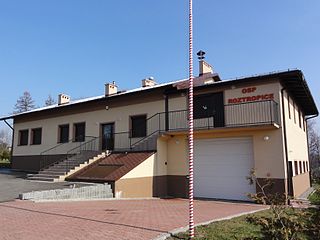
932:
924:
916:
908:
897:
889:
878:
868:
858:
848:
818:
704:
688:
660:
644:
624:
608:
588:
571:
555:
535:
519:
501:http://commons.wikimedia.org/User:D_T_G
437:
421:
404:
401:
382:
375:
190:
219:View this and other nearby images on:
838:
7:
277:http://www.gnu.org/copyleft/fdl.html
1171:Reference for direction of movement
739:
304:
829:
395:
389:
370:
320:
295:
244:
154:
146:
129:
75:
394:
359:Creative Commons Attribution 3.0
1187:Reference for direction of image
891:Date and time of data generation
691:coordinates of the point of view
380:
340:Under the following conditions:
311:This file is licensed under the
303:
297:
253:
252:
225:
211:
203:
96:
21:
377:
147:
14:
376:
283:GNU Free Documentation License
272:GNU Free Documentation License
262:GNU Free Documentation License
202:
155:
26:
1:
706:49°50'30.671"N, 18°51'6.858"E
663:original creation by uploader
31:
913:322.8 meters above sea level
451:object of statement has role
402:Items portrayed in this file
1219:GPS differential correction
987:Date and time of digitizing
1239:
152:Fire station in Roztropice
1203:Geodetic survey data used
1150:3-dimensional measurement
952:File change date and time
740:
169:
16:
627:Sony Cyber-shot DSC-HX5V
379:
316:Attribution 3.0 Unported
267:Free Software Foundation
103:This is a file from the
1142:Measurement in progress
1123:North or south latitude
1059:Custom image processing
797:
175:
165:
139:
107:. Information from its
1131:East or west longitude
995:Image compression mode
231:49.841853; 18.851905
142:POL Roztropice OSP.JPG
110:description page there
41:Size of this preview:
1179:Direction of movement
1163:Speed of GPS receiver
1013:Maximum land aperture
926:Horizontal resolution
990:15:04, 22 March 2011
955:18:06, 23 March 2011
894:15:04, 22 March 2011
776:17:27, 23 March 2011
69:3,300 × 2,475 pixels
65:2,560 × 1,920 pixels
1158:Kilometers per hour
1016:3.625 APEX (f/3.51)
960:Y and C positioning
934:Vertical resolution
840:Camera manufacturer
806:[[Category:Fire sta
804:Category:Roztropice
335:– to adapt the work
47:Other resolutions:
1195:Direction of image
1190:Magnetic direction
1085:Scene capture type
1080:Auto white balance
479:Wikimedia username
466:author name string
61:1,280 × 960 pixels
57:1,024 × 768 pixels
1226:
1225:
865:1/250 sec (0.004)
809:
682:
558:copyright license
388:
294:
293:
236:
235:
185:
184:
125:
124:
105:Wikimedia Commons
1230:
1147:Measurement mode
968:Exposure Program
837:
788:
728:
727:
722:
522:copyright status
503:
498:
488:
483:
473:
470:
460:
455:
366:
363:
360:
357:
354:
313:Creative Commons
307:
306:
301:
300:
290:
287:
284:
281:
278:
256:
255:
249:
232:
229:
215:
214:
208:
207:
206:
200:
199:
188:
171:
159:
151:
143:
137:
121:
100:
99:
93:
87:
85:
72:
53:640 × 480 pixels
49:320 × 240 pixels
43:800 × 600 pixels
1238:
1237:
1233:
1232:
1231:
1229:
1228:
1227:
1139:Receiver status
825:
817:
810:
794:
786:
742:
741:
738:
737:
736:
735:
734:
733:
732:
731:
730:
729:
725:
723:
720:
711:
710:
709:
707:
697:
696:
695:
693:
674:
673:
672:
671:
670:
669:
668:
667:
665:
653:
652:
651:
649:
638:
637:
636:
635:
634:
633:
632:
631:
629:
617:
616:
615:
613:
602:
601:
600:
599:
598:
597:
596:
595:
593:
582:
581:
580:
579:
578:
576:
564:
563:
562:
560:
549:
548:
547:
546:
545:
544:
543:
542:
540:
528:
527:
526:
524:
513:
512:
511:
510:
509:
508:
507:
506:
505:
504:
499:
496:
490:
489:
484:
481:
475:
474:
471:
468:
462:
461:
456:
453:
444:
443:
442:
440:
430:
429:
428:
426:
415:
414:
413:
412:
411:
409:
393:
392:
391:
374:
373:
372:
368:
367:
364:
361:
358:
355:
352:
351:
319:
308:
288:
285:
282:
279:
276:
247:
246:
241:
230:
204:
195:
194:
191:Camera location
186:
161:
153:
141:
134:
127:
126:
115:
114:
113:is shown below.
89:
83:
81:
74:
73:
46:
12:
11:
5:
1236:
1234:
1224:
1223:
1220:
1216:
1215:
1212:
1208:
1207:
1204:
1200:
1199:
1196:
1192:
1191:
1188:
1184:
1183:
1180:
1176:
1175:
1174:True direction
1172:
1168:
1167:
1164:
1160:
1159:
1156:
1152:
1151:
1148:
1144:
1143:
1140:
1136:
1135:
1134:East longitude
1132:
1128:
1127:
1126:North latitude
1124:
1120:
1119:
1116:
1110:
1109:
1106:
1100:
1099:
1096:
1090:
1089:
1086:
1082:
1081:
1078:
1072:
1071:
1068:
1064:
1063:
1062:Normal process
1060:
1056:
1055:
1052:
1046:
1045:
1042:
1036:
1035:
1032:
1028:
1027:
1024:
1018:
1017:
1014:
1010:
1009:
1006:
1000:
999:
996:
992:
991:
988:
984:
983:
980:
973:
972:
971:Normal program
969:
965:
964:
961:
957:
956:
953:
949:
948:
943:
939:
938:
935:
931:
930:
927:
923:
922:
919:
915:
914:
911:
907:
906:
903:
896:
895:
892:
888:
887:
884:
877:
876:
873:
867:
866:
863:
857:
856:
851:
847:
846:
841:
828:
824:
823:
815:
814:
813:
808:
807:
796:
792:
789:
785:3,300 × 2,475
783:
778:
773:
769:
768:
765:
762:
759:
756:
753:
746:
745:
716:
715:
714:
713:
712:
708:
705:
703:
702:
701:
700:
699:
698:
694:
689:
687:
686:
685:
684:
678:
666:
661:
659:
658:
657:
656:
655:
654:
650:
647:source of file
645:
643:
642:
641:
640:
639:
630:
625:
623:
622:
621:
620:
619:
618:
614:
609:
607:
606:
605:
604:
603:
594:
589:
587:
586:
585:
584:
583:
577:
572:
570:
569:
568:
567:
566:
565:
561:
556:
554:
553:
552:
551:
550:
541:
536:
534:
533:
532:
531:
530:
529:
525:
520:
518:
517:
516:
515:
514:
492:
491:
477:
476:
464:
463:
449:
448:
447:
446:
445:
441:
438:
436:
435:
434:
433:
432:
431:
427:
422:
420:
419:
418:
417:
416:
410:
405:
403:
400:
399:
398:
397:
396:
385:
384:
381:
378:
369:
350:
349:
348:
347:
338:
337:
336:
330:
323:You are free:
310:
309:
296:
292:
291:
257:
243:
242:
240:
237:
234:
233:
223:
217:
192:
183:
182:
177:
173:
172:
167:
163:
162:
160:OSP Roztropice
144:
135:
133:
130:
128:
123:
122:
101:
91:
90:
40:
36:
35:
34:
29:
24:
19:
13:
10:
9:
6:
4:
3:
2:
1235:
1221:
1218:
1214:22 March 2011
1213:
1210:
1205:
1202:
1197:
1194:
1189:
1186:
1181:
1178:
1173:
1170:
1165:
1162:
1157:
1154:
1149:
1146:
1141:
1138:
1133:
1130:
1125:
1122:
1117:
1115:
1112:
1107:
1105:
1102:
1097:
1095:
1092:
1087:
1084:
1079:
1077:
1076:White balance
1074:
1070:Auto exposure
1069:
1067:Exposure mode
1066:
1061:
1058:
1053:
1051:
1048:
1043:
1041:
1038:
1033:
1030:
1025:
1023:
1022:Metering mode
1020:
1015:
1012:
1007:
1005:
1004:Exposure bias
1002:
997:
994:
989:
986:
981:
978:
975:
970:
967:
962:
959:
954:
951:
947:
944:
942:Software used
941:
936:
933:
928:
925:
920:
917:
912:
909:
904:
902:
898:
893:
890:
885:
882:
879:
874:
872:
869:
864:
862:
861:Exposure time
859:
855:
852:
849:
845:
842:
839:
835:
832:
826:
822:
819:
811:
805:
801:
795:
790:
784:
782:
779:
777:
774:
771:
770:
766:
763:
760:
757:
754:
752:
751:
749:
743:
719:
692:
664:
648:
628:
612:
611:captured with
592:
575:
559:
539:
523:
502:
495:
487:
480:
467:
459:
452:
425:
408:
345:
342:
341:
339:
334:
331:
328:
325:
324:
322:
321:
317:
314:
302:
274:
273:
268:
264:
263:
258:
251:
250:
238:
228:
224:
222:
221:OpenStreetMap
218:
216:
198:
193:
189:
181:
178:
174:
168:
164:
158:
150:
145:
138:
131:
119:
112:
111:
106:
102:
95:
94:
88:
79:
78:Original file
70:
66:
62:
58:
54:
50:
44:
39:
33:
30:
28:
25:
23:
20:
18:
15:
1031:Light source
901:focal length
850:Camera model
833:
830:
747:
744:File history
458:photographer
343:
332:
326:
270:
260:
201:
156:
148:
118:You can help
108:
76:
22:File history
1050:Color space
946:GIMP 2.6.11
918:Orientation
538:copyrighted
344:attribution
140:Description
1155:Speed unit
1104:Saturation
821:Roztropice
812:File usage
761:Dimensions
439:some value
356:CC BY 3.0
84:image/jpeg
27:File usage
1114:Sharpness
1088:Landscape
881:ISO speed
787:(2.29 MB)
758:Thumbnail
755:Date/Time
239:Licensing
149:English:
1211:GPS date
1094:Contrast
963:Co-sited
910:Altitude
871:F-number
854:DSC-HX5V
827:Metadata
383:Captions
333:to remix
327:to share
318:license.
170:Own work
157:Polski:
32:Metadata
1034:Unknown
1026:Pattern
979:version
905:4.41 mm
772:current
767:Comment
718:heading
677:heading
424:creator
407:depicts
387:English
132:Summary
80:
1206:WGS-84
1118:Normal
1108:Normal
1098:Normal
937:72 dpi
929:72 dpi
921:Normal
883:rating
726:degree
724:96.75
681:degree
209:
176:Author
166:Source
1198:96.75
1040:Flash
899:Lens
800:D T G
793:D T G
486:D T G
472:D T G
180:D T G
1182:34.9
1054:sRGB
982:2.21
977:Exif
844:SONY
764:User
365:true
362:true
289:true
286:true
280:GFDL
17:File
886:125
875:f/8
494:URL
721::
497::
482::
469::
454::
67:|
63:|
59:|
55:|
51:|
45:.
1222:0
1166:0
1008:0
998:4
275:.
120:.
86:)
71:.
Text is available under the Creative Commons Attribution-ShareAlike License. Additional terms may apply.
