348:
281:
231:
273:
223:
295:
245:
316:
354:
359:
72:
824:"}},"text\/plain":{"en":{"":"heading"}}},"{\"value\":{\"amount\":\"+22\",\"unit\":\"http:\\\/\\\/www.wikidata.org\\\/entity\\\/Q28390\"},\"type\":\"quantity\"}":{"text\/html":{"en":{"P7787":"22
760:"}},"text\/plain":{"en":{"":"heading"}}},"{\"value\":{\"amount\":\"+22\",\"unit\":\"http:\\\/\\\/www.wikidata.org\\\/entity\\\/Q28390\"},\"type\":\"quantity\"}":{"text\/html":{"en":{"P7787":"22
820:
264:
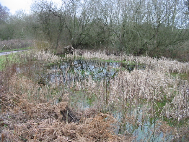
943:== {{int:filedesc}} == {{Information |description={{en|1=Pond at Gibbin's Brook The area here is variously known as Gibbin's Brook, Gibbins Brook, Gibbons Brook (in the telephone directory) and Gibbinge Brook by former residence.}} |date=2007-12-30 |sourc
214:
43:
406:– You must give appropriate credit, provide a link to the license, and indicate if changes were made. You may do so in any reasonable manner, but not in any way that suggests the licensor endorses you or your use.
83:
51:
126:
Pond at Gibbin's Brook The area here is variously known as Gibbin's Brook, Gibbins Brook, Gibbons Brook (in the telephone directory) and
Gibbinge Brook by former residence.
821:
757:
658:
622:
586:
288:
238:
693:
1096:
323:
988:
This file contains additional information, probably added from the digital camera or scanner used to create or digitize it.
413:
549:
925:
920:
42:
862:
835:
798:
771:
671:
642:
570:
542:
527:
514:
729:
701:
686:
606:
487:
470:
310:
369:
991:
If the file has been modified from its original state, some details may not fully reflect the modified file.
1141:
412:– If you remix, transform, or build upon the material, you must distribute your contributions under the
330:
on the
Geograph website for the photographer's contact details. The copyright on this image is owned by
936:
366:
953:
The following pages on the
English Knowledge use this file (pages on other projects are not listed):
1177:
1010:
828:"}},"text\/plain":{"en":{"P7787":"22 degree"}}}}": -->
764:"}},"text\/plain":{"en":{"P7787":"22 degree"}}}}": -->
91:
183:
957:
708:
678:
534:
167:
1000:
294:
244:
1167:
1123:
1017:
335:
78:
1046:
1187:
135:
278:
228:
156:
146:
1027:
315:
327:
893:
Click on a date/time to view the file as it appeared at that time.
280:
230:
255:
205:
66:
265:
51° 06′ 29″ N, 1° 01′ 21″ E
215:
51° 06′ 28″ N, 1° 01′ 20″ E
52:
Pond_at_Gibbin's_Brook_-_geograph.org.uk_-_643616.jpg
454:
Add a one-line explanation of what this file represents
975:
116:
Pond at Gibbin's Brook - geograph.org.uk - 643616.jpg
110:
90:
Commons is a freely licensed media file repository.
623:
Creative
Commons Attribution-ShareAlike 2.0 Generic
56:(640 × 480 pixels, file size: 265 KB, MIME type:
423:https://creativecommons.org/licenses/by-sa/2.0
71:
429:Creative Commons Attribution-Share Alike 2.0
347:
8:
825:
761:
389:– to copy, distribute and transmit the work
993:
895:
450:
968:The following other wikis use this file:
709:https://www.geograph.org.uk/photo/643616
535:https://www.geograph.org.uk/profile/4474
1219:
1211:
1203:
1195:
1185:
1175:
1165:
1157:
1149:
1139:
1131:
1121:
1113:
1105:
1094:
1086:
1078:
1070:
1062:
1054:
1043:
1035:
1025:
1015:
1005:
955:
849:
833:
785:
769:
743:
727:
656:
640:
620:
604:
584:
568:
501:
485:
468:
465:
446:
439:
258:
208:
287:View this and other nearby images on:
237:View this and other nearby images on:
995:
7:
334:and is licensed for reuse under the
884:
370:Attribution-Share Alike 2.0 Generic
358:
353:
338:Attribution-ShareAlike 2.0 license.
986:
459:
453:
344:
321:
120:
103:
49:
458:
1037:Date and time of data generation
772:coordinates of the point of view
444:
400:Under the following conditions:
365:This file is licensed under the
357:
352:
346:
314:
293:
279:
271:
243:
229:
221:
70:
31:
21:
441:
121:
46:No higher resolution available.
14:
659:file available on the internet
440:
322:This image was taken from the
26:
1:
836:coordinates of depicted place
36:
1154:2.9708557128906 APEX (f/2.8)
694:Geograph Britain and Ireland
543:object of statement has role
466:Items portrayed in this file
1213:Focal plane resolution unit
1107:Date and time of digitizing
270:
220:
1241:
1224:One-chip color area sensor
972:Usage on www.wikidata.org
414:same or compatible license
1080:File change date and time
885:
851:51°6'29.45"N, 1°1'21.00"E
787:51°6'28.19"N, 1°1'19.92"E
16:
1205:Focal plane Y resolution
1197:Focal plane X resolution
672:geograph.org.uk image ID
443:
380:
77:This is a file from the
1110:12:31, 30 December 2007
1083:12:31, 30 December 2007
1040:12:31, 30 December 2007
942:
196:Nick Smith /
177:Nick Smith /
168:required by the license
152:
141:
134:
131:
113:
81:. Information from its
1115:Image compression mode
328:this photograph's page
299:51.108180; 1.022500
249:51.107830; 1.022200
198:Pond at Gibbin's Brook
179:Pond at Gibbin's Brook
84:description page there
1151:Maximum land aperture
1064:Horizontal resolution
921:19:28, 11 March 2011
1088:Y and C positioning
1072:Vertical resolution
1011:Canon PowerShot A20
997:Camera manufacturer
958:Gibbin's Brook
395:– to adapt the work
1182:Flash did not fire
515:author name string
1228:
1227:
964:Global file usage
946:
827:
763:
607:copyright license
452:
343:
342:
326:collection. See
304:
303:
254:
253:
203:
202:
171:
99:
98:
79:Wikimedia Commons
32:Global file usage
1232:
1208:3,096.7741935484
1200:3,106.7961165049
1159:Subject distance
1022:1/100 sec (0.01)
994:
933:
873:
872:
867:
809:
808:
803:
745:30 December 2007
711:
706:
702:described at URL
696:
691:
681:
676:
571:copyright status
552:
547:
537:
532:
522:
519:
436:
433:
430:
427:
424:
416:as the original.
378:
367:Creative Commons
361:
360:
356:
355:
350:
349:
336:Creative Commons
324:Geograph project
318:
311:
300:
297:
283:
282:
276:
275:
274:
268:
267:
256:
250:
247:
233:
232:
226:
225:
224:
218:
217:
206:
165:
137:
136:30 December 2007
125:
117:
111:
95:
74:
73:
67:
61:
59:
1240:
1239:
1235:
1234:
1233:
1231:
1230:
1229:
982:
962:
954:
947:
939:
931:
887:
886:
883:
882:
881:
880:
879:
878:
877:
876:
875:
874:
870:
868:
865:
856:
855:
854:
852:
842:
841:
840:
838:
819:
818:
817:
816:
815:
814:
813:
812:
811:
810:
806:
804:
801:
792:
791:
790:
788:
778:
777:
776:
774:
755:
754:
753:
752:
751:
750:
749:
748:
746:
736:
735:
734:
732:
721:
720:
719:
718:
717:
716:
715:
714:
713:
712:
707:
704:
698:
697:
692:
689:
683:
682:
677:
674:
665:
664:
663:
661:
649:
648:
647:
645:
634:
633:
632:
631:
630:
629:
628:
627:
625:
613:
612:
611:
609:
598:
597:
596:
595:
594:
593:
592:
591:
589:
577:
576:
575:
573:
562:
561:
560:
559:
558:
557:
556:
555:
554:
553:
548:
545:
539:
538:
533:
530:
524:
523:
520:
517:
508:
507:
506:
504:
494:
493:
492:
490:
479:
478:
477:
476:
475:
473:
457:
456:
455:
438:
437:
434:
431:
428:
425:
422:
421:
379:
376:
373:
362:
339:
309:
298:
272:
263:
262:
259:Object location
248:
222:
213:
212:
209:Camera location
204:
193:
186:
174:
147:geograph.org.uk
127:
115:
108:
101:
100:
89:
88:
87:is shown below.
63:
57:
55:
48:
47:
12:
11:
5:
1238:
1236:
1226:
1225:
1222:
1221:Sensing method
1218:
1217:
1214:
1210:
1209:
1206:
1202:
1201:
1198:
1194:
1193:
1190:
1184:
1183:
1180:
1174:
1173:
1170:
1164:
1163:
1160:
1156:
1155:
1152:
1148:
1147:
1144:
1138:
1137:
1134:
1130:
1129:
1126:
1120:
1119:
1116:
1112:
1111:
1108:
1104:
1103:
1100:
1093:
1092:
1089:
1085:
1084:
1081:
1077:
1076:
1073:
1069:
1068:
1065:
1061:
1060:
1057:
1053:
1052:
1049:
1042:
1041:
1038:
1034:
1033:
1030:
1024:
1023:
1020:
1014:
1013:
1008:
1004:
1003:
998:
985:
981:
980:
979:
978:
966:
965:
961:
960:
952:
951:
950:
945:
944:
941:
937:
934:
928:
923:
918:
914:
913:
910:
907:
904:
901:
898:
891:
890:
861:
860:
859:
858:
857:
853:
850:
848:
847:
846:
845:
844:
843:
839:
834:
832:
831:
830:
829:
823:
797:
796:
795:
794:
793:
789:
786:
784:
783:
782:
781:
780:
779:
775:
770:
768:
767:
766:
765:
759:
747:
744:
742:
741:
740:
739:
738:
737:
733:
728:
726:
725:
724:
723:
722:
700:
699:
685:
684:
670:
669:
668:
667:
666:
662:
657:
655:
654:
653:
652:
651:
650:
646:
643:source of file
641:
639:
638:
637:
636:
635:
626:
621:
619:
618:
617:
616:
615:
614:
610:
605:
603:
602:
601:
600:
599:
590:
585:
583:
582:
581:
580:
579:
578:
574:
569:
567:
566:
565:
564:
563:
541:
540:
526:
525:
513:
512:
511:
510:
509:
505:
502:
500:
499:
498:
497:
496:
495:
491:
486:
484:
483:
482:
481:
480:
474:
469:
467:
464:
463:
462:
461:
460:
449:
448:
445:
442:
420:
419:
418:
417:
407:
398:
397:
396:
390:
383:You are free:
374:
364:
363:
345:
341:
340:
319:
308:
305:
302:
301:
291:
285:
260:
252:
251:
241:
235:
210:
201:
200:
194:
191:
188:
187:
182:
175:
172:
160:
159:
154:
150:
149:
143:
139:
138:
133:
129:
128:
118:
109:
107:
104:
102:
97:
96:
75:
65:
64:
45:
41:
40:
39:
34:
29:
24:
19:
13:
10:
9:
6:
4:
3:
2:
1237:
1223:
1220:
1215:
1212:
1207:
1204:
1199:
1196:
1191:
1189:
1186:
1181:
1179:
1176:
1171:
1169:
1168:Metering mode
1166:
1161:
1158:
1153:
1150:
1145:
1143:
1142:Exposure bias
1140:
1135:
1133:APEX aperture
1132:
1127:
1125:
1124:Shutter speed
1122:
1117:
1114:
1109:
1106:
1101:
1098:
1095:
1090:
1087:
1082:
1079:
1074:
1071:
1066:
1063:
1058:
1055:
1050:
1048:
1044:
1039:
1036:
1031:
1029:
1026:
1021:
1019:
1018:Exposure time
1016:
1012:
1009:
1006:
1002:
999:
996:
992:
989:
983:
977:
974:
973:
971:
970:
969:
963:
959:
956:
948:
940:
935:
929:
927:
924:
922:
919:
916:
915:
911:
908:
905:
902:
899:
897:
896:
894:
888:
864:
837:
800:
773:
731:
710:
703:
695:
688:
680:
673:
660:
644:
624:
608:
588:
572:
551:
544:
536:
529:
516:
489:
472:
426:CC BY-SA 2.0
415:
411:
408:
405:
402:
401:
399:
394:
391:
388:
385:
384:
382:
381:
375:Attribution:
371:
368:
351:
337:
333:
329:
325:
320:
317:
313:
312:
306:
296:
292:
290:
289:OpenStreetMap
286:
284:
266:
261:
257:
246:
242:
240:
239:OpenStreetMap
236:
234:
216:
211:
207:
199:
195:
190:
189:
185:
181: /
180:
176:
169:
164:
162:
161:
158:
155:
151:
148:
144:
140:
130:
124:
119:
112:
105:
93:
86:
85:
80:
76:
69:
68:
62:
53:
44:
38:
35:
33:
30:
28:
25:
23:
20:
18:
15:
1162:0.609 meters
1047:focal length
1007:Camera model
990:
987:
967:
892:
889:File history
550:photographer
409:
403:
392:
386:
331:
269:
219:
197:
184:CC BY-SA 2.0
178:
122:
92:You can help
82:
50:
22:File history
1188:Color space
1056:Orientation
938:GeographBot
587:copyrighted
410:share alike
404:attribution
163:Attribution
114:Description
1051:5.40625 mm
949:File usage
930:640 × 480
906:Dimensions
521:Nick Smith
503:some value
377:Nick Smith
332:Nick Smith
157:Nick Smith
58:image/jpeg
27:File usage
976:Q48861565
903:Thumbnail
900:Date/Time
730:inception
307:Licensing
192:InfoField
173:InfoField
123:English:
1091:Centered
1028:F-number
984:Metadata
932:(265 KB)
687:operator
447:Captions
393:to remix
387:to share
372:license.
37:Metadata
1172:Pattern
1128:6.65625
1099:version
1075:180 dpi
1067:180 dpi
917:current
912:Comment
863:heading
822:heading
799:heading
758:heading
488:creator
471:depicts
451:English
106:Summary
54:
1216:inches
1136:3.0625
1059:Normal
871:degree
826:degree
807:degree
762:degree
679:643616
277:
227:
153:Author
142:Source
1178:Flash
1045:Lens
1032:f/2.8
1001:Canon
145:From
1192:sRGB
1097:Exif
909:User
435:true
432:true
132:Date
17:File
1102:2.1
869:22
805:22
528:URL
866::
802::
705::
690::
675::
546::
531::
518::
1146:0
1118:5
170:)
166:(
94:.
60:)
Text is available under the Creative Commons Attribution-ShareAlike License. Additional terms may apply.
_heading:22.00&language=en)
_heading:22.00&language=en)
