293:
223:
237:
261:
299:
304:
72:
952:
214:
43:
351:– You must give appropriate credit, provide a link to the license, and indicate if changes were made. You may do so in any reasonable manner, but not in any way that suggests the licensor endorses you or your use.
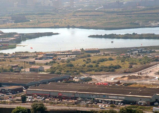
969:== {{int:filedesc}} == {{Information |description={{en|1=Port Talbot Docks. Looking south over the docks and industrial area.}} |date=2005-08 |source=From |author=[http://www.geograph.org.uk/profile
83:
1006:
51:
1001:
603:
567:
531:
230:
638:
1166:
268:
1039:
This file contains additional information, probably added from the digital camera or scanner used to create or digitize it.
897:
358:
466:
847:
813:
776:
742:
674:
616:
587:
515:
487:
474:
459:
708:
646:
631:
551:
432:
415:
881:
255:
951:
946:
42:
314:
1042:
If the file has been modified from its original state, some details may not fully reflect the modified file.
1219:
357:– If you remix, transform, or build upon the material, you must distribute your contributions under the
275:
on the
Geograph website for the photographer's contact details. The copyright on this image is owned by
962:
311:
1247:
1135:
983:
91:
183:
167:
1061:
653:
623:
494:
236:
1237:
1193:
280:
78:
1098:
1257:
1078:
135:
220:
156:
146:
1068:
1051:
260:
272:
126:
Port Talbot Docks. Looking south over the docks and industrial area.
919:
Click on a date/time to view the file as it appeared at that time.
222:
205:
66:
215:
51° 36′ 07″ N, 3° 47′ 13″ W
1016:
667:
399:
Add a one-line explanation of what this file represents
1026:
110:
90:
Commons is a freely licensed media file repository.
568:
Creative
Commons Attribution-ShareAlike 2.0 Generic
56:(640 × 455 pixels, file size: 111 KB, MIME type:
116:Port Talbot Docks - geograph.org.uk - 41571.jpg
52:Port_Talbot_Docks_-_geograph.org.uk_-_41571.jpg
368:https://creativecommons.org/licenses/by-sa/2.0
71:
374:Creative Commons Attribution-Share Alike 2.0
292:
8:
334:– to copy, distribute and transmit the work
1044:
921:
395:
994:The following other wikis use this file:
1289:
1281:
1273:
1265:
1255:
1245:
1235:
1227:
1217:
1209:
1201:
1191:
1183:
1175:
1164:
1156:
1148:
1140:
1130:
1122:
1114:
1106:
1095:
1087:
1076:
1066:
1056:
981:
895:
879:
861:
845:
827:
811:
790:
774:
756:
740:
722:
706:
688:
672:
654:https://www.geograph.org.uk/photo/41571
601:
585:
565:
549:
529:
513:
495:https://www.geograph.org.uk/profile/843
446:
430:
413:
410:
391:
384:
208:
229:View this and other nearby images on:
1046:
7:
279:and is licensed for reuse under the
979:The following page uses this file:
910:
315:Attribution-Share Alike 2.0 Generic
303:
298:
283:Attribution-ShareAlike 2.0 license.
1037:
404:
398:
289:
266:
120:
103:
49:
403:
1089:Date and time of data generation
675:coordinates of the point of view
389:
345:Under the following conditions:
310:This file is licensed under the
302:
297:
291:
259:
235:
221:
70:
31:
21:
386:
121:
46:No higher resolution available.
14:
604:file available on the internet
385:
267:This image was taken from the
26:
1:
36:
639:Geograph Britain and Ireland
460:object of statement has role
411:Items portrayed in this file
1283:Focal plane resolution unit
1177:Date and time of digitizing
998:Usage on arz.wikipedia.org
1311:
1294:One-chip color area sensor
1023:Usage on www.wikidata.org
1013:Usage on eu.wikipedia.org
359:same or compatible license
1142:File change date and time
911:
16:
1275:Focal plane Y resolution
1267:Focal plane X resolution
617:geograph.org.uk image ID
388:
325:
77:This is a file from the
1007:ليستة الموانى فى العالم
968:
196:Chris Shaw /
177:Chris Shaw /
168:required by the license
152:
141:
134:
131:
113:
81:. Information from its
1185:Image compression mode
947:17:32, 30 January 2010
273:this photograph's page
241:51.602000; -3.787000
84:description page there
1229:Maximum land aperture
1180:11:55, 17 August 2005
1145:23:27, 22 August 2005
1116:Horizontal resolution
1092:11:55, 17 August 2005
690:51°36'7"N, 3°47'13"W
1150:Y and C positioning
1136:Adobe Photoshop 7.0
1124:Vertical resolution
1048:Camera manufacturer
984:Port of Port Talbot
340:– to adapt the work
1252:Flash did not fire
475:author name string
1298:
1297:
990:Global file usage
972:
552:copyright license
397:
288:
287:
271:collection. See
246:
245:
203:
202:
198:Port Talbot Docks
179:Port Talbot Docks
171:
99:
98:
79:Wikimedia Commons
32:Global file usage
1302:
1158:Exposure Program
1045:
1002:مينا بورت تالبوت
959:
795:
656:
651:
647:described at URL
641:
636:
626:
621:
516:copyright status
497:
492:
482:
479:
469:
464:
381:
378:
375:
372:
369:
361:as the original.
323:
312:Creative Commons
306:
305:
301:
300:
295:
294:
281:Creative Commons
269:Geograph project
263:
256:
242:
239:
225:
224:
218:
217:
206:
165:
137:
125:
117:
111:
95:
74:
73:
67:
61:
59:
1310:
1309:
1305:
1304:
1303:
1301:
1300:
1299:
1232:3 APEX (f/2.83)
1211:APEX brightness
1062:FinePix2800ZOOM
1033:
988:
973:
965:
957:
913:
912:
909:
908:
907:
906:
905:
904:
903:
902:
900:
888:
887:
886:
884:
873:
872:
871:
870:
869:
868:
867:
866:
864:
854:
853:
852:
850:
839:
838:
837:
836:
835:
834:
833:
832:
830:
820:
819:
818:
816:
805:
804:
803:
802:
801:
800:
799:
798:
796:
793:
783:
782:
781:
779:
768:
767:
766:
765:
764:
763:
762:
761:
759:
749:
748:
747:
745:
734:
733:
732:
731:
730:
729:
728:
727:
725:
715:
714:
713:
711:
700:
699:
698:
697:
696:
695:
694:
693:
691:
681:
680:
679:
677:
666:
665:
664:
663:
662:
661:
660:
659:
658:
657:
652:
649:
643:
642:
637:
634:
628:
627:
622:
619:
610:
609:
608:
606:
594:
593:
592:
590:
579:
578:
577:
576:
575:
574:
573:
572:
570:
558:
557:
556:
554:
543:
542:
541:
540:
539:
538:
537:
536:
534:
522:
521:
520:
518:
507:
506:
505:
504:
503:
502:
501:
500:
499:
498:
493:
490:
484:
483:
480:
477:
471:
470:
465:
462:
453:
452:
451:
449:
439:
438:
437:
435:
424:
423:
422:
421:
420:
418:
402:
401:
400:
383:
382:
379:
376:
373:
370:
367:
366:
324:
321:
318:
307:
284:
254:
240:
213:
212:
209:Camera location
204:
193:
186:
174:
147:geograph.org.uk
127:
115:
108:
101:
100:
89:
88:
87:is shown below.
63:
57:
55:
48:
47:
12:
11:
5:
1308:
1306:
1296:
1295:
1292:
1291:Sensing method
1288:
1287:
1284:
1280:
1279:
1276:
1272:
1271:
1268:
1264:
1263:
1260:
1254:
1253:
1250:
1244:
1243:
1240:
1234:
1233:
1230:
1226:
1225:
1222:
1216:
1215:
1212:
1208:
1207:
1204:
1200:
1199:
1196:
1190:
1189:
1186:
1182:
1181:
1178:
1174:
1173:
1170:
1163:
1162:
1161:Normal program
1159:
1155:
1154:
1151:
1147:
1146:
1143:
1139:
1138:
1133:
1129:
1128:
1125:
1121:
1120:
1117:
1113:
1112:
1109:
1105:
1104:
1101:
1094:
1093:
1090:
1086:
1085:
1082:
1075:
1074:
1071:
1065:
1064:
1059:
1055:
1054:
1049:
1036:
1032:
1031:
1030:
1029:
1021:
1020:
1019:
1011:
1010:
1009:
1004:
992:
991:
987:
986:
977:
976:
971:
970:
967:
963:
960:
954:
949:
944:
940:
939:
936:
933:
930:
927:
924:
917:
916:
901:
896:
894:
893:
892:
891:
890:
889:
885:
880:
878:
877:
876:
875:
874:
865:
862:
860:
859:
858:
857:
856:
855:
851:
846:
844:
843:
842:
841:
840:
831:
828:
826:
825:
824:
823:
822:
821:
817:
812:
810:
809:
808:
807:
806:
797:
791:
789:
788:
787:
786:
785:
784:
780:
775:
773:
772:
771:
770:
769:
760:
757:
755:
754:
753:
752:
751:
750:
746:
741:
739:
738:
737:
736:
735:
726:
723:
721:
720:
719:
718:
717:
716:
712:
707:
705:
704:
703:
702:
701:
692:
689:
687:
686:
685:
684:
683:
682:
678:
673:
671:
670:
669:
668:
645:
644:
630:
629:
615:
614:
613:
612:
611:
607:
602:
600:
599:
598:
597:
596:
595:
591:
588:source of file
586:
584:
583:
582:
581:
580:
571:
566:
564:
563:
562:
561:
560:
559:
555:
550:
548:
547:
546:
545:
544:
535:
530:
528:
527:
526:
525:
524:
523:
519:
514:
512:
511:
510:
509:
508:
486:
485:
473:
472:
458:
457:
456:
455:
454:
450:
447:
445:
444:
443:
442:
441:
440:
436:
431:
429:
428:
427:
426:
425:
419:
414:
412:
409:
408:
407:
406:
405:
394:
393:
390:
387:
365:
364:
363:
362:
352:
343:
342:
341:
335:
328:You are free:
319:
309:
308:
290:
286:
285:
264:
253:
250:
244:
243:
233:
227:
210:
201:
200:
194:
191:
188:
187:
182:
175:
172:
160:
159:
154:
150:
149:
143:
139:
138:
133:
129:
128:
118:
109:
107:
104:
102:
97:
96:
75:
65:
64:
45:
41:
40:
39:
34:
29:
24:
19:
13:
10:
9:
6:
4:
3:
2:
1307:
1293:
1290:
1285:
1282:
1277:
1274:
1269:
1266:
1261:
1259:
1256:
1251:
1249:
1246:
1241:
1239:
1238:Metering mode
1236:
1231:
1228:
1223:
1221:
1220:Exposure bias
1218:
1213:
1210:
1205:
1203:APEX aperture
1202:
1197:
1195:
1194:Shutter speed
1192:
1187:
1184:
1179:
1176:
1171:
1168:
1165:
1160:
1157:
1152:
1149:
1144:
1141:
1137:
1134:
1132:Software used
1131:
1126:
1123:
1118:
1115:
1110:
1107:
1102:
1100:
1096:
1091:
1088:
1083:
1080:
1077:
1072:
1070:
1067:
1063:
1060:
1057:
1053:
1050:
1047:
1043:
1040:
1034:
1028:
1025:
1024:
1022:
1018:
1015:
1014:
1012:
1008:
1005:
1003:
1000:
999:
997:
996:
995:
989:
985:
982:
980:
974:
966:
961:
955:
953:
950:
948:
945:
942:
941:
937:
934:
931:
928:
925:
923:
922:
920:
914:
899:
883:
849:
815:
778:
744:
710:
676:
655:
648:
640:
633:
625:
618:
605:
589:
569:
553:
533:
517:
496:
489:
476:
468:
461:
434:
417:
371:CC BY-SA 2.0
360:
356:
353:
350:
347:
346:
344:
339:
336:
333:
330:
329:
327:
326:
320:Attribution:
316:
313:
296:
282:
278:
274:
270:
265:
262:
258:
257:
251:
249:
248:
238:
234:
232:
231:OpenStreetMap
228:
226:
216:
211:
207:
199:
195:
190:
189:
185:
181: /
180:
176:
169:
164:
162:
161:
158:
155:
151:
148:
144:
140:
130:
124:
119:
112:
105:
93:
86:
85:
80:
76:
69:
68:
62:
53:
44:
38:
35:
33:
30:
28:
25:
23:
20:
18:
15:
1099:focal length
1058:Camera model
1041:
1038:
993:
978:
918:
915:File history
777:focal length
467:photographer
354:
348:
337:
331:
276:
247:
197:
184:CC BY-SA 2.0
178:
122:
92:You can help
82:
50:
22:File history
1258:Color space
1108:Orientation
1017:Port Talbot
964:GeographBot
882:instance of
724:August 2005
532:copyrighted
355:share alike
349:attribution
163:Attribution
136:August 2005
114:Description
975:File usage
956:640 × 455
932:Dimensions
898:photograph
863:image/jpeg
848:media type
794:millimetre
481:Chris Shaw
448:some value
322:Chris Shaw
277:Chris Shaw
157:Chris Shaw
58:image/jpeg
27:File usage
1079:ISO speed
929:Thumbnail
926:Date/Time
814:ISO speed
709:inception
252:Licensing
192:InfoField
173:InfoField
123:English:
1153:Co-sited
1069:F-number
1052:FUJIFILM
1035:Metadata
1027:Q7231235
958:(111 KB)
743:f-number
632:operator
392:Captions
338:to remix
332:to share
317:license.
37:Metadata
1242:Pattern
1169:version
1103:28.7 mm
943:current
938:Comment
433:creator
416:depicts
396:English
106:Summary
54:
1127:72 dpi
1119:72 dpi
1111:Normal
1081:rating
219:
153:Author
142:Source
1278:3,053
1270:3,053
1248:Flash
1097:Lens
1073:f/4.8
792:28.7
624:41571
145:From
1262:sRGB
1214:9.11
1167:Exif
935:User
380:true
377:true
132:Date
17:File
1206:4.5
1198:9.1
1188:1.6
1172:2.1
1084:100
829:100
758:4.8
488:URL
650::
635::
620::
491::
478::
463::
1286:3
1224:0
170:)
166:(
94:.
60:)
Text is available under the Creative Commons Attribution-ShareAlike License. Additional terms may apply.
_&language=en)
