105:
67:
205:
402:
1030:
38:
942:
433:
1274:
200:
131:
for more information. If an SVG form of this image is available, please upload it and afterwards replace this template with
630:
128:
347:
311:
78:
46:
825:
295:
1075:
148:
134:
1000:
775:
331:
278:
1060:
885:
420:
925:
122:
845:
655:
475:
850:
835:
785:
412:
432:
More than 100 pages use this file. The following list shows the first 100 pages that use this file only. A
765:
510:
570:
485:
460:
495:
480:
1070:
890:
760:
665:
530:
905:
770:
450:
86:
880:
750:
212:
935:
930:
920:
855:
730:
645:
520:
500:
470:
440:
118:
401:
396:
37:
755:
635:
590:
545:
490:
1100:
740:
725:
705:
700:
685:
650:
620:
600:
515:
745:
715:
710:
695:
690:
660:
640:
615:
595:
540:
505:
445:
147:
It is recommended to name the SVG file “Position of
Northland.svg”—then the template
73:
910:
805:
780:
735:
680:
675:
580:
525:
455:
234:
218:
720:
670:
585:
575:
565:
560:
555:
550:
625:
605:
465:
152:
915:
875:
870:
840:
830:
535:
1085:
419:
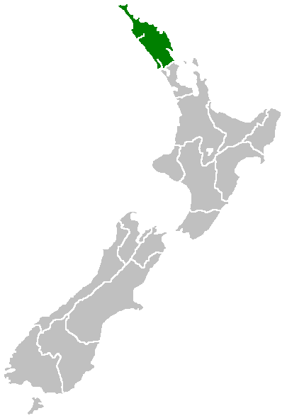
Region of New
Zealand, position on the map (source:English Wiki) {{PD}}
865:
795:
610:
900:
860:
815:
800:
790:
241:, without any conditions, unless such conditions are required by law.
810:
369:
Click on a date/time to view the file as it appeared at that time.
895:
820:
1105:
990:
171:
Region of New
Zealand, position on the map (source:English Wiki)
1090:
312:
copyrighted, dedicated to the public domain by copyright holder
196:
99:
61:
1050:
1020:
980:
1260:
1225:
1175:
1170:
222:
1135:
1095:
1230:
1200:
1145:
1140:
1130:
1255:
1185:
970:
348:
released into the public domain by the copyright holder
262:
Add a one-line explanation of what this file represents
1245:
1165:
1150:
1125:
1040:
1010:
960:
1250:
1220:
1215:
1210:
1190:
1180:
1155:
1110:
1205:
1195:
1120:
85:
Commons is a freely licensed media file repository.
1265:
1235:
1160:
1240:
1115:
51:(405 × 590 pixels, file size: 7 KB, MIME type:
66:
8:
1101:Template:Maramara matawhenua (Tai-tokerau)
371:
258:
176:
953:The following other wikis use this file:
237:grants anyone the right to use this work
127:. This has several advantages; see
438:
345:
329:
309:
293:
276:
273:
254:
247:
231:In case this is not legally possible:
210:This work has been released into the
7:
360:
631:Lake Rotokawau (Aupōuri Peninsula)
267:
261:
165:
110:
98:
44:
266:
252:
203:
103:
65:
31:
21:
249:
166:
41:No higher resolution available.
14:
248:
26:
1:
826:Rainbow Falls (Waianiwaniwa)
421:Category:Maps of New Zealand
274:Items portrayed in this file
977:Usage on de.wikivoyage.org
967:Usage on ceb.wikipedia.org
776:Mount Hikurangi (Northland)
1291:
1082:Usage on mi.wikipedia.org
1067:Usage on ko.wikipedia.org
1057:Usage on ja.wikipedia.org
1047:Usage on id.wikipedia.org
1037:Usage on hr.wikipedia.org
1027:Usage on hi.wikipedia.org
1017:Usage on gd.wikipedia.org
1007:Usage on fi.wikipedia.org
997:Usage on fa.wikipedia.org
987:Usage on eu.wikipedia.org
957:Usage on af.wikipedia.org
886:The Big Lake (New Zealand)
115:image could be re-created
926:Weber County, New Zealand
361:
227:. This applies worldwide.
129:Commons:Media for cleanup
47:Position_of_Northland.png
16:
1086:Whangārei-terenga-paraoa
846:Split Lake (New Zealand)
656:Lake Rotoroa (Northland)
476:Bulrush Lake (Northland)
251:
149:Vector version available
135:vector version available
72:This is a file from the
851:Swan Lake (New Zealand)
836:Salt Lake (New Zealand)
786:Ngawha geothermal field
418:
223:English Knowledge (XXG)
76:. Information from its
766:Maungaturoto (volcano)
79:description page there
571:Lake Karoro / Mathews
486:Cape Maria van Diemen
461:Bay of Islands County
496:Dargaville Aerodrome
481:Cape Brett Peninsula
397:07:40, 27 April 2005
155:) does not need the
991:Northland eskualdea
891:Titoki, New Zealand
761:Maungataniwha Range
666:Lake Rototuna Lower
531:Kokopu, New Zealand
511:Horahora, Whangārei
1091:Portland, Aotearoa
1031:नॉर्थलैण्ड क्षेत्र
906:Urupukapuka Island
771:Motukawanui Island
451:Arakaninihi Island
1275:more global usage
949:Global file usage
881:Te Puke (volcano)
425:
414:Domie~commonswiki
332:copyright license
260:
246:
245:
232:
195:
194:
164:
163:
94:
93:
74:Wikimedia Commons
32:Global file usage
1282:
1051:Region Northland
1021:Northland Region
936:Whangaroa County
931:Whangarei County
921:Waitahora Lagoon
856:Tarahi (volcano)
731:Lake Waiporohita
646:Lake Rotootuauru
521:Jellicoe Channel
501:Half Mile Lagoon
471:Brynderwyn Range
441:Aorangaia Island
409:
296:copyright status
230:
207:
206:
202:
197:
191:
188:
185:
182:
177:
170:
142:
107:
106:
100:
90:
69:
68:
62:
56:
54:
1290:
1289:
1285:
1284:
1283:
1281:
1280:
1279:
1106:Whangārei Heads
981:Vorlage:NZL-map
947:
756:Mangonui County
636:Lake Rotokereru
591:Lake Morehurehu
546:Lake Kahuparere
491:Cavalli Islands
426:
415:
407:
363:
362:
359:
358:
357:
356:
355:
354:
353:
352:
350:
338:
337:
336:
334:
323:
322:
321:
320:
319:
318:
317:
316:
314:
302:
301:
300:
298:
287:
286:
285:
284:
283:
281:
265:
264:
263:
239:for any purpose
216:by its author,
204:
189:
186:
183:
180:
172:
160:
132:
119:vector graphics
104:
96:
95:
84:
83:
82:is shown below.
58:
52:
50:
43:
42:
12:
11:
5:
1288:
1286:
1277:of this file.
1271:
1270:
1269:
1268:
1263:
1258:
1253:
1248:
1243:
1238:
1233:
1228:
1223:
1218:
1213:
1208:
1203:
1198:
1193:
1188:
1183:
1178:
1173:
1168:
1163:
1158:
1153:
1148:
1143:
1138:
1133:
1128:
1123:
1118:
1113:
1108:
1103:
1098:
1093:
1088:
1080:
1079:
1078:
1073:
1065:
1064:
1063:
1055:
1054:
1053:
1045:
1044:
1043:
1035:
1034:
1033:
1025:
1024:
1023:
1015:
1014:
1013:
1005:
1004:
1003:
995:
994:
993:
985:
984:
983:
975:
974:
973:
965:
964:
963:
951:
950:
945:to this file.
939:
938:
933:
928:
923:
918:
913:
908:
903:
898:
893:
888:
883:
878:
873:
868:
863:
858:
853:
848:
843:
838:
833:
828:
823:
818:
813:
808:
803:
798:
793:
788:
783:
778:
773:
768:
763:
758:
753:
751:Lake Ōwhareiti
748:
743:
741:Lake Whakaneke
738:
733:
728:
726:Lake Waiparera
723:
718:
713:
708:
706:Lake Waimimiha
703:
701:Lake Waikaramu
698:
693:
688:
686:Lake Te Kahika
683:
678:
673:
668:
663:
658:
653:
651:Lake Rotopouua
648:
643:
638:
633:
628:
623:
621:Lake Parawanui
618:
613:
608:
603:
601:Lake Ngakeketa
598:
593:
588:
583:
578:
573:
568:
563:
558:
553:
548:
543:
538:
533:
528:
523:
518:
516:Horeke basalts
513:
508:
503:
498:
493:
488:
483:
478:
473:
468:
463:
458:
453:
448:
443:
436:is available.
430:
429:
424:
423:
417:
413:
410:
404:
399:
394:
390:
389:
386:
383:
380:
377:
374:
367:
366:
351:
346:
344:
343:
342:
341:
340:
339:
335:
330:
328:
327:
326:
325:
324:
315:
310:
308:
307:
306:
305:
304:
303:
299:
294:
292:
291:
290:
289:
288:
282:
277:
275:
272:
271:
270:
269:
268:
257:
256:
253:
250:
244:
243:
208:
193:
192:
162:
161:
157:new image name
139:new image name
108:
97:
92:
91:
70:
60:
59:
40:
36:
35:
34:
29:
24:
19:
13:
10:
9:
6:
4:
3:
2:
1287:
1278:
1276:
1267:
1264:
1262:
1261:Awakino Point
1259:
1257:
1254:
1252:
1249:
1247:
1244:
1242:
1239:
1237:
1234:
1232:
1229:
1227:
1226:Marsden Point
1224:
1222:
1219:
1217:
1214:
1212:
1209:
1207:
1204:
1202:
1199:
1197:
1194:
1192:
1189:
1187:
1184:
1182:
1179:
1177:
1176:Maungakaramea
1174:
1172:
1171:Urquharts Bay
1169:
1167:
1164:
1162:
1159:
1157:
1154:
1152:
1149:
1147:
1144:
1142:
1139:
1137:
1134:
1132:
1129:
1127:
1124:
1122:
1119:
1117:
1114:
1112:
1109:
1107:
1104:
1102:
1099:
1097:
1094:
1092:
1089:
1087:
1084:
1083:
1081:
1077:
1074:
1072:
1069:
1068:
1066:
1062:
1059:
1058:
1056:
1052:
1049:
1048:
1046:
1042:
1039:
1038:
1036:
1032:
1029:
1028:
1026:
1022:
1019:
1018:
1016:
1012:
1009:
1008:
1006:
1002:
1001:منطقه نورثلند
999:
998:
996:
992:
989:
988:
986:
982:
979:
978:
976:
972:
969:
968:
966:
962:
959:
958:
956:
955:
954:
948:
946:
944:
937:
934:
932:
929:
927:
924:
922:
919:
917:
914:
912:
909:
907:
904:
902:
899:
897:
894:
892:
889:
887:
884:
882:
879:
877:
874:
872:
869:
867:
864:
862:
859:
857:
854:
852:
849:
847:
844:
842:
839:
837:
834:
832:
829:
827:
824:
822:
819:
817:
814:
812:
809:
807:
804:
802:
799:
797:
794:
792:
789:
787:
784:
782:
779:
777:
774:
772:
769:
767:
764:
762:
759:
757:
754:
752:
749:
747:
746:Lake Whirirau
744:
742:
739:
737:
734:
732:
729:
727:
724:
722:
719:
717:
716:Lake Waingata
714:
712:
711:Lake Waingaro
709:
707:
704:
702:
699:
697:
696:Lake Waikanae
694:
692:
691:Lake Wahakari
689:
687:
684:
682:
679:
677:
674:
672:
669:
667:
664:
662:
661:Lake Rototuna
659:
657:
654:
652:
649:
647:
644:
642:
641:Lake Rotomata
639:
637:
634:
632:
629:
627:
624:
622:
619:
617:
616:Lake Otapuiti
614:
612:
609:
607:
604:
602:
599:
597:
596:Lake Ngakapua
594:
592:
589:
587:
584:
582:
579:
577:
574:
572:
569:
567:
564:
562:
559:
557:
554:
552:
549:
547:
544:
542:
541:Lake Humuhumu
539:
537:
534:
532:
529:
527:
524:
522:
519:
517:
514:
512:
509:
507:
506:Henderson Bay
504:
502:
499:
497:
494:
492:
489:
487:
484:
482:
479:
477:
474:
472:
469:
467:
464:
462:
459:
457:
454:
452:
449:
447:
446:Araara Island
444:
442:
439:
437:
435:
427:
422:
416:
411:
405:
403:
400:
398:
395:
392:
391:
387:
384:
381:
378:
375:
373:
372:
370:
364:
349:
333:
313:
297:
280:
242:
240:
236:
233:
228:
226:
224:
220:
215:
214:
213:public domain
209:
199:
198:
184:Public domain
181:Public domain
179:
178:
175:
174:
169:
158:
154:
150:
146:
145:
140:
136:
130:
126:
124:
120:
114:
109:
102:
101:
88:
81:
80:
75:
71:
64:
63:
57:
48:
39:
33:
30:
28:
25:
23:
20:
18:
15:
1272:
1136:Tangiteroria
1096:Wheki Valley
952:
940:
911:Waihopo Lake
806:Phoebes Lake
781:Mount Manaia
736:Lake Wairere
681:Lake Tauanui
676:Lake Tairutu
581:Lake Manuwai
526:Kaikohe Hill
456:Aroha Island
431:
368:
365:File history
238:
229:
217:
211:
173:
167:
156:
144:
138:
116:
112:
87:You can help
77:
45:
22:File history
1231:Springfield
1201:Tangowahine
1146:Marsden Bay
1141:Ocean Beach
1131:Reotahi Bay
721:Lake Wainui
671:Lake Taeore
586:Lake Mokeno
576:Lake Kihona
566:Lake Karaka
561:Lake Kapoai
556:Lake Kanono
551:Lake Kaiwai
113:locator map
1256:Pikiwahine
1186:Kirikopuni
1076:분류:노스랜드 지방
943:more links
626:Lake Puhau
606:Lake Ngatu
466:Brynderwyn
428:File usage
406:405 × 590
382:Dimensions
159:parameter.
27:File usage
1246:Te Wharau
1166:Mamaranui
1151:Takahiwai
1126:Taurikura
1041:Northland
1011:Northland
971:Northland
961:Northland
916:Waimamaku
876:Te Ahuahu
871:Taurikura
841:Shag Lake
831:Rotopouri
536:Lake Half
434:full list
379:Thumbnail
376:Date/Time
221:, at the
168:English:
53:image/png
1251:Parahaka
1221:Pukehuia
1216:Tauraroa
1211:Moewhare
1191:Mangapai
1181:Tangihua
1156:Oakleigh
1111:Waiotama
1061:ノースランド地方
866:Tauraroa
796:Oromahoe
611:Lake Ora
255:Captions
1206:Omamari
1196:Maitahi
1121:Maropiu
1071:노스랜드 지방
901:Umawera
861:Tauanui
816:Pouerua
801:Pakotai
791:Omanaia
393:current
388:Comment
279:depicts
259:English
225:project
49:
1266:Parore
1236:Hoanga
1161:Waihue
811:Poroti
408:(7 KB)
235:Furius
219:Furius
201:
121:as an
117:using
1273:View
1241:Omana
1116:Avoca
941:View
896:Towai
821:Purua
190:false
187:false
111:This
385:User
151:(or
125:file
17:File
153:Vva
123:SVG
141:}}
133:{{
143:.
137:|
89:.
55:)
Text is available under the Creative Commons Attribution-ShareAlike License. Additional terms may apply.