245:
43:
200:
251:
256:
99:
1093:
1098:
725:
742:{{Information |Description=Topographic locator map for Papua (Indonesian part of New Guinea). Created with GMT from SRTM data. Left: 130, Bottom: -10, Right: 142, Top: 2 |Source=self-made |Date=Sep 11, 2007 |Author=
310:– You must give appropriate credit, provide a link to the license, and indicate if changes were made. You may do so in any reasonable manner, but not in any way that suggests the licensor endorses you or your use.
803:
1157:
1118:
775:
1108:
217:
838:
147:
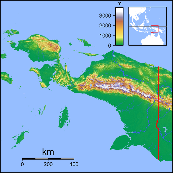
Topographic locator map for Papua (Indonesian part of New Guinea). Created with GMT from SRTM data. Left: 130, Bottom: -10, Right: 142, Top: 2
65:
215:; with no Invariant Sections, no Front-Cover Texts, and no Back-Cover Texts. A copy of the license is included in the section entitled
61:
57:
53:
47:
207:
110:
818:
78:
670:
600:
583:
566:
549:
532:
496:
918:
1148:
1168:
This file contains additional information, probably added from the digital camera or scanner used to create or digitize it.
317:
813:
654:
480:
452:
437:
424:
212:
620:
516:
397:
380:
459:
279:
275:
271:
267:
1199:
1171:
If the file has been modified from its original state, some details may not fully reflect the modified file.
756:
The following pages on the
English Knowledge (XXG) use this file (pages on other projects are not listed):
316:– If you remix, transform, or build upon the material, you must distribute your contributions under the
263:
913:
798:
118:
444:
1038:
823:
780:
724:
719:
194:
69:
42:
205:
Permission is granted to copy, distribute and/or modify this document under the terms of the
1033:
1083:
765:
743:
735:
1128:
191:
I, the copyright holder of this work, hereby publish it under the following licenses:
105:
770:
760:
175:
1023:
928:
1073:
155:
1053:
958:
1003:
833:
1043:
988:
978:
973:
968:
983:
998:
898:
893:
692:
Click on a date/time to view the file as it appeared at that time.
848:
1063:
993:
963:
1018:
1008:
858:
93:
1013:
953:
948:
903:
883:
863:
1058:
938:
1138:
364:
Add a one-line explanation of what this file represents
83:(1,591 × 1,591 pixels, file size: 1.57 MB, MIME type:
601:
Creative
Commons Attribution-ShareAlike 3.0 Unported
567:
211:, Version 1.2 or any later version published by the
137:
117:
Commons is a freely licensed media file repository.
584:
Creative
Commons Attribution-ShareAlike 1.0 Generic
550:
Creative
Commons Attribution-ShareAlike 2.5 Generic
533:
Creative
Commons Attribution-ShareAlike 2.0 Generic
873:
1039:Modulo:Mapa ti lokasion/datos/Indonesia Papua/dok
776:Knowledge (XXG):WikiProject Indonesia/Cartography
327:https://creativecommons.org/licenses/by-sa/3.0
98:
1034:Modulo:Mapa ti lokasion/datos/Indonesia Papua
445:https://commons.wikimedia.org/user:Sadalmelik
333:Creative Commons Attribution-Share Alike 3.0
244:
8:
293:– to copy, distribute and transmit the work
1173:
694:
360:
345:You may select the license of your choice.
791:The following other wikis use this file:
1196:
1191:
1183:
1175:
758:
668:
652:
634:
618:
598:
581:
564:
547:
530:
514:
494:
478:
411:
395:
378:
375:
356:
349:
1109:ಟೆಂಪ್ಲೇಟು:Location map Indonesia Papua
1129:Veidne:VietasKarte Papua (Indonēzija)
7:
1074:Parchi nazionali dell'Indonesia
1054:Parchi nazionali dell'Indonesia
223:http://www.gnu.org/copyleft/fdl.html
1024:Gempa bumi Laut Banda November 2023
683:
255:
250:
1166:
369:
363:
344:
241:
190:
130:
76:
959:Taman Nasional Teluk Cenderawasih
914:الگو:Location map Indonesia Papua
804:تريجانا للخدمات الجوية الرحلة 267
799:قالب:Location map Indonesia Papua
368:
1094:ინდონეზიის ეროვნული პარკების სია
354:
304:Under the following conditions:
262:This file is licensed under the
254:
249:
243:
199:
198:
97:
31:
21:
351:
14:
1004:Jalur Lipatan Anjakan Lengguru
350:
229:GNU Free Documentation License
218:GNU Free Documentation License
208:GNU Free Documentation License
26:
1:
1099:თარგი:პოზრუკა ინდონეზია პაპუა
671:original creation by uploader
36:
376:Items portrayed in this file
143:Papua Locator Topography.png
1135:Usage on min.wikipedia.org
1070:Usage on it.wikivoyage.org
1044:Lingsat Dampier (Indonesia)
1030:Usage on ilo.wikipedia.org
989:Bandar Udara Mopah, Merauke
979:Lapangan Terbang Middelburg
855:Usage on ceb.wikipedia.org
810:Usage on arz.wikipedia.org
1221:
1145:Usage on ml.wikipedia.org
1125:Usage on lv.wikipedia.org
1115:Usage on ko.wikipedia.org
1105:Usage on kn.wikipedia.org
1090:Usage on ka.wikipedia.org
1080:Usage on ja.wikipedia.org
1050:Usage on it.wikipedia.org
974:Templat:Location map Papua
969:Gempa bumi Irian Jaya 1976
945:Usage on id.wikipedia.org
935:Usage on fr.wikipedia.org
925:Usage on fi.wikipedia.org
910:Usage on fa.wikipedia.org
890:Usage on es.wikipedia.org
880:Usage on eo.wikipedia.org
870:Usage on cs.wikipedia.org
845:Usage on ca.wikipedia.org
830:Usage on bg.wikipedia.org
795:Usage on ar.wikipedia.org
318:same or compatible license
984:Lapangan Terbang Sansapor
929:Länsi-Papuan maanjäristys
684:
165:
16:
999:Komolom, Kimaam, Merauke
720:19:54, 11 September 2007
353:
284:
266:Attribution-Share Alike
213:Free Software Foundation
104:This is a file from the
894:Nueva Guinea Occidental
741:
171:
161:
154:
151:
140:
108:. Information from its
1200:ESP Ghostscript 815.02
111:description page there
46:Size of this preview:
1177:Horizontal resolution
849:Badia de Cenderawasih
1064:Baia di Cenderawasih
994:Gempa bumi Biak 1996
964:Taman Nasional Wasur
70:1,591 × 1,591 pixels
66:1,024 × 1,024 pixels
1185:Vertical resolution
839:Чендравасих (залив)
299:– to adapt the work
52:Other resolutions:
899:Bahía Cenderawasih
453:Wikimedia username
425:author name string
1208:
1207:
1158:more global usage
1119:틀:위치 지도 인도네시아 파푸아
1019:Liga 3 2023 Papua
1009:Merauke (distrik)
787:Global file usage
781:Portal:New Guinea
749:
636:11 September 2007
517:copyright license
362:
240:
239:
181:
180:
156:11 September 2007
126:
125:
106:Wikimedia Commons
32:Global file usage
1212:
1202:
1174:
1014:Merauke, Merauke
954:Pegunungan Maoke
859:Pegunungan Maoke
819:جبل نجا پيليمسيت
732:
481:copyright status
462:
457:
447:
442:
432:
429:
340:
337:
334:
331:
328:
320:as the original.
264:Creative Commons
258:
257:
253:
252:
247:
246:
236:
233:
230:
227:
224:
202:
201:
195:
167:
157:
144:
138:
122:
101:
100:
94:
88:
86:
73:
62:768 × 768 pixels
58:480 × 480 pixels
54:240 × 240 pixels
48:600 × 600 pixels
1220:
1219:
1215:
1214:
1213:
1211:
1210:
1209:
1198:
1162:
785:
766:Maoke Mountains
757:
750:
738:
730:
686:
685:
682:
681:
680:
679:
678:
677:
676:
675:
673:
661:
660:
659:
657:
646:
645:
644:
643:
642:
641:
640:
639:
637:
627:
626:
625:
623:
612:
611:
610:
609:
608:
607:
606:
605:
603:
592:
591:
590:
589:
588:
586:
575:
574:
573:
572:
571:
569:
558:
557:
556:
555:
554:
552:
541:
540:
539:
538:
537:
535:
523:
522:
521:
519:
508:
507:
506:
505:
504:
503:
502:
501:
499:
487:
486:
485:
483:
472:
471:
470:
469:
468:
467:
466:
465:
464:
463:
458:
455:
449:
448:
443:
440:
434:
433:
430:
427:
418:
417:
416:
414:
404:
403:
402:
400:
389:
388:
387:
386:
385:
383:
367:
366:
365:
348:
347:
346:
342:
341:
338:
335:
332:
329:
326:
325:
283:
259:
234:
231:
228:
225:
222:
193:
192:
187:
182:
142:
135:
128:
127:
116:
115:
114:is shown below.
90:
84:
82:
75:
74:
51:
12:
11:
5:
1218:
1216:
1206:
1205:
1204:
1203:
1194:
1190:
1189:
1186:
1182:
1181:
1178:
1165:
1160:of this file.
1154:
1153:
1152:
1151:
1143:
1142:
1141:
1133:
1132:
1131:
1123:
1122:
1121:
1113:
1112:
1111:
1103:
1102:
1101:
1096:
1088:
1087:
1086:
1078:
1077:
1076:
1068:
1067:
1066:
1061:
1056:
1048:
1047:
1046:
1041:
1036:
1028:
1027:
1026:
1021:
1016:
1011:
1006:
1001:
996:
991:
986:
981:
976:
971:
966:
961:
956:
951:
949:Nabire, Nabire
943:
942:
941:
933:
932:
931:
923:
922:
921:
919:کوههای مائوکه
916:
908:
907:
906:
901:
896:
888:
887:
886:
878:
877:
876:
868:
867:
866:
861:
853:
852:
851:
843:
842:
841:
836:
828:
827:
826:
821:
816:
814:جبل اوسوا انين
808:
807:
806:
801:
789:
788:
784:
783:
778:
773:
768:
763:
755:
754:
753:
748:
747:
740:
736:
733:
729:1,591 × 1,591
727:
722:
717:
713:
712:
709:
706:
703:
700:
697:
690:
689:
674:
669:
667:
666:
665:
664:
663:
662:
658:
655:source of file
653:
651:
650:
649:
648:
647:
638:
635:
633:
632:
631:
630:
629:
628:
624:
619:
617:
616:
615:
614:
613:
604:
599:
597:
596:
595:
594:
593:
587:
582:
580:
579:
578:
577:
576:
570:
565:
563:
562:
561:
560:
559:
553:
548:
546:
545:
544:
543:
542:
536:
531:
529:
528:
527:
526:
525:
524:
520:
515:
513:
512:
511:
510:
509:
500:
495:
493:
492:
491:
490:
489:
488:
484:
479:
477:
476:
475:
474:
473:
451:
450:
436:
435:
423:
422:
421:
420:
419:
415:
412:
410:
409:
408:
407:
406:
405:
401:
396:
394:
393:
392:
391:
390:
384:
379:
377:
374:
373:
372:
371:
370:
359:
358:
355:
352:
343:
324:
323:
322:
321:
311:
302:
301:
300:
294:
287:You are free:
261:
260:
242:
238:
237:
203:
189:
188:
186:
183:
179:
178:
173:
169:
168:
163:
159:
158:
153:
149:
148:
145:
136:
134:
131:
129:
124:
123:
102:
92:
91:
45:
41:
40:
39:
34:
29:
24:
19:
13:
10:
9:
6:
4:
3:
2:
1217:
1201:
1197:
1195:
1193:Software used
1192:
1187:
1184:
1179:
1176:
1172:
1169:
1163:
1161:
1159:
1150:
1147:
1146:
1144:
1140:
1137:
1136:
1134:
1130:
1127:
1126:
1124:
1120:
1117:
1116:
1114:
1110:
1107:
1106:
1104:
1100:
1097:
1095:
1092:
1091:
1089:
1085:
1082:
1081:
1079:
1075:
1072:
1071:
1069:
1065:
1062:
1060:
1057:
1055:
1052:
1051:
1049:
1045:
1042:
1040:
1037:
1035:
1032:
1031:
1029:
1025:
1022:
1020:
1017:
1015:
1012:
1010:
1007:
1005:
1002:
1000:
997:
995:
992:
990:
987:
985:
982:
980:
977:
975:
972:
970:
967:
965:
962:
960:
957:
955:
952:
950:
947:
946:
944:
940:
937:
936:
934:
930:
927:
926:
924:
920:
917:
915:
912:
911:
909:
905:
902:
900:
897:
895:
892:
891:
889:
885:
882:
881:
879:
875:
872:
871:
869:
865:
862:
860:
857:
856:
854:
850:
847:
846:
844:
840:
837:
835:
832:
831:
829:
825:
822:
820:
817:
815:
812:
811:
809:
805:
802:
800:
797:
796:
794:
793:
792:
786:
782:
779:
777:
774:
772:
769:
767:
764:
762:
759:
751:
745:
739:
734:
728:
726:
723:
721:
718:
715:
714:
710:
707:
704:
701:
698:
696:
695:
693:
687:
672:
656:
622:
602:
585:
568:
551:
534:
518:
498:
482:
461:
454:
446:
439:
426:
399:
382:
330:CC BY-SA 3.0
319:
315:
312:
309:
306:
305:
303:
298:
295:
292:
289:
288:
286:
285:
281:
277:
273:
269:
265:
248:
220:
219:
214:
210:
209:
204:
197:
196:
184:
177:
174:
170:
164:
160:
150:
146:
139:
132:
120:
113:
112:
107:
103:
96:
95:
89:
80:
79:Original file
71:
67:
63:
59:
55:
49:
44:
38:
35:
33:
30:
28:
25:
23:
20:
18:
15:
1170:
1167:
1155:
904:Montes Maoke
884:Golfo Sarera
790:
771:Tariku River
761:Lakes Plains
691:
688:File history
313:
307:
296:
290:
268:3.0 Unported
216:
206:
119:You can help
109:
77:
22:File history
1059:Monti Maoke
939:Monts Maoke
864:Teluk Irian
497:copyrighted
314:share alike
308:attribution
280:1.0 Generic
276:2.0 Generic
272:2.5 Generic
141:Description
752:File usage
744:Sadalmelik
737:Sadalmelik
705:Dimensions
460:Sadalmelik
431:Sadalmelik
413:some value
176:Sadalmelik
27:File usage
1149:സുമന്ത്രി
1139:Ngga pulu
824:نهر بولاو
731:(1.57 MB)
702:Thumbnail
699:Date/Time
621:inception
185:Licensing
85:image/png
1164:Metadata
746:}} [[Ca
357:Captions
297:to remix
291:to share
282:license.
166:Own work
37:Metadata
1188:100 dpc
1180:100 dpc
716:current
711:Comment
398:creator
381:depicts
361:English
133:Summary
81:
172:Author
162:Source
1156:View
1084:マオケ山脈
874:Maoke
834:Маоке
708:User
339:true
336:true
278:and
235:true
232:true
226:GFDL
152:Date
17:File
438:URL
456::
441::
428::
274:,
270:,
68:|
64:|
60:|
56:|
50:.
221:.
121:.
87:)
72:.
Text is available under the Creative Commons Attribution-ShareAlike License. Additional terms may apply.
