303:
233:
225:
247:
271:
309:
314:
67:
734:"}},"text\/plain":{"en":{"":"heading"}}},"{\"value\":{\"amount\":\"+337\",\"unit\":\"http:\\\/\\\/www.wikidata.org\\\/entity\\\/Q28390\"},\"type\":\"quantity\"}":{"text\/html":{"en":{"P7787":"337
730:
216:
361:– You must give appropriate credit, provide a link to the license, and indicate if changes were made. You may do so in any reasonable manner, but not in any way that suggests the licensor endorses you or your use.
38:
950:
731:
78:
46:
194:
666:
596:
560:
441:
240:
817:
686:
278:
368:
523:
837:
801:
772:
745:
694:
650:
544:
516:
503:
488:
709:
679:
616:
580:
461:
425:
931:|Source=Geograph project http://www.geograph.org.uk/photo/261461 |Date=Friday, 13 October, 2006 |Author=Roger Gilb
265:
148:
928:
324:
367:– If you remix, transform, or build upon the material, you must distribute your contributions under the
285:
on the
Geograph website for the photographer's contact details. The copyright on this image is owned by
905:
900:
37:
321:
110:
738:"}},"text\/plain":{"en":{"P7787":"337 degree"}}}}": -->
916:
86:
144:
105:
716:
701:
495:
945:
924:
246:
290:
73:
968:
230:
162:
183:
173:
270:
282:
873:
Click on a date/time to view the file as it appeared at that time.
232:
217:
54° 01′ 00.13″ N, 0° 46′ 03.2″ W
207:
61:
988:
1008:
998:
978:
951:
List of church restorations and alterations by G. E. Street
409:
Add a one-line explanation of what this file represents
1018:
201:
Creative
Commons Attribution Share-alike license 2.0
127:
99:
85:
Commons is a freely licensed media file repository.
597:
Creative
Commons Attribution-ShareAlike 2.0 Generic
51:(636 × 480 pixels, file size: 100 KB, MIME type:
378:https://creativecommons.org/licenses/by-sa/2.0
66:
384:Creative Commons Attribution-Share Alike 2.0
302:
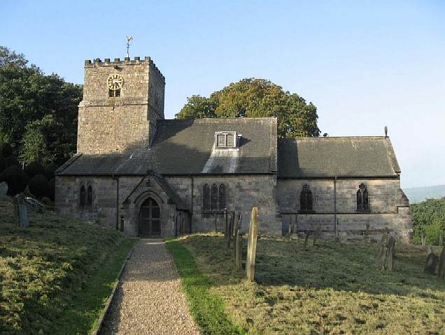
153:The Parish Church is dedicated to All Saints.
8:
735:
344:– to copy, distribute and transmit the work
923:{{Information |Description=Parish Church,
875:
405:
961:The following other wikis use this file:
717:https://www.geograph.org.uk/photo/261461
496:https://www.geograph.org.uk/profile/6184
943:
851:
835:
815:
799:
759:
743:
664:
648:
630:
614:
594:
578:
558:
542:
475:
459:
439:
423:
420:
401:
394:
210:
239:View this and other nearby images on:
969:Kirby Underdale (kapital sa distrito)
941:The following 2 pages use this file:
7:
289:and is licensed for reuse under the
864:
325:Attribution-Share Alike 2.0 Generic
313:
308:
293:Attribution-ShareAlike 2.0 license.
414:
408:
299:
276:
137:
133:Parish Church, Kirby Underdale.jpg
103:
98:
47:Parish_Church,_Kirby_Underdale.jpg
44:
413:
399:
355:Under the following conditions:
320:This file is licensed under the
312:
307:
301:
269:
245:
231:
223:
65:
31:
21:
396:
138:
41:No higher resolution available.
14:
667:file available on the internet
395:
277:This image was taken from the
26:
1:
746:coordinates of depicted place
687:Geograph Britain and Ireland
517:object of statement has role
421:Items portrayed in this file
222:
985:Usage on lld.wikipedia.org
965:Usage on ceb.wikipedia.org
1037:
1015:Usage on www.wikidata.org
1005:Usage on pl.wikipedia.org
995:Usage on nl.wikipedia.org
975:Usage on fr.wikipedia.org
761:54°1'0.131"N, 0°46'3.180"W
369:same or compatible license
143:All Saints Parish Church,
865:
16:
929:East Riding of Yorkshire
695:geograph.org.uk image ID
398:
335:
149:East Riding of Yorkshire
72:This is a file from the
922:
189:
179:
168:
161:
158:
130:
76:. Information from its
901:21:10, 14 October 2007
283:this photograph's page
251:54.016703; -0.767550
79:description page there
802:location of creation
442:Church of All Saints
350:– to adapt the work
104:This is a photo of
504:author name string
957:Global file usage
934:
737:
581:copyright license
407:
298:
297:
281:collection. See
256:
255:
205:
204:
198:
195:Reusing this file
120:
119:
94:
93:
74:Wikimedia Commons
32:Global file usage
1028:
913:
783:
782:
777:
719:
714:
710:described at URL
704:
699:
689:
684:
545:copyright status
526:
521:
511:
510:Roger Gilbertson
508:
498:
493:
391:
388:
385:
382:
379:
371:as the original.
333:
332:Roger Gilbertson
322:Creative Commons
316:
315:
311:
310:
305:
304:
291:Creative Commons
287:Roger Gilbertson
279:Geograph project
273:
266:
252:
249:
235:
234:
228:
227:
226:
220:
219:
208:
192:
184:Roger Gilbertson
164:
142:
134:
128:
113:
100:
90:
69:
68:
62:
56:
54:
1036:
1035:
1031:
1030:
1029:
1027:
1026:
1025:
1009:Kirby Underdale
999:Kirby Underdale
989:Kirby Underdale
979:Kirby Underdale
955:
946:Kirby Underdale
935:
925:Kirby Underdale
919:
911:
867:
866:
863:
862:
861:
860:
859:
858:
857:
856:
854:
844:
843:
842:
840:
829:
828:
827:
826:
825:
824:
823:
822:
820:
818:Kirby Underdale
808:
807:
806:
804:
793:
792:
791:
790:
789:
788:
787:
786:
785:
784:
780:
778:
775:
766:
765:
764:
762:
752:
751:
750:
748:
729:
728:
727:
726:
725:
724:
723:
722:
721:
720:
715:
712:
706:
705:
700:
697:
691:
690:
685:
682:
673:
672:
671:
669:
657:
656:
655:
653:
642:
641:
640:
639:
638:
637:
636:
635:
633:
632:13 October 2006
623:
622:
621:
619:
608:
607:
606:
605:
604:
603:
602:
601:
599:
587:
586:
585:
583:
572:
571:
570:
569:
568:
567:
566:
565:
563:
551:
550:
549:
547:
536:
535:
534:
533:
532:
531:
530:
529:
528:
527:
522:
519:
513:
512:
509:
506:
500:
499:
494:
491:
482:
481:
480:
478:
468:
467:
466:
464:
453:
452:
451:
450:
449:
448:
447:
446:
444:
432:
431:
430:
428:
412:
411:
410:
393:
392:
389:
386:
383:
380:
377:
376:
334:
331:
328:
317:
294:
264:
250:
224:
215:
214:
211:Object location
206:
174:geograph.org.uk
163:13 October 2006
154:
145:Kirby Underdale
132:
125:
115:
109:
106:listed building
96:
95:
84:
83:
82:is shown below.
58:
52:
50:
43:
42:
12:
11:
5:
1034:
1032:
1024:
1023:
1022:
1021:
1013:
1012:
1011:
1003:
1002:
1001:
993:
992:
991:
983:
982:
981:
973:
972:
971:
959:
958:
954:
953:
948:
939:
938:
933:
932:
921:
917:
914:
908:
903:
898:
894:
893:
890:
887:
884:
881:
878:
871:
870:
855:
852:
850:
849:
848:
847:
846:
845:
841:
836:
834:
833:
832:
831:
830:
821:
816:
814:
813:
812:
811:
810:
809:
805:
800:
798:
797:
796:
795:
794:
771:
770:
769:
768:
767:
763:
760:
758:
757:
756:
755:
754:
753:
749:
744:
742:
741:
740:
739:
733:
708:
707:
693:
692:
678:
677:
676:
675:
674:
670:
665:
663:
662:
661:
660:
659:
658:
654:
651:source of file
649:
647:
646:
645:
644:
643:
634:
631:
629:
628:
627:
626:
625:
624:
620:
615:
613:
612:
611:
610:
609:
600:
595:
593:
592:
591:
590:
589:
588:
584:
579:
577:
576:
575:
574:
573:
564:
559:
557:
556:
555:
554:
553:
552:
548:
543:
541:
540:
539:
538:
537:
515:
514:
502:
501:
487:
486:
485:
484:
483:
479:
476:
474:
473:
472:
471:
470:
469:
465:
460:
458:
457:
456:
455:
454:
445:
440:
438:
437:
436:
435:
434:
433:
429:
424:
422:
419:
418:
417:
416:
415:
404:
403:
400:
397:
375:
374:
373:
372:
362:
353:
352:
351:
345:
338:You are free:
329:
319:
318:
300:
296:
295:
274:
263:
260:
254:
253:
243:
237:
212:
203:
202:
199:
187:
186:
181:
177:
176:
170:
166:
165:
160:
156:
155:
135:
126:
124:
121:
118:
117:
97:
92:
91:
70:
60:
59:
40:
36:
35:
34:
29:
24:
19:
13:
10:
9:
6:
4:
3:
2:
1033:
1020:
1017:
1016:
1014:
1010:
1007:
1006:
1004:
1000:
997:
996:
994:
990:
987:
986:
984:
980:
977:
976:
974:
970:
967:
966:
964:
963:
962:
956:
952:
949:
947:
944:
942:
936:
930:
926:
920:
918:Angusmclellan
915:
909:
907:
904:
902:
899:
896:
895:
891:
888:
885:
882:
879:
877:
876:
874:
868:
839:
819:
803:
774:
747:
718:
711:
703:
696:
688:
681:
668:
652:
618:
598:
582:
562:
546:
525:
518:
505:
497:
490:
463:
443:
427:
381:CC BY-SA 2.0
370:
366:
363:
360:
357:
356:
354:
349:
346:
343:
340:
339:
337:
336:
330:Attribution:
326:
323:
306:
292:
288:
284:
280:
275:
272:
268:
267:
261:
259:
258:
248:
244:
242:
241:OpenStreetMap
238:
236:
218:
213:
209:
200:
196:
191:
188:
185:
182:
178:
175:
171:
167:
157:
152:
150:
146:
141:
136:
129:
122:
116:
112:
107:
102:
101:
88:
81:
80:
75:
71:
64:
63:
57:
48:
39:
33:
30:
28:
25:
23:
20:
18:
15:
960:
940:
872:
869:File history
524:photographer
364:
358:
347:
341:
286:
257:
221:
139:
87:You can help
77:
45:
22:File history
561:copyrighted
365:share alike
359:attribution
131:Description
937:File usage
910:636 × 480
886:Dimensions
853:image/jpeg
838:media type
477:some value
190:Permission
151:, England.
53:image/jpeg
27:File usage
883:Thumbnail
880:Date/Time
617:inception
262:Licensing
140:English:
1019:Q4693676
912:(100 KB)
680:operator
402:Captions
348:to remix
342:to share
327:license.
897:current
892:Comment
773:heading
732:heading
462:creator
426:depicts
406:English
123:Summary
111:1083837
108:number
49:
781:degree
736:degree
702:261461
229:
180:Author
169:Source
172:From
889:User
779:337
390:true
387:true
159:Date
17:File
489:URL
927:,
776::
713::
698::
683::
520::
507::
492::
147:,
197:)
193:(
114:.
89:.
55:)
Text is available under the Creative Commons Attribution-ShareAlike License. Additional terms may apply.
_region:GB-ENG_heading:337.00&language=en)
