300:
230:
399:
222:
244:
268:
306:
311:
67:
828:"}},"text\/plain":{"en":{"":"heading"}}},"{\"value\":{\"amount\":\"+45\",\"unit\":\"http:\\\/\\\/www.wikidata.org\\\/entity\\\/Q28390\"},\"type\":\"quantity\"}":{"text\/html":{"en":{"P7787":"45
824:
213:
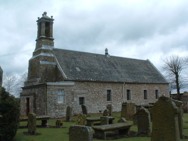
947:== {{int:filedesc}} == {{Information |description={{en|1=Pettinain Church. A quaint little building, curious design.. see http://www.srct.org.uk/pettinain.html for more info.}} |date=2006-05-01 |source=From [http://www.geograph.org.uk/photo/162213 geograp
38:
358:– You must give appropriate credit, provide a link to the license, and indicate if changes were made. You may do so in any reasonable manner, but not in any way that suggests the licensor endorses you or your use.
78:
46:
825:
407:
424:
760:
690:
654:
237:
780:
1114:
275:
977:
This file contains additional information, probably added from the digital camera or scanner used to create or digitize it.
365:
617:
1083:
866:
839:
788:
744:
638:
610:
597:
582:
500:
803:
773:
710:
674:
555:
538:
447:
961:
262:
929:
924:
439:
37:
321:
980:
If the file has been modified from its original state, some details may not fully reflect the modified file.
420:
957:
The following pages on the
English Knowledge (XXG) use this file (pages on other projects are not listed):
1167:
364:– If you remix, transform, or build upon the material, you must distribute your contributions under the
282:
on the
Geograph website for the photographer's contact details. The copyright on this image is owned by
940:
318:
1203:
832:"}},"text\/plain":{"en":{"P7787":"45 degree"}}}}": -->
428:
86:
182:
413:
Remove redundant categories and try to put this image in the most specific category/categories
810:
795:
589:
166:
491:
495:
487:
483:
479:
475:
471:
467:
463:
459:
455:
243:
1271:
1185:
1141:
1006:
287:
73:
1046:
999:
1213:
134:
1026:
966:
155:
145:
227:
1289:
1016:
989:
267:
122:
279:
897:
Click on a date/time to view the file as it appeared at that time.
121:
Pettinain Church. A quaint little building, curious design.. see
229:
204:
61:
522:
Add a one-line explanation of what this file represents
427:
combined with a database. You can also have a look at
419:
The location categories are based on information from
105:
85:
Commons is a freely licensed media file repository.
691:
Creative
Commons Attribution-ShareAlike 2.0 Generic
1208:Flash did not fire, compulsory flash suppression
51:(640 × 480 pixels, file size: 78 KB, MIME type:
404:The categories of this image should be checked.
111:Pettinain Church - geograph.org.uk - 162213.jpg
47:Pettinain_Church_-_geograph.org.uk_-_162213.jpg
375:https://creativecommons.org/licenses/by-sa/2.0
66:
381:Creative Commons Attribution-Share Alike 2.0
299:
8:
829:
341:– to copy, distribute and transmit the work
982:
899:
518:
499:
811:https://www.geograph.org.uk/photo/162213
590:https://www.geograph.org.uk/profile/1594
1297:
1287:
1279:
1269:
1261:
1253:
1245:
1237:
1229:
1221:
1211:
1201:
1193:
1183:
1175:
1165:
1157:
1149:
1139:
1131:
1123:
1112:
1104:
1096:
1088:
1078:
1070:
1062:
1054:
1043:
1035:
1024:
1014:
1004:
994:
959:
853:
837:
758:
742:
724:
708:
688:
672:
652:
636:
569:
553:
536:
533:
514:
507:
446:This image was uploaded as part of the
214:55° 40′ N, 3° 40′ W
207:
236:View this and other nearby images on:
1084:Digital Camera FinePix S304 Ver1.00
984:
434:The topic category from Geograph was
123:http://www.srct.org.uk/pettinain.html
7:
286:and is licensed for reuse under the
888:
322:Attribution-Share Alike 2.0 Generic
310:
305:
290:Attribution-ShareAlike 2.0 license.
975:
527:
521:
296:
273:
115:
98:
44:
526:
1037:Date and time of data generation
512:
397:
352:Under the following conditions:
317:This file is licensed under the
309:
304:
298:
266:
242:
228:
220:
65:
21:
509:
116:
41:No higher resolution available.
14:
1011:1/170 sec (0.0058823529411765)
761:file available on the internet
508:
274:This image was taken from the
26:
1:
840:coordinates of depicted place
31:
781:Geograph Britain and Ireland
611:object of statement has role
534:Items portrayed in this file
1239:Focal plane resolution unit
1125:Date and time of digitizing
219:
1319:
1250:One-chip color area sensor
962:Historic Churches Scotland
366:same or compatible license
1090:File change date and time
889:
195:Alan Stewart /
176:Alan Stewart /
16:
1231:Focal plane Y resolution
1223:Focal plane X resolution
789:geograph.org.uk image ID
511:
429:this tool from mysociety
395:
394:
332:
72:This is a file from the
1255:Custom image processing
946:
425:this OpenStreetMap tool
167:required by the license
151:
140:
133:
130:
108:
76:. Information from its
1299:Subject distance range
1133:Image compression mode
925:11:36, 31 January 2010
280:this photograph's page
248:55.665000; -3.660000
79:description page there
1177:Maximum land aperture
1064:Horizontal resolution
855:55°39'54"N, 3°39'36"W
448:Geograph batch upload
438:(find similar images
416:Remove this template
1098:Y and C positioning
1072:Vertical resolution
986:Camera manufacturer
492:português do Brasil
347:– to adapt the work
1281:Scene capture type
1276:Auto white balance
598:author name string
421:this geonames tool
1306:
1305:
1128:13:51, 1 May 2006
1093:13:51, 1 May 2006
1040:13:51, 1 May 2006
950:
831:
675:copyright license
520:
503:
450:
295:
294:
278:collection. See
253:
252:
202:
201:
170:
94:
93:
74:Wikimedia Commons
1310:
1106:Exposure Program
983:
937:
877:
876:
871:
813:
808:
804:described at URL
798:
793:
783:
778:
639:copyright status
620:
615:
605:
602:
592:
587:
504:
445:
402:
401:
400:
388:
385:
382:
379:
376:
368:as the original.
330:
319:Creative Commons
313:
312:
308:
307:
302:
301:
288:Creative Commons
276:Geograph project
270:
263:
249:
246:
232:
231:
225:
224:
223:
217:
216:
205:
197:Pettinain Church
178:Pettinain Church
164:
136:
120:
112:
106:
90:
69:
68:
62:
56:
54:
1318:
1317:
1313:
1312:
1311:
1309:
1308:
1307:
1180:3 APEX (f/2.83)
1159:APEX brightness
971:
958:
951:
943:
935:
891:
890:
887:
886:
885:
884:
883:
882:
881:
880:
879:
878:
874:
872:
869:
860:
859:
858:
856:
846:
845:
844:
842:
823:
822:
821:
820:
819:
818:
817:
816:
815:
814:
809:
806:
800:
799:
794:
791:
785:
784:
779:
776:
767:
766:
765:
763:
751:
750:
749:
747:
736:
735:
734:
733:
732:
731:
730:
729:
727:
717:
716:
715:
713:
702:
701:
700:
699:
698:
697:
696:
695:
693:
681:
680:
679:
677:
666:
665:
664:
663:
662:
661:
660:
659:
657:
645:
644:
643:
641:
630:
629:
628:
627:
626:
625:
624:
623:
622:
621:
616:
613:
607:
606:
603:
600:
594:
593:
588:
585:
576:
575:
574:
572:
562:
561:
560:
558:
547:
546:
545:
544:
543:
541:
525:
524:
523:
506:
454:
451:
408:Check them now!
398:
396:
390:
389:
386:
383:
380:
377:
374:
373:
331:
328:
325:
314:
291:
261:
247:
221:
212:
211:
208:Object location
203:
192:
185:
173:
146:geograph.org.uk
126:
110:
103:
96:
95:
84:
83:
82:is shown below.
58:
52:
50:
43:
42:
12:
11:
5:
1316:
1314:
1304:
1303:
1300:
1296:
1295:
1292:
1286:
1285:
1282:
1278:
1277:
1274:
1268:
1267:
1264:
1260:
1259:
1258:Normal process
1256:
1252:
1251:
1248:
1247:Sensing method
1244:
1243:
1240:
1236:
1235:
1232:
1228:
1227:
1224:
1220:
1219:
1216:
1210:
1209:
1206:
1200:
1199:
1196:
1192:
1191:
1188:
1182:
1181:
1178:
1174:
1173:
1170:
1164:
1163:
1160:
1156:
1155:
1152:
1148:
1147:
1144:
1138:
1137:
1134:
1130:
1129:
1126:
1122:
1121:
1118:
1111:
1110:
1109:Normal program
1107:
1103:
1102:
1099:
1095:
1094:
1091:
1087:
1086:
1081:
1077:
1076:
1073:
1069:
1068:
1065:
1061:
1060:
1057:
1053:
1052:
1049:
1042:
1041:
1038:
1034:
1033:
1030:
1023:
1022:
1019:
1013:
1012:
1009:
1003:
1002:
1000:FinePix S304
997:
993:
992:
987:
974:
970:
969:
964:
956:
955:
954:
949:
948:
945:
941:
938:
932:
927:
922:
918:
917:
914:
911:
908:
905:
902:
895:
894:
865:
864:
863:
862:
861:
857:
854:
852:
851:
850:
849:
848:
847:
843:
838:
836:
835:
834:
833:
827:
802:
801:
787:
786:
772:
771:
770:
769:
768:
764:
759:
757:
756:
755:
754:
753:
752:
748:
745:source of file
743:
741:
740:
739:
738:
737:
728:
725:
723:
722:
721:
720:
719:
718:
714:
709:
707:
706:
705:
704:
703:
694:
689:
687:
686:
685:
684:
683:
682:
678:
673:
671:
670:
669:
668:
667:
658:
653:
651:
650:
649:
648:
647:
646:
642:
637:
635:
634:
633:
632:
631:
609:
608:
596:
595:
581:
580:
579:
578:
577:
573:
570:
568:
567:
566:
565:
564:
563:
559:
554:
552:
551:
550:
549:
548:
542:
537:
535:
532:
531:
530:
529:
528:
517:
516:
513:
510:
444:
443:
432:
417:
414:
372:
371:
370:
369:
359:
350:
349:
348:
342:
335:You are free:
326:
316:
315:
297:
293:
292:
271:
260:
257:
251:
250:
240:
234:
209:
200:
199:
193:
190:
187:
186:
181:
174:
171:
159:
158:
153:
149:
148:
142:
138:
137:
132:
128:
127:
125:for more info.
113:
104:
102:
99:
97:
92:
91:
70:
60:
59:
40:
36:
35:
34:
29:
24:
19:
13:
10:
9:
6:
4:
3:
2:
1315:
1301:
1298:
1293:
1291:
1288:
1283:
1280:
1275:
1273:
1272:White balance
1270:
1266:Auto exposure
1265:
1263:Exposure mode
1262:
1257:
1254:
1249:
1246:
1241:
1238:
1233:
1230:
1225:
1222:
1217:
1215:
1212:
1207:
1205:
1202:
1197:
1194:
1189:
1187:
1186:Metering mode
1184:
1179:
1176:
1171:
1169:
1168:Exposure bias
1166:
1161:
1158:
1153:
1151:APEX aperture
1150:
1145:
1143:
1142:Shutter speed
1140:
1135:
1132:
1127:
1124:
1119:
1116:
1113:
1108:
1105:
1100:
1097:
1092:
1089:
1085:
1082:
1080:Software used
1079:
1074:
1071:
1066:
1063:
1058:
1055:
1050:
1048:
1044:
1039:
1036:
1031:
1028:
1025:
1020:
1018:
1015:
1010:
1008:
1007:Exposure time
1005:
1001:
998:
995:
991:
988:
985:
981:
978:
972:
968:
965:
963:
960:
952:
944:
939:
933:
931:
928:
926:
923:
920:
919:
915:
912:
909:
906:
903:
901:
900:
898:
892:
868:
841:
812:
805:
797:
790:
782:
775:
762:
746:
712:
692:
676:
656:
640:
619:
612:
599:
591:
584:
557:
540:
505:
502:
497:
493:
489:
485:
481:
477:
473:
469:
465:
461:
457:
452:
449:
441:
437:
433:
430:
426:
422:
418:
415:
412:
411:
410:
409:
405:
393:
392:
378:CC BY-SA 2.0
367:
363:
360:
357:
354:
353:
351:
346:
343:
340:
337:
336:
334:
333:
327:Attribution:
323:
320:
303:
289:
285:
281:
277:
272:
269:
265:
264:
258:
256:
255:
245:
241:
239:
238:OpenStreetMap
235:
233:
215:
210:
206:
198:
194:
189:
188:
184:
180: /
179:
175:
168:
163:
161:
160:
157:
154:
150:
147:
143:
139:
129:
124:
119:
114:
107:
100:
88:
81:
80:
75:
71:
64:
63:
57:
48:
39:
33:
30:
28:
25:
23:
20:
18:
15:
1195:Light source
1047:focal length
996:Camera model
979:
976:
896:
893:File history
618:photographer
604:Alan Stewart
453:
435:
406:
403:
391:
361:
355:
344:
338:
329:Alan Stewart
284:Alan Stewart
283:
254:
218:
196:
183:CC BY-SA 2.0
177:
156:Alan Stewart
117:
87:You can help
77:
45:
22:File history
1214:Color space
1056:Orientation
942:GeographBot
655:copyrighted
440:at Geograph
362:share alike
356:attribution
162:Attribution
109:Description
953:File usage
934:640 × 480
910:Dimensions
726:1 May 2006
571:some value
480:македонски
135:1 May 2006
53:image/jpeg
27:File usage
1290:Sharpness
1027:ISO speed
967:Pettinain
907:Thumbnail
904:Date/Time
711:inception
488:português
259:Licensing
191:InfoField
172:InfoField
118:English:
1284:Standard
1101:Co-sited
1017:F-number
990:FUJIFILM
973:Metadata
774:operator
515:Captions
498: |
494: |
490: |
486: |
482: |
478: |
474: |
470: |
466: |
464:français
462: |
458: |
345:to remix
339:to share
324:license.
32:Metadata
1302:Unknown
1198:Unknown
1190:Pattern
1117:version
936:(78 KB)
921:current
916:Comment
867:heading
826:heading
556:creator
539:depicts
519:English
456:English
101:Summary
49:
1075:72 dpi
1067:72 dpi
1059:Normal
1029:rating
875:degree
830:degree
796:162213
496:Türkçe
484:മലയാളം
476:magyar
468:galego
436:Church
226:
152:Author
141:Source
1234:3,884
1226:3,884
1204:Flash
1045:Lens
1021:f/8.2
472:עברית
460:suomi
144:From
1218:sRGB
1162:8.61
1115:Exif
1051:6 mm
913:User
423:and
387:true
384:true
131:Date
17:File
1154:6.1
1146:7.4
1136:1.5
1120:2.2
1032:100
873:45
583:URL
501:+/−
870::
807::
792::
777::
614::
601::
586::
1294:3
1242:3
1172:0
442:)
431:.
169:)
165:(
89:.
55:)
Text is available under the Creative Commons Attribution-ShareAlike License. Additional terms may apply.
_heading:45.00&language=en)
