43:
212:
230:
236:
241:
95:
788:
504:
282:– You must give appropriate credit, provide a link to the license, and indicate if changes were made. You may do so in any reasonable manner, but not in any way that suggests the licensor endorses you or your use.
69:
65:
61:
57:
53:
47:
78:
600:
106:
798:
206:
673:
620:
185:
615:
415:
379:
846:
This file contains additional information, probably added from the digital camera or scanner used to create or digitize it.
289:
363:
435:
399:
346:
503:
498:
42:
251:
849:
If the file has been modified from its original state, some details may not fully reflect the modified file.
793:
288:– If you remix, transform, or build upon the material, you must distribute your contributions under the
248:
688:
595:
114:
658:
638:
211:
550:
653:
580:
545:
718:
610:
590:
555:
540:
535:
683:
575:
560:
101:
713:
585:
570:
828:
813:
195:
605:
514:
175:
823:
808:
565:
758:
663:
778:
471:
Click on a date/time to view the file as it appeared at that time.
743:
648:
698:
723:
703:
89:
833:
763:
728:
151:
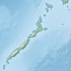
Equirectangular projection based on the parallel of 10°43' N
733:
83:(SVG file, nominally 377 × 377 pixels, file size: 2.21 MB)
738:
768:
330:
Add a one-line explanation of what this file represents
753:
416:
Creative
Commons Attribution-ShareAlike 3.0 Unported
133:
113:
Commons is a freely licensed media file repository.
149:Physical location map of the Philippines (Palawan)
659:Module:Mapa nin kinamumugtakan/datos/Palawan/doc
601:Puerto Princesa Subterranean River National Park
299:https://creativecommons.org/licenses/by-sa/3.0
94:
305:Creative Commons Attribution-Share Alike 3.0
229:
139:Philippines relief location map (Palawan).svg
8:
689:Modèle:Géolocalisation/Palawan/Documentation
654:Module:Mapa nin kinamumugtakan/datos/Palawan
207:Philippines relief location map (square).svg
265:– to copy, distribute and transmit the work
46:Size of this PNG preview of this SVG file:
851:
473:
326:
186:File:Philippines location map (square).svg
719:Modulo:Mapa ti lokasion/datos/Palawan/dok
631:The following other wikis use this file:
861:
853:
533:
449:
433:
413:
397:
377:
361:
344:
341:
322:
315:
531:The following 18 pages use this file:
799:ഘടകം:Location map/data/Palawan/വിവരണം
714:Modulo:Mapa ti lokasion/datos/Palawan
639:Taman Nasional Aungan Puérto Princésa
7:
829:Module:Location map/data/Palawan/doc
814:Module:Location map/data/Palawan/doc
621:Module:Location map/data/Palawan/doc
252:Attribution-Share Alike 3.0 Unported
521:User created page with UploadWizard
462:
240:
235:
844:
335:
329:
226:
143:
126:
76:
334:
824:Module:Location map/data/Palawan
809:Module:Location map/data/Palawan
789:തുബ്ബത്തഹ റീഫ്സ് നാച്വറൽ പാർക്ക്
616:Module:Location map/data/Palawan
320:
276:Under the following conditions:
247:This file is licensed under the
239:
234:
228:
210:
93:
31:
21:
317:
144:
14:
794:ഘടകം:Location map/data/Palawan
684:Modèle:Géolocalisation/Palawan
316:
26:
1:
205:This file was derived from:
36:
775:Usage on meta.wikimedia.org
342:Items portrayed in this file
759:Veidne:VietasKarte Palavana
710:Usage on ilo.wikipedia.org
645:Usage on bcl.wikipedia.org
635:Usage on ban.wikipedia.org
883:
820:Usage on uz.wikipedia.org
805:Usage on si.wikipedia.org
785:Usage on ml.wikipedia.org
750:Usage on lv.wikipedia.org
695:Usage on id.wikipedia.org
680:Usage on fr.wikipedia.org
670:Usage on fa.wikipedia.org
290:same or compatible license
463:
16:
319:
256:
100:This is a file from the
520:
201:
191:
181:
174:
171:
136:
104:. Information from its
664:Kaislahan kan Calamian
499:17:23, 26 October 2017
107:description page there
779:User:Ustad abu gosok
744:Bantay Mantalingajan
699:Pengguna:AshleyYakan
649:Bahura nin Tubbataha
70:2,048 × 2,048 pixels
66:1,024 × 1,024 pixels
596:Mount Mantalingajan
271:– to adapt the work
52:Other resolutions:
870:
869:
704:Kepulauan Calamia
674:کوه مانتالینگاجان
627:Global file usage
524:
400:copyright license
328:
219:
218:
122:
121:
102:Wikimedia Commons
32:Global file usage
874:
852:
834:Bacungan daryosi
764:Kalamjanas salas
724:Is-isla Calamian
551:Calamian Islands
511:
364:copyright status
312:
309:
306:
303:
300:
292:as the original.
249:Creative Commons
243:
242:
238:
237:
232:
231:
214:
177:
148:
140:
134:
118:
97:
96:
90:
84:
73:
62:768 × 768 pixels
58:480 × 480 pixels
54:240 × 240 pixels
48:377 × 377 pixels
882:
881:
877:
876:
875:
873:
872:
871:
840:
729:Lingsat Mindoro
625:
581:Malampaya Sound
546:Busuanga Island
525:
517:
509:
465:
464:
461:
460:
459:
458:
457:
456:
455:
454:
452:
451:26 October 2017
442:
441:
440:
438:
427:
426:
425:
424:
423:
422:
421:
420:
418:
406:
405:
404:
402:
391:
390:
389:
388:
387:
386:
385:
384:
382:
370:
369:
368:
366:
355:
354:
353:
352:
351:
349:
333:
332:
331:
314:
313:
310:
307:
304:
301:
298:
297:
255:
244:
225:
220:
176:26 October 2017
167:
138:
131:
124:
123:
112:
111:
110:is shown below.
86:
82:
75:
74:
51:
12:
11:
5:
880:
878:
868:
867:
864:
860:
859:
856:
843:
839:
838:
837:
836:
831:
826:
818:
817:
816:
811:
803:
802:
801:
796:
791:
783:
782:
781:
773:
772:
771:
766:
761:
756:
748:
747:
746:
741:
736:
731:
726:
721:
716:
708:
707:
706:
701:
693:
692:
691:
686:
678:
677:
676:
668:
667:
666:
661:
656:
651:
643:
642:
641:
629:
628:
624:
623:
618:
613:
611:Tubbataha Reef
608:
603:
598:
593:
591:Mindoro Strait
588:
583:
578:
573:
568:
563:
558:
556:Calauit Island
553:
548:
543:
541:Balabac Island
538:
536:Bacungan River
529:
528:
523:
522:
519:
515:
512:
506:
501:
496:
492:
491:
488:
485:
482:
479:
476:
469:
468:
453:
450:
448:
447:
446:
445:
444:
443:
439:
434:
432:
431:
430:
429:
428:
419:
414:
412:
411:
410:
409:
408:
407:
403:
398:
396:
395:
394:
393:
392:
383:
378:
376:
375:
374:
373:
372:
371:
367:
362:
360:
359:
358:
357:
356:
350:
345:
343:
340:
339:
338:
337:
336:
325:
324:
321:
318:
296:
295:
294:
293:
283:
274:
273:
272:
266:
259:You are free:
246:
245:
227:
224:
221:
217:
216:
203:
202:Other versions
199:
198:
196:User:Hellerick
193:
189:
188:
183:
179:
178:
173:
169:
168:
166:
165:
162:
159:
156:
141:
132:
130:
127:
125:
120:
119:
98:
88:
87:
45:
41:
40:
39:
34:
29:
24:
19:
13:
10:
9:
6:
4:
3:
2:
879:
865:
862:
857:
854:
850:
847:
841:
835:
832:
830:
827:
825:
822:
821:
819:
815:
812:
810:
807:
806:
804:
800:
797:
795:
792:
790:
787:
786:
784:
780:
777:
776:
774:
770:
767:
765:
762:
760:
757:
755:
752:
751:
749:
745:
742:
740:
737:
735:
734:Danaw Manguao
732:
730:
727:
725:
722:
720:
717:
715:
712:
711:
709:
705:
702:
700:
697:
696:
694:
690:
687:
685:
682:
681:
679:
675:
672:
671:
669:
665:
662:
660:
657:
655:
652:
650:
647:
646:
644:
640:
637:
636:
634:
633:
632:
626:
622:
619:
617:
614:
612:
609:
607:
604:
602:
599:
597:
594:
592:
589:
587:
584:
582:
579:
577:
576:Kayangan Lake
574:
572:
569:
567:
564:
562:
561:Delian Island
559:
557:
554:
552:
549:
547:
544:
542:
539:
537:
534:
532:
526:
518:
513:
507:
505:
502:
500:
497:
494:
493:
489:
486:
483:
480:
477:
475:
474:
472:
466:
437:
417:
401:
381:
365:
348:
302:CC BY-SA 3.0
291:
287:
284:
281:
278:
277:
275:
270:
267:
264:
261:
260:
258:
257:
253:
250:
233:
222:
215:
213:
208:
204:
200:
197:
194:
190:
187:
184:
180:
170:
163:
160:
157:
154:
153:
152:
147:
142:
135:
128:
116:
109:
108:
103:
99:
92:
91:
85:
80:
79:Original file
71:
67:
63:
59:
55:
49:
44:
38:
35:
33:
30:
28:
25:
23:
20:
18:
15:
848:
845:
630:
586:Mangarin Bay
571:Iwahig River
530:
470:
467:File history
285:
279:
268:
262:
164:E: 121.61° E
161:W: 116.74° E
150:
145:
115:You can help
105:
77:
22:File history
606:Rasa Island
380:copyrighted
286:share alike
280:attribution
155:N: 12.49° N
137:Description
769:Kujo salas
739:Luek Honda
527:File usage
508:377 × 377
484:Dimensions
158:S: 7.71° N
27:File usage
566:Honda Bay
510:(2.21 MB)
481:Thumbnail
478:Date/Time
436:inception
223:Licensing
146:English:
842:Metadata
754:Palavana
323:Captions
269:to remix
263:to share
254:license.
37:Metadata
495:current
490:Comment
347:depicts
327:English
209::
129:Summary
81:
863:Height
516:Mliu92
192:Author
182:Source
855:Width
487:User
311:true
308:true
172:Date
17:File
866:377
858:377
68:|
64:|
60:|
56:|
50:.
117:.
72:.
Text is available under the Creative Commons Attribution-ShareAlike License. Additional terms may apply.

.svg)
.svg)
.svg)