378:
311:
261:
38:
303:
253:
325:
275:
346:
384:
389:
86:
890:"}},"text\/plain":{"en":{"":"heading"}}},"{\"value\":{\"amount\":\"+180\",\"unit\":\"http:\\\/\\\/www.wikidata.org\\\/entity\\\/Q28390\"},\"type\":\"quantity\"}":{"text\/html":{"en":{"P7787":"180
790:"}},"text\/plain":{"en":{"":"heading"}}},"{\"value\":{\"amount\":\"+180\",\"unit\":\"http:\\\/\\\/www.wikidata.org\\\/entity\\\/Q28390\"},\"type\":\"quantity\"}":{"text\/html":{"en":{"P7787":"180
992:
786:
244:
436:– You must give appropriate credit, provide a link to the license, and indicate if changes were made. You may do so in any reasonable manner, but not in any way that suggests the licensor endorses you or your use.
52:
48:
42:
65:
97:
887:
787:
181:
688:
652:
616:
318:
268:
991:
986:
56:
37:
708:
1174:
353:
1037:
This file contains additional information, probably added from the digital camera or scanner used to create or digitize it.
443:
1002:
873:
551:
1026:
928:
901:
857:
828:
801:
716:
672:
600:
572:
559:
544:
759:
731:
701:
636:
517:
500:
340:
399:
1040:
If the file has been modified from its original state, some details may not fully reflect the modified file.
1022:
The following pages on the
English Knowledge (XXG) use this file (pages on other projects are not listed):
1232:
442:– If you remix, transform, or build upon the material, you must distribute your contributions under the
360:
on the
Geograph website for the photographer's contact details. The copyright on this image is owned by
396:
894:"}},"text\/plain":{"en":{"P7787":"180 degree"}}}}": -->
794:"}},"text\/plain":{"en":{"P7787":"180 degree"}}}}": -->
1252:
105:
213:
738:
723:
579:
197:
1049:
324:
274:
1242:
1214:
1074:
1059:
365:
92:
1114:
258:
149:
1143:
1094:
1010:
308:
170:
160:
1084:
345:
357:
959:
Click on a date/time to view the file as it appeared at that time.
310:
260:
245:
53° 07′ 00.85″ N, 3° 02′ 14.33″ W
285:
235:
80:
295:
53° 06′ 59.7″ N, 3° 02′ 14″ W
484:
Add a one-line explanation of what this file represents
130:
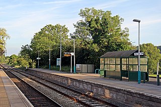
Platform 1, Hope railway station (geograph 4032659).jpg
188:
Creative
Commons Attribution Share-alike license 2.0
124:
104:
Commons is a freely licensed media file repository.
653:
Creative
Commons Attribution-ShareAlike 2.0 Generic
70:(1,024 × 683 pixels, file size: 239 KB, MIME type:
1257:Flash did not fire, compulsory flash suppression
453:https://creativecommons.org/licenses/by-sa/2.0
85:
459:Creative Commons Attribution-Share Alike 2.0
377:
8:
891:
791:
419:– to copy, distribute and transmit the work
1042:
961:
480:
739:https://www.geograph.org.uk/photo/4032659
580:https://www.geograph.org.uk/profile/38853
1260:
1250:
1240:
1230:
1222:
1212:
1191:
1183:
1172:
1164:
1156:
1148:
1138:
1130:
1122:
1111:
1103:
1092:
1082:
1072:
1064:
1054:
1024:
915:
899:
871:
855:
815:
799:
773:
757:
686:
670:
650:
634:
614:
598:
531:
515:
498:
495:
476:
469:
288:
238:
317:View this and other nearby images on:
267:View this and other nearby images on:
1044:
7:
364:and is licensed for reuse under the
950:
400:Attribution-Share Alike 2.0 Generic
388:
383:
368:Attribution-ShareAlike 2.0 license.
1035:
489:
483:
374:
351:
134:
117:
63:
488:
1105:Date and time of data generation
802:coordinates of the point of view
474:
430:Under the following conditions:
395:This file is licensed under the
387:
382:
376:
344:
323:
309:
301:
273:
259:
251:
228:Platform 1, Hope railway station
209:Platform 1, Hope railway station
140:Platform 1, Hope railway station
84:
21:
1004:File Upload Bot (Magnus Manske)
471:
135:
14:
689:file available on the internet
470:
352:This image was taken from the
26:
1:
1009:Transferred from Geograph by
902:coordinates of depicted place
31:
1027:Hope railway station (Wales)
709:Geograph Britain and Ireland
545:object of statement has role
496:Items portrayed in this file
300:
250:
1185:Date and time of digitizing
1282:
817:53°7'0.851"N, 3°2'14.327"W
444:same or compatible license
1193:Meaning of each component
1150:File change date and time
951:
917:53°6'59.72"N, 3°2'13.56"W
16:
717:geograph.org.uk image ID
473:
410:
91:This is a file from the
1008:
226:El Pollock /
207:El Pollock /
198:required by the license
176:
166:
155:
148:
145:
127:
95:. Information from its
358:this photograph's page
329:53.116590; -3.037100
279:53.116903; -3.037313
98:description page there
41:Size of this preview:
1124:Horizontal resolution
1188:19:52, 16 June 2014
1158:Y and C positioning
1153:19:52, 16 June 2014
1132:Vertical resolution
1108:19:52, 16 June 2014
1079:1/800 sec (0.00125)
1046:Camera manufacturer
987:14:17, 19 June 2014
425:– to adapt the work
47:Other resolutions:
560:author name string
57:1,024 × 683 pixels
1269:
1268:
1262:Rating (out of 5)
1237:−0.66666666666667
1169:Aperture priority
1015:
893:
793:
637:copyright license
482:
373:
372:
356:collection. See
334:
333:
284:
283:
233:
232:
201:
185:
182:Reusing this file
113:
112:
93:Wikimedia Commons
1273:
1166:Exposure Program
1043:
999:
939:
938:
933:
839:
838:
833:
741:
736:
732:described at URL
726:
721:
711:
706:
601:copyright status
582:
577:
567:
564:
554:
549:
466:
463:
460:
457:
454:
446:as the original.
408:
397:Creative Commons
391:
390:
386:
385:
380:
379:
366:Creative Commons
354:Geograph project
348:
341:
330:
327:
313:
312:
306:
305:
304:
298:
297:
286:
280:
277:
263:
262:
256:
255:
254:
248:
247:
236:
195:
179:
151:
139:
131:
125:
109:
88:
87:
81:
75:
73:
60:
53:640 × 427 pixels
49:320 × 213 pixels
43:800 × 534 pixels
1281:
1280:
1276:
1275:
1274:
1272:
1271:
1270:
1031:
1023:
1016:
1005:
997:
953:
952:
949:
948:
947:
946:
945:
944:
943:
942:
941:
940:
936:
934:
931:
922:
921:
920:
918:
908:
907:
906:
904:
885:
884:
883:
882:
881:
880:
879:
878:
876:
864:
863:
862:
860:
849:
848:
847:
846:
845:
844:
843:
842:
841:
840:
836:
834:
831:
822:
821:
820:
818:
808:
807:
806:
804:
785:
784:
783:
782:
781:
780:
779:
778:
776:
766:
765:
764:
762:
751:
750:
749:
748:
747:
746:
745:
744:
743:
742:
737:
734:
728:
727:
722:
719:
713:
712:
707:
704:
695:
694:
693:
691:
679:
678:
677:
675:
664:
663:
662:
661:
660:
659:
658:
657:
655:
643:
642:
641:
639:
628:
627:
626:
625:
624:
623:
622:
621:
619:
607:
606:
605:
603:
592:
591:
590:
589:
588:
587:
586:
585:
584:
583:
578:
575:
569:
568:
565:
562:
556:
555:
550:
547:
538:
537:
536:
534:
524:
523:
522:
520:
509:
508:
507:
506:
505:
503:
487:
486:
485:
468:
467:
464:
461:
458:
455:
452:
451:
409:
406:
403:
392:
369:
339:
328:
302:
293:
292:
289:Object location
278:
252:
243:
242:
239:Camera location
234:
223:
216:
204:
161:geograph.org.uk
141:
129:
122:
115:
114:
103:
102:
101:is shown below.
77:
71:
69:
62:
61:
46:
12:
11:
5:
1279:
1277:
1267:
1266:
1263:
1259:
1258:
1255:
1249:
1248:
1245:
1239:
1238:
1235:
1229:
1228:
1225:
1221:
1220:
1217:
1211:
1210:
1209:
1208:
1207:does not exist
1205:
1202:
1199:
1194:
1190:
1189:
1186:
1182:
1181:
1178:
1171:
1170:
1167:
1163:
1162:
1159:
1155:
1154:
1151:
1147:
1146:
1141:
1137:
1136:
1133:
1129:
1128:
1125:
1121:
1120:
1117:
1110:
1109:
1106:
1102:
1101:
1098:
1091:
1090:
1087:
1081:
1080:
1077:
1071:
1070:
1067:
1063:
1062:
1057:
1053:
1052:
1047:
1034:
1030:
1029:
1021:
1020:
1019:
1014:
1013:
1007:
1003:
1000:
994:
989:
984:
980:
979:
976:
973:
970:
967:
964:
957:
956:
927:
926:
925:
924:
923:
919:
916:
914:
913:
912:
911:
910:
909:
905:
900:
898:
897:
896:
895:
889:
877:
872:
870:
869:
868:
867:
866:
865:
861:
856:
854:
853:
852:
851:
850:
827:
826:
825:
824:
823:
819:
816:
814:
813:
812:
811:
810:
809:
805:
800:
798:
797:
796:
795:
789:
777:
774:
772:
771:
770:
769:
768:
767:
763:
758:
756:
755:
754:
753:
752:
730:
729:
715:
714:
700:
699:
698:
697:
696:
692:
687:
685:
684:
683:
682:
681:
680:
676:
673:source of file
671:
669:
668:
667:
666:
665:
656:
651:
649:
648:
647:
646:
645:
644:
640:
635:
633:
632:
631:
630:
629:
620:
615:
613:
612:
611:
610:
609:
608:
604:
599:
597:
596:
595:
594:
593:
571:
570:
558:
557:
543:
542:
541:
540:
539:
535:
532:
530:
529:
528:
527:
526:
525:
521:
516:
514:
513:
512:
511:
510:
504:
499:
497:
494:
493:
492:
491:
490:
479:
478:
475:
472:
450:
449:
448:
447:
437:
428:
427:
426:
420:
413:You are free:
404:
394:
393:
375:
371:
370:
349:
338:
335:
332:
331:
321:
315:
290:
282:
281:
271:
265:
240:
231:
230:
224:
221:
218:
217:
212:
205:
202:
190:
189:
186:
174:
173:
168:
164:
163:
157:
153:
152:
147:
143:
142:
132:
123:
121:
118:
116:
111:
110:
89:
79:
78:
40:
36:
35:
34:
29:
24:
19:
13:
10:
9:
6:
4:
3:
2:
1278:
1264:
1261:
1256:
1254:
1251:
1246:
1244:
1243:Metering mode
1241:
1236:
1234:
1233:Exposure bias
1231:
1226:
1224:APEX aperture
1223:
1218:
1216:
1215:Shutter speed
1213:
1206:
1203:
1200:
1197:
1196:
1195:
1192:
1187:
1184:
1179:
1176:
1173:
1168:
1165:
1160:
1157:
1152:
1149:
1145:
1142:
1140:Software used
1139:
1134:
1131:
1126:
1123:
1118:
1116:
1112:
1107:
1104:
1099:
1096:
1093:
1088:
1086:
1083:
1078:
1076:
1075:Exposure time
1073:
1068:
1065:
1061:
1060:Canon EOS 60D
1058:
1055:
1051:
1048:
1045:
1041:
1038:
1032:
1028:
1025:
1017:
1012:
1006:
1001:
995:
993:
990:
988:
985:
982:
981:
977:
974:
971:
968:
965:
963:
962:
960:
954:
930:
903:
875:
874:Canon EOS 60D
859:
858:captured with
830:
803:
761:
740:
733:
725:
718:
710:
703:
690:
674:
654:
638:
618:
602:
581:
574:
561:
553:
546:
519:
502:
456:CC BY-SA 2.0
445:
441:
438:
435:
432:
431:
429:
424:
421:
418:
415:
414:
412:
411:
405:Attribution:
401:
398:
381:
367:
363:
359:
355:
350:
347:
343:
342:
336:
326:
322:
320:
319:OpenStreetMap
316:
314:
296:
291:
287:
276:
272:
270:
269:OpenStreetMap
266:
264:
246:
241:
237:
229:
225:
220:
219:
215:
211: /
210:
206:
199:
194:
192:
191:
187:
183:
178:
175:
172:
169:
165:
162:
158:
154:
144:
138:
133:
126:
119:
107:
100:
99:
94:
90:
83:
82:
76:
67:
66:Original file
58:
54:
50:
44:
39:
33:
30:
28:
25:
23:
20:
18:
15:
1115:focal length
1056:Camera model
1039:
1036:
996:1,024 × 683
958:
955:File history
775:16 June 2014
552:photographer
439:
433:
422:
416:
361:
299:
249:
227:
214:CC BY-SA 2.0
208:
150:16 June 2014
136:
106:You can help
96:
64:
22:File history
617:copyrighted
440:share alike
434:attribution
193:Attribution
128:Description
1144:PhotoScape
1069:El Pollock
1018:File usage
1011:User:EP111
972:Dimensions
566:El Pollock
533:some value
407:El Pollock
362:El Pollock
177:Permission
171:El Pollock
72:image/jpeg
27:File usage
1095:ISO speed
969:Thumbnail
966:Date/Time
760:inception
337:Licensing
222:InfoField
203:InfoField
137:English:
1161:Co-sited
1085:F-number
1033:Metadata
998:(239 KB)
702:operator
477:Captions
423:to remix
417:to share
402:license.
32:Metadata
1247:Pattern
1177:version
983:current
978:Comment
929:heading
888:heading
829:heading
788:heading
724:4032659
518:creator
501:depicts
481:English
120:Summary
68:
1135:72 dpi
1127:72 dpi
1097:rating
1066:Author
937:degree
892:degree
837:degree
792:degree
307:
257:
167:Author
156:Source
1253:Flash
1219:9.625
1119:24 mm
1113:Lens
1089:f/2.8
1050:Canon
159:From
1175:Exif
975:User
935:180
835:180
465:true
462:true
146:Date
17:File
1180:2.3
1100:100
573:URL
1204:Cr
1201:Cb
932::
832::
735::
720::
705::
576::
563::
548::
55:|
51:|
45:.
1265:0
1227:3
1198:Y
200:)
196:(
184:)
180:(
108:.
74:)
59:.
Text is available under the Creative Commons Attribution-ShareAlike License. Additional terms may apply.

.jpg)
.jpg¶ms=053.116903_N_-003.037313_E_globe:Earth_type:camera_heading:180.00_source:geograph&language=en)
.jpg¶ms=053.116590_N_-003.037100_E_globe:Earth_class:object_type:object_source:geograph-osgb36(SJ30685821)_region:GB-GBN_heading:180.00&language=en)
