381:
314:
264:
306:
256:
328:
278:
349:
387:
392:
67:
912:"}},"text\/plain":{"en":{"":"heading"}}},"{\"value\":{\"amount\":\"+90\",\"unit\":\"http:\\\/\\\/www.wikidata.org\\\/entity\\\/Q28390\"},\"type\":\"quantity\"}":{"text\/html":{"en":{"P7787":"90
812:"}},"text\/plain":{"en":{"":"heading"}}},"{\"value\":{\"amount\":\"+90\",\"unit\":\"http:\\\/\\\/www.wikidata.org\\\/entity\\\/Q28390\"},\"type\":\"quantity\"}":{"text\/html":{"en":{"P7787":"90
1047:
808:
297:
247:
38:
439:– You must give appropriate credit, provide a link to the license, and indicate if changes were made. You may do so in any reasonable manner, but not in any way that suggests the licensor endorses you or your use.
1081:
909:
809:
46:
78:
1091:
1046:
1041:
184:
1086:
744:
674:
638:
519:
321:
271:
895:
764:
356:
446:
1057:
1024:
586:
1096:
950:
923:
879:
850:
823:
772:
728:
622:
594:
579:
566:
787:
757:
694:
658:
539:
503:
1013:
1008:
37:
343:
402:
1077:
The following pages on the
English Knowledge (XXG) use this file (pages on other projects are not listed):
445:– If you remix, transform, or build upon the material, you must distribute your contributions under the
363:
on the
Geograph website for the photographer's contact details. The copyright on this image is owned by
399:
115:
916:"}},"text\/plain":{"en":{"P7787":"90 degree"}}}}": -->
816:"}},"text\/plain":{"en":{"P7787":"90 degree"}}}}": -->
86:
216:
1114:
110:
794:
779:
601:
200:
327:
277:
1065:
1032:
368:
73:
261:
152:
311:
173:
163:
348:
360:
981:
Click on a date/time to view the file as it appeared at that time.
313:
263:
248:
52° 16′ 30.01″ N, 1° 53′ 34.15″ W
288:
238:
61:
1082:
Grade II* listed buildings in
Stratford-on-Avon (district)
298:
52° 16′ 30″ N, 1° 53′ 31″ W
487:
Add a one-line explanation of what this file represents
1124:
1115:
Monasteri soppressi da Enrico VIII d'Inghilterra
191:
Creative
Commons Attribution Share-alike license 2.0
127:
104:
85:
Commons is a freely licensed media file repository.
675:
Creative
Commons Attribution-ShareAlike 2.0 Generic
51:(640 × 428 pixels, file size: 93 KB, MIME type:
456:https://creativecommons.org/licenses/by-sa/2.0
66:
462:Creative Commons Attribution-Share Alike 2.0
380:
8:
913:
813:
422:– to copy, distribute and transmit the work
133:Priory Farm, Studley (geograph 1486071).jpg
47:Priory_Farm,_Studley_(geograph_1486071).jpg
983:
483:
1107:The following other wikis use this file:
795:https://www.geograph.org.uk/photo/1486071
602:https://www.geograph.org.uk/profile/30342
1092:List of monastic houses in Warwickshire
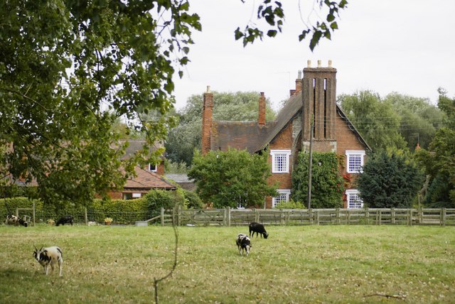
1079:
937:
921:
893:
877:
837:
821:
742:
726:
708:
692:
672:
656:
636:
620:
553:
537:
517:
501:
498:
479:
472:
291:
241:
320:View this and other nearby images on:
270:View this and other nearby images on:
7:
367:and is licensed for reuse under the
972:
403:Attribution-Share Alike 2.0 Generic
391:
386:
371:Attribution-ShareAlike 2.0 license.
1087:List of monastic houses in England
492:
486:
377:
354:
137:
108:
98:
44:
491:
824:coordinates of the point of view
477:
433:Under the following conditions:
398:This file is licensed under the
390:
385:
379:
347:
326:
312:
304:
276:
262:
254:
65:
31:
21:
1059:File Upload Bot (Magnus Manske)
1026:File Upload Bot (Magnus Manske)
474:
138:
41:No higher resolution available.
14:
745:file available on the internet
473:
355:This image was taken from the
26:
1:
1064:Transferred from Geograph by
1031:Transferred from Geograph by
924:coordinates of depicted place
839:52°16'30.007"N, 1°53'34.148"W
1097:Studley Priory, Warwickshire
765:Geograph Britain and Ireland
580:object of statement has role
499:Items portrayed in this file
939:52°16'30.18"N, 1°53'31.20"W
303:
253:
1143:
1121:Usage on www.wikidata.org
1111:Usage on it.wikipedia.org
447:same or compatible license
973:
16:
1042:17:50, 25 September 2014
1009:17:50, 25 September 2014
773:geograph.org.uk image ID
476:
413:
229:Colin Craig /
210:Colin Craig /
72:This is a file from the
1063:
1030:
201:required by the license
179:
169:
158:
151:
148:
130:
76:. Information from its
361:this photograph's page
332:52.275050; -1.892000
282:52.275002; -1.892819
79:description page there
880:location of creation
231:Priory Farm, Studley
212:Priory Farm, Studley
143:Priory Farm, Studley
428:– to adapt the work
109:This is a photo of
567:author name string
1103:Global file usage
1070:
915:
896:Stratford-on-Avon
815:
710:13 September 2009
659:copyright license
485:
376:
375:
359:collection. See
337:
336:
287:
286:
236:
235:
204:
188:
185:Reusing this file
153:13 September 2009
125:
124:
94:
93:
74:Wikimedia Commons
32:Global file usage
1134:
1054:
1021:
961:
960:
955:
861:
860:
855:
797:
792:
788:described at URL
782:
777:
767:
762:
623:copyright status
604:
599:
589:
584:
574:
571:
520:Priory Farmhouse
469:
466:
463:
460:
457:
449:as the original.
411:
400:Creative Commons
394:
393:
389:
388:
383:
382:
369:Creative Commons
357:Geograph project
351:
344:
333:
330:
316:
315:
309:
308:
307:
301:
300:
289:
283:
280:
266:
265:
259:
258:
257:
251:
250:
239:
198:
182:
154:
142:
134:
128:
118:
105:
90:
69:
68:
62:
56:
54:
1142:
1141:
1137:
1136:
1135:
1133:
1132:
1131:
1101:
1078:
1071:
1060:
1052:
1027:
1019:
975:
974:
971:
970:
969:
968:
967:
966:
965:
964:
963:
962:
958:
956:
953:
944:
943:
942:
940:
930:
929:
928:
926:
907:
906:
905:
904:
903:
902:
901:
900:
898:
886:
885:
884:
882:
871:
870:
869:
868:
867:
866:
865:
864:
863:
862:
858:
856:
853:
844:
843:
842:
840:
830:
829:
828:
826:
807:
806:
805:
804:
803:
802:
801:
800:
799:
798:
793:
790:
784:
783:
778:
775:
769:
768:
763:
760:
751:
750:
749:
747:
735:
734:
733:
731:
720:
719:
718:
717:
716:
715:
714:
713:
711:
701:
700:
699:
697:
686:
685:
684:
683:
682:
681:
680:
679:
677:
665:
664:
663:
661:
650:
649:
648:
647:
646:
645:
644:
643:
641:
629:
628:
627:
625:
614:
613:
612:
611:
610:
609:
608:
607:
606:
605:
600:
597:
591:
590:
585:
582:
576:
575:
572:
569:
560:
559:
558:
556:
546:
545:
544:
542:
531:
530:
529:
528:
527:
526:
525:
524:
522:
510:
509:
508:
506:
490:
489:
488:
471:
470:
467:
464:
461:
458:
455:
454:
412:
409:
406:
395:
372:
342:
331:
305:
296:
295:
292:Object location
281:
255:
246:
245:
242:Camera location
237:
226:
219:
207:
164:geograph.org.uk
144:
132:
120:
114:
111:listed building
103:
96:
95:
84:
83:
82:is shown below.
58:
52:
50:
43:
42:
12:
11:
5:
1140:
1138:
1130:
1129:
1128:
1127:
1119:
1118:
1117:
1105:
1104:
1100:
1099:
1094:
1089:
1084:
1076:
1075:
1074:
1069:
1068:
1062:
1058:
1055:
1049:
1044:
1039:
1036:
1035:
1029:
1025:
1022:
1016:
1011:
1006:
1002:
1001:
998:
995:
992:
989:
986:
979:
978:
949:
948:
947:
946:
945:
941:
938:
936:
935:
934:
933:
932:
931:
927:
922:
920:
919:
918:
917:
911:
899:
894:
892:
891:
890:
889:
888:
887:
883:
878:
876:
875:
874:
873:
872:
849:
848:
847:
846:
845:
841:
838:
836:
835:
834:
833:
832:
831:
827:
822:
820:
819:
818:
817:
811:
786:
785:
771:
770:
756:
755:
754:
753:
752:
748:
743:
741:
740:
739:
738:
737:
736:
732:
729:source of file
727:
725:
724:
723:
722:
721:
712:
709:
707:
706:
705:
704:
703:
702:
698:
693:
691:
690:
689:
688:
687:
678:
673:
671:
670:
669:
668:
667:
666:
662:
657:
655:
654:
653:
652:
651:
642:
637:
635:
634:
633:
632:
631:
630:
626:
621:
619:
618:
617:
616:
615:
593:
592:
578:
577:
565:
564:
563:
562:
561:
557:
554:
552:
551:
550:
549:
548:
547:
543:
538:
536:
535:
534:
533:
532:
523:
518:
516:
515:
514:
513:
512:
511:
507:
502:
500:
497:
496:
495:
494:
493:
482:
481:
478:
475:
453:
452:
451:
450:
440:
431:
430:
429:
423:
416:You are free:
407:
397:
396:
378:
374:
373:
352:
341:
338:
335:
334:
324:
318:
293:
285:
284:
274:
268:
243:
234:
233:
227:
224:
221:
220:
215:
208:
205:
193:
192:
189:
177:
176:
171:
167:
166:
160:
156:
155:
150:
146:
145:
135:
126:
123:
122:
102:
99:
97:
92:
91:
70:
60:
59:
40:
36:
35:
34:
29:
24:
19:
13:
10:
9:
6:
4:
3:
2:
1139:
1126:
1123:
1122:
1120:
1116:
1113:
1112:
1110:
1109:
1108:
1102:
1098:
1095:
1093:
1090:
1088:
1085:
1083:
1080:
1072:
1067:
1066:User:plucas58
1061:
1056:
1050:
1048:
1045:
1043:
1040:
1038:
1037:
1034:
1033:User:plucas58
1028:
1023:
1017:
1015:
1012:
1010:
1007:
1004:
1003:
999:
996:
993:
990:
987:
985:
984:
982:
976:
952:
925:
897:
881:
852:
825:
796:
789:
781:
774:
766:
759:
746:
730:
696:
676:
660:
640:
624:
603:
596:
588:
581:
568:
541:
521:
505:
459:CC BY-SA 2.0
448:
444:
441:
438:
435:
434:
432:
427:
424:
421:
418:
417:
415:
414:
408:Attribution:
404:
401:
384:
370:
366:
362:
358:
353:
350:
346:
345:
339:
329:
325:
323:
322:OpenStreetMap
319:
317:
299:
294:
290:
279:
275:
273:
272:OpenStreetMap
269:
267:
249:
244:
240:
232:
228:
223:
222:
218:
214: /
213:
209:
202:
197:
195:
194:
190:
186:
181:
178:
175:
172:
168:
165:
161:
157:
147:
141:
136:
129:
121:
117:
112:
107:
106:
100:
88:
81:
80:
75:
71:
64:
63:
57:
48:
39:
33:
30:
28:
25:
23:
20:
18:
15:
1106:
980:
977:File history
587:photographer
442:
436:
425:
419:
364:
302:
252:
230:
217:CC BY-SA 2.0
211:
139:
87:You can help
77:
45:
22:File history
639:copyrighted
573:Colin Craig
443:share alike
437:attribution
410:Colin Craig
365:Colin Craig
196:Attribution
174:Colin Craig
131:Description
1073:File usage
1051:640 × 428
1018:640 × 428
994:Dimensions
555:some value
180:Permission
53:image/jpeg
27:File usage
1125:Q17551522
991:Thumbnail
988:Date/Time
695:inception
340:Licensing
225:InfoField
206:InfoField
140:English:
758:operator
480:Captions
426:to remix
420:to share
405:license.
1053:(93 KB)
1020:(93 KB)
1005:current
1000:Comment
951:heading
910:heading
851:heading
810:heading
780:1486071
540:creator
504:depicts
484:English
116:1299578
113:number
101:Summary
49:
959:degree
914:degree
859:degree
814:degree
310:
260:
170:Author
159:Source
162:From
997:User
468:true
465:true
149:Date
17:File
957:90
857:90
595:URL
954::
854::
791::
776::
761::
598::
583::
570::
203:)
199:(
187:)
183:(
119:.
89:.
55:)
Text is available under the Creative Commons Attribution-ShareAlike License. Additional terms may apply.
.jpg)
.jpg¶ms=052.275002_N_-001.892819_E_globe:Earth_type:camera_heading:90.00_source:geograph&language=en)
.jpg¶ms=052.275050_N_-001.892000_E_globe:Earth_class:object_type:object_source:geograph-osgb36(SP07466410)_region:GB-ENG_heading:90.00&language=en)
