453:
351:
284:
234:
276:
226:
298:
248:
319:
357:
362:
72:
873:"}},"text\/plain":{"en":{"":"heading"}}},"{\"value\":{\"amount\":\"+337\",\"unit\":\"http:\\\/\\\/www.wikidata.org\\\/entity\\\/Q28390\"},\"type\":\"quantity\"}":{"text\/html":{"en":{"P7787":"337
722:"}},"text\/plain":{"en":{"":"heading"}}},"{\"value\":{\"amount\":\"+337\",\"unit\":\"http:\\\/\\\/www.wikidata.org\\\/entity\\\/Q28390\"},\"type\":\"quantity\"}":{"text\/html":{"en":{"P7787":"337
869:
267:
217:
43:
409:– You must give appropriate credit, provide a link to the license, and indicate if changes were made. You may do so in any reasonable manner, but not in any way that suggests the licensor endorses you or your use.
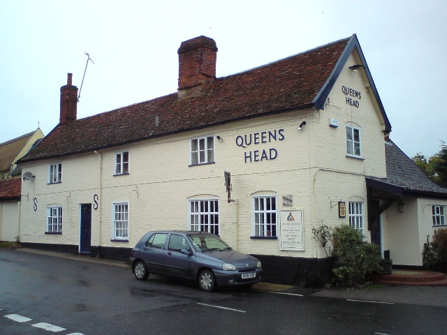
1204:== {{int:filedesc}} == {{Information |description={{en|1=Queens Head, Bramfield Award winning village pub.
http://www.queensheadbramfield.co.uk/index.asp}} |date=2009-10-21 |source=From |author=[
83:
51:
473:
462:
870:
719:
805:
671:
635:
291:
241:
825:
1370:
326:
1249:
This file contains additional information, probably added from the digital camera or scanner used to create or digitize it.
1132:
416:
1347:
1186:
1181:
570:
42:
1082:
1048:
1011:
977:
940:
911:
884:
833:
789:
760:
733:
619:
591:
578:
563:
848:
818:
691:
655:
536:
519:
1218:
1116:
313:
372:
1252:
If the file has been modified from its original state, some details may not fully reflect the modified file.
1389:
415:– If you remix, transform, or build upon the material, you must distribute your contributions under the
333:
on the
Geograph website for the photographer's contact details. The copyright on this image is owned by
1197:
469:
Please remove redundant categories and try to put this image in the most specific category/categories.
369:
877:"}},"text\/plain":{"en":{"P7787":"337 degree"}}}}": -->
726:"}},"text\/plain":{"en":{"P7787":"337 degree"}}}}": -->
1417:
91:
186:
855:
840:
598:
170:
1271:
297:
247:
1453:
1399:
1278:
1261:
338:
78:
1463:
1318:
127:
1427:
138:
1298:
281:
231:
149:
159:
1288:
318:
330:
1154:
Click on a date/time to view the file as it appeared at that time.
283:
233:
258:
208:
66:
268:
52° 18′ 34.6″ N, 1° 31′ 09″ E
218:
52° 18′ 34.6″ N, 1° 31′ 09″ E
459:
The categories of this image need checking. You can do so
503:
Add a one-line explanation of what this file represents
116:
Queens Head, Bramfield - geograph.org.uk - 1549338.jpg
52:
Queens_Head,_Bramfield_-_geograph.org.uk_-_1549338.jpg
1236:
110:
90:
Commons is a freely licensed media file repository.
672:
Creative
Commons Attribution-ShareAlike 2.0 Generic
126:Queens Head, Bramfield Award winning village pub.
56:(640 × 480 pixels, file size: 116 KB, MIME type:
1422:Flash did not fire, compulsory flash suppression
426:https://creativecommons.org/licenses/by-sa/2.0
128:http://www.queensheadbramfield.co.uk/index.asp
71:
432:Creative Commons Attribution-Share Alike 2.0
350:
8:
874:
723:
392:– to copy, distribute and transmit the work
1254:
1156:
499:
1229:The following other wikis use this file:
856:https://www.geograph.org.uk/photo/1549338
472:You can remove this template by clicking
1348:R3EA037 prg12049289_GENERIC_NG 00.00
599:https://www.geograph.org.uk/profile/2083
1496:
1488:
1480:
1472:
1461:
1451:
1443:
1435:
1425:
1415:
1407:
1397:
1387:
1379:
1368:
1360:
1352:
1342:
1334:
1326:
1315:
1307:
1296:
1286:
1276:
1266:
1216:
1130:
1114:
1096:
1080:
1062:
1046:
1025:
1009:
991:
975:
954:
938:
898:
882:
803:
787:
747:
731:
705:
689:
669:
653:
633:
617:
550:
534:
517:
514:
495:
488:
261:
211:
290:View this and other nearby images on:
240:View this and other nearby images on:
1256:
7:
337:and is licensed for reuse under the
1214:The following page uses this file:
1145:
373:Attribution-Share Alike 2.0 Generic
361:
356:
341:Attribution-ShareAlike 2.0 license.
1247:
508:
502:
446:
347:
324:
120:
103:
49:
507:
1309:Date and time of data generation
734:coordinates of the point of view
493:
451:
403:Under the following conditions:
368:This file is licensed under the
360:
355:
349:
317:
296:
282:
274:
246:
232:
224:
70:
31:
21:
490:
121:
46:No higher resolution available.
14:
806:file available on the internet
489:
325:This image was taken from the
26:
1:
885:coordinates of depicted place
36:
1219:Queen's Head, Bramfield
826:Geograph Britain and Ireland
564:object of statement has role
515:Items portrayed in this file
273:
223:
1381:Date and time of digitizing
1518:
1233:Usage on www.wikidata.org
900:52°18'34.56"N, 1°31'8.76"E
450:
417:same or compatible license
1498:Geodetic survey data used
1354:File change date and time
1331:51 meters above sea level
1146:
199:Tim Marchant /
180:Tim Marchant /
16:
834:geograph.org.uk image ID
749:52°18'34.6"N, 1°31'8.8"E
492:
383:
77:This is a file from the
1482:North or south latitude
1437:Custom image processing
1404:Center weighted average
1203:
476:(or on the first line).
171:required by the license
155:
144:
137:
134:
113:
81:. Information from its
1490:East or west longitude
1384:12:07, 21 October 2009
1357:12:07, 21 October 2009
1312:12:07, 21 October 2009
331:this photograph's page
302:52.309600; 1.519100
252:52.309600; 1.519100
201:Queens Head, Bramfield
182:Queens Head, Bramfield
84:description page there
1362:Y and C positioning
1258:Camera manufacturer
1182:10:36, 3 March 2011
398:– to adapt the work
1474:Scene capture type
1458:Auto white balance
579:author name string
1505:
1504:
1225:Global file usage
1207:
876:
725:
656:copyright license
501:
482:
481:
346:
345:
329:collection. See
307:
306:
257:
256:
206:
205:
174:
99:
98:
79:Wikimedia Commons
32:Global file usage
1509:
1283:1/100 sec (0.01)
1255:
1194:
1030:
959:
922:
921:
916:
858:
853:
849:described at URL
843:
838:
828:
823:
771:
770:
765:
620:copyright status
601:
596:
586:
583:
573:
568:
455:
454:
448:
447:
439:
436:
433:
430:
427:
419:as the original.
381:
370:Creative Commons
364:
363:
359:
358:
353:
352:
339:Creative Commons
327:Geograph project
321:
314:
303:
300:
286:
285:
279:
278:
277:
271:
270:
259:
253:
250:
236:
235:
229:
228:
227:
221:
220:
209:
168:
140:
125:
117:
111:
95:
74:
73:
67:
61:
59:
1517:
1516:
1512:
1511:
1510:
1508:
1507:
1506:
1243:
1223:
1208:
1200:
1192:
1148:
1147:
1144:
1143:
1142:
1141:
1140:
1139:
1138:
1137:
1135:
1123:
1122:
1121:
1119:
1108:
1107:
1106:
1105:
1104:
1103:
1102:
1101:
1099:
1089:
1088:
1087:
1085:
1074:
1073:
1072:
1071:
1070:
1069:
1068:
1067:
1065:
1055:
1054:
1053:
1051:
1040:
1039:
1038:
1037:
1036:
1035:
1034:
1033:
1031:
1028:
1018:
1017:
1016:
1014:
1003:
1002:
1001:
1000:
999:
998:
997:
996:
994:
984:
983:
982:
980:
969:
968:
967:
966:
965:
964:
963:
962:
960:
957:
947:
946:
945:
943:
932:
931:
930:
929:
928:
927:
926:
925:
924:
923:
919:
917:
914:
905:
904:
903:
901:
891:
890:
889:
887:
868:
867:
866:
865:
864:
863:
862:
861:
860:
859:
854:
851:
845:
844:
839:
836:
830:
829:
824:
821:
812:
811:
810:
808:
796:
795:
794:
792:
781:
780:
779:
778:
777:
776:
775:
774:
773:
772:
768:
766:
763:
754:
753:
752:
750:
740:
739:
738:
736:
717:
716:
715:
714:
713:
712:
711:
710:
708:
707:21 October 2009
698:
697:
696:
694:
683:
682:
681:
680:
679:
678:
677:
676:
674:
662:
661:
660:
658:
647:
646:
645:
644:
643:
642:
641:
640:
638:
626:
625:
624:
622:
611:
610:
609:
608:
607:
606:
605:
604:
603:
602:
597:
594:
588:
587:
584:
581:
575:
574:
569:
566:
557:
556:
555:
553:
543:
542:
541:
539:
528:
527:
526:
525:
524:
522:
506:
505:
504:
487:
483:
452:
441:
440:
437:
434:
431:
428:
425:
424:
382:
379:
376:
365:
342:
312:
301:
275:
266:
265:
262:Object location
251:
225:
216:
215:
212:Camera location
207:
196:
189:
177:
150:geograph.org.uk
139:21 October 2009
130:
115:
108:
101:
100:
89:
88:
87:is shown below.
63:
57:
55:
48:
47:
12:
11:
5:
1515:
1513:
1503:
1502:
1499:
1495:
1494:
1493:East longitude
1491:
1487:
1486:
1485:North latitude
1483:
1479:
1478:
1475:
1471:
1470:
1467:
1460:
1459:
1456:
1450:
1449:
1446:
1442:
1441:
1440:Normal process
1438:
1434:
1433:
1430:
1424:
1423:
1420:
1414:
1413:
1410:
1406:
1405:
1402:
1396:
1395:
1392:
1386:
1385:
1382:
1378:
1377:
1374:
1367:
1366:
1363:
1359:
1358:
1355:
1351:
1350:
1345:
1341:
1340:
1337:
1333:
1332:
1329:
1325:
1324:
1321:
1314:
1313:
1310:
1306:
1305:
1302:
1295:
1294:
1291:
1285:
1284:
1281:
1275:
1274:
1269:
1265:
1264:
1259:
1246:
1242:
1241:
1240:
1239:
1227:
1226:
1222:
1221:
1212:
1211:
1206:
1205:
1202:
1198:
1195:
1189:
1184:
1179:
1175:
1174:
1171:
1168:
1165:
1162:
1159:
1152:
1151:
1136:
1131:
1129:
1128:
1127:
1126:
1125:
1124:
1120:
1115:
1113:
1112:
1111:
1110:
1109:
1100:
1097:
1095:
1094:
1093:
1092:
1091:
1090:
1086:
1081:
1079:
1078:
1077:
1076:
1075:
1066:
1063:
1061:
1060:
1059:
1058:
1057:
1056:
1052:
1047:
1045:
1044:
1043:
1042:
1041:
1032:
1026:
1024:
1023:
1022:
1021:
1020:
1019:
1015:
1010:
1008:
1007:
1006:
1005:
1004:
995:
992:
990:
989:
988:
987:
986:
985:
981:
976:
974:
973:
972:
971:
970:
961:
955:
953:
952:
951:
950:
949:
948:
944:
939:
937:
936:
935:
934:
933:
910:
909:
908:
907:
906:
902:
899:
897:
896:
895:
894:
893:
892:
888:
883:
881:
880:
879:
878:
872:
847:
846:
832:
831:
817:
816:
815:
814:
813:
809:
804:
802:
801:
800:
799:
798:
797:
793:
790:source of file
788:
786:
785:
784:
783:
782:
759:
758:
757:
756:
755:
751:
748:
746:
745:
744:
743:
742:
741:
737:
732:
730:
729:
728:
727:
721:
709:
706:
704:
703:
702:
701:
700:
699:
695:
690:
688:
687:
686:
685:
684:
675:
670:
668:
667:
666:
665:
664:
663:
659:
654:
652:
651:
650:
649:
648:
639:
634:
632:
631:
630:
629:
628:
627:
623:
618:
616:
615:
614:
613:
612:
590:
589:
577:
576:
562:
561:
560:
559:
558:
554:
551:
549:
548:
547:
546:
545:
544:
540:
535:
533:
532:
531:
530:
529:
523:
518:
516:
513:
512:
511:
510:
509:
498:
497:
494:
491:
480:
479:
478:
477:
470:
456:
445:
423:
422:
421:
420:
410:
401:
400:
399:
393:
386:You are free:
377:
367:
366:
348:
344:
343:
322:
311:
308:
305:
304:
294:
288:
263:
255:
254:
244:
238:
213:
204:
203:
197:
194:
191:
190:
185:
178:
175:
163:
162:
157:
153:
152:
146:
142:
141:
136:
132:
131:
118:
109:
107:
104:
102:
97:
96:
75:
65:
64:
45:
41:
40:
39:
34:
29:
24:
19:
13:
10:
9:
6:
4:
3:
2:
1514:
1500:
1497:
1492:
1489:
1484:
1481:
1476:
1473:
1468:
1465:
1462:
1457:
1455:
1454:White balance
1452:
1448:Auto exposure
1447:
1445:Exposure mode
1444:
1439:
1436:
1431:
1429:
1426:
1421:
1419:
1416:
1411:
1408:
1403:
1401:
1400:Metering mode
1398:
1393:
1391:
1390:Exposure bias
1388:
1383:
1380:
1375:
1372:
1369:
1364:
1361:
1356:
1353:
1349:
1346:
1344:Software used
1343:
1338:
1335:
1330:
1327:
1322:
1320:
1316:
1311:
1308:
1303:
1300:
1297:
1292:
1290:
1287:
1282:
1280:
1279:Exposure time
1277:
1273:
1270:
1267:
1263:
1262:Sony Ericsson
1260:
1257:
1253:
1250:
1244:
1238:
1235:
1234:
1232:
1231:
1230:
1224:
1220:
1217:
1215:
1209:
1201:
1196:
1190:
1188:
1185:
1183:
1180:
1177:
1176:
1172:
1169:
1166:
1163:
1160:
1158:
1157:
1155:
1149:
1134:
1118:
1084:
1050:
1013:
979:
942:
941:exposure time
913:
886:
857:
850:
842:
835:
827:
820:
807:
791:
762:
735:
693:
673:
657:
637:
621:
600:
593:
580:
572:
565:
538:
521:
486:
485:
475:
471:
468:
467:
466:
464:
460:
457:
449:
444:
443:
429:CC BY-SA 2.0
418:
414:
411:
408:
405:
404:
402:
397:
394:
391:
388:
387:
385:
384:
378:Attribution:
374:
371:
354:
340:
336:
332:
328:
323:
320:
316:
315:
309:
299:
295:
293:
292:OpenStreetMap
289:
287:
269:
264:
260:
249:
245:
243:
242:OpenStreetMap
239:
237:
219:
214:
210:
202:
198:
193:
192:
188:
184: /
183:
179:
172:
167:
165:
164:
161:
158:
154:
151:
147:
143:
133:
129:
124:
119:
112:
105:
93:
86:
85:
80:
76:
69:
68:
62:
53:
44:
38:
35:
33:
30:
28:
25:
23:
20:
18:
15:
1464:Digital zoom
1409:Light source
1319:focal length
1268:Camera model
1251:
1248:
1228:
1213:
1153:
1150:File history
1012:focal length
585:Tim Marchant
571:photographer
484:
461:
458:
442:
412:
406:
395:
389:
380:Tim Marchant
335:Tim Marchant
334:
272:
222:
200:
187:CC BY-SA 2.0
181:
160:Tim Marchant
122:
92:You can help
82:
50:
22:File history
1428:Color space
1336:Orientation
1199:GeographBot
1117:instance of
636:copyrighted
413:share alike
407:attribution
166:Attribution
114:Description
1210:File usage
1191:640 × 480
1167:Dimensions
1133:photograph
1098:image/jpeg
1083:media type
1029:millimetre
552:some value
58:image/jpeg
27:File usage
1299:ISO speed
1164:Thumbnail
1161:Date/Time
1049:ISO speed
692:inception
310:Licensing
195:InfoField
176:InfoField
123:English:
1477:Standard
1365:Co-sited
1328:Altitude
1289:F-number
1245:Metadata
1237:Q7270009
1193:(116 KB)
978:f-number
819:operator
496:Captions
396:to remix
390:to share
375:license.
37:Metadata
1412:Unknown
1373:version
1178:current
1173:Comment
912:heading
871:heading
841:1549338
761:heading
720:heading
537:creator
520:depicts
500:English
106:Summary
54:
1501:WGS-84
1339:Normal
1323:4.2 mm
1301:rating
958:second
920:degree
875:degree
769:degree
724:degree
280:
230:
156:Author
145:Source
1466:ratio
1418:Flash
1317:Lens
1293:f/3.2
956:0.01
148:From
1432:sRGB
1371:Exif
1272:C702
1170:User
1027:4.2
918:337
767:337
474:here
463:here
438:true
435:true
135:Date
17:File
1376:2.2
993:3.2
592:URL
1304:80
1064:80
915::
852::
837::
822::
764::
595::
582::
567::
1469:1
1394:0
465:.
173:)
169:(
94:.
60:)
Text is available under the Creative Commons Attribution-ShareAlike License. Additional terms may apply.
_heading:337.00&language=en)
_heading:337.00&language=en)
