359:
292:
242:
284:
234:
306:
256:
327:
365:
370:
67:
835:"}},"text\/plain":{"en":{"":"heading"}}},"{\"value\":{\"amount\":\"+247\",\"unit\":\"http:\\\/\\\/www.wikidata.org\\\/entity\\\/Q28390\"},\"type\":\"quantity\"}":{"text\/html":{"en":{"P7787":"247
771:"}},"text\/plain":{"en":{"":"heading"}}},"{\"value\":{\"amount\":\"+247\",\"unit\":\"http:\\\/\\\/www.wikidata.org\\\/entity\\\/Q28390\"},\"type\":\"quantity\"}":{"text\/html":{"en":{"P7787":"247
767:
275:
225:
417:– You must give appropriate credit, provide a link to the license, and indicate if changes were made. You may do so in any reasonable manner, but not in any way that suggests the licensor endorses you or your use.
38:
832:
768:
46:
78:
162:
669:
633:
597:
299:
249:
689:
1266:
334:
1121:
This file contains additional information, probably added from the digital camera or scanner used to create or digitize it.
424:
532:
1007:
973:
936:
902:
873:
846:
809:
782:
697:
653:
581:
553:
540:
525:
740:
712:
682:
617:
498:
481:
321:
1078:
1073:
380:
37:
1124:
If the file has been modified from its original state, some details may not fully reflect the modified file.
1106:
The following pages on the
English Knowledge (XXG) use this file (pages on other projects are not listed):
1089:
1314:
423:– If you remix, transform, or build upon the material, you must distribute your contributions under the
341:
on the
Geograph website for the photographer's contact details. The copyright on this image is owned by
377:
839:"}},"text\/plain":{"en":{"P7787":"247 degree"}}}}": -->
775:"}},"text\/plain":{"en":{"P7787":"247 degree"}}}}": -->
1350:
1141:
1235:
86:
1151:
719:
704:
560:
178:
305:
255:
1332:
1166:
346:
73:
1206:
194:
239:
1368:
130:
1186:
289:
1110:
141:
151:
1176:
326:
338:
1046:
Click on a date/time to view the file as it appeared at that time.
291:
241:
266:
216:
61:
276:
54° 09′ 59.4″ N, 7° 48′ 17″ W
226:
54° 10′ 00.1″ N, 7° 48′ 14″ W
465:
Add a one-line explanation of what this file represents
169:
Creative
Commons Attribution Share-alike license 2.0
105:
85:
Commons is a freely licensed media file repository.
634:
Creative
Commons Attribution-ShareAlike 2.0 Generic
1355:Flash did not fire, compulsory flash suppression
51:(640 × 480 pixels, file size: 65 KB, MIME type:
434:https://creativecommons.org/licenses/by-sa/2.0
66:
440:Creative Commons Attribution-Share Alike 2.0
358:
8:
836:
772:
400:– to copy, distribute and transmit the work
1126:
1048:
461:
720:https://www.geograph.org.uk/photo/3597120
561:https://www.geograph.org.uk/profile/2282
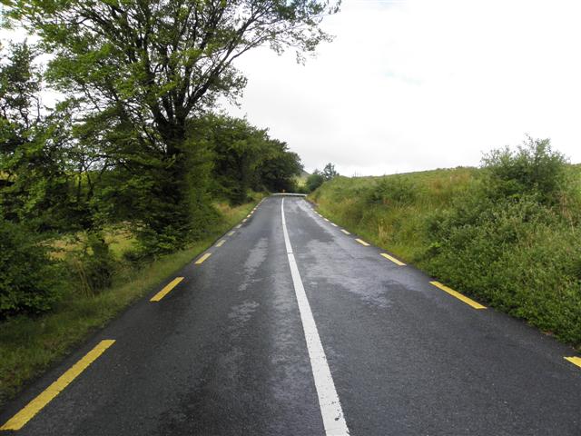
111:R200 at Legnaderk (geograph 3597120).jpg
47:R200_at_Legnaderk_(geograph_3597120).jpg
1384:
1376:
1366:
1358:
1348:
1340:
1330:
1322:
1312:
1304:
1283:
1275:
1264:
1256:
1248:
1240:
1230:
1222:
1214:
1203:
1195:
1184:
1174:
1164:
1156:
1146:
1128:
1108:
1021:
1005:
987:
971:
950:
934:
916:
900:
860:
844:
796:
780:
754:
738:
667:
651:
631:
615:
595:
579:
512:
496:
479:
476:
457:
450:
269:
219:
1096:Transferred from geograph.co.uk using
298:View this and other nearby images on:
248:View this and other nearby images on:
1136:
7:
345:and is licensed for reuse under the
1037:
381:Attribution-Share Alike 2.0 Generic
369:
364:
349:Attribution-ShareAlike 2.0 license.
1119:
470:
464:
355:
332:
115:
98:
44:
469:
1197:Date and time of data generation
783:coordinates of the point of view
455:
411:Under the following conditions:
376:This file is licensed under the
368:
363:
357:
325:
304:
290:
282:
254:
240:
232:
65:
21:
1236:Version 1.0
1133:OLYMPUS DIGITAL CAMERA
452:
116:
41:No higher resolution available.
14:
670:file available on the internet
451:
333:This image was taken from the
26:
1:
1389:A directly photographed image
847:coordinates of depicted place
31:
798:54°10'0.059"N, 7°48'13.878"W
690:Geograph Britain and Ireland
526:object of statement has role
477:Items portrayed in this file
281:
231:
1277:Date and time of digitizing
207:Kenneth Allen /
188:Kenneth Allen /
1406:
1360:Supported Flashpix version
862:54°9'59.40"N, 7°48'16.63"W
425:same or compatible license
1285:Meaning of each component
1242:File change date and time
1038:
16:
698:geograph.org.uk image ID
454:
391:
72:This is a file from the
1152:SP590UZ
1095:
179:required by the license
157:
147:
136:
129:
126:
108:
76:. Information from its
1306:Image compression mode
339:this photograph's page
310:54.166500; -7.804620
260:54.166683; -7.803855
79:description page there
1324:Maximum land aperture
1280:10:18, 12 August 2013
1245:16:43, 12 August 2013
1216:Horizontal resolution
1200:10:18, 12 August 2013
1142:OLYMPUS IMAGING CORP.
1381:Digital still camera
1250:Y and C positioning
1224:Vertical resolution
1138:Camera manufacturer
1074:13:07, 1 April 2019
406:– to adapt the work
541:author name string
1393:
1392:
1327:2.97 APEX (f/2.8)
1099:
838:
774:
618:copyright license
463:
354:
353:
337:collection. See
315:
314:
265:
264:
214:
213:
209:R200 at Legnaderk
190:R200 at Legnaderk
182:
166:
163:Reusing this file
121:R200 at Legnaderk
94:
93:
74:Wikimedia Commons
1397:
1258:Exposure Program
1171:1/100 sec (0.01)
1127:
1086:
1026:
955:
884:
883:
878:
820:
819:
814:
722:
717:
713:described at URL
707:
702:
692:
687:
582:copyright status
563:
558:
548:
545:
535:
530:
447:
444:
441:
438:
435:
427:as the original.
389:
378:Creative Commons
372:
371:
367:
366:
361:
360:
347:Creative Commons
335:Geograph project
329:
322:
311:
308:
294:
293:
287:
286:
285:
279:
278:
267:
261:
258:
244:
243:
237:
236:
235:
229:
228:
217:
176:
160:
132:
120:
112:
106:
90:
69:
68:
62:
56:
54:
1405:
1404:
1400:
1399:
1398:
1396:
1395:
1394:
1115:
1107:
1100:
1092:
1084:
1040:
1039:
1036:
1035:
1034:
1033:
1032:
1031:
1030:
1029:
1027:
1024:
1014:
1013:
1012:
1010:
999:
998:
997:
996:
995:
994:
993:
992:
990:
980:
979:
978:
976:
965:
964:
963:
962:
961:
960:
959:
958:
956:
953:
943:
942:
941:
939:
928:
927:
926:
925:
924:
923:
922:
921:
919:
909:
908:
907:
905:
894:
893:
892:
891:
890:
889:
888:
887:
886:
885:
881:
879:
876:
867:
866:
865:
863:
853:
852:
851:
849:
830:
829:
828:
827:
826:
825:
824:
823:
822:
821:
817:
815:
812:
803:
802:
801:
799:
789:
788:
787:
785:
766:
765:
764:
763:
762:
761:
760:
759:
757:
747:
746:
745:
743:
732:
731:
730:
729:
728:
727:
726:
725:
724:
723:
718:
715:
709:
708:
703:
700:
694:
693:
688:
685:
676:
675:
674:
672:
660:
659:
658:
656:
645:
644:
643:
642:
641:
640:
639:
638:
636:
624:
623:
622:
620:
609:
608:
607:
606:
605:
604:
603:
602:
600:
588:
587:
586:
584:
573:
572:
571:
570:
569:
568:
567:
566:
565:
564:
559:
556:
550:
549:
546:
543:
537:
536:
531:
528:
519:
518:
517:
515:
505:
504:
503:
501:
490:
489:
488:
487:
486:
484:
468:
467:
466:
449:
448:
445:
442:
439:
436:
433:
432:
390:
387:
384:
373:
350:
320:
309:
283:
274:
273:
270:Object location
259:
233:
224:
223:
220:Camera location
215:
204:
197:
185:
142:geograph.org.uk
122:
110:
103:
96:
95:
84:
83:
82:is shown below.
58:
52:
50:
43:
42:
12:
11:
5:
1403:
1401:
1391:
1390:
1387:
1383:
1382:
1379:
1375:
1374:
1371:
1365:
1364:
1361:
1357:
1356:
1353:
1347:
1346:
1343:
1339:
1338:
1335:
1329:
1328:
1325:
1321:
1320:
1317:
1311:
1310:
1307:
1303:
1302:
1301:
1300:
1299:does not exist
1297:
1294:
1291:
1286:
1282:
1281:
1278:
1274:
1273:
1270:
1263:
1262:
1261:Normal program
1259:
1255:
1254:
1251:
1247:
1246:
1243:
1239:
1238:
1233:
1229:
1228:
1225:
1221:
1220:
1217:
1213:
1212:
1209:
1202:
1201:
1198:
1194:
1193:
1190:
1183:
1182:
1179:
1173:
1172:
1169:
1163:
1162:
1159:
1155:
1154:
1149:
1145:
1144:
1139:
1135:
1134:
1131:
1118:
1114:
1113:
1105:
1104:
1103:
1098:
1097:
1094:
1091:Cormac1cormac1
1090:
1087:
1081:
1076:
1071:
1067:
1066:
1063:
1060:
1057:
1054:
1051:
1044:
1043:
1028:
1022:
1020:
1019:
1018:
1017:
1016:
1015:
1011:
1006:
1004:
1003:
1002:
1001:
1000:
991:
988:
986:
985:
984:
983:
982:
981:
977:
972:
970:
969:
968:
967:
966:
957:
951:
949:
948:
947:
946:
945:
944:
940:
935:
933:
932:
931:
930:
929:
920:
917:
915:
914:
913:
912:
911:
910:
906:
901:
899:
898:
897:
896:
895:
872:
871:
870:
869:
868:
864:
861:
859:
858:
857:
856:
855:
854:
850:
845:
843:
842:
841:
840:
834:
808:
807:
806:
805:
804:
800:
797:
795:
794:
793:
792:
791:
790:
786:
781:
779:
778:
777:
776:
770:
758:
756:12 August 2013
755:
753:
752:
751:
750:
749:
748:
744:
739:
737:
736:
735:
734:
733:
711:
710:
696:
695:
681:
680:
679:
678:
677:
673:
668:
666:
665:
664:
663:
662:
661:
657:
654:source of file
652:
650:
649:
648:
647:
646:
637:
632:
630:
629:
628:
627:
626:
625:
621:
616:
614:
613:
612:
611:
610:
601:
596:
594:
593:
592:
591:
590:
589:
585:
580:
578:
577:
576:
575:
574:
552:
551:
547:Kenneth Allen
539:
538:
524:
523:
522:
521:
520:
516:
513:
511:
510:
509:
508:
507:
506:
502:
497:
495:
494:
493:
492:
491:
485:
480:
478:
475:
474:
473:
472:
471:
460:
459:
456:
453:
431:
430:
429:
428:
418:
409:
408:
407:
401:
394:You are free:
388:Kenneth Allen
385:
375:
374:
356:
352:
351:
343:Kenneth Allen
330:
319:
316:
313:
312:
302:
296:
271:
263:
262:
252:
246:
221:
212:
211:
205:
202:
199:
198:
193:
186:
183:
171:
170:
167:
155:
154:
152:Kenneth Allen
149:
145:
144:
138:
134:
133:
131:12 August 2013
128:
124:
123:
113:
104:
102:
99:
97:
92:
91:
70:
60:
59:
40:
36:
35:
34:
29:
24:
19:
13:
10:
9:
6:
4:
3:
2:
1402:
1388:
1385:
1380:
1377:
1372:
1370:
1367:
1362:
1359:
1354:
1352:
1349:
1344:
1341:
1336:
1334:
1333:Metering mode
1331:
1326:
1323:
1318:
1316:
1315:Exposure bias
1313:
1308:
1305:
1298:
1295:
1292:
1289:
1288:
1287:
1284:
1279:
1276:
1271:
1268:
1265:
1260:
1257:
1252:
1249:
1244:
1241:
1237:
1234:
1232:Software used
1231:
1226:
1223:
1218:
1215:
1210:
1208:
1204:
1199:
1196:
1191:
1188:
1185:
1180:
1178:
1175:
1170:
1168:
1167:Exposure time
1165:
1160:
1157:
1153:
1150:
1147:
1143:
1140:
1137:
1132:
1129:
1125:
1122:
1116:
1112:
1109:
1101:
1093:
1088:
1082:
1080:
1077:
1075:
1072:
1069:
1068:
1064:
1061:
1058:
1055:
1052:
1050:
1049:
1047:
1041:
1009:
975:
938:
937:exposure time
904:
875:
848:
811:
784:
742:
721:
714:
706:
699:
691:
684:
671:
655:
635:
619:
599:
583:
562:
555:
542:
534:
527:
500:
483:
437:CC BY-SA 2.0
426:
422:
419:
416:
413:
412:
410:
405:
402:
399:
396:
395:
393:
392:
386:Attribution:
382:
379:
362:
348:
344:
340:
336:
331:
328:
324:
323:
317:
307:
303:
301:
300:OpenStreetMap
297:
295:
277:
272:
268:
257:
253:
251:
250:OpenStreetMap
247:
245:
227:
222:
218:
210:
206:
201:
200:
196:
192: /
191:
187:
180:
175:
173:
172:
168:
164:
159:
156:
153:
150:
146:
143:
139:
135:
125:
119:
114:
107:
100:
88:
81:
80:
75:
71:
64:
63:
57:
48:
39:
33:
30:
28:
25:
23:
20:
18:
15:
1342:Light source
1207:focal length
1148:Camera model
1123:
1120:
1045:
1042:File history
1008:focal length
533:photographer
420:
414:
403:
397:
342:
280:
230:
208:
195:CC BY-SA 2.0
189:
117:
87:You can help
77:
45:
22:File history
1378:File source
1369:Color space
1130:Image title
598:copyrighted
421:share alike
415:attribution
174:Attribution
109:Description
1386:Scene type
1102:File usage
1083:640 × 480
1059:Dimensions
1025:millimetre
514:some value
158:Permission
53:image/jpeg
27:File usage
1187:ISO speed
1111:Legnaderk
1056:Thumbnail
1053:Date/Time
903:ISO speed
741:inception
318:Licensing
203:InfoField
184:InfoField
118:English:
1253:Co-sited
1177:F-number
1117:Metadata
974:f-number
683:operator
458:Captions
404:to remix
398:to share
383:license.
32:Metadata
1345:Unknown
1337:Pattern
1269:version
1085:(65 KB)
1070:current
1065:Comment
874:heading
833:heading
810:heading
769:heading
705:3597120
499:creator
482:depicts
462:English
101:Summary
49:
1227:72 dpi
1219:72 dpi
1211:4.6 mm
1189:rating
1161:Picasa
1158:Author
954:second
882:degree
837:degree
818:degree
773:degree
288:
238:
148:Author
137:Source
1351:Flash
1205:Lens
1181:f/5.6
952:0.01
140:From
1373:sRGB
1272:2.21
1267:Exif
1062:User
1023:4.6
880:247
816:247
446:true
443:true
127:Date
17:File
989:5.6
554:URL
1296:Cr
1293:Cb
1192:64
918:64
877::
813::
716::
701::
686::
557::
544::
529::
1363:1
1319:0
1309:4
1290:Y
181:)
177:(
165:)
161:(
89:.
55:)
Text is available under the Creative Commons Attribution-ShareAlike License. Additional terms may apply.
.jpg)
.jpg¶ms=054.166683_N_-007.803855_E_globe:Earth_type:camera_source:geograph-irishgrid(H12862420)_heading:247.00&language=en)
.jpg¶ms=054.166500_N_-007.804620_E_globe:Earth_class:object_type:object_source:geograph-irishgrid(H12812418)_heading:247.00&language=en)
