354:
287:
237:
279:
229:
301:
251:
322:
360:
365:
62:
626:"}},"text\/plain":{"en":{"":"heading"}}},"{\"value\":{\"amount\":\"+270\",\"unit\":\"http:\\\/\\\/www.wikidata.org\\\/entity\\\/Q28390\"},\"type\":\"quantity\"}":{"text\/html":{"en":{"P7787":"270
562:"}},"text\/plain":{"en":{"":"heading"}}},"{\"value\":{\"amount\":\"+270\",\"unit\":\"http:\\\/\\\/www.wikidata.org\\\/entity\\\/Q28390\"},\"type\":\"quantity\"}":{"text\/html":{"en":{"P7787":"270
558:
622:
220:
33:
412:– You must give appropriate credit, provide a link to the license, and indicate if changes were made. You may do so in any reasonable manner, but not in any way that suggests the licensor endorses you or your use.
41:
73:
623:
559:
157:
545:
509:
294:
244:
761:
756:
32:
329:
419:
793:
664:
637:
600:
573:
493:
693:
529:
476:
316:
375:
789:
The following pages on the
English Knowledge (XXG) use this file (pages on other projects are not listed):
418:– If you remix, transform, or build upon the material, you must distribute your contributions under the
336:
on the
Geograph website for the photographer's contact details. The copyright on this image is owned by
372:
630:"}},"text\/plain":{"en":{"P7787":"270 degree"}}}}": -->
566:"}},"text\/plain":{"en":{"P7787":"270 degree"}}}}": -->
81:
173:
300:
250:
341:
68:
772:
189:
234:
125:
284:
136:
146:
321:
333:
729:
Click on a date/time to view the file as it appeared at that time.
286:
236:
261:
211:
56:
271:
53° 16′ 19.2″ N, 3° 22′ 21″ W
221:
53° 16′ 19.6″ N, 3° 22′ 15″ W
106:
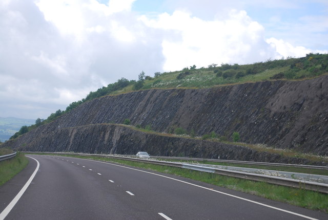
Rock cutting, A55 (geograph 3157194 by N Chadwick).jpg
42:
Rock_cutting,_A55_(geograph_3157194_by_N_Chadwick).jpg
164:
Creative
Commons Attribution Share-alike license 2.0
100:
80:
Commons is a freely licensed media file repository.
546:
Creative
Commons Attribution-ShareAlike 2.0 Generic
46:(640 × 430 pixels, file size: 53 KB, MIME type:
429:https://creativecommons.org/licenses/by-sa/2.0
61:
435:Creative Commons Attribution-Share Alike 2.0
353:
8:
627:
563:
395:– to copy, distribute and transmit the work
731:
456:
791:
707:
691:
651:
635:
587:
571:
543:
527:
507:
491:
474:
471:
452:
445:
264:
214:
293:View this and other nearby images on:
243:View this and other nearby images on:
7:
340:and is licensed for reuse under the
779:Uploaded own work with UploadWizard
720:
376:Attribution-Share Alike 2.0 Generic
364:
359:
344:Attribution-ShareAlike 2.0 license.
465:
459:
350:
327:
110:
93:
39:
464:
574:coordinates of the point of view
450:
406:Under the following conditions:
371:This file is licensed under the
363:
358:
352:
320:
299:
285:
277:
249:
235:
227:
60:
21:
447:
111:
36:No higher resolution available.
14:
446:
328:This image was taken from the
26:
1:
794:Clwydian Range and Dee Valley
638:coordinates of depicted place
589:53°16'19.571"N, 3°22'15.506"W
472:Items portrayed in this file
276:
226:
653:53°16'19.20"N, 3°22'20.89"W
810:
420:same or compatible license
721:
16:
449:
386:
67:This is a file from the
778:
202:N Chadwick /
183:N Chadwick /
174:required by the license
152:
142:
131:
124:
121:
103:
71:. Information from its
334:this photograph's page
305:53.272000; -3.372470
255:53.272103; -3.370974
74:description page there
757:14:08, 6 October 2021
401:– to adapt the work
782:
629:
565:
530:copyright license
458:
349:
348:
332:collection. See
310:
309:
260:
259:
209:
208:
204:Rock cutting, A55
185:Rock cutting, A55
177:
161:
158:Reusing this file
116:Rock cutting, A55
89:
88:
69:Wikimedia Commons
801:
769:
675:
674:
669:
611:
610:
605:
494:copyright status
460:A55 Rock Cutting
442:
439:
436:
433:
430:
422:as the original.
384:
373:Creative Commons
367:
366:
362:
361:
356:
355:
342:Creative Commons
330:Geograph project
324:
317:
306:
303:
289:
288:
282:
281:
280:
274:
273:
262:
256:
253:
239:
238:
232:
231:
230:
224:
223:
212:
171:
155:
127:
115:
107:
101:
85:
64:
63:
57:
51:
49:
809:
808:
804:
803:
802:
800:
799:
798:
790:
783:
775:
767:
723:
722:
719:
718:
717:
716:
715:
714:
713:
712:
710:
700:
699:
698:
696:
685:
684:
683:
682:
681:
680:
679:
678:
677:
676:
672:
670:
667:
658:
657:
656:
654:
644:
643:
642:
640:
621:
620:
619:
618:
617:
616:
615:
614:
613:
612:
608:
606:
603:
594:
593:
592:
590:
580:
579:
578:
576:
557:
556:
555:
554:
553:
552:
551:
550:
548:
536:
535:
534:
532:
521:
520:
519:
518:
517:
516:
515:
514:
512:
500:
499:
498:
496:
485:
484:
483:
482:
481:
479:
463:
462:
461:
444:
443:
440:
437:
434:
431:
428:
427:
385:
382:
379:
368:
345:
315:
304:
278:
269:
268:
265:Object location
254:
228:
219:
218:
215:Camera location
210:
199:
192:
180:
137:geograph.org.uk
117:
105:
98:
91:
90:
79:
78:
77:is shown below.
53:
47:
45:
38:
37:
12:
11:
5:
807:
805:
797:
796:
788:
787:
786:
781:
780:
777:
773:
770:
764:
759:
754:
750:
749:
746:
743:
740:
737:
734:
727:
726:
711:
708:
706:
705:
704:
703:
702:
701:
697:
692:
690:
689:
688:
687:
686:
663:
662:
661:
660:
659:
655:
652:
650:
649:
648:
647:
646:
645:
641:
636:
634:
633:
632:
631:
625:
599:
598:
597:
596:
595:
591:
588:
586:
585:
584:
583:
582:
581:
577:
572:
570:
569:
568:
567:
561:
549:
544:
542:
541:
540:
539:
538:
537:
533:
528:
526:
525:
524:
523:
522:
513:
508:
506:
505:
504:
503:
502:
501:
497:
492:
490:
489:
488:
487:
486:
480:
475:
473:
470:
469:
468:
467:
466:
455:
454:
451:
448:
426:
425:
424:
423:
413:
404:
403:
402:
396:
389:You are free:
380:
370:
369:
351:
347:
346:
325:
314:
311:
308:
307:
297:
291:
266:
258:
257:
247:
241:
216:
207:
206:
200:
197:
194:
193:
188:
181:
178:
166:
165:
162:
150:
149:
144:
140:
139:
133:
129:
128:
123:
119:
118:
108:
99:
97:
94:
92:
87:
86:
65:
55:
54:
35:
31:
30:
29:
24:
19:
13:
10:
9:
6:
4:
3:
2:
806:
795:
792:
784:
776:
771:
765:
763:
760:
758:
755:
752:
751:
747:
744:
741:
738:
735:
733:
732:
730:
724:
695:
666:
639:
602:
575:
547:
531:
511:
495:
478:
432:CC BY-SA 2.0
421:
417:
414:
411:
408:
407:
405:
400:
397:
394:
391:
390:
388:
387:
381:Attribution:
377:
374:
357:
343:
339:
335:
331:
326:
323:
319:
318:
312:
302:
298:
296:
295:OpenStreetMap
292:
290:
272:
267:
263:
252:
248:
246:
245:OpenStreetMap
242:
240:
222:
217:
213:
205:
201:
196:
195:
191:
187: /
186:
182:
175:
170:
168:
167:
163:
159:
154:
151:
148:
145:
141:
138:
134:
130:
120:
114:
109:
102:
95:
83:
76:
75:
70:
66:
59:
58:
52:
43:
34:
28:
25:
23:
20:
18:
15:
728:
725:File history
709:24 June 2012
415:
409:
398:
392:
337:
275:
225:
203:
190:CC BY-SA 2.0
184:
126:24 June 2012
112:
82:You can help
72:
40:
22:File history
510:copyrighted
416:share alike
410:attribution
169:Attribution
104:Description
785:File usage
766:640 × 430
742:Dimensions
383:N Chadwick
338:N Chadwick
153:Permission
147:N Chadwick
48:image/jpeg
27:File usage
739:Thumbnail
736:Date/Time
694:inception
313:Licensing
198:InfoField
179:InfoField
113:English:
453:Captions
399:to remix
393:to share
378:license.
774:DankJae
768:(53 KB)
753:current
748:Comment
665:heading
624:heading
601:heading
560:heading
477:depicts
457:English
96:Summary
44:
673:degree
628:degree
609:degree
564:degree
283:
233:
143:Author
132:Source
135:From
745:User
671:270
607:270
441:true
438:true
122:Date
17:File
668::
604::
176:)
172:(
160:)
156:(
84:.
50:)
Text is available under the Creative Commons Attribution-ShareAlike License. Additional terms may apply.
.jpg)
.jpg¶ms=053.272103_N_-003.370974_E_globe:Earth_type:camera_source:geograph-osgb36(SJ08677589)_heading:270.00&language=en)
.jpg¶ms=053.272000_N_-003.372470_E_globe:Earth_class:object_type:object_source:geograph-osgb36(SJ08577588)_heading:270.00&language=en)
