257:
181:
439:
371:
453:
263:
187:
72:
268:
778:
320:– You must give appropriate credit, provide a link to the license, and indicate if changes were made. You may do so in any reasonable manner, but not in any way that suggests the licensor endorses you or your use.
228:– You must give appropriate credit, provide a link to the license, and indicate if changes were made. You may do so in any reasonable manner, but not in any way that suggests the licensor endorses you or your use.
430:
43:
388:
882:
795:{{Information |Description=By madmaxmarchhare - Rock Island Centennial Bridge in 11/06 |Source=Originally from ; description page is/was . |
386:; with no Invariant Sections, no Front-Cover Texts, and no Back-Cover Texts. A copy of the license is included in the section entitled
170:
378:
393:
281:
621:
604:
587:
551:
446:
829:
121:
895:
This file contains additional information, probably added from the digital camera or scanner used to create or digitize it.
872:
327:
709:
675:
535:
383:
641:
571:
518:
83:
51:
155:
277:
898:
If the file has been modified from its original state, some details may not fully reflect the modified file.
805:
The following pages on the
English Knowledge (XXG) use this file (pages on other projects are not listed):
824:
819:
478:
326:– If you remix, transform, or build upon the material, you must distribute your contributions under the
197:
274:
194:
91:
365:
376:
Permission is granted to copy, distribute and/or modify this document under the terms of the
341:
814:
809:
452:
370:
777:
772:
42:
78:
436:
788:
847:
745:
Click on a date/time to view the file as it appeared at that time.
668:
159:
438:
862:
421:
340:
This licensing tag was added to this file as part of the GFDL
251:
66:
852:
483:
By madmaxmarchhare - Rock Island
Centennial Bridge in 11/06
431:
41° 30′ 54″ N, 90° 34′ 54″ W
502:
Add a one-line explanation of what this file represents
470:
622:
Creative
Commons Attribution-ShareAlike 3.0 Unported
588:
382:, Version 1.2 or any later version published by the
105:
90:
Commons is a freely licensed media file repository.
473:. All following user names refer to en.wikipedia.
56:(604 × 373 pixels, file size: 46 KB, MIME type:
347:http://creativecommons.org/licenses/by-sa/3.0/
143:
71:
256:
180:
8:
353:Creative Commons Attribution-Share Alike 3.0
133:November 2006; 5 December 2006 (upload date)
303:– to copy, distribute and transmit the work
235:https://creativecommons.org/licenses/by/2.5
211:– to copy, distribute and transmit the work
900:
747:
498:
840:The following other wikis use this file:
605:Creative Commons Attribution 2.5 Generic
902:
807:
723:
707:
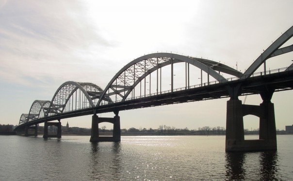
689:
673:
655:
639:
619:
602:
585:
569:
549:
533:
516:
513:
494:
487:
424:
445:View this and other nearby images on:
7:
398:http://www.gnu.org/copyleft/fdl.html
278:Attribution-Share Alike 3.0 Unported
736:
267:
262:
186:
893:
507:
501:
469:The original description page was
468:
202:
177:
115:
103:
49:
506:
241:Creative Commons Attribution 2.5
492:
451:
437:
369:
314:Under the following conditions:
273:This file is licensed under the
266:
261:
255:
222:Under the following conditions:
193:This file is licensed under the
185:
179:
70:
31:
21:
489:
116:
46:No higher resolution available.
14:
830:File talk:Rockiscentbridge.jpg
691:41°30'54.000"N, 90°34'54.001"W
488:
404:GNU Free Documentation License
389:GNU Free Documentation License
379:GNU Free Documentation License
26:
1:
848:Rock Island Centennial Bridge
676:coordinates of depicted place
122:Rock Island Centennial Bridge
36:
514:Items portrayed in this file
924:
879:Usage on ja.wikipedia.org
869:Usage on fa.wikipedia.org
859:Usage on eo.wikipedia.org
844:Usage on de.wikipedia.org
328:same or compatible license
737:
286:
254:
16:
491:
481:604×373×8 (46822 bytes)
384:Free Software Foundation
77:This is a file from the
794:
198:Attribution 2.5 Generic
165:
160:English Knowledge (XXG)
151:
137:
132:
129:
108:
81:. Information from its
457:41.515000; -90.581667
84:description page there
825:U.S. Route 67 in Iowa
820:Rock Island, Illinois
773:21:14, 15 August 2007
280:license. Subject to
111:Rockiscentbridge.jpg
52:Rockiscentbridge.jpg
465:Original upload log
309:– to adapt the work
217:– to adapt the work
911:
910:
863:Davenport (Iovao)
836:Global file usage
798:
572:copyright license
500:
477:2006-12-05 20:22
462:
461:
419:
418:
415:
414:
364:
363:
174:
171:Reusing this file
141:Transferred from
99:
98:
79:Wikimedia Commons
32:Global file usage
915:
901:
815:Iowa Highway 150
785:
536:copyright status
458:
455:
441:
440:
434:
433:
422:
411:
408:
405:
402:
399:
373:
366:
360:
357:
354:
351:
348:
345:
342:licensing update
330:as the original.
275:Creative Commons
270:
269:
265:
264:
259:
258:
252:
248:
245:
242:
239:
236:
195:Creative Commons
189:
188:
183:
182:
168:
146:
120:
112:
106:
95:
74:
73:
67:
61:
59:
923:
922:
918:
917:
916:
914:
913:
912:
889:
853:U.S. Highway 67
834:
810:Davenport, Iowa
806:
799:
791:
783:
739:
738:
735:
734:
733:
732:
731:
730:
729:
728:
726:
716:
715:
714:
712:
701:
700:
699:
698:
697:
696:
695:
694:
692:
682:
681:
680:
678:
667:
666:
665:
664:
663:
662:
661:
660:
658:
648:
647:
646:
644:
633:
632:
631:
630:
629:
628:
627:
626:
624:
613:
612:
611:
610:
609:
607:
596:
595:
594:
593:
592:
590:
578:
577:
576:
574:
563:
562:
561:
560:
559:
558:
557:
556:
554:
542:
541:
540:
538:
527:
526:
525:
524:
523:
521:
505:
504:
503:
479:Madmaxmarchhare
474:
467:
456:
429:
428:
425:Object location
420:
409:
406:
403:
400:
397:
358:
355:
352:
349:
346:
339:
250:
249:
246:
243:
240:
237:
234:
233:
201:
190:
156:Madmaxmarchhare
142:
125:
110:
101:
100:
89:
88:
87:is shown below.
63:
57:
55:
48:
47:
12:
11:
5:
921:
919:
909:
908:
905:
892:
888:
887:
886:
885:
883:ダベンポート (アイオワ州)
877:
876:
875:
873:دونپورت، آیووا
867:
866:
865:
857:
856:
855:
850:
838:
837:
833:
832:
827:
822:
817:
812:
804:
803:
802:
797:
796:
793:
789:
786:
780:
775:
770:
766:
765:
762:
759:
756:
753:
750:
743:
742:
727:
724:
722:
721:
720:
719:
718:
717:
713:
708:
706:
705:
704:
703:
702:
693:
690:
688:
687:
686:
685:
684:
683:
679:
674:
672:
671:
670:
669:
659:
656:
654:
653:
652:
651:
650:
649:
645:
640:
638:
637:
636:
635:
634:
625:
620:
618:
617:
616:
615:
614:
608:
603:
601:
600:
599:
598:
597:
591:
586:
584:
583:
582:
581:
580:
579:
575:
570:
568:
567:
566:
565:
564:
555:
550:
548:
547:
546:
545:
544:
543:
539:
534:
532:
531:
530:
529:
528:
522:
517:
515:
512:
511:
510:
509:
508:
497:
496:
493:
490:
486:
485:
466:
463:
460:
459:
449:
443:
426:
417:
416:
413:
412:
374:
362:
361:
336:
335:
334:
333:
332:
331:
321:
312:
311:
310:
304:
297:You are free:
292:
291:
288:
287:
285:
271:
232:
231:
230:
229:
220:
219:
218:
212:
205:You are free:
192:
191:
178:
175:
163:
162:
153:
149:
148:
139:
135:
134:
131:
127:
126:
113:
104:
102:
97:
96:
75:
65:
64:
45:
41:
40:
39:
34:
29:
24:
19:
13:
10:
9:
6:
4:
3:
2:
920:
906:
903:
899:
896:
890:
884:
881:
880:
878:
874:
871:
870:
868:
864:
861:
860:
858:
854:
851:
849:
846:
845:
843:
842:
841:
835:
831:
828:
826:
823:
821:
818:
816:
813:
811:
808:
800:
792:
787:
781:
779:
776:
774:
771:
768:
767:
763:
760:
757:
754:
751:
749:
748:
746:
740:
711:
677:
657:November 2006
643:
623:
606:
589:
573:
553:
537:
520:
484:
480:
476:
475:
472:
464:
454:
450:
448:
447:OpenStreetMap
444:
442:
432:
427:
423:
395:
392:. Subject to
391:
390:
385:
381:
380:
375:
372:
368:
367:
343:
338:
337:
329:
325:
322:
319:
316:
315:
313:
308:
305:
302:
299:
298:
296:
295:
294:
293:
290:
289:
283:
279:
276:
272:
260:
253:
227:
224:
223:
221:
216:
213:
210:
207:
206:
204:
203:
199:
196:
184:
176:
172:
167:
164:
161:
157:
154:
150:
145:
140:
136:
128:
123:
119:
114:
107:
93:
86:
85:
80:
76:
69:
68:
62:
53:
44:
38:
35:
33:
30:
28:
25:
23:
20:
18:
15:
897:
894:
839:
744:
741:File history
482:
387:
377:
350:CC BY-SA 3.0
323:
317:
306:
300:
225:
214:
208:
144:en.wikipedia
117:
92:You can help
82:
50:
22:File history
552:copyrighted
394:disclaimers
324:share alike
318:attribution
282:disclaimers
226:attribution
147:to Commons.
109:Description
904:_error
801:File usage
782:604 × 373
758:Dimensions
725:image/jpeg
710:media type
238:CC BY 2.5
166:Permission
58:image/jpeg
27:File usage
755:Thumbnail
752:Date/Time
642:inception
118:English:
891:Metadata
495:Captions
307:to remix
301:to share
215:to remix
209:to share
200:license.
124:in 11/06
37:Metadata
784:(46 KB)
769:current
764:Comment
519:depicts
499:English
54:
435:
152:Author
138:Source
790:Diba
761:User
471:here
410:true
407:true
401:GFDL
359:true
356:true
247:true
244:true
130:Date
17:File
158:at
284:.
907:0
396:.
344:.
173:)
169:(
94:.
60:)
Text is available under the Creative Commons Attribution-ShareAlike License. Additional terms may apply.
