230:
165:
179:
198:
236:
241:
67:
544:
156:
288:– You must give appropriate credit, provide a link to the license, and indicate if changes were made. You may do so in any reasonable manner, but not in any way that suggests the licensor endorses you or your use.
565:|Source=Geograph http://www.geograph.org.uk/photo/26459 |Date=Tuesday, 12 July, 2005 |Author=Richard Webb |Permission=see below |other_versions= }} {{geograph|26459|Richard Webb}} [
38:
597:
677:
421:
385:
172:
205:
295:
78:
46:
475:
369:
441:
405:
352:
192:
251:
575:
The following pages on the
English Knowledge (XXG) use this file (pages on other projects are not listed):
294:– If you remix, transform, or build upon the material, you must distribute your contributions under the
212:
on the
Geograph website for the photographer's contact details. The copyright on this image is owned by
248:
110:
579:
562:
554:
86:
543:
538:
37:
178:
217:
73:
120:
162:
131:
197:
209:
647:
511:
Click on a date/time to view the file as it appeared at that time.
637:
667:
627:
164:
717:
147:
61:
468:
157:
55° 51′ 28″ N, 3° 09′ 50″ W
336:
Add a one-line explanation of what this file represents
727:
697:
100:
85:
Commons is a freely licensed media file repository.
707:
687:
657:
617:
607:
422:
Creative
Commons Attribution-ShareAlike 2.0 Generic
51:(640 × 458 pixels, file size: 69 KB, MIME type:
305:https://creativecommons.org/licenses/by-sa/2.0
66:
311:Creative Commons Attribution-Share Alike 2.0
229:
8:
271:– to copy, distribute and transmit the work
513:
332:
590:The following other wikis use this file:
577:
489:
473:
455:
439:
419:
403:
383:
367:
350:
347:
328:
321:
150:
132:https://www.geograph.org.uk/photo/26459
171:View this and other nearby images on:
7:
216:and is licensed for reuse under the
502:
252:Attribution-Share Alike 2.0 Generic
240:
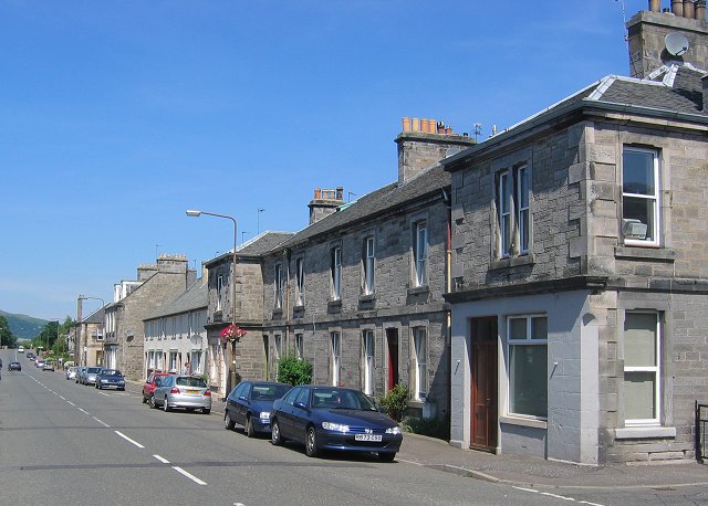
235:
220:Attribution-ShareAlike 2.0 license.
341:
335:
226:
203:
98:
44:
340:
326:
282:Under the following conditions:
247:This file is licensed under the
239:
234:
228:
196:
177:
163:
65:
31:
21:
323:
41:No higher resolution available.
14:
322:
204:This image was taken from the
26:
1:
476:coordinates of depicted place
348:Items portrayed in this file
644:Usage on en.wikivoyage.org
634:Usage on de.wikivoyage.org
594:Usage on azb.wikipedia.org
561:{{Information |Description=
746:
724:Usage on www.wikidata.org
714:Usage on sv.wikipedia.org
704:Usage on is.wikipedia.org
694:Usage on ga.wikipedia.org
684:Usage on fr.wikipedia.org
674:Usage on fa.wikipedia.org
664:Usage on eu.wikipedia.org
654:Usage on es.wikipedia.org
624:Usage on de.wikipedia.org
614:Usage on cy.wikipedia.org
604:Usage on ca.wikipedia.org
296:same or compatible license
503:
16:
491:55°51'28.1"N, 3°9'50.4"W
325:
262:
72:This is a file from the
560:
539:12:41, 18 November 2007
137:
126:
119:
116:
103:
76:. Information from its
210:this photograph's page
183:55.857800; -3.164000
106:Roslin, Midlothian.jpg
79:description page there
47:Roslin,_Midlothian.jpg
648:User:Inferno986return
668:Roslin (Midlothian)
638:Roslin (Midlothian)
628:Roslin (Midlothian)
277:– to adapt the work
580:Roslin, Midlothian
563:Roslin, Midlothian
111:Roslin, Midlothian
718:Roslin, Skottland
586:Global file usage
568:
406:copyright license
334:
225:
224:
208:collection. See
188:
187:
145:
144:
94:
93:
74:Wikimedia Commons
32:Global file usage
737:
678:روسلین، میدلودین
598:روسلین، میدلودین
551:
370:copyright status
318:
315:
312:
309:
306:
298:as the original.
260:
249:Creative Commons
243:
242:
238:
237:
232:
231:
218:Creative Commons
206:Geograph project
200:
193:
184:
181:
167:
166:
160:
159:
148:
122:
107:
101:
90:
69:
68:
62:
56:
54:
745:
744:
740:
739:
738:
736:
735:
734:
584:
576:
569:
557:
549:
505:
504:
501:
500:
499:
498:
497:
496:
495:
494:
492:
482:
481:
480:
478:
467:
466:
465:
464:
463:
462:
461:
460:
458:
448:
447:
446:
444:
433:
432:
431:
430:
429:
428:
427:
426:
424:
412:
411:
410:
408:
397:
396:
395:
394:
393:
392:
391:
390:
388:
376:
375:
374:
372:
361:
360:
359:
358:
357:
355:
339:
338:
337:
320:
319:
316:
313:
310:
307:
304:
303:
261:
258:
255:
244:
221:
182:
155:
154:
151:Object location
146:
105:
96:
95:
84:
83:
82:is shown below.
58:
52:
50:
43:
42:
12:
11:
5:
743:
741:
733:
732:
731:
730:
722:
721:
720:
712:
711:
710:
702:
701:
700:
692:
691:
690:
682:
681:
680:
672:
671:
670:
662:
661:
660:
652:
651:
650:
642:
641:
640:
632:
631:
630:
622:
621:
620:
612:
611:
610:
602:
601:
600:
588:
587:
583:
582:
574:
573:
572:
567:
566:
559:
555:
552:
546:
541:
536:
532:
531:
528:
525:
522:
519:
516:
509:
508:
493:
490:
488:
487:
486:
485:
484:
483:
479:
474:
472:
471:
470:
469:
459:
456:
454:
453:
452:
451:
450:
449:
445:
440:
438:
437:
436:
435:
434:
425:
420:
418:
417:
416:
415:
414:
413:
409:
404:
402:
401:
400:
399:
398:
389:
384:
382:
381:
380:
379:
378:
377:
373:
368:
366:
365:
364:
363:
362:
356:
351:
349:
346:
345:
344:
343:
342:
331:
330:
327:
324:
302:
301:
300:
299:
289:
280:
279:
278:
272:
265:You are free:
256:
246:
245:
227:
223:
222:
201:
186:
185:
175:
169:
152:
143:
142:
139:
135:
134:
128:
124:
123:
118:
114:
113:
108:
99:
97:
92:
91:
70:
60:
59:
40:
36:
35:
34:
29:
24:
19:
13:
10:
9:
6:
4:
3:
2:
742:
729:
726:
725:
723:
719:
716:
715:
713:
709:
706:
705:
703:
699:
696:
695:
693:
689:
686:
685:
683:
679:
676:
675:
673:
669:
666:
665:
663:
659:
656:
655:
653:
649:
646:
645:
643:
639:
636:
635:
633:
629:
626:
625:
623:
619:
616:
615:
613:
609:
606:
605:
603:
599:
596:
595:
593:
592:
591:
585:
581:
578:
570:
564:
558:
556:Angusmclellan
553:
547:
545:
542:
540:
537:
534:
533:
529:
526:
523:
520:
517:
515:
514:
512:
506:
477:
443:
423:
407:
387:
371:
354:
308:CC BY-SA 2.0
297:
293:
290:
287:
284:
283:
281:
276:
273:
270:
267:
266:
264:
263:
257:Attribution:
253:
250:
233:
219:
215:
211:
207:
202:
199:
195:
194:
191:
190:
180:
176:
174:
173:OpenStreetMap
170:
168:
158:
153:
149:
140:
136:
133:
129:
125:
115:
112:
109:
102:
88:
81:
80:
75:
71:
64:
63:
57:
48:
39:
33:
30:
28:
25:
23:
20:
18:
15:
589:
510:
507:File history
457:12 July 2005
291:
285:
274:
268:
259:Richard Webb
214:Richard Webb
213:
189:
141:Richard Webb
121:12 July 2005
87:You can help
77:
45:
22:File history
386:copyrighted
292:share alike
286:attribution
104:Description
571:File usage
548:640 × 458
524:Dimensions
53:image/jpeg
27:File usage
521:Thumbnail
518:Date/Time
442:inception
130:Geograph
728:Q2037998
698:Roslainn
329:Captions
275:to remix
269:to share
254:license.
550:(69 KB)
535:current
530:Comment
353:depicts
333:English
49:
708:Roslin
688:Roslin
658:Roslin
618:Roslin
608:Roslin
161:
138:Author
127:Source
527:User
317:true
314:true
117:Date
17:File
89:.
55:)
Text is available under the Creative Commons Attribution-ShareAlike License. Additional terms may apply.
_region:GB-GBN_&language=en)
