301:
231:
400:
223:
245:
269:
307:
312:
72:
829:"}},"text\/plain":{"en":{"":"heading"}}},"{\"value\":{\"amount\":\"+0.00\",\"unit\":\"http:\\\/\\\/www.wikidata.org\\\/entity\\\/Q28390\"},\"type\":\"quantity\"}":{"text\/html":{"en":{"P7787":"0.00
893:"}},"text\/plain":{"en":{"":"heading"}}},"{\"value\":{\"amount\":\"+0\",\"unit\":\"http:\\\/\\\/www.wikidata.org\\\/entity\\\/Q28390\"},\"type\":\"quantity\"}":{"text\/html":{"en":{"P7787":"0
825:
889:
1012:== {{int:filedesc}} == {{Information |description={{en|1=Railway viaduct, Willington. This picture was taken on first day of cycle ride "Coasts and Castles" from Newcastle to Edinburgh}} |date=2006-07-26 |source=From [http://www.geograph.org.uk/photo/2469
43:
359:– You must give appropriate credit, provide a link to the license, and indicate if changes were made. You may do so in any reasonable manner, but not in any way that suggests the licensor endorses you or your use.
83:
51:
1026:
408:
890:
826:
425:
761:
691:
655:
238:
126:
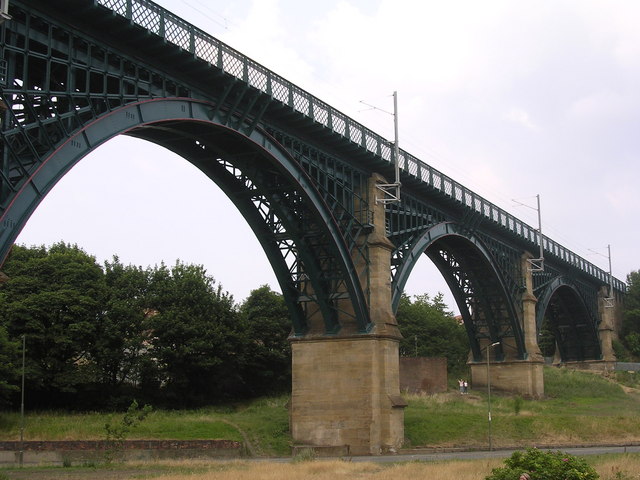
Railway viaduct, Willington. This picture was taken on first day of cycle ride "Coasts and
Castles" from Newcastle to Edinburgh
994:
989:
781:
42:
1204:
276:
1067:
This file contains additional information, probably added from the digital camera or scanner used to create or digitize it.
366:
618:
931:
904:
867:
840:
789:
745:
639:
611:
598:
583:
501:
804:
774:
711:
675:
556:
539:
448:
440:
263:
322:
1070:
If the file has been modified from its original state, some details may not fully reflect the modified file.
1031:
421:
1022:
The following pages on the
English Knowledge (XXG) use this file (pages on other projects are not listed):
1231:
1036:
365:– If you remix, transform, or build upon the material, you must distribute your contributions under the
283:
on the
Geograph website for the photographer's contact details. The copyright on this image is owned by
1005:
833:"}},"text\/plain":{"en":{"P7787":"0.00 degree"}}}}": -->
319:
1267:
897:"}},"text\/plain":{"en":{"P7787":"0 degree"}}}}": -->
429:
91:
183:
1173:
1340:
414:
Remove redundant categories and try to put this image in the most specific category/categories
811:
796:
590:
167:
492:
496:
488:
484:
480:
476:
472:
468:
464:
460:
456:
244:
1303:
1249:
1096:
288:
78:
1350:
1313:
1136:
1277:
135:
1116:
228:
156:
146:
1360:
1106:
268:
280:
962:
Click on a date/time to view the file as it appeared at that time.
1089:
1079:
230:
205:
66:
1027:
List of railway bridges and viaducts in the United
Kingdom
116:
Railway viaduct, Willington - geograph.org.uk - 246914.jpg
52:
Railway_viaduct,_Willington_-_geograph.org.uk_-_246914.jpg
215:
54° 59′ 27″ N, 1° 30′ 14″ W
523:
Add a one-line explanation of what this file represents
1054:
428:
combined with a database. You can also have a look at
420:
The location categories are based on information from
110:
90:
Commons is a freely licensed media file repository.
692:
Creative
Commons Attribution-ShareAlike 2.0 Generic
56:(640 × 480 pixels, file size: 108 KB, MIME type:
405:The categories of this image should be checked.
376:https://creativecommons.org/licenses/by-sa/2.0
71:
382:Creative Commons Attribution-Share Alike 2.0
300:
8:
894:
830:
342:– to copy, distribute and transmit the work
1072:
964:
519:
500:
1047:The following other wikis use this file:
812:https://www.geograph.org.uk/photo/246914
591:https://www.geograph.org.uk/profile/3238
1368:
1358:
1348:
1338:
1330:
1322:
1311:
1301:
1293:
1285:
1275:
1265:
1257:
1247:
1239:
1229:
1221:
1213:
1202:
1194:
1186:
1178:
1168:
1160:
1152:
1144:
1133:
1125:
1114:
1104:
1094:
1084:
1024:
918:
902:
854:
838:
759:
743:
725:
709:
689:
673:
653:
637:
570:
554:
537:
534:
515:
508:
447:This image was uploaded as part of the
208:
237:View this and other nearby images on:
1074:
435:The topic category from Geograph was
7:
287:and is licensed for reuse under the
953:
323:Attribution-Share Alike 2.0 Generic
311:
306:
291:Attribution-ShareAlike 2.0 license.
1065:
528:
522:
297:
274:
120:
103:
49:
1101:10/3,523 sec (0.0028384899233608)
527:
1127:Date and time of data generation
841:coordinates of the point of view
513:
398:
353:Under the following conditions:
318:This file is licensed under the
310:
305:
299:
267:
243:
229:
221:
70:
31:
21:
510:
121:
46:No higher resolution available.
14:
762:file available on the internet
509:
275:This image was taken from the
196:Richard Greenwood /
177:Richard Greenwood /
26:
1:
1272:Flash did not fire, auto mode
905:coordinates of depicted place
856:54°59'26.520"N, 1°30'14.400"W
36:
782:Geograph Britain and Ireland
612:object of statement has role
535:Items portrayed in this file
1215:Date and time of digitizing
198:Railway viaduct, Willington
179:Railway viaduct, Willington
1390:
1324:Focal length in 35 mm film
1051:Usage on www.wikidata.org
367:same or compatible license
220:
1180:File change date and time
954:
920:54°59'26.5"N, 1°30'14.4"W
16:
790:geograph.org.uk image ID
512:
430:this tool from mysociety
396:
395:
333:
77:This is a file from the
1287:Custom image processing
1032:Willington Dene Viaduct
1011:
426:this OpenStreetMap tool
168:required by the license
152:
141:
134:
131:
113:
81:. Information from its
1370:Subject distance range
1223:Image compression mode
990:16:09, 1 February 2010
281:this photograph's page
249:54.990700; -1.504000
84:description page there
1241:Maximum land aperture
1154:Horizontal resolution
1037:User:Turini2/sandbox2
449:Geograph batch upload
439:(find similar images
417:Remove this template
1218:17:32, 26 July 2006
1188:Y and C positioning
1183:17:32, 26 July 2006
1162:Vertical resolution
1130:17:32, 26 July 2006
1076:Camera manufacturer
493:português do Brasil
348:– to adapt the work
1332:Scene capture type
1308:Auto white balance
599:author name string
422:this geonames tool
1377:
1376:
1043:Global file usage
1015:
896:
832:
676:copyright license
605:Richard Greenwood
521:
504:
451:
330:Richard Greenwood
296:
295:
285:Richard Greenwood
279:collection. See
254:
253:
203:
202:
171:
157:Richard Greenwood
99:
98:
79:Wikimedia Commons
32:Global file usage
1381:
1196:Exposure Program
1073:
1002:
942:
941:
936:
878:
877:
872:
814:
809:
805:described at URL
799:
794:
784:
779:
640:copyright status
621:
616:
606:
603:
593:
588:
505:
446:
403:
402:
401:
389:
386:
383:
380:
377:
369:as the original.
331:
320:Creative Commons
314:
313:
309:
308:
303:
302:
289:Creative Commons
277:Geograph project
271:
264:
250:
247:
233:
232:
226:
225:
224:
218:
217:
206:
165:
137:
125:
117:
111:
95:
74:
73:
67:
61:
59:
1389:
1388:
1384:
1383:
1382:
1380:
1379:
1378:
1244:3 APEX (f/2.83)
1061:
1041:
1023:
1016:
1008:
1000:
956:
955:
952:
951:
950:
949:
948:
947:
946:
945:
944:
943:
939:
937:
934:
925:
924:
923:
921:
911:
910:
909:
907:
888:
887:
886:
885:
884:
883:
882:
881:
880:
879:
875:
873:
870:
861:
860:
859:
857:
847:
846:
845:
843:
824:
823:
822:
821:
820:
819:
818:
817:
816:
815:
810:
807:
801:
800:
795:
792:
786:
785:
780:
777:
768:
767:
766:
764:
752:
751:
750:
748:
737:
736:
735:
734:
733:
732:
731:
730:
728:
718:
717:
716:
714:
703:
702:
701:
700:
699:
698:
697:
696:
694:
682:
681:
680:
678:
667:
666:
665:
664:
663:
662:
661:
660:
658:
646:
645:
644:
642:
631:
630:
629:
628:
627:
626:
625:
624:
623:
622:
617:
614:
608:
607:
604:
601:
595:
594:
589:
586:
577:
576:
575:
573:
563:
562:
561:
559:
548:
547:
546:
545:
544:
542:
526:
525:
524:
507:
455:
452:
409:Check them now!
399:
397:
391:
390:
387:
384:
381:
378:
375:
374:
332:
329:
326:
315:
292:
262:
248:
222:
213:
212:
209:Object location
204:
193:
186:
174:
147:geograph.org.uk
127:
115:
108:
101:
100:
89:
88:
87:is shown below.
63:
57:
55:
48:
47:
12:
11:
5:
1387:
1385:
1375:
1374:
1371:
1367:
1366:
1363:
1357:
1356:
1353:
1347:
1346:
1343:
1337:
1336:
1333:
1329:
1328:
1325:
1321:
1320:
1317:
1310:
1309:
1306:
1300:
1299:
1296:
1292:
1291:
1290:Normal process
1288:
1284:
1283:
1280:
1274:
1273:
1270:
1264:
1263:
1260:
1256:
1255:
1252:
1246:
1245:
1242:
1238:
1237:
1234:
1228:
1227:
1224:
1220:
1219:
1216:
1212:
1211:
1208:
1201:
1200:
1199:Normal program
1197:
1193:
1192:
1189:
1185:
1184:
1181:
1177:
1176:
1171:
1167:
1166:
1163:
1159:
1158:
1155:
1151:
1150:
1147:
1143:
1142:
1139:
1132:
1131:
1128:
1124:
1123:
1120:
1113:
1112:
1109:
1103:
1102:
1099:
1093:
1092:
1087:
1083:
1082:
1077:
1064:
1060:
1059:
1058:
1057:
1045:
1044:
1040:
1039:
1034:
1029:
1021:
1020:
1019:
1014:
1013:
1010:
1006:
1003:
997:
992:
987:
983:
982:
979:
976:
973:
970:
967:
960:
959:
930:
929:
928:
927:
926:
922:
919:
917:
916:
915:
914:
913:
912:
908:
903:
901:
900:
899:
898:
892:
866:
865:
864:
863:
862:
858:
855:
853:
852:
851:
850:
849:
848:
844:
839:
837:
836:
835:
834:
828:
803:
802:
788:
787:
773:
772:
771:
770:
769:
765:
760:
758:
757:
756:
755:
754:
753:
749:
746:source of file
744:
742:
741:
740:
739:
738:
729:
726:
724:
723:
722:
721:
720:
719:
715:
710:
708:
707:
706:
705:
704:
695:
690:
688:
687:
686:
685:
684:
683:
679:
674:
672:
671:
670:
669:
668:
659:
654:
652:
651:
650:
649:
648:
647:
643:
638:
636:
635:
634:
633:
632:
610:
609:
597:
596:
582:
581:
580:
579:
578:
574:
571:
569:
568:
567:
566:
565:
564:
560:
555:
553:
552:
551:
550:
549:
543:
538:
536:
533:
532:
531:
530:
529:
518:
517:
514:
511:
445:
444:
433:
418:
415:
373:
372:
371:
370:
360:
351:
350:
349:
343:
336:You are free:
327:
317:
316:
298:
294:
293:
272:
261:
258:
252:
251:
241:
235:
210:
201:
200:
194:
191:
188:
187:
182:
175:
172:
160:
159:
154:
150:
149:
143:
139:
138:
133:
129:
128:
118:
109:
107:
104:
102:
97:
96:
75:
65:
64:
45:
41:
40:
39:
34:
29:
24:
19:
13:
10:
9:
6:
4:
3:
2:
1386:
1372:
1369:
1364:
1362:
1359:
1354:
1352:
1349:
1344:
1342:
1339:
1334:
1331:
1326:
1323:
1318:
1315:
1312:
1307:
1305:
1304:White balance
1302:
1298:Auto exposure
1297:
1295:Exposure mode
1294:
1289:
1286:
1281:
1279:
1276:
1271:
1269:
1266:
1261:
1258:
1253:
1251:
1250:Metering mode
1248:
1243:
1240:
1235:
1233:
1232:Exposure bias
1230:
1225:
1222:
1217:
1214:
1209:
1206:
1203:
1198:
1195:
1190:
1187:
1182:
1179:
1175:
1172:
1170:Software used
1169:
1164:
1161:
1156:
1153:
1148:
1145:
1140:
1138:
1134:
1129:
1126:
1121:
1118:
1115:
1110:
1108:
1105:
1100:
1098:
1097:Exposure time
1095:
1091:
1088:
1085:
1081:
1078:
1075:
1071:
1068:
1062:
1056:
1053:
1052:
1050:
1049:
1048:
1042:
1038:
1035:
1033:
1030:
1028:
1025:
1017:
1009:
1004:
998:
996:
993:
991:
988:
985:
984:
980:
977:
974:
971:
968:
966:
965:
963:
957:
933:
906:
869:
842:
813:
806:
798:
791:
783:
776:
763:
747:
713:
693:
677:
657:
641:
620:
613:
600:
592:
585:
558:
541:
506:
503:
498:
494:
490:
486:
482:
478:
474:
470:
466:
462:
458:
453:
450:
442:
438:
434:
431:
427:
423:
419:
416:
413:
412:
411:
410:
406:
394:
393:
379:CC BY-SA 2.0
368:
364:
361:
358:
355:
354:
352:
347:
344:
341:
338:
337:
335:
334:
328:Attribution:
324:
321:
304:
290:
286:
282:
278:
273:
270:
266:
265:
259:
257:
256:
246:
242:
240:
239:OpenStreetMap
236:
234:
216:
211:
207:
199:
195:
190:
189:
185:
181: /
180:
176:
169:
164:
162:
161:
158:
155:
151:
148:
144:
140:
130:
124:
119:
112:
105:
93:
86:
85:
80:
76:
69:
68:
62:
53:
44:
38:
35:
33:
30:
28:
25:
23:
20:
18:
15:
1314:Digital zoom
1259:Light source
1137:focal length
1086:Camera model
1069:
1066:
1046:
961:
958:File history
727:26 July 2006
619:photographer
454:
436:
407:
404:
392:
362:
356:
345:
339:
284:
255:
219:
197:
184:CC BY-SA 2.0
178:
136:26 July 2006
122:
92:You can help
82:
50:
22:File history
1278:Color space
1146:Orientation
1007:GeographBot
656:copyrighted
441:at Geograph
363:share alike
357:attribution
163:Attribution
114:Description
1351:Saturation
1018:File usage
999:640 × 480
975:Dimensions
572:some value
481:македонски
58:image/jpeg
27:File usage
1361:Sharpness
1174:E3100v1.2
1117:ISO speed
1055:Q26276186
972:Thumbnail
969:Date/Time
712:inception
489:português
260:Licensing
192:InfoField
173:InfoField
123:English:
1341:Contrast
1335:Standard
1191:Co-sited
1107:F-number
1063:Metadata
1001:(108 KB)
775:operator
516:Captions
499: |
495: |
491: |
487: |
483: |
479: |
475: |
471: |
467: |
465:français
463: |
459: |
346:to remix
340:to share
325:license.
37:Metadata
1373:Unknown
1262:Unknown
1254:Pattern
1207:version
1165:300 dpi
1157:300 dpi
986:current
981:Comment
932:heading
891:heading
868:heading
827:heading
557:creator
540:depicts
520:English
457:English
437:Viaduct
106:Summary
54:
1365:Normal
1355:Normal
1345:Normal
1149:Normal
1119:rating
940:degree
895:degree
876:degree
831:degree
797:246914
497:Türkçe
485:മലയാളം
477:magyar
469:galego
227:
153:Author
142:Source
1327:53 mm
1316:ratio
1268:Flash
1135:Lens
1111:f/3.2
1090:E3100
1080:NIKON
874:0.00
473:עברית
461:suomi
145:From
1282:sRGB
1205:Exif
1141:8 mm
978:User
424:and
388:true
385:true
132:Date
17:File
1210:2.2
1122:100
584:URL
502:+/−
938:0
935::
871::
808::
793::
778::
615::
602::
587::
1319:0
1236:0
1226:2
443:)
432:.
170:)
166:(
94:.
60:)
Text is available under the Creative Commons Attribution-ShareAlike License. Additional terms may apply.
_heading:0.00&language=en)
