366:
299:
249:
291:
241:
313:
263:
334:
372:
377:
72:
842:"}},"text\/plain":{"en":{"":"heading"}}},"{\"value\":{\"amount\":\"+225\",\"unit\":\"http:\\\/\\\/www.wikidata.org\\\/entity\\\/Q28390\"},\"type\":\"quantity\"}":{"text\/html":{"en":{"P7787":"225
778:"}},"text\/plain":{"en":{"":"heading"}}},"{\"value\":{\"amount\":\"+225\",\"unit\":\"http:\\\/\\\/www.wikidata.org\\\/entity\\\/Q28390\"},\"type\":\"quantity\"}":{"text\/html":{"en":{"P7787":"225
944:
838:
232:
43:
424:– You must give appropriate credit, provide a link to the license, and indicate if changes were made. You may do so in any reasonable manner, but not in any way that suggests the licensor endorses you or your use.
83:
51:
1028:
839:
775:
961:== {{int:filedesc}} == {{Information |description={{en|1=Remains of Inverallochy Castle}} |date=2004-07-23 |source=From |author= |permission= |
990:
980:
676:
640:
604:
306:
256:
943:
938:
42:
711:
341:
1061:
This file contains additional information, probably added from the digital camera or scanner used to create or digitize it.
431:
567:
880:
853:
816:
789:
689:
660:
588:
560:
545:
532:
985:
747:
719:
704:
624:
505:
488:
328:
387:
1064:
If the file has been modified from its original state, some details may not fully reflect the modified file.
971:
The following pages on the
English Knowledge (XXG) use this file (pages on other projects are not listed):
430:– If you remix, transform, or build upon the material, you must distribute your contributions under the
348:
on the
Geograph website for the photographer's contact details. The copyright on this image is owned by
954:
384:
846:"}},"text\/plain":{"en":{"P7787":"225 degree"}}}}": -->
782:"}},"text\/plain":{"en":{"P7787":"225 degree"}}}}": -->
110:
975:
91:
201:
726:
696:
552:
185:
115:
312:
262:
353:
78:
153:
296:
246:
174:
164:
333:
345:
104:
1038:
911:
Click on a date/time to view the file as it appeared at that time.
1018:
1008:
298:
248:
273:
223:
66:
134:
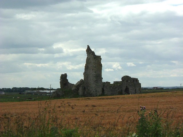
Remains of
Inverallochy Castle - geograph.org.uk - 614169.jpg
52:
Remains_of_Inverallochy_Castle_-_geograph.org.uk_-_614169.jpg
283:
57° 39′ 24″ N, 1° 55′ 59″ W
233:
57° 39′ 28″ N, 1° 55′ 52″ W
472:
Add a one-line explanation of what this file represents
1048:
128:
90:
Commons is a freely licensed media file repository.
641:
Creative
Commons Attribution-ShareAlike 2.0 Generic
56:(640 × 480 pixels, file size: 50 KB, MIME type:
441:https://creativecommons.org/licenses/by-sa/2.0
71:
447:Creative Commons Attribution-Share Alike 2.0
365:
8:
843:
779:
407:– to copy, distribute and transmit the work
1066:
913:
468:
1001:The following other wikis use this file:
727:https://www.geograph.org.uk/photo/614169
553:https://www.geograph.org.uk/profile/7629
1068:
973:
867:
851:
803:
787:
761:
745:
674:
658:
638:
622:
602:
586:
519:
503:
486:
483:
464:
457:
276:
226:
305:View this and other nearby images on:
255:View this and other nearby images on:
7:
991:Scheduled monuments in Aberdeenshire
352:and is licensed for reuse under the
902:
388:Attribution-Share Alike 2.0 Generic
376:
371:
356:Attribution-ShareAlike 2.0 license.
1059:
477:
471:
362:
339:
138:
108:
103:
49:
476:
981:List of castles in Aberdeenshire
790:coordinates of the point of view
462:
418:Under the following conditions:
383:This file is licensed under the
375:
370:
364:
332:
311:
297:
289:
261:
247:
239:
70:
31:
21:
459:
139:
46:No higher resolution available.
14:
677:file available on the internet
458:
340:This image was taken from the
216:Remains of Inverallochy Castle
197:Remains of Inverallochy Castle
144:Remains of Inverallochy Castle
26:
1:
854:coordinates of depicted place
36:
712:Geograph Britain and Ireland
561:object of statement has role
484:Items portrayed in this file
288:
238:
986:Nine castles of the Knuckle
869:57°39'23.98"N, 1°55'58.80"W
805:57°39'27.54"N, 1°55'51.60"W
1090:
1045:Usage on www.wikidata.org
1035:Usage on uz.wikipedia.org
1025:Usage on ru.wikipedia.org
1015:Usage on pt.wikipedia.org
1005:Usage on de.wikipedia.org
432:same or compatible license
1039:Inverallochy qal'asi
1029:Список замков Абердиншира
903:
214:Stanley Howe /
195:Stanley Howe /
16:
690:geograph.org.uk image ID
461:
398:
77:This is a file from the
960:
186:required by the license
170:
159:
152:
149:
131:
81:. Information from its
939:03:25, 7 February 2011
346:this photograph's page
317:57.656660; -1.933000
267:57.657650; -1.931000
84:description page there
1019:Castelo Inverallochy
1009:Inverallochy Castle
976:Inverallochy Castle
413:– to adapt the work
109:This is a photo of
533:author name string
111:scheduled monument
1077:
1076:
997:Global file usage
964:
845:
781:
625:copyright license
470:
361:
360:
344:collection. See
322:
321:
272:
271:
221:
220:
189:
121:
120:
99:
98:
79:Wikimedia Commons
32:Global file usage
1081:
1067:
951:
891:
890:
885:
827:
826:
821:
729:
724:
720:described at URL
714:
709:
699:
694:
589:copyright status
570:
565:
555:
550:
540:
537:
454:
451:
448:
445:
442:
434:as the original.
396:
385:Creative Commons
379:
378:
374:
373:
368:
367:
354:Creative Commons
342:Geograph project
336:
329:
318:
315:
301:
300:
294:
293:
292:
286:
285:
274:
268:
265:
251:
250:
244:
243:
242:
236:
235:
224:
183:
155:
143:
135:
129:
105:
95:
74:
73:
67:
61:
59:
1089:
1088:
1084:
1083:
1082:
1080:
1079:
1078:
1055:
995:
972:
965:
957:
949:
905:
904:
901:
900:
899:
898:
897:
896:
895:
894:
893:
892:
888:
886:
883:
874:
873:
872:
870:
860:
859:
858:
856:
837:
836:
835:
834:
833:
832:
831:
830:
829:
828:
824:
822:
819:
810:
809:
808:
806:
796:
795:
794:
792:
773:
772:
771:
770:
769:
768:
767:
766:
764:
754:
753:
752:
750:
739:
738:
737:
736:
735:
734:
733:
732:
731:
730:
725:
722:
716:
715:
710:
707:
701:
700:
695:
692:
683:
682:
681:
679:
667:
666:
665:
663:
652:
651:
650:
649:
648:
647:
646:
645:
643:
631:
630:
629:
627:
616:
615:
614:
613:
612:
611:
610:
609:
607:
595:
594:
593:
591:
580:
579:
578:
577:
576:
575:
574:
573:
572:
571:
566:
563:
557:
556:
551:
548:
542:
541:
538:
535:
526:
525:
524:
522:
512:
511:
510:
508:
497:
496:
495:
494:
493:
491:
475:
474:
473:
456:
455:
452:
449:
446:
443:
440:
439:
397:
394:
391:
380:
357:
327:
316:
290:
281:
280:
277:Object location
266:
240:
231:
230:
227:Camera location
222:
211:
204:
192:
165:geograph.org.uk
145:
133:
126:
114:
101:
100:
89:
88:
87:is shown below.
63:
57:
55:
48:
47:
12:
11:
5:
1087:
1085:
1075:
1074:
1071:
1058:
1054:
1053:
1052:
1051:
1043:
1042:
1041:
1033:
1032:
1031:
1023:
1022:
1021:
1013:
1012:
1011:
999:
998:
994:
993:
988:
983:
978:
970:
969:
968:
963:
962:
959:
955:
952:
946:
941:
936:
932:
931:
928:
925:
922:
919:
916:
909:
908:
879:
878:
877:
876:
875:
871:
868:
866:
865:
864:
863:
862:
861:
857:
852:
850:
849:
848:
847:
841:
815:
814:
813:
812:
811:
807:
804:
802:
801:
800:
799:
798:
797:
793:
788:
786:
785:
784:
783:
777:
765:
762:
760:
759:
758:
757:
756:
755:
751:
746:
744:
743:
742:
741:
740:
718:
717:
703:
702:
688:
687:
686:
685:
684:
680:
675:
673:
672:
671:
670:
669:
668:
664:
661:source of file
659:
657:
656:
655:
654:
653:
644:
639:
637:
636:
635:
634:
633:
632:
628:
623:
621:
620:
619:
618:
617:
608:
603:
601:
600:
599:
598:
597:
596:
592:
587:
585:
584:
583:
582:
581:
559:
558:
544:
543:
531:
530:
529:
528:
527:
523:
520:
518:
517:
516:
515:
514:
513:
509:
504:
502:
501:
500:
499:
498:
492:
487:
485:
482:
481:
480:
479:
478:
467:
466:
463:
460:
438:
437:
436:
435:
425:
416:
415:
414:
408:
401:You are free:
392:
382:
381:
363:
359:
358:
337:
326:
323:
320:
319:
309:
303:
278:
270:
269:
259:
253:
228:
219:
218:
212:
209:
206:
205:
200:
193:
190:
178:
177:
172:
168:
167:
161:
157:
156:
151:
147:
146:
136:
127:
125:
122:
119:
118:
102:
97:
96:
75:
65:
64:
45:
41:
40:
39:
34:
29:
24:
19:
13:
10:
9:
6:
4:
3:
2:
1086:
1072:
1069:
1065:
1062:
1056:
1050:
1047:
1046:
1044:
1040:
1037:
1036:
1034:
1030:
1027:
1026:
1024:
1020:
1017:
1016:
1014:
1010:
1007:
1006:
1004:
1003:
1002:
996:
992:
989:
987:
984:
982:
979:
977:
974:
966:
958:
953:
947:
945:
942:
940:
937:
934:
933:
929:
926:
923:
920:
917:
915:
914:
912:
906:
882:
855:
818:
791:
749:
728:
721:
713:
706:
698:
691:
678:
662:
642:
626:
606:
590:
569:
562:
554:
547:
534:
507:
490:
444:CC BY-SA 2.0
433:
429:
426:
423:
420:
419:
417:
412:
409:
406:
403:
402:
400:
399:
393:Attribution:
389:
386:
369:
355:
351:
347:
343:
338:
335:
331:
330:
324:
314:
310:
308:
307:OpenStreetMap
304:
302:
284:
279:
275:
264:
260:
258:
257:OpenStreetMap
254:
252:
234:
229:
225:
217:
213:
208:
207:
203:
199: /
198:
194:
187:
182:
180:
179:
176:
173:
169:
166:
162:
158:
148:
142:
137:
130:
123:
117:
112:
107:
106:
93:
86:
85:
80:
76:
69:
68:
62:
53:
44:
38:
35:
33:
30:
28:
25:
23:
20:
18:
15:
1063:
1060:
1000:
910:
907:File history
763:23 July 2004
568:photographer
539:Stanley Howe
427:
421:
410:
404:
395:Stanley Howe
350:Stanley Howe
349:
287:
237:
215:
202:CC BY-SA 2.0
196:
175:Stanley Howe
154:23 July 2004
140:
92:You can help
82:
50:
22:File history
956:GeographBot
605:copyrighted
428:share alike
422:attribution
181:Attribution
132:Description
1070:_error
967:File usage
948:640 × 480
924:Dimensions
521:some value
58:image/jpeg
27:File usage
921:Thumbnail
918:Date/Time
748:inception
325:Licensing
210:InfoField
191:InfoField
141:English:
1057:Metadata
1049:Q6059992
705:operator
465:Captions
411:to remix
405:to share
390:license.
37:Metadata
950:(50 KB)
935:current
930:Comment
881:heading
840:heading
817:heading
776:heading
506:creator
489:depicts
469:English
124:Summary
54:
889:degree
844:degree
825:degree
780:degree
697:614169
295:
245:
171:Author
160:Source
113:number
163:From
927:User
887:225
823:225
453:true
450:true
150:Date
17:File
546:URL
884::
820::
723::
708::
693::
564::
549::
536::
116:97
1073:0
188:)
184:(
94:.
60:)
Text is available under the Creative Commons Attribution-ShareAlike License. Additional terms may apply.
_heading:225.00&language=en)
_heading:225.00&language=en)
