348:
281:
231:
273:
223:
295:
245:
316:
354:
359:
72:
860:"}},"text\/plain":{"en":{"":"heading"}}},"{\"value\":{\"amount\":\"+247\",\"unit\":\"http:\\\/\\\/www.wikidata.org\\\/entity\\\/Q28390\"},\"type\":\"quantity\"}":{"text\/html":{"en":{"P7787":"247
639:"}},"text\/plain":{"en":{"":"heading"}}},"{\"value\":{\"amount\":\"+247\",\"unit\":\"http:\\\/\\\/www.wikidata.org\\\/entity\\\/Q28390\"},\"type\":\"quantity\"}":{"text\/html":{"en":{"P7787":"247
856:
264:
214:
43:
406:– You must give appropriate credit, provide a link to the license, and indicate if changes were made. You may do so in any reasonable manner, but not in any way that suggests the licensor endorses you or your use.
979:== {{int:filedesc}} == {{Information |description={{en|1=River Ryburn With Slitheroe Bridge hidden in the trees, this bridge carries the A672 over the river.}} |date=2008-11-10 |source=From |autho
857:
636:
83:
51:
756:
622:
586:
288:
238:
843:
791:
1163:
323:
1034:
This file contains additional information, probably added from the digital camera or scanner used to create or digitize it.
413:
534:
898:
871:
827:
769:
740:
677:
650:
570:
542:
527:
514:
1140:
799:
784:
706:
606:
487:
470:
310:
961:
956:
369:
42:
1037:
If the file has been modified from its original state, some details may not fully reflect the modified file.
989:
The following pages on the
English Knowledge (XXG) use this file (pages on other projects are not listed):
1190:
412:– If you remix, transform, or build upon the material, you must distribute your contributions under the
330:
on the
Geograph website for the photographer's contact details. The copyright on this image is owned by
972:
366:
864:"}},"text\/plain":{"en":{"P7787":"247 degree"}}}}": -->
643:"}},"text\/plain":{"en":{"P7787":"247 degree"}}}}": -->
126:
River Ryburn With
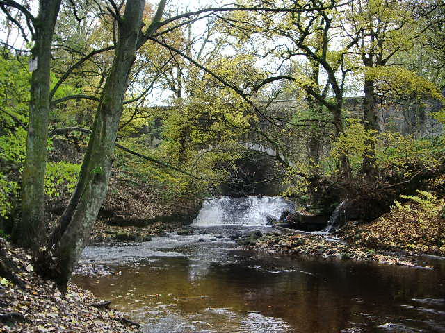
Slitheroe Bridge hidden in the trees, this bridge carries the A672 over the river.
1218:
1046:
91:
183:
1299:
1011:
1056:
806:
776:
549:
167:
294:
244:
1262:
1208:
1063:
335:
78:
1309:
1272:
1103:
993:
1236:
135:
1083:
278:
228:
146:
156:
1319:
1073:
315:
327:
929:
Click on a date/time to view the file as it appeared at that time.
280:
230:
255:
205:
66:
265:
53° 39′ 56″ N, 1° 56′ 56″ W
215:
53° 39′ 57″ N, 1° 56′ 51″ W
454:
Add a one-line explanation of what this file represents
1021:
110:
90:
Commons is a freely licensed media file repository.
623:
Creative
Commons Attribution-ShareAlike 2.0 Generic
56:(640 × 480 pixels, file size: 197 KB, MIME type:
1223:Flash did not fire, compulsory flash suppression
423:https://creativecommons.org/licenses/by-sa/2.0
71:
429:Creative Commons Attribution-Share Alike 2.0
347:
8:
1012:Bruger:Palnatoke/Autolister/Nordsøens floder
116:River Ryburn - geograph.org.uk - 1040864.jpg
52:River_Ryburn_-_geograph.org.uk_-_1040864.jpg
861:
640:
389:– to copy, distribute and transmit the work
1039:
931:
450:
1004:The following other wikis use this file:
807:https://www.geograph.org.uk/photo/1040864
550:https://www.geograph.org.uk/profile/3216
1327:
1317:
1307:
1297:
1289:
1281:
1270:
1260:
1252:
1244:
1234:
1226:
1216:
1206:
1198:
1188:
1180:
1172:
1161:
1153:
1145:
1135:
1127:
1119:
1111:
1100:
1092:
1081:
1071:
1061:
1051:
991:
885:
869:
841:
825:
754:
738:
720:
704:
664:
648:
620:
604:
584:
568:
501:
485:
468:
465:
446:
439:
258:
208:
287:View this and other nearby images on:
237:View this and other nearby images on:
1041:
7:
334:and is licensed for reuse under the
920:
370:Attribution-Share Alike 2.0 Generic
358:
353:
338:Attribution-ShareAlike 2.0 license.
1032:
459:
453:
344:
321:
120:
103:
49:
458:
1094:Date and time of data generation
651:coordinates of the point of view
444:
400:Under the following conditions:
365:This file is licensed under the
357:
352:
346:
314:
293:
279:
271:
243:
229:
221:
70:
31:
21:
441:
121:
46:No higher resolution available.
14:
757:file available on the internet
440:
322:This image was taken from the
26:
1:
872:coordinates of depicted place
196:Alexander P Kapp /
177:Alexander P Kapp /
36:
792:Geograph Britain and Ireland
528:object of statement has role
466:Items portrayed in this file
270:
220:
1174:Date and time of digitizing
1141:ACD Systems Digital Imaging
887:53°39'55.94"N, 1°56'56.40"W
1349:
1283:Focal length in 35 mm film
1018:Usage on www.wikidata.org
1008:Usage on da.wikipedia.org
414:same or compatible license
1147:File change date and time
921:
666:53°39'56.9"N, 1°56'51.0"W
16:
770:geograph.org.uk image ID
443:
380:
77:This is a file from the
1246:Custom image processing
1177:05:50, 10 November 2008
1150:23:26, 10 November 2008
1097:05:50, 10 November 2008
978:
957:22:14, 23 February 2011
168:required by the license
152:
141:
134:
131:
113:
81:. Information from its
1329:Subject distance range
1182:Image compression mode
328:this photograph's page
299:53.665540; -1.949000
249:53.665800; -1.947500
84:description page there
1200:Maximum land aperture
1121:Horizontal resolution
1228:DateTime subseconds
1155:Y and C positioning
1129:Vertical resolution
1043:Camera manufacturer
395:– to adapt the work
1291:Scene capture type
1267:Auto white balance
1047:PENTAX Corporation
515:author name string
1336:
1335:
1203:2.8 APEX (f/2.64)
1000:Global file usage
982:
863:
642:
607:copyright license
452:
343:
342:
326:collection. See
304:
303:
254:
253:
203:
202:
171:
99:
98:
79:Wikimedia Commons
32:Global file usage
1340:
1057:PENTAX Optio S50
1040:
969:
909:
908:
903:
844:Pentax Optio S50
809:
804:
800:described at URL
794:
789:
779:
774:
722:10 November 2008
688:
687:
682:
571:copyright status
552:
547:
537:
532:
522:
521:Alexander P Kapp
519:
436:
433:
430:
427:
424:
416:as the original.
378:
377:Alexander P Kapp
367:Creative Commons
361:
360:
356:
355:
350:
349:
336:Creative Commons
332:Alexander P Kapp
324:Geograph project
318:
311:
300:
297:
283:
282:
276:
275:
274:
268:
267:
256:
250:
247:
233:
232:
226:
225:
224:
218:
217:
206:
165:
157:Alexander P Kapp
137:
136:10 November 2008
125:
117:
111:
95:
74:
73:
67:
61:
59:
1348:
1347:
1343:
1342:
1341:
1339:
1338:
1337:
1314:High saturation
1068:1/50 sec (0.02)
1028:
998:
990:
983:
975:
967:
923:
922:
919:
918:
917:
916:
915:
914:
913:
912:
911:
910:
906:
904:
901:
892:
891:
890:
888:
878:
877:
876:
874:
855:
854:
853:
852:
851:
850:
849:
848:
846:
834:
833:
832:
830:
819:
818:
817:
816:
815:
814:
813:
812:
811:
810:
805:
802:
796:
795:
790:
787:
781:
780:
775:
772:
763:
762:
761:
759:
747:
746:
745:
743:
732:
731:
730:
729:
728:
727:
726:
725:
723:
713:
712:
711:
709:
698:
697:
696:
695:
694:
693:
692:
691:
690:
689:
685:
683:
680:
671:
670:
669:
667:
657:
656:
655:
653:
634:
633:
632:
631:
630:
629:
628:
627:
625:
613:
612:
611:
609:
598:
597:
596:
595:
594:
593:
592:
591:
589:
577:
576:
575:
573:
562:
561:
560:
559:
558:
557:
556:
555:
554:
553:
548:
545:
539:
538:
533:
530:
524:
523:
520:
517:
508:
507:
506:
504:
494:
493:
492:
490:
479:
478:
477:
476:
475:
473:
457:
456:
455:
438:
437:
434:
431:
428:
425:
422:
421:
379:
376:
373:
362:
339:
309:
298:
272:
263:
262:
259:Object location
248:
222:
213:
212:
209:Camera location
204:
193:
186:
174:
147:geograph.org.uk
127:
115:
108:
101:
100:
89:
88:
87:is shown below.
63:
57:
55:
48:
47:
12:
11:
5:
1346:
1344:
1334:
1333:
1330:
1326:
1325:
1322:
1316:
1315:
1312:
1306:
1305:
1302:
1296:
1295:
1292:
1288:
1287:
1284:
1280:
1279:
1276:
1269:
1268:
1265:
1259:
1258:
1255:
1251:
1250:
1249:Normal process
1247:
1243:
1242:
1239:
1233:
1232:
1229:
1225:
1224:
1221:
1215:
1214:
1211:
1205:
1204:
1201:
1197:
1196:
1193:
1187:
1186:
1183:
1179:
1178:
1175:
1171:
1170:
1167:
1160:
1159:
1156:
1152:
1151:
1148:
1144:
1143:
1138:
1134:
1133:
1130:
1126:
1125:
1122:
1118:
1117:
1114:
1110:
1109:
1106:
1099:
1098:
1095:
1091:
1090:
1087:
1080:
1079:
1076:
1070:
1069:
1066:
1060:
1059:
1054:
1050:
1049:
1044:
1031:
1027:
1026:
1025:
1024:
1016:
1015:
1014:
1002:
1001:
997:
996:
988:
987:
986:
981:
980:
977:
973:
970:
964:
959:
954:
950:
949:
946:
943:
940:
937:
934:
927:
926:
897:
896:
895:
894:
893:
889:
886:
884:
883:
882:
881:
880:
879:
875:
870:
868:
867:
866:
865:
859:
847:
842:
840:
839:
838:
837:
836:
835:
831:
826:
824:
823:
822:
821:
820:
798:
797:
783:
782:
768:
767:
766:
765:
764:
760:
755:
753:
752:
751:
750:
749:
748:
744:
741:source of file
739:
737:
736:
735:
734:
733:
724:
721:
719:
718:
717:
716:
715:
714:
710:
705:
703:
702:
701:
700:
699:
676:
675:
674:
673:
672:
668:
665:
663:
662:
661:
660:
659:
658:
654:
649:
647:
646:
645:
644:
638:
626:
621:
619:
618:
617:
616:
615:
614:
610:
605:
603:
602:
601:
600:
599:
590:
585:
583:
582:
581:
580:
579:
578:
574:
569:
567:
566:
565:
564:
563:
541:
540:
526:
525:
513:
512:
511:
510:
509:
505:
502:
500:
499:
498:
497:
496:
495:
491:
486:
484:
483:
482:
481:
480:
474:
469:
467:
464:
463:
462:
461:
460:
449:
448:
445:
442:
420:
419:
418:
417:
407:
398:
397:
396:
390:
383:You are free:
374:
364:
363:
345:
341:
340:
319:
308:
305:
302:
301:
291:
285:
260:
252:
251:
241:
235:
210:
201:
200:
194:
191:
188:
187:
182:
175:
172:
160:
159:
154:
150:
149:
143:
139:
138:
133:
129:
128:
118:
109:
107:
104:
102:
97:
96:
75:
65:
64:
45:
41:
40:
39:
34:
29:
24:
19:
13:
10:
9:
6:
4:
3:
2:
1345:
1331:
1328:
1323:
1321:
1318:
1313:
1311:
1308:
1303:
1301:
1298:
1293:
1290:
1285:
1282:
1277:
1274:
1271:
1266:
1264:
1263:White balance
1261:
1257:Auto exposure
1256:
1254:Exposure mode
1253:
1248:
1245:
1240:
1238:
1235:
1230:
1227:
1222:
1220:
1217:
1212:
1210:
1209:Metering mode
1207:
1202:
1199:
1194:
1192:
1191:Exposure bias
1189:
1184:
1181:
1176:
1173:
1168:
1165:
1162:
1157:
1154:
1149:
1146:
1142:
1139:
1137:Software used
1136:
1131:
1128:
1123:
1120:
1115:
1112:
1107:
1105:
1101:
1096:
1093:
1088:
1085:
1082:
1077:
1075:
1072:
1067:
1065:
1064:Exposure time
1062:
1058:
1055:
1052:
1048:
1045:
1042:
1038:
1035:
1029:
1023:
1020:
1019:
1017:
1013:
1010:
1009:
1007:
1006:
1005:
999:
995:
992:
984:
976:
971:
965:
963:
960:
958:
955:
952:
951:
947:
944:
941:
938:
935:
933:
932:
930:
924:
900:
873:
845:
829:
828:captured with
808:
801:
793:
786:
778:
771:
758:
742:
708:
679:
652:
624:
608:
588:
572:
551:
544:
536:
529:
516:
489:
472:
426:CC BY-SA 2.0
415:
411:
408:
405:
402:
401:
399:
394:
391:
388:
385:
384:
382:
381:
375:Attribution:
371:
368:
351:
337:
333:
329:
325:
320:
317:
313:
312:
306:
296:
292:
290:
289:OpenStreetMap
286:
284:
266:
261:
257:
246:
242:
240:
239:OpenStreetMap
236:
234:
216:
211:
207:
199:
195:
190:
189:
185:
181: /
180:
176:
169:
164:
162:
161:
158:
155:
151:
148:
144:
140:
130:
124:
119:
112:
105:
93:
86:
85:
80:
76:
69:
68:
62:
53:
44:
38:
35:
33:
30:
28:
25:
23:
20:
18:
15:
1332:Distant view
1273:Digital zoom
1104:focal length
1053:Camera model
1036:
1033:
1003:
994:River Ryburn
928:
925:File history
535:photographer
409:
403:
392:
386:
331:
269:
219:
198:River Ryburn
197:
184:CC BY-SA 2.0
179:River Ryburn
178:
122:
92:You can help
82:
50:
22:File history
1237:Color space
1185:2.157578125
1113:Orientation
974:GeographBot
587:copyrighted
410:share alike
404:attribution
163:Attribution
114:Description
1310:Saturation
985:File usage
966:640 × 480
942:Dimensions
503:some value
58:image/jpeg
27:File usage
1320:Sharpness
1294:Landscape
1084:ISO speed
939:Thumbnail
936:Date/Time
707:inception
307:Licensing
192:InfoField
173:InfoField
123:English:
1300:Contrast
1158:Centered
1074:F-number
1030:Metadata
1022:Q7337781
968:(197 KB)
785:operator
447:Captions
393:to remix
387:to share
372:license.
37:Metadata
1213:Pattern
1166:version
953:current
948:Comment
899:heading
858:heading
777:1040864
678:heading
637:heading
488:creator
471:depicts
451:English
106:Summary
54:
1132:72 dpi
1124:72 dpi
1116:Normal
1108:5.8 mm
1086:rating
907:degree
862:degree
686:degree
641:degree
277:
227:
153:Author
142:Source
1286:35 mm
1275:ratio
1219:Flash
1102:Lens
1078:f/2.6
145:From
1324:Hard
1304:Hard
1241:sRGB
1164:Exif
945:User
905:247
684:247
435:true
432:true
132:Date
17:File
1169:2.2
1089:100
543:URL
1231:78
902::
803::
788::
773::
681::
546::
531::
518::
1278:0
1195:0
170:)
166:(
94:.
60:)
Text is available under the Creative Commons Attribution-ShareAlike License. Additional terms may apply.
_heading:247.00&language=en)
_heading:247.00&language=en)
