359:
292:
242:
284:
234:
306:
256:
327:
365:
370:
67:
835:"}},"text\/plain":{"en":{"":"heading"}}},"{\"value\":{\"amount\":\"+247\",\"unit\":\"http:\\\/\\\/www.wikidata.org\\\/entity\\\/Q28390\"},\"type\":\"quantity\"}":{"text\/html":{"en":{"P7787":"247
771:"}},"text\/plain":{"en":{"":"heading"}}},"{\"value\":{\"amount\":\"+247\",\"unit\":\"http:\\\/\\\/www.wikidata.org\\\/entity\\\/Q28390\"},\"type\":\"quantity\"}":{"text\/html":{"en":{"P7787":"247
767:
275:
225:
417:– You must give appropriate credit, provide a link to the license, and indicate if changes were made. You may do so in any reasonable manner, but not in any way that suggests the licensor endorses you or your use.
38:
832:
768:
46:
78:
162:
669:
633:
597:
299:
249:
689:
334:
424:
532:
873:
846:
809:
782:
697:
653:
581:
553:
540:
525:
740:
712:
682:
617:
498:
481:
321:
380:
936:
931:
37:
423:– If you remix, transform, or build upon the material, you must distribute your contributions under the
341:
on the
Geograph website for the photographer's contact details. The copyright on this image is owned by
377:
839:"}},"text\/plain":{"en":{"P7787":"247 degree"}}}}": -->
775:"}},"text\/plain":{"en":{"P7787":"247 degree"}}}}": -->
86:
194:
719:
704:
560:
178:
305:
255:
947:
346:
73:
973:
239:
130:
289:
141:
151:
326:
338:
968:
904:
Click on a date/time to view the file as it appeared at that time.
291:
241:
226:
53° 40′ 36.45″ N, 2° 41′ 43.39″ W
266:
216:
61:
276:
53° 40′ 34.6″ N, 2° 41′ 48″ W
465:
Add a one-line explanation of what this file represents
991:
169:
Creative
Commons Attribution Share-alike license 2.0
105:
85:
Commons is a freely licensed media file repository.
634:
Creative
Commons Attribution-ShareAlike 2.0 Generic
51:(640 × 427 pixels, file size: 68 KB, MIME type:
434:https://creativecommons.org/licenses/by-sa/2.0
66:
440:Creative Commons Attribution-Share Alike 2.0
358:
8:
836:
772:
400:– to copy, distribute and transmit the work
906:
461:
984:The following other wikis use this file:
720:https://www.geograph.org.uk/photo/3308701
561:https://www.geograph.org.uk/profile/9857
966:
860:
844:
796:
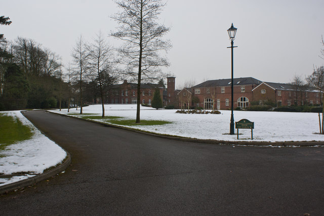
780:
754:
738:
667:
651:
631:
615:
595:
579:
512:
496:
479:
476:
457:
450:
269:
219:
954:Transferred from geograph.co.uk using
298:View this and other nearby images on:
248:View this and other nearby images on:
964:The following 2 pages use this file:
7:
345:and is licensed for reuse under the
895:
381:Attribution-Share Alike 2.0 Generic
369:
364:
349:Attribution-ShareAlike 2.0 license.
111:Runshaw Hall (geograph 3308701).jpg
47:Runshaw_Hall_(geograph_3308701).jpg
470:
464:
355:
332:
115:
98:
44:
469:
783:coordinates of the point of view
455:
411:Under the following conditions:
376:This file is licensed under the
368:
363:
357:
325:
304:
290:
282:
254:
240:
232:
65:
31:
21:
452:
116:
41:No higher resolution available.
14:
670:file available on the internet
451:
333:This image was taken from the
26:
1:
847:coordinates of depicted place
798:53°40'36.455"N, 2°41'43.386"W
690:Geograph Britain and Ireland
526:object of statement has role
477:Items portrayed in this file
281:
231:
862:53°40'34.61"N, 2°41'48.12"W
1010:
988:Usage on www.wikidata.org
425:same or compatible license
896:
16:
698:geograph.org.uk image ID
454:
391:
72:This is a file from the
953:
179:required by the license
157:
147:
136:
129:
126:
108:
76:. Information from its
339:this photograph's page
310:53.676280; -2.696700
260:53.676793; -2.695385
207:Ian Greig /
188:Ian Greig /
79:description page there
406:– to adapt the work
932:00:52, 26 May 2017
541:author name string
980:Global file usage
957:
838:
774:
618:copyright license
463:
354:
353:
337:collection. See
315:
314:
265:
264:
214:
213:
182:
166:
163:Reusing this file
94:
93:
74:Wikimedia Commons
32:Global file usage
1001:
944:
884:
883:
878:
820:
819:
814:
722:
717:
713:described at URL
707:
702:
692:
687:
582:copyright status
563:
558:
548:
545:
535:
530:
447:
444:
441:
438:
435:
427:as the original.
389:
378:Creative Commons
372:
371:
367:
366:
361:
360:
347:Creative Commons
335:Geograph project
329:
322:
311:
308:
294:
293:
287:
286:
285:
279:
278:
267:
261:
258:
244:
243:
237:
236:
235:
229:
228:
217:
176:
160:
132:
120:
112:
106:
90:
69:
68:
62:
56:
54:
1009:
1008:
1004:
1003:
1002:
1000:
999:
998:
978:
958:
950:
942:
898:
897:
894:
893:
892:
891:
890:
889:
888:
887:
886:
885:
881:
879:
876:
867:
866:
865:
863:
853:
852:
851:
849:
830:
829:
828:
827:
826:
825:
824:
823:
822:
821:
817:
815:
812:
803:
802:
801:
799:
789:
788:
787:
785:
766:
765:
764:
763:
762:
761:
760:
759:
757:
756:25 January 2013
747:
746:
745:
743:
732:
731:
730:
729:
728:
727:
726:
725:
724:
723:
718:
715:
709:
708:
703:
700:
694:
693:
688:
685:
676:
675:
674:
672:
660:
659:
658:
656:
645:
644:
643:
642:
641:
640:
639:
638:
636:
624:
623:
622:
620:
609:
608:
607:
606:
605:
604:
603:
602:
600:
588:
587:
586:
584:
573:
572:
571:
570:
569:
568:
567:
566:
565:
564:
559:
556:
550:
549:
546:
543:
537:
536:
531:
528:
519:
518:
517:
515:
505:
504:
503:
501:
490:
489:
488:
487:
486:
484:
468:
467:
466:
449:
448:
445:
442:
439:
436:
433:
432:
390:
387:
384:
373:
350:
320:
309:
283:
274:
273:
270:Object location
259:
233:
224:
223:
220:Camera location
215:
204:
197:
185:
142:geograph.org.uk
131:25 January 2013
122:
110:
103:
96:
95:
84:
83:
82:is shown below.
58:
52:
50:
43:
42:
12:
11:
5:
1007:
1005:
997:
996:
995:
994:
982:
981:
977:
976:
971:
962:
961:
956:
955:
952:
948:
945:
939:
934:
929:
925:
924:
921:
918:
915:
912:
909:
902:
901:
872:
871:
870:
869:
868:
864:
861:
859:
858:
857:
856:
855:
854:
850:
845:
843:
842:
841:
840:
834:
808:
807:
806:
805:
804:
800:
797:
795:
794:
793:
792:
791:
790:
786:
781:
779:
778:
777:
776:
770:
758:
755:
753:
752:
751:
750:
749:
748:
744:
739:
737:
736:
735:
734:
733:
711:
710:
696:
695:
681:
680:
679:
678:
677:
673:
668:
666:
665:
664:
663:
662:
661:
657:
654:source of file
652:
650:
649:
648:
647:
646:
637:
632:
630:
629:
628:
627:
626:
625:
621:
616:
614:
613:
612:
611:
610:
601:
596:
594:
593:
592:
591:
590:
589:
585:
580:
578:
577:
576:
575:
574:
552:
551:
539:
538:
524:
523:
522:
521:
520:
516:
513:
511:
510:
509:
508:
507:
506:
502:
497:
495:
494:
493:
492:
491:
485:
480:
478:
475:
474:
473:
472:
471:
460:
459:
456:
453:
431:
430:
429:
428:
418:
409:
408:
407:
401:
394:You are free:
385:
375:
374:
356:
352:
351:
330:
319:
316:
313:
312:
302:
296:
271:
263:
262:
252:
246:
221:
212:
211:
205:
202:
199:
198:
193:
186:
183:
171:
170:
167:
155:
154:
149:
145:
144:
138:
134:
133:
128:
124:
123:
113:
104:
102:
99:
97:
92:
91:
70:
60:
59:
40:
36:
35:
34:
29:
24:
19:
13:
10:
9:
6:
4:
3:
2:
1006:
993:
990:
989:
987:
986:
985:
979:
975:
972:
970:
967:
965:
959:
951:
946:
940:
938:
935:
933:
930:
927:
926:
922:
919:
916:
913:
910:
908:
907:
905:
899:
875:
848:
811:
784:
742:
721:
714:
706:
699:
691:
684:
671:
655:
635:
619:
599:
583:
562:
555:
542:
534:
527:
500:
483:
437:CC BY-SA 2.0
426:
422:
419:
416:
413:
412:
410:
405:
402:
399:
396:
395:
393:
392:
386:Attribution:
382:
379:
362:
348:
344:
340:
336:
331:
328:
324:
323:
317:
307:
303:
301:
300:OpenStreetMap
297:
295:
277:
272:
268:
257:
253:
251:
250:OpenStreetMap
247:
245:
227:
222:
218:
210:
206:
201:
200:
196:
192: /
191:
187:
180:
175:
173:
172:
168:
164:
159:
156:
153:
150:
146:
143:
139:
135:
125:
119:
114:
107:
100:
88:
81:
80:
75:
71:
64:
63:
57:
48:
39:
33:
30:
28:
25:
23:
20:
18:
15:
983:
974:Runshaw Hall
963:
903:
900:File history
533:photographer
420:
414:
403:
397:
342:
280:
230:
209:Runshaw Hall
208:
195:CC BY-SA 2.0
190:Runshaw Hall
189:
121:Runshaw Hall
117:
87:You can help
77:
45:
22:File history
598:copyrighted
421:share alike
415:attribution
174:Attribution
109:Description
960:File usage
941:640 × 427
917:Dimensions
514:some value
158:Permission
53:image/jpeg
27:File usage
914:Thumbnail
911:Date/Time
741:inception
547:Ian Greig
388:Ian Greig
343:Ian Greig
318:Licensing
203:InfoField
184:InfoField
152:Ian Greig
118:English:
992:Q7380115
949:Plucas58
683:operator
458:Captions
404:to remix
398:to share
383:license.
943:(68 KB)
928:current
923:Comment
874:heading
833:heading
810:heading
769:heading
705:3308701
499:creator
482:depicts
462:English
101:Summary
49:
969:Euxton
882:degree
837:degree
818:degree
773:degree
288:
238:
148:Author
137:Source
140:From
920:User
880:247
816:247
446:true
443:true
127:Date
17:File
554:URL
877::
813::
716::
701::
686::
557::
544::
529::
181:)
177:(
165:)
161:(
89:.
55:)
Text is available under the Creative Commons Attribution-ShareAlike License. Additional terms may apply.
.jpg)
.jpg¶ms=053.676793_N_-002.695385_E_globe:Earth_type:camera_heading:247.00_source:geograph&language=en)
.jpg¶ms=053.676280_N_-002.696700_E_globe:Earth_class:object_type:object_source:geograph-osgb36(SD54072020)_region:GB-GBN_heading:247.00&language=en)
