441:
324:
229:
277:
243:
447:
330:
91:
335:
134:
43:
819:
836:{{FIH}} {{Information |Description=Rygnestadloftet, Rygnestadtunet, Valle municipality, Setesdal, Aust-Agder county, Norway. |Source=Own Work |Date=2007.07.06 |Author=Frode Inge Helland |Permission= |other_versions= }}
497:– You must give appropriate credit, provide a link to the license, and indicate if changes were made. You may do so in any reasonable manner, but not in any way that suggests the licensor endorses you or your use.
392:– You must give appropriate credit, provide a link to the license, and indicate if changes were made. You may do so in any reasonable manner, but not in any way that suggests the licensor endorses you or your use.
220:
294:
292:; with no Invariant Sections, no Front-Cover Texts, and no Back-Cover Texts. A copy of the license is included in the section entitled
284:
696:
660:
643:
626:
590:
236:
966:
This file contains additional information, probably added from the digital camera or scanner used to create or digitize it.
399:
140:
750:
680:
574:
289:
57:
53:
47:
716:
610:
557:
102:
70:
177:
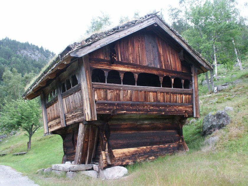
Rygnestadloftet, Rygnestadtunet, Valle municipality, Setesdal, Aust-Agder county, Norway. Part of
Setesdalsmuseet
344:
969:
If the file has been modified from its original state, some details may not fully reflect the modified file.
829:
846:
The following pages on the
English Knowledge (XXG) use this file (pages on other projects are not listed):
457:
398:– If you remix, transform, or build upon the material, you must distribute your contributions under the
454:
341:
466:
358:
265:
146:
110:
271:
413:
282:
Permission is granted to copy, distribute and/or modify this document under the terms of the
850:
242:
818:
813:
268:, the copyright holder of this work, hereby publishes it under the following licenses:
61:
42:
855:
97:
185:
226:
786:
Click on a date/time to view the file as it appeared at that time.
228:
953:
743:
412:
This licensing tag was added to this file as part of the GFDL
318:
221:
59° 15′ 45.9″ N, 7° 29′ 23.86″ E
211:
85:
883:
913:
893:
933:
928:
873:
903:
133:
541:
Add a one-line explanation of what this file represents
943:
661:
627:
Creative
Commons Attribution-ShareAlike 3.0 Unported
288:, Version 1.2 or any later version published by the
167:
109:
Commons is a freely licensed media file repository.
923:
75:(840 × 630 pixels, file size: 129 KB, MIME type:
419:http://creativecommons.org/licenses/by-sa/3.0/
90:
440:
323:
8:
425:Creative Commons Attribution-Share Alike 3.0
504:https://creativecommons.org/licenses/by/2.5
480:– to copy, distribute and transmit the work
375:– to copy, distribute and transmit the work
971:
788:
537:
522:You may select the license of your choice.
866:The following other wikis use this file:
644:Creative Commons Attribution 2.5 Generic
160:in the immediate vicinity of the image.
973:
848:
764:
748:
730:
714:
694:
678:
658:
641:
624:
608:
588:
572:
555:
552:
533:
526:
214:
235:View this and other nearby images on:
7:
345:Attribution-Share Alike 3.0 Unported
300:http://www.gnu.org/copyleft/fdl.html
777:
446:
334:
329:
964:
546:
540:
521:
471:
437:
263:
122:
68:
545:
510:Creative Commons Attribution 2.5
531:
491:Under the following conditions:
453:This file is licensed under the
445:
439:
386:Under the following conditions:
340:This file is licensed under the
333:
328:
322:
276:
275:
241:
227:
132:
89:
31:
21:
528:
128:
14:
527:
306:GNU Free Documentation License
295:GNU Free Documentation License
285:GNU Free Documentation License
26:
1:
751:coordinates of depicted place
697:original creation by uploader
36:
553:Items portrayed in this file
138:
766:59°15'45.90"N, 7°29'23.86"E
995:
950:Usage on zh.wikipedia.org
940:Usage on www.wikidata.org
920:Usage on no.wikipedia.org
910:Usage on nn.wikipedia.org
900:Usage on fr.wikipedia.org
890:Usage on es.wikipedia.org
880:Usage on eo.wikipedia.org
870:Usage on de.wikipedia.org
400:same or compatible license
131:
778:
349:
321:
195:
154:Please credit this photo
16:
530:
290:Free Software Foundation
96:This is a file from the
835:
458:Attribution 2.5 Generic
201:
191:
184:
181:
170:
100:. Information from its
247:59.262750; 7.489960
103:description page there
46:Size of this preview:
173:Rygnestadtunet02.jpg
814:13:43, 27 July 2007
486:– to adapt the work
381:– to adapt the work
52:Other resolutions:
831:Frode Inge Helland
467:Frode Inge Helland
359:Frode Inge Helland
266:Frode Inge Helland
205:Frode Inge Helland
157:Frode Inge Helland
147:Frode Inge Helland
982:
981:
862:Global file usage
839:
611:copyright license
539:
436:
435:
317:
316:
252:
251:
209:
208:
165:
164:
118:
117:
98:Wikimedia Commons
32:Global file usage
986:
972:
884:Valle (Norvegio)
826:
575:copyright status
517:
514:
511:
508:
505:
469:
455:Creative Commons
449:
448:
443:
442:
432:
429:
426:
423:
420:
417:
414:licensing update
402:as the original.
362:
361:
342:Creative Commons
337:
336:
332:
331:
326:
325:
319:
313:
310:
307:
304:
301:
279:
278:
272:
248:
245:
231:
230:
224:
223:
212:
197:
187:
174:
168:
136:
129:
114:
93:
92:
86:
80:
78:
65:
62:840 × 630 pixels
58:640 × 480 pixels
54:320 × 240 pixels
48:800 × 600 pixels
994:
993:
989:
988:
987:
985:
984:
983:
960:
914:Setesdalsmuseet
894:Valle (Noruega)
860:
847:
840:
832:
824:
780:
779:
776:
775:
774:
773:
772:
771:
770:
769:
767:
757:
756:
755:
753:
742:
741:
740:
739:
738:
737:
736:
735:
733:
723:
722:
721:
719:
708:
707:
706:
705:
704:
703:
702:
701:
699:
687:
686:
685:
683:
672:
671:
670:
669:
668:
667:
666:
665:
663:
652:
651:
650:
649:
648:
646:
635:
634:
633:
632:
631:
629:
617:
616:
615:
613:
602:
601:
600:
599:
598:
597:
596:
595:
593:
581:
580:
579:
577:
566:
565:
564:
563:
562:
560:
544:
543:
542:
525:
524:
523:
519:
518:
515:
512:
509:
506:
503:
502:
470:
464:
461:
450:
430:
427:
424:
421:
418:
411:
356:
354:
311:
308:
305:
302:
299:
270:
269:
260:
246:
219:
218:
215:Object location
210:
172:
127:
120:
119:
108:
107:
106:is shown below.
82:
76:
74:
67:
66:
51:
12:
11:
5:
992:
990:
980:
979:
976:
963:
959:
958:
957:
956:
948:
947:
946:
938:
937:
936:
934:Loft (bygning)
931:
929:Rygnestadtunet
926:
918:
917:
916:
908:
907:
906:
898:
897:
896:
888:
887:
886:
878:
877:
876:
874:Rygnestadtunet
864:
863:
859:
858:
853:
851:Rygnestadtunet
845:
844:
843:
838:
837:
834:
830:
827:
821:
816:
811:
807:
806:
803:
800:
797:
794:
791:
784:
783:
768:
765:
763:
762:
761:
760:
759:
758:
754:
749:
747:
746:
745:
744:
734:
731:
729:
728:
727:
726:
725:
724:
720:
715:
713:
712:
711:
710:
709:
700:
695:
693:
692:
691:
690:
689:
688:
684:
681:source of file
679:
677:
676:
675:
674:
673:
664:
659:
657:
656:
655:
654:
653:
647:
642:
640:
639:
638:
637:
636:
630:
625:
623:
622:
621:
620:
619:
618:
614:
609:
607:
606:
605:
604:
603:
594:
589:
587:
586:
585:
584:
583:
582:
578:
573:
571:
570:
569:
568:
567:
561:
556:
554:
551:
550:
549:
548:
547:
536:
535:
532:
529:
520:
501:
500:
499:
498:
489:
488:
487:
481:
474:You are free:
462:
452:
451:
438:
434:
433:
408:
407:
406:
405:
404:
403:
393:
384:
383:
382:
376:
369:You are free:
364:
363:
351:
350:
348:
338:
315:
314:
280:
262:
261:
259:
256:
250:
249:
239:
233:
216:
207:
206:
203:
199:
198:
193:
189:
188:
183:
179:
178:
175:
166:
163:
162:
137:
126:
123:
121:
116:
115:
94:
84:
83:
45:
41:
40:
39:
34:
29:
24:
19:
13:
10:
9:
6:
4:
3:
2:
991:
977:
974:
970:
967:
961:
955:
952:
951:
949:
945:
942:
941:
939:
935:
932:
930:
927:
925:
922:
921:
919:
915:
912:
911:
909:
905:
904:Valle (Agder)
902:
901:
899:
895:
892:
891:
889:
885:
882:
881:
879:
875:
872:
871:
869:
868:
867:
861:
857:
856:Valle, Norway
854:
852:
849:
841:
833:
828:
822:
820:
817:
815:
812:
809:
808:
804:
801:
798:
795:
792:
790:
789:
787:
781:
752:
718:
698:
682:
662:
645:
628:
612:
592:
576:
559:
496:
493:
492:
490:
485:
482:
479:
476:
475:
473:
472:
468:
463:Attribution:
459:
456:
444:
415:
410:
409:
401:
397:
394:
391:
388:
387:
385:
380:
377:
374:
371:
370:
368:
367:
366:
365:
360:
355:Attribution:
353:
352:
346:
343:
339:
327:
320:
297:
296:
291:
287:
286:
281:
274:
273:
267:
257:
255:
254:
244:
240:
238:
237:OpenStreetMap
234:
232:
222:
217:
213:
204:
200:
194:
190:
180:
176:
169:
161:
159:
158:
152:
149:
148:
144:
143:was taken by
142:
135:
130:
124:
112:
105:
104:
99:
95:
88:
87:
81:
72:
71:Original file
63:
59:
55:
49:
44:
38:
35:
33:
30:
28:
25:
23:
20:
18:
15:
968:
965:
865:
785:
782:File history
494:
483:
477:
422:CC BY-SA 3.0
395:
389:
378:
372:
293:
283:
253:
156:
155:
153:
150:
145:
139:
111:You can help
101:
69:
22:File history
732:6 July 2007
591:copyrighted
495:attribution
396:share alike
390:attribution
186:6 July 2007
171:Description
975:_error
842:File usage
823:840 × 630
799:Dimensions
507:CC BY 2.5
141:This photo
77:image/jpeg
27:File usage
796:Thumbnail
793:Date/Time
717:inception
347:license.
258:Licensing
962:Metadata
944:Q7385055
825:(129 KB)
534:Captions
484:to remix
478:to share
460:license.
379:to remix
373:to share
196:Own work
37:Metadata
810:current
805:Comment
558:depicts
538:English
125:Summary
73:
225:
202:Author
192:Source
924:Valle
802:User
516:true
513:true
431:true
428:true
312:true
309:true
303:GFDL
182:Date
17:File
465:I,
357:I,
264:I,
954:瓦勒
60:|
56:|
50:.
978:0
416:.
298:.
151:.
113:.
79:)
64:.
Text is available under the Creative Commons Attribution-ShareAlike License. Additional terms may apply.
