266:
227:
43:
219:
241:
272:
277:
99:
503:"}},"text\/plain":{"en":{"":"heading"}}},"{\"value\":{\"amount\":\"+108\",\"unit\":\"http:\\\/\\\/www.wikidata.org\\\/entity\\\/Q28390\"},\"type\":\"quantity\"}":{"text\/html":{"en":{"P7787":"108
499:
816:
318:– You must give appropriate credit, provide a link to the license, and indicate if changes were made. You may do so in any reasonable manner, but not in any way that suggests the licensor endorses you or your use.
210:
500:
190:
65:
61:
57:
53:
47:
901:
871:
622:
452:
416:
234:
776:
1118:
949:
This file contains additional information, probably added from the digital camera or scanner used to create or digitize it.
325:
586:
606:
570:
541:
514:
400:
1095:
472:
436:
383:
881:
110:
78:
287:
736:
952:
If the file has been modified from its original state, some details may not fully reflect the modified file.
1155:
324:– If you remix, transform, or build upon the material, you must distribute your contributions under the
746:
284:
507:"}},"text\/plain":{"en":{"P7787":"108 degree"}}}}": -->
1183:
153:
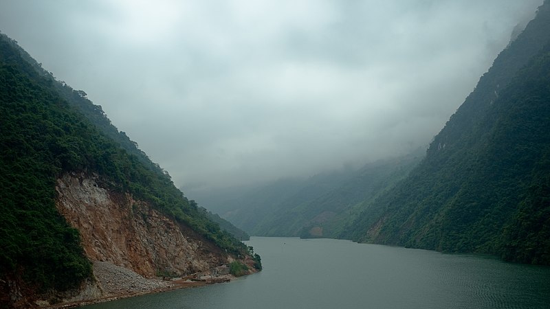
Black River (Sông Đà), taken from Hang Tôm bridge near Mường Lay town, Điện Biên province, Vietnam
708:
118:
687:
676:
671:
161:Река Да, снято с моста Hang Tôm около малого города Mường Lay в провинции Điện Biên, Вьетнам
69:
42:
961:
906:
170:
971:
240:
1249:
1173:
1137:
1002:
105:
936:
866:
259:
I, the copyright holder of this work, hereby publish it under the following license:
1042:
224:
1022:
786:
1012:
756:
916:
891:
644:
Click on a date/time to view the file as it appeared at that time.
211:
22° 04′ 41.21″ N, 103° 10′ 21.52″ E
226:
826:
806:
766:
201:
93:
856:
846:
836:
726:
796:
367:
Add a one-line explanation of what this file represents
926:
992:
193:
83:(1,920 × 1,080 pixels, file size: 991 KB, MIME type:
453:
Creative
Commons Attribution-ShareAlike 3.0 Unported
137:
117:
Commons is a freely licensed media file repository.
335:https://creativecommons.org/licenses/by-sa/3.0
98:
341:Creative Commons Attribution-Share Alike 3.0
265:
8:
504:
301:– to copy, distribute and transmit the work
954:
646:
530:22°4'41.207999999"N, 103°10'21.522000000"E
363:
719:The following other wikis use this file:
1449:
1441:
1433:
1425:
1417:
1409:
1401:
1393:
1385:
1377:
1369:
1361:
1353:
1345:
1337:
1329:
1321:
1313:
1305:
1297:
1289:
1281:
1273:
1265:
1257:
1247:
1239:
1231:
1223:
1215:
1207:
1199:
1191:
1181:
1171:
1163:
1153:
1145:
1135:
1127:
1116:
1108:
1100:
1090:
1082:
1074:
1066:
1058:
1050:
1039:
1031:
1020:
1010:
1000:
989:
984:
976:
966:
706:
620:
604:
584:
568:
528:
512:
486:
470:
450:
434:
414:
398:
381:
378:
359:
352:
204:
233:View this and other nearby images on:
956:
7:
288:Attribution-Share Alike 3.0 Unported
704:The following page uses this file:
694:User created page with UploadWizard
635:
276:
271:
947:
372:
366:
262:
258:
155:
147:
130:
76:
1096:Adobe DNG Converter 8.3 (Windows)
371:
1446:178C6AD2BFCE065D799BD3D528CD9A31
1323:Reference for direction of image
1033:Date and time of data generation
515:coordinates of the point of view
357:
312:Under the following conditions:
283:This file is licensed under the
275:
270:
264:
239:
225:
217:
97:
31:
21:
1435:Date metadata was last modified
1275:Satellites used for measurement
817:Ұзындығы бойынша өзендер тізімі
354:
156:
148:
14:
1443:Unique ID of original document
353:
26:
1:
737:Černá řeka (přítok Rudé řeky)
623:original creation by uploader
36:
1201:DateTimeDigitized subseconds
1071:234.1 meters above sea level
379:Items portrayed in this file
216:
1371:GPS differential correction
1225:Focal plane resolution unit
1193:DateTimeOriginal subseconds
1129:Date and time of digitizing
888:Usage on th.wiktionary.org
763:Usage on de.wikivoyage.org
1471:
933:Usage on zh.wikipedia.org
923:Usage on www.wikidata.org
913:Usage on vi.wikipedia.org
898:Usage on uk.wikipedia.org
878:Usage on th.wikipedia.org
863:Usage on ru.wikipedia.org
853:Usage on no.wikipedia.org
843:Usage on nl.wikipedia.org
833:Usage on lt.wikipedia.org
823:Usage on ko.wikipedia.org
813:Usage on kk.wikipedia.org
803:Usage on ja.wikipedia.org
793:Usage on it.wikipedia.org
783:Usage on hy.wikipedia.org
773:Usage on he.wikipedia.org
753:Usage on de.wikipedia.org
743:Usage on cv.wikipedia.org
733:Usage on cs.wikipedia.org
723:Usage on be.wikipedia.org
326:same or compatible license
1339:Geodetic survey data used
1294:3-dimensional measurement
1102:File change date and time
636:
180:
171:25 October 2013, 07:18:34
16:
1217:Focal plane Y resolution
1209:Focal plane X resolution
356:
292:
104:This is a file from the
1438:01:34, 29 December 2013
1387:Serial number of camera
1355:Distance to destination
1286:Measurement in progress
1267:GPS time (atomic clock)
1233:Custom image processing
1105:21:48, 28 December 2013
693:
672:17:58, 28 December 2013
186:
176:
169:
166:
140:
108:. Information from its
1347:Bearing of destination
1132:07:18, 25 October 2013
1036:07:18, 25 October 2013
245:22.078113; 103.172645
111:description page there
46:Size of this preview:
1315:Direction of movement
1307:Speed of GPS receiver
1299:Measurement precision
1165:Maximum land aperture
1076:Horizontal resolution
1254:Manual white balance
1007:1/320 sec (0.003125)
70:1,920 × 1,080 pixels
1084:Vertical resolution
958:Camera manufacturer
307:– to adapt the work
52:Other resolutions:
1331:Direction of image
1326:Magnetic direction
1259:Scene capture type
1188:Flash did not fire
993:http://shansov.net
981:enside@hotmail.com
709:Black River (Asia)
194:http://shansov.net
66:1,280 × 720 pixels
62:1,024 × 576 pixels
1458:
1457:
1113:Aperture priority
1063:103° 10′ 21.52″ E
777:הנהר השחור (אסיה)
715:Global file usage
697:
506:
437:copyright license
365:
250:
249:
199:
198:
126:
125:
106:Wikimedia Commons
32:Global file usage
1462:
1398:EF40mm f/2.8 STM
1291:Measurement mode
1110:Exposure Program
995:
986:Copyright holder
955:
767:Goldenes Dreieck
684:
552:
551:
546:
401:copyright status
348:
345:
342:
339:
336:
328:as the original.
285:Creative Commons
279:
278:
274:
273:
268:
267:
246:
243:
229:
228:
222:
221:
220:
214:
213:
202:
182:
172:
160:
152:
144:
138:
122:
101:
100:
94:
88:
86:
73:
58:640 × 360 pixels
54:320 × 180 pixels
48:800 × 450 pixels
1470:
1469:
1465:
1464:
1463:
1461:
1460:
1459:
1379:GPS tag version
1366:25 October 2013
1283:Receiver status
1168:3 APEX (f/2.83)
1055:22° 4′ 41.21″ N
991:
943:
713:
698:
690:
682:
638:
637:
634:
633:
632:
631:
630:
629:
628:
627:
625:
613:
612:
611:
609:
598:
597:
596:
595:
594:
593:
592:
591:
589:
577:
576:
575:
573:
562:
561:
560:
559:
558:
557:
556:
555:
554:
553:
549:
547:
544:
535:
534:
533:
531:
521:
520:
519:
517:
498:
497:
496:
495:
494:
493:
492:
491:
489:
488:25 October 2013
479:
478:
477:
475:
464:
463:
462:
461:
460:
459:
458:
457:
455:
443:
442:
441:
439:
428:
427:
426:
425:
424:
423:
422:
421:
419:
407:
406:
405:
403:
392:
391:
390:
389:
388:
386:
370:
369:
368:
351:
350:
349:
346:
343:
340:
337:
334:
333:
291:
280:
261:
260:
255:
244:
218:
209:
208:
205:Camera location
200:
162:
154:
142:
135:
128:
127:
116:
115:
114:is shown below.
90:
84:
82:
75:
74:
51:
12:
11:
5:
1468:
1466:
1456:
1455:
1452:
1448:
1447:
1444:
1440:
1439:
1436:
1432:
1431:
1428:
1424:
1423:
1420:
1416:
1415:
1412:
1408:
1407:
1404:
1400:
1399:
1396:
1392:
1391:
1388:
1384:
1383:
1380:
1376:
1375:
1372:
1368:
1367:
1364:
1360:
1359:
1356:
1352:
1351:
1348:
1344:
1343:
1340:
1336:
1335:
1332:
1328:
1327:
1324:
1320:
1319:
1316:
1312:
1311:
1308:
1304:
1303:
1300:
1296:
1295:
1292:
1288:
1287:
1284:
1280:
1279:
1276:
1272:
1271:
1268:
1264:
1263:
1260:
1256:
1255:
1252:
1246:
1245:
1242:
1238:
1237:
1236:Normal process
1234:
1230:
1229:
1226:
1222:
1221:
1218:
1214:
1213:
1210:
1206:
1205:
1202:
1198:
1197:
1194:
1190:
1189:
1186:
1180:
1179:
1176:
1170:
1169:
1166:
1162:
1161:
1158:
1152:
1151:
1148:
1144:
1143:
1140:
1134:
1133:
1130:
1126:
1125:
1122:
1115:
1114:
1111:
1107:
1106:
1103:
1099:
1098:
1093:
1089:
1088:
1085:
1081:
1080:
1077:
1073:
1072:
1069:
1065:
1064:
1061:
1057:
1056:
1053:
1049:
1048:
1045:
1038:
1037:
1034:
1030:
1029:
1026:
1019:
1018:
1015:
1009:
1008:
1005:
999:
998:
997:
996:
987:
983:
982:
979:
975:
974:
972:Canon EOS-1D X
969:
965:
964:
959:
946:
942:
941:
940:
939:
931:
930:
929:
921:
920:
919:
911:
910:
909:
904:
902:Сипсонгчаутхай
896:
895:
894:
886:
885:
884:
876:
875:
874:
872:Сипсонгчаутхай
869:
861:
860:
859:
851:
850:
849:
841:
840:
839:
831:
830:
829:
821:
820:
819:
811:
810:
809:
801:
800:
799:
791:
790:
789:
781:
780:
779:
771:
770:
769:
761:
760:
759:
751:
750:
749:
741:
740:
739:
731:
730:
729:
717:
716:
712:
711:
702:
701:
696:
695:
692:
688:
685:
681:1,920 × 1,080
679:
674:
669:
665:
664:
661:
658:
655:
652:
649:
642:
641:
626:
621:
619:
618:
617:
616:
615:
614:
610:
607:source of file
605:
603:
602:
601:
600:
599:
590:
587:Canon EOS-1D X
585:
583:
582:
581:
580:
579:
578:
574:
569:
567:
566:
565:
564:
563:
540:
539:
538:
537:
536:
532:
529:
527:
526:
525:
524:
523:
522:
518:
513:
511:
510:
509:
508:
502:
490:
487:
485:
484:
483:
482:
481:
480:
476:
471:
469:
468:
467:
466:
465:
456:
451:
449:
448:
447:
446:
445:
444:
440:
435:
433:
432:
431:
430:
429:
420:
415:
413:
412:
411:
410:
409:
408:
404:
399:
397:
396:
395:
394:
393:
387:
382:
380:
377:
376:
375:
374:
373:
362:
361:
358:
355:
332:
331:
330:
329:
319:
310:
309:
308:
302:
295:You are free:
282:
281:
263:
257:
256:
254:
251:
248:
247:
237:
231:
206:
197:
196:
188:
184:
183:
178:
174:
173:
168:
164:
163:
145:
136:
134:
131:
129:
124:
123:
102:
92:
91:
45:
41:
40:
39:
34:
29:
24:
19:
13:
10:
9:
6:
4:
3:
2:
1467:
1453:
1450:
1445:
1442:
1437:
1434:
1429:
1426:
1421:
1418:
1413:
1410:
1405:
1402:
1397:
1394:
1389:
1386:
1381:
1378:
1373:
1370:
1365:
1362:
1357:
1354:
1349:
1346:
1341:
1338:
1333:
1330:
1325:
1322:
1317:
1314:
1309:
1306:
1301:
1298:
1293:
1290:
1285:
1282:
1277:
1274:
1269:
1266:
1261:
1258:
1253:
1251:
1250:White balance
1248:
1244:Auto exposure
1243:
1241:Exposure mode
1240:
1235:
1232:
1227:
1224:
1219:
1216:
1211:
1208:
1203:
1200:
1195:
1192:
1187:
1185:
1182:
1177:
1175:
1174:Metering mode
1172:
1167:
1164:
1159:
1157:
1156:Exposure bias
1154:
1149:
1147:APEX aperture
1146:
1141:
1139:
1138:Shutter speed
1136:
1131:
1128:
1123:
1120:
1117:
1112:
1109:
1104:
1101:
1097:
1094:
1092:Software used
1091:
1086:
1083:
1078:
1075:
1070:
1067:
1062:
1059:
1054:
1051:
1046:
1044:
1040:
1035:
1032:
1027:
1024:
1021:
1016:
1014:
1011:
1006:
1004:
1003:Exposure time
1001:
994:
990:
988:
985:
980:
977:
973:
970:
967:
963:
960:
957:
953:
950:
944:
938:
935:
934:
932:
928:
925:
924:
922:
918:
915:
914:
912:
908:
905:
903:
900:
899:
897:
893:
890:
889:
887:
883:
880:
879:
877:
873:
870:
868:
865:
864:
862:
858:
857:Den sorte elv
855:
854:
852:
848:
847:Zwarte Rivier
845:
844:
842:
838:
835:
834:
832:
828:
825:
824:
822:
818:
815:
814:
812:
808:
805:
804:
802:
798:
795:
794:
792:
788:
785:
784:
782:
778:
775:
774:
772:
768:
765:
764:
762:
758:
755:
754:
752:
748:
745:
744:
742:
738:
735:
734:
732:
728:
725:
724:
722:
721:
720:
714:
710:
707:
705:
699:
691:
686:
680:
678:
675:
673:
670:
667:
666:
662:
659:
656:
653:
650:
648:
647:
645:
639:
624:
608:
588:
572:
571:captured with
543:
516:
474:
454:
438:
418:
402:
385:
338:CC BY-SA 3.0
327:
323:
320:
317:
314:
313:
311:
306:
303:
300:
297:
296:
294:
293:
289:
286:
269:
252:
242:
238:
236:
235:OpenStreetMap
232:
230:
212:
207:
203:
195:
191:
189:
185:
179:
175:
165:
159:
151:
146:
139:
132:
120:
113:
112:
107:
103:
96:
95:
89:
80:
79:Original file
71:
67:
63:
59:
55:
49:
44:
38:
35:
33:
30:
28:
25:
23:
20:
18:
15:
1427:Image height
1390:053011002431
1043:focal length
968:Camera model
951:
948:
917:Cầu Hang Tôm
747:Да (юханшыв)
718:
703:
643:
640:File history
321:
315:
304:
298:
215:
157:
149:
119:You can help
109:
77:
22:File history
1451:IIM version
1419:Image width
689:Shansov.net
417:copyrighted
322:share alike
316:attribution
143:Sông Đà.jpg
141:Description
1302:Poor (5.5)
907:Да (річка)
797:Fiume Nero
700:File usage
657:Dimensions
85:image/jpeg
27:File usage
1395:Lens used
1060:Longitude
1023:ISO speed
927:Q85381441
867:Да (река)
757:Điện Biên
654:Thumbnail
651:Date/Time
473:inception
253:Licensing
158:Русский:
150:English:
1430:1,080 px
1422:1,920 px
1414:1,080 px
1406:1,920 px
1363:GPS date
1262:Standard
1142:8.321928
1068:Altitude
1052:Latitude
1013:F-number
945:Metadata
882:แม่น้ำดำ
837:Da (upė)
787:Դա (գետ)
683:(991 KB)
360:Captions
305:to remix
299:to share
290:license.
181:Own work
37:Metadata
1382:0.0.3.2
1178:Pattern
1121:version
1087:240 dpi
1079:240 dpi
937:沱江 (紅河)
892:sông Đà
668:current
663:Comment
542:heading
501:heading
384:depicts
364:English
133:Summary
81:
1411:Height
1342:WGS-84
1025:rating
978:Author
550:degree
505:degree
223:
187:Author
177:Source
1403:Width
1270:00:18
1220:1,440
1212:1,440
1184:Flash
1047:40 mm
1041:Lens
962:Canon
1119:Exif
660:User
548:108
347:true
344:true
167:Date
17:File
1334:108
1124:2.3
1028:320
1017:f/4
1278:12
1204:89
1196:89
827:다강
807:ダ川
727:Да
545::
192:,
68:|
64:|
60:|
56:|
50:.
1454:2
1374:0
1358:0
1350:0
1318:0
1310:0
1228:3
1160:0
1150:4
121:.
87:)
72:.
Text is available under the Creative Commons Attribution-ShareAlike License. Additional terms may apply.
