343:
276:
226:
268:
218:
442:
290:
240:
311:
349:
354:
67:
935:"}},"text\/plain":{"en":{"":"heading"}}},"{\"value\":{\"amount\":\"+315\",\"unit\":\"http:\\\/\\\/www.wikidata.org\\\/entity\\\/Q28390\"},\"type\":\"quantity\"}":{"text\/html":{"en":{"P7787":"315
871:"}},"text\/plain":{"en":{"":"heading"}}},"{\"value\":{\"amount\":\"+315\",\"unit\":\"http:\\\/\\\/www.wikidata.org\\\/entity\\\/Q28390\"},\"type\":\"quantity\"}":{"text\/html":{"en":{"P7787":"315
931:
259:
209:
38:
401:– You must give appropriate credit, provide a link to the license, and indicate if changes were made. You may do so in any reasonable manner, but not in any way that suggests the licensor endorses you or your use.
1054:== {{int:filedesc}} == {{Information |description={{en|1=Woodham Park Way Junction of Langshott Close and Woodham Park Way looking NW}} |date=2007-04-10 |source=From |author=[http://www.geograph.or
78:
46:
932:
868:
450:
467:
769:
733:
697:
283:
233:
804:
318:
1079:
This file contains additional information, probably added from the digital camera or scanner used to create or digitize it.
408:
660:
973:
946:
909:
882:
782:
753:
681:
653:
638:
625:
543:
840:
812:
797:
717:
598:
581:
490:
482:
305:
1036:
1031:
37:
364:
1082:
If the file has been modified from its original state, some details may not fully reflect the modified file.
463:
1064:
The following pages on the
English Knowledge (XXG) use this file (pages on other projects are not listed):
407:– If you remix, transform, or build upon the material, you must distribute your contributions under the
325:
on the
Geograph website for the photographer's contact details. The copyright on this image is owned by
1047:
361:
939:"}},"text\/plain":{"en":{"P7787":"315 degree"}}}}": -->
875:"}},"text\/plain":{"en":{"P7787":"315 degree"}}}}": -->
471:
86:
178:
456:
Remove redundant categories and try to put this image in the most specific category/categories
645:
819:
789:
162:
1068:
534:
538:
530:
526:
522:
518:
514:
510:
506:
502:
498:
289:
239:
330:
73:
130:
273:
223:
151:
121:
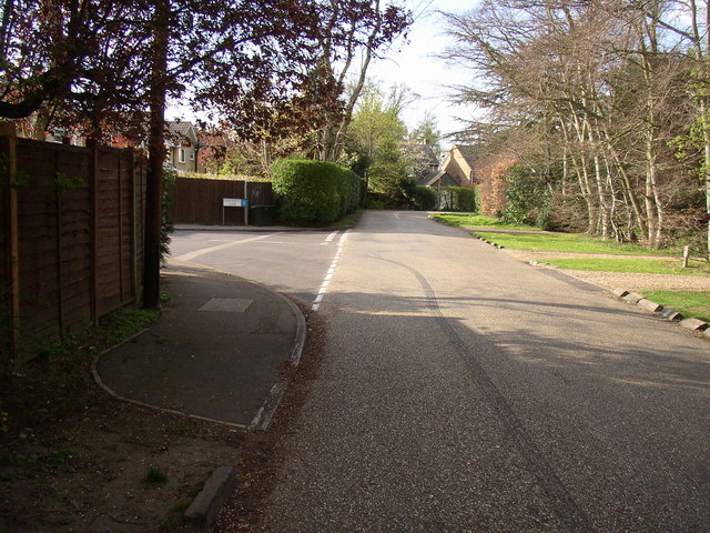
Woodham Park Way
Junction of Langshott Close and Woodham Park Way looking NW
141:
310:
322:
1004:
Click on a date/time to view the file as it appeared at that time.
275:
225:
250:
200:
61:
260:
51° 20′ 46″ N, 0° 30′ 51″ W
210:
51° 20′ 44″ N, 0° 30′ 49″ W
565:
Add a one-line explanation of what this file represents
470:
combined with a database. You can also have a look at
462:
The location categories are based on information from
105:
85:
Commons is a freely licensed media file repository.
734:
Creative
Commons Attribution-ShareAlike 2.0 Generic
51:(640 × 480 pixels, file size: 119 KB, MIME type:
447:The categories of this image should be checked.
111:Woodham Park Way - geograph.org.uk - 686824.jpg
47:Woodham_Park_Way_-_geograph.org.uk_-_686824.jpg
418:https://creativecommons.org/licenses/by-sa/2.0
66:
424:Creative Commons Attribution-Share Alike 2.0
342:
8:
936:
872:
384:– to copy, distribute and transmit the work
1084:
1006:
561:
542:
646:https://www.geograph.org.uk/profile/22500
820:https://www.geograph.org.uk/photo/686824
1086:
1066:
960:
944:
896:
880:
854:
838:
767:
751:
731:
715:
695:
679:
612:
596:
579:
576:
557:
550:
489:This image was uploaded as part of the
253:
203:
282:View this and other nearby images on:
232:View this and other nearby images on:
477:The topic category from Geograph was
7:
329:and is licensed for reuse under the
995:
365:Attribution-Share Alike 2.0 Generic
353:
348:
333:Attribution-ShareAlike 2.0 license.
1077:
570:
564:
339:
316:
115:
98:
44:
569:
883:coordinates of the point of view
555:
440:
395:Under the following conditions:
360:This file is licensed under the
352:
347:
341:
309:
288:
274:
266:
238:
224:
216:
65:
21:
552:
116:
41:No higher resolution available.
14:
770:file available on the internet
551:
317:This image was taken from the
26:
1:
947:coordinates of depicted place
31:
805:Geograph Britain and Ireland
654:object of statement has role
577:Items portrayed in this file
265:
215:
962:51°20'45.56"N, 0°30'51.12"W
898:51°20'43.91"N, 0°30'48.60"W
1108:
409:same or compatible license
996:
16:
783:geograph.org.uk image ID
554:
472:this tool from mysociety
438:
437:
375:
72:This is a file from the
1053:
468:this OpenStreetMap tool
191:Glenn Rees /
172:Glenn Rees /
163:required by the license
147:
136:
129:
126:
108:
76:. Information from its
1032:03:24, 8 February 2011
323:this photograph's page
294:51.345990; -0.514200
244:51.345530; -0.513500
79:description page there
491:Geograph batch upload
481:(find similar images
459:Remove this template
535:português do Brasil
390:– to adapt the work
626:author name string
464:this geonames tool
1095:
1094:
1057:
938:
874:
718:copyright license
563:
546:
493:
338:
337:
321:collection. See
299:
298:
249:
248:
198:
197:
166:
94:
93:
74:Wikimedia Commons
1099:
1085:
1044:
984:
983:
978:
920:
919:
914:
822:
817:
813:described at URL
807:
802:
792:
787:
682:copyright status
663:
658:
648:
643:
633:
630:
547:
488:
483:road at Geograph
445:
444:
443:
431:
428:
425:
422:
419:
411:as the original.
373:
362:Creative Commons
356:
355:
351:
350:
345:
344:
331:Creative Commons
319:Geograph project
313:
306:
295:
292:
278:
277:
271:
270:
269:
263:
262:
251:
245:
242:
228:
227:
221:
220:
219:
213:
212:
201:
193:Woodham Park Way
174:Woodham Park Way
160:
132:
120:
112:
106:
90:
69:
68:
62:
56:
54:
1107:
1106:
1102:
1101:
1100:
1098:
1097:
1096:
1073:
1069:Woodham, Surrey
1065:
1058:
1050:
1042:
998:
997:
994:
993:
992:
991:
990:
989:
988:
987:
986:
985:
981:
979:
976:
967:
966:
965:
963:
953:
952:
951:
949:
930:
929:
928:
927:
926:
925:
924:
923:
922:
921:
917:
915:
912:
903:
902:
901:
899:
889:
888:
887:
885:
866:
865:
864:
863:
862:
861:
860:
859:
857:
847:
846:
845:
843:
832:
831:
830:
829:
828:
827:
826:
825:
824:
823:
818:
815:
809:
808:
803:
800:
794:
793:
788:
785:
776:
775:
774:
772:
760:
759:
758:
756:
745:
744:
743:
742:
741:
740:
739:
738:
736:
724:
723:
722:
720:
709:
708:
707:
706:
705:
704:
703:
702:
700:
688:
687:
686:
684:
673:
672:
671:
670:
669:
668:
667:
666:
665:
664:
659:
656:
650:
649:
644:
641:
635:
634:
631:
628:
619:
618:
617:
615:
605:
604:
603:
601:
590:
589:
588:
587:
586:
584:
568:
567:
566:
549:
497:
494:
451:Check them now!
441:
439:
433:
432:
429:
426:
423:
420:
417:
416:
374:
371:
368:
357:
334:
304:
293:
267:
258:
257:
254:Object location
243:
217:
208:
207:
204:Camera location
199:
188:
181:
169:
142:geograph.org.uk
122:
110:
103:
96:
95:
84:
83:
82:is shown below.
58:
52:
50:
43:
42:
12:
11:
5:
1105:
1103:
1093:
1092:
1089:
1076:
1072:
1071:
1063:
1062:
1061:
1056:
1055:
1052:
1048:
1045:
1039:
1034:
1029:
1025:
1024:
1021:
1018:
1015:
1012:
1009:
1002:
1001:
972:
971:
970:
969:
968:
964:
961:
959:
958:
957:
956:
955:
954:
950:
945:
943:
942:
941:
940:
934:
908:
907:
906:
905:
904:
900:
897:
895:
894:
893:
892:
891:
890:
886:
881:
879:
878:
877:
876:
870:
858:
855:
853:
852:
851:
850:
849:
848:
844:
839:
837:
836:
835:
834:
833:
811:
810:
796:
795:
781:
780:
779:
778:
777:
773:
768:
766:
765:
764:
763:
762:
761:
757:
754:source of file
752:
750:
749:
748:
747:
746:
737:
732:
730:
729:
728:
727:
726:
725:
721:
716:
714:
713:
712:
711:
710:
701:
696:
694:
693:
692:
691:
690:
689:
685:
680:
678:
677:
676:
675:
674:
652:
651:
637:
636:
624:
623:
622:
621:
620:
616:
613:
611:
610:
609:
608:
607:
606:
602:
597:
595:
594:
593:
592:
591:
585:
580:
578:
575:
574:
573:
572:
571:
560:
559:
556:
553:
487:
486:
475:
460:
457:
415:
414:
413:
412:
402:
393:
392:
391:
385:
378:You are free:
369:
359:
358:
340:
336:
335:
314:
303:
300:
297:
296:
286:
280:
255:
247:
246:
236:
230:
205:
196:
195:
189:
186:
183:
182:
177:
170:
167:
155:
154:
149:
145:
144:
138:
134:
133:
128:
124:
123:
113:
104:
102:
99:
97:
92:
91:
70:
60:
59:
40:
36:
35:
34:
29:
24:
19:
13:
10:
9:
6:
4:
3:
2:
1104:
1090:
1087:
1083:
1080:
1074:
1070:
1067:
1059:
1051:
1046:
1040:
1038:
1035:
1033:
1030:
1027:
1026:
1022:
1019:
1016:
1013:
1010:
1008:
1007:
1005:
999:
975:
948:
911:
884:
856:10 April 2007
842:
821:
814:
806:
799:
791:
784:
771:
755:
735:
719:
699:
683:
662:
655:
647:
640:
627:
600:
583:
548:
545:
540:
536:
532:
528:
524:
520:
516:
512:
508:
504:
500:
495:
492:
484:
480:
476:
473:
469:
465:
461:
458:
455:
454:
453:
452:
448:
436:
435:
421:CC BY-SA 2.0
410:
406:
403:
400:
397:
396:
394:
389:
386:
383:
380:
379:
377:
376:
370:Attribution:
366:
363:
346:
332:
328:
324:
320:
315:
312:
308:
307:
301:
291:
287:
285:
284:OpenStreetMap
281:
279:
261:
256:
252:
241:
237:
235:
234:OpenStreetMap
231:
229:
211:
206:
202:
194:
190:
185:
184:
180:
176: /
175:
171:
164:
159:
157:
156:
153:
150:
146:
143:
139:
135:
131:10 April 2007
125:
119:
114:
107:
100:
88:
81:
80:
75:
71:
64:
63:
57:
48:
39:
33:
30:
28:
25:
23:
20:
18:
15:
1081:
1078:
1003:
1000:File history
661:photographer
496:
479:Private road
478:
449:
446:
434:
404:
398:
387:
381:
326:
264:
214:
192:
179:CC BY-SA 2.0
173:
117:
87:You can help
77:
45:
22:File history
1049:GeographBot
698:copyrighted
405:share alike
399:attribution
158:Attribution
109:Description
1088:_error
1060:File usage
1041:640 × 480
1017:Dimensions
632:Glenn Rees
614:some value
523:македонски
372:Glenn Rees
327:Glenn Rees
152:Glenn Rees
53:image/jpeg
27:File usage
1014:Thumbnail
1011:Date/Time
841:inception
531:português
302:Licensing
187:InfoField
168:InfoField
118:English:
1075:Metadata
1043:(119 KB)
798:operator
558:Captions
541: |
537: |
533: |
529: |
525: |
521: |
517: |
513: |
509: |
507:français
505: |
501: |
388:to remix
382:to share
367:license.
32:Metadata
1028:current
1023:Comment
974:heading
933:heading
910:heading
869:heading
599:creator
582:depicts
562:English
499:English
101:Summary
49:
982:degree
937:degree
918:degree
873:degree
790:686824
539:Türkçe
527:മലയാളം
519:magyar
511:galego
272:
222:
148:Author
137:Source
515:עברית
503:suomi
140:From
1020:User
980:315
916:315
466:and
430:true
427:true
127:Date
17:File
639:URL
544:+/−
977::
913::
816::
801::
786::
657::
642::
629::
1091:0
485:)
474:.
165:)
161:(
89:.
55:)
Text is available under the Creative Commons Attribution-ShareAlike License. Additional terms may apply.
_heading:315.00&language=en)
_heading:315.00&language=en)
