332:
265:
215:
257:
207:
279:
229:
300:
338:
343:
72:
808:"}},"text\/plain":{"en":{"":"heading"}}},"{\"value\":{\"amount\":\"+292\",\"unit\":\"http:\\\/\\\/www.wikidata.org\\\/entity\\\/Q28390\"},\"type\":\"quantity\"}":{"text\/html":{"en":{"P7787":"292
744:"}},"text\/plain":{"en":{"":"heading"}}},"{\"value\":{\"amount\":\"+292\",\"unit\":\"http:\\\/\\\/www.wikidata.org\\\/entity\\\/Q28390\"},\"type\":\"quantity\"}":{"text\/html":{"en":{"P7787":"292
740:
248:
198:
43:
390:– You must give appropriate credit, provide a link to the license, and indicate if changes were made. You may do so in any reasonable manner, but not in any way that suggests the licensor endorses you or your use.
805:
741:
83:
51:
950:
940:
150:
945:
176:
642:
606:
570:
272:
222:
662:
307:
1051:
This file contains additional information, probably added from the digital camera or scanner used to create or digitize it.
397:
920:
533:
846:
819:
782:
755:
685:
626:
554:
526:
513:
498:
713:
670:
655:
590:
471:
454:
294:
909:
904:
42:
353:
1054:
If the file has been modified from its original state, some details may not fully reflect the modified file.
396:– If you remix, transform, or build upon the material, you must distribute your contributions under the
314:
on the
Geograph website for the photographer's contact details. The copyright on this image is owned by
350:
812:"}},"text\/plain":{"en":{"P7787":"292 degree"}}}}": -->
748:"}},"text\/plain":{"en":{"P7787":"292 degree"}}}}": -->
91:
692:
677:
505:
278:
228:
319:
78:
983:
212:
135:
262:
165:
146:
299:
955:
311:
877:
Click on a date/time to view the file as it appeared at that time.
264:
214:
199:
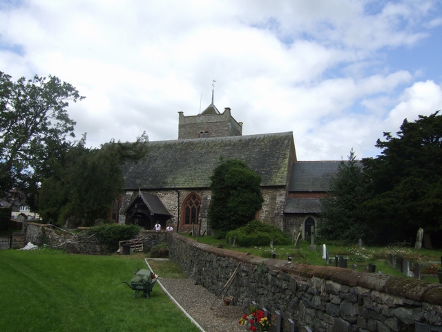
52° 38′ 08.84″ N, 2° 59′ 35.12″ W
154:
239:
189:
66:
126:
Worthen Church, near to
Worthen, Shropshire, Great Britain.
249:
52° 38′ 10″ N, 2° 59′ 38″ W
438:
Add a one-line explanation of what this file represents
1038:
1033:
1003:
1023:
1013:
993:
973:
183:
Creative
Commons Attribution Share-alike license 2.0
110:
90:
Commons is a freely licensed media file repository.
607:
Creative
Commons Attribution-ShareAlike 2.0 Generic
56:(640 × 480 pixels, file size: 226 KB, MIME type:
407:https://creativecommons.org/licenses/by-sa/2.0
71:
413:Creative Commons Attribution-Share Alike 2.0
331:
116:Worthen Church - geograph.org.uk - 487732.jpg
52:Worthen_Church_-_geograph.org.uk_-_487732.jpg
8:
809:
745:
373:– to copy, distribute and transmit the work
1056:
879:
434:
966:The following other wikis use this file:
678:https://www.geograph.org.uk/photo/487732
506:https://www.geograph.org.uk/profile/7388
1058:
951:Listed buildings in Worthen with Shelve
938:
833:
817:
769:
753:
727:
711:
640:
624:
604:
588:
568:
552:
485:
469:
452:
449:
430:
423:
242:
192:
984:Grade I listed buildings in Shropshire
941:Grade I listed buildings in Shropshire
271:View this and other nearby images on:
221:View this and other nearby images on:
946:Grade I listed churches in Shropshire
936:The following 4 pages use this file:
7:
318:and is licensed for reuse under the
868:
354:Attribution-Share Alike 2.0 Generic
342:
337:
322:Attribution-ShareAlike 2.0 license.
1049:
443:
437:
328:
305:
120:
103:
49:
442:
756:coordinates of the point of view
428:
384:Under the following conditions:
349:This file is licensed under the
341:
336:
330:
298:
277:
263:
255:
227:
213:
205:
70:
31:
21:
922:File Upload Bot (Magnus Manske)
425:
121:
46:No higher resolution available.
14:
643:file available on the internet
424:
306:This image was taken from the
26:
1:
820:coordinates of depicted place
36:
771:52°38'8.844"N, 2°59'35.117"W
663:Geograph Britain and Ireland
527:object of statement has role
450:Items portrayed in this file
254:
204:
1000:Usage on lld.wikipedia.org
980:Usage on dag.wikipedia.org
1080:
1030:Usage on www.wikidata.org
1020:Usage on sv.wikipedia.org
1010:Usage on pl.wikipedia.org
990:Usage on fr.wikipedia.org
970:Usage on cy.wikipedia.org
835:52°38'9.96"N, 2°59'37.68"W
398:same or compatible license
869:
16:
686:geograph.org.uk image ID
427:
364:
77:This is a file from the
926:
171:
161:
141:
134:
131:
113:
81:. Information from its
905:15:34, 24 October 2010
312:this photograph's page
283:52.636100; -2.993800
233:52.635790; -2.993088
84:description page there
155:geograph_org2commons
379:– to adapt the work
514:author name string
1067:
1066:
962:Global file usage
929:
811:
747:
591:copyright license
436:
327:
326:
310:collection. See
288:
287:
238:
237:
187:
186:
180:
177:Reusing this file
149:; transferred by
99:
98:
79:Wikimedia Commons
32:Global file usage
1071:
1057:
917:
857:
856:
851:
793:
792:
787:
695:
690:
680:
675:
671:described at URL
665:
660:
555:copyright status
536:
531:
521:
518:
508:
503:
420:
417:
414:
411:
408:
400:as the original.
362:
351:Creative Commons
345:
344:
340:
339:
334:
333:
320:Creative Commons
308:Geograph project
302:
295:
284:
281:
267:
266:
260:
259:
258:
252:
251:
240:
234:
231:
217:
216:
210:
209:
208:
202:
201:
190:
174:
137:
125:
117:
111:
95:
74:
73:
67:
61:
59:
1079:
1078:
1074:
1073:
1072:
1070:
1069:
1068:
1045:
960:
930:
923:
915:
871:
870:
867:
866:
865:
864:
863:
862:
861:
860:
859:
858:
854:
852:
849:
840:
839:
838:
836:
826:
825:
824:
822:
803:
802:
801:
800:
799:
798:
797:
796:
795:
794:
790:
788:
785:
776:
775:
774:
772:
762:
761:
760:
758:
739:
738:
737:
736:
735:
734:
733:
732:
730:
720:
719:
718:
716:
705:
704:
703:
702:
701:
700:
699:
698:
697:
696:
691:
688:
682:
681:
676:
673:
667:
666:
661:
658:
649:
648:
647:
645:
633:
632:
631:
629:
618:
617:
616:
615:
614:
613:
612:
611:
609:
597:
596:
595:
593:
582:
581:
580:
579:
578:
577:
576:
575:
573:
561:
560:
559:
557:
546:
545:
544:
543:
542:
541:
540:
539:
538:
537:
532:
529:
523:
522:
519:
516:
510:
509:
504:
501:
492:
491:
490:
488:
478:
477:
476:
474:
463:
462:
461:
460:
459:
457:
441:
440:
439:
422:
421:
418:
415:
412:
409:
406:
405:
363:
360:
357:
346:
323:
293:
282:
256:
247:
246:
243:Object location
232:
206:
197:
196:
193:Camera location
188:
147:geograph.org.uk
127:
115:
108:
101:
100:
89:
88:
87:is shown below.
63:
57:
55:
48:
47:
12:
11:
5:
1077:
1075:
1065:
1064:
1061:
1048:
1044:
1043:
1042:
1041:
1036:
1028:
1027:
1026:
1018:
1017:
1016:
1008:
1007:
1006:
998:
997:
996:
988:
987:
986:
978:
977:
976:
964:
963:
959:
958:
953:
948:
943:
934:
933:
928:
927:
925:
921:
918:
912:
907:
902:
898:
897:
894:
891:
888:
885:
882:
875:
874:
845:
844:
843:
842:
841:
837:
834:
832:
831:
830:
829:
828:
827:
823:
818:
816:
815:
814:
813:
807:
781:
780:
779:
778:
777:
773:
770:
768:
767:
766:
765:
764:
763:
759:
754:
752:
751:
750:
749:
743:
731:
728:
726:
725:
724:
723:
722:
721:
717:
712:
710:
709:
708:
707:
706:
684:
683:
669:
668:
654:
653:
652:
651:
650:
646:
641:
639:
638:
637:
636:
635:
634:
630:
627:source of file
625:
623:
622:
621:
620:
619:
610:
605:
603:
602:
601:
600:
599:
598:
594:
589:
587:
586:
585:
584:
583:
574:
569:
567:
566:
565:
564:
563:
562:
558:
553:
551:
550:
549:
548:
547:
525:
524:
512:
511:
497:
496:
495:
494:
493:
489:
486:
484:
483:
482:
481:
480:
479:
475:
470:
468:
467:
466:
465:
464:
458:
453:
451:
448:
447:
446:
445:
444:
433:
432:
429:
426:
404:
403:
402:
401:
391:
382:
381:
380:
374:
367:You are free:
358:
348:
347:
329:
325:
324:
303:
292:
289:
286:
285:
275:
269:
244:
236:
235:
225:
219:
194:
185:
184:
181:
169:
168:
163:
159:
158:
143:
139:
138:
133:
129:
128:
118:
109:
107:
104:
102:
97:
96:
75:
65:
64:
45:
41:
40:
39:
34:
29:
24:
19:
13:
10:
9:
6:
4:
3:
2:
1076:
1062:
1059:
1055:
1052:
1046:
1040:
1037:
1035:
1032:
1031:
1029:
1025:
1022:
1021:
1019:
1015:
1012:
1011:
1009:
1005:
1002:
1001:
999:
995:
992:
991:
989:
985:
982:
981:
979:
975:
972:
971:
969:
968:
967:
961:
957:
954:
952:
949:
947:
944:
942:
939:
937:
931:
924:
919:
913:
911:
908:
906:
903:
900:
899:
895:
892:
889:
886:
883:
881:
880:
878:
872:
848:
821:
784:
757:
715:
694:
687:
679:
672:
664:
657:
644:
628:
608:
592:
572:
556:
535:
528:
515:
507:
500:
473:
456:
410:CC BY-SA 2.0
399:
395:
392:
389:
386:
385:
383:
378:
375:
372:
369:
368:
366:
365:
359:Attribution:
355:
352:
335:
321:
317:
313:
309:
304:
301:
297:
296:
290:
280:
276:
274:
273:OpenStreetMap
270:
268:
250:
245:
241:
230:
226:
224:
223:OpenStreetMap
220:
218:
200:
195:
191:
182:
178:
173:
170:
167:
164:
160:
156:
152:
148:
144:
140:
130:
124:
119:
112:
105:
93:
86:
85:
80:
76:
69:
68:
62:
53:
44:
38:
35:
33:
30:
28:
25:
23:
20:
18:
15:
1053:
1050:
965:
935:
876:
873:File history
534:photographer
393:
387:
376:
370:
315:
253:
203:
151:User:svejk74
122:
92:You can help
82:
50:
22:File history
729:7 July 2007
571:copyrighted
394:share alike
388:attribution
136:7 July 2007
114:Description
1060:_error
932:File usage
914:640 × 480
890:Dimensions
487:some value
172:Permission
58:image/jpeg
27:File usage
1039:Q17529611
887:Thumbnail
884:Date/Time
714:inception
291:Licensing
123:English:
1047:Metadata
1034:Q3876903
916:(226 KB)
656:operator
431:Captions
377:to remix
371:to share
356:license.
37:Metadata
1024:Worthen
1014:Worthen
1004:Worthen
994:Worthen
974:Worthen
956:Worthen
901:current
896:Comment
847:heading
806:heading
783:heading
742:heading
472:creator
455:depicts
435:English
106:Summary
54:
855:degree
810:degree
791:degree
746:degree
693:487732
520:John M
361:John M
316:John M
261:
211:
166:John M
162:Author
153:using
142:Source
145:From
893:User
853:292
789:292
419:true
416:true
132:Date
17:File
499:URL
850::
786::
689::
674::
659::
530::
517::
502::
1063:0
179:)
175:(
157:.
94:.
60:)
Text is available under the Creative Commons Attribution-ShareAlike License. Additional terms may apply.
_region:GB-GBN_heading:292.00&language=en)
